 Block
Kokomo, Indiana
11 topographic sheets cover this place, the earliest surveyed in 1953 and the latest in 1992. It stands in Center Township. It lies in ZIP code area 46901. The Survey maps it on the Kokomo West quadrangle. 59,604 people lived here at the 2020 count. It stands 810 feet above sea level.
Research this city
On record in Kokomo
Buildings and businesses the archive holds for this place. Each opens its own page, with the source record it came from.
On the National Register 12 of 13 shown
 Elwood Haynes Houselisted 1984
 Howard Masonic Templelisted 2018
 Kokomo City Buildinglisted 1981
 Kokomo County Club Golf Courselisted 2006
 Kokomo Courthouse Square Historic Districtlisted 2008
 Kokomo High School and Memorial Gymnasiumlisted 2005
 Lake Erie and Western Depot Historic Districtlisted 2008
 Learner Buildinglisted 1984
 Old Silk Stocking Historic Districtlisted 2008
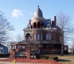 Seiberling Mansionlisted 1971
 Henry W. Smith Houselisted 1979
 George and Helen Tate Houselisted 2018
Population over time
2 figuresKokomo grew from 45,468 to 59,604 between 2010 and 2020. These are the recorded population figures Wikidata holds for this place, reached through the Geographic Names Information System number this page is keyed on rather than by name, so they belong to this place and not to another of the same name. Most are census counts, but not all are: an early figure may be a founding or settlement estimate, and an estimate published within five years of a census is left out. The change column is computed, and is left blank where more than 20 years separate a figure from the one before it, because a gap that long is not a change between two counts.
| Year | People | Change |
|---|---|---|
| 2010 | 45,468 | |
| 2020 | 59,604 | +14,136 (+31%) |
Topographic sheets covering this place
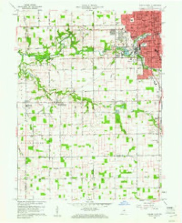
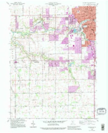
6 surveys from 11 printed sheetsMatched by testing this settlement's coordinate against the published boundary of every sheet in the United States Geological Survey's historical collection. Each opens the scanned sheet at the Survey.
- 1953 USGS Danville quadrangle1:250000, 3 printings
- 1955 USGS Danville quadrangle1:250000
- 1956 USGS Danville quadrangle1:250000
- 1960 USGS Kokomo West quadrangle1:24000, 3 printings
- 1984 USGS Lafayette quadrangle1:100000, 2 printings
- 1992 USGS Kokomo West quadrangle1:24000




Mines and quarries near this place
6 within 5 milesRegional context, not property-specific evidence. The federal mineral resources record lists 6 workings within 5 miles of Kokomo: 5 producers, 1 occurrence. 5 still produce. What was taken out: Sand and Gravel, Construction, Stone, Stone, Crushed/Broken, Zinc. Distance is straight-line from the map coordinates, so a quarry counted here may appear on a neighbouring settlement's page as well.
| Where | Site | Commodity | Status | Recorded |
|---|---|---|---|---|
| American Standard Plant | Fire Clay (Refractory) | Producer | ||
| Howard Co. Hwy. Dept. | Stone | Producer | ||
| Sphalerite Occurrence Z77 | Zinc, Sulfur | Occurrence | Sphalerite | |
| Yeoman Stone Quarry | Stone, Crushed/Broken | Producer | ||
| Kokomo Sand & Gravel | Sand and Gravel, Construction | Producer | ||
| Kyle Gravel Pit | Sand and Gravel, Construction | Producer |
Storms near this place
60 of 110 shownRegional context, not property-specific evidence. The National Weather Service names Kokomo in 110 storm reports between 1995 and 2025: 52 thunderstorm wind, 37 hail, 9 flash flood, 5 tornado. The reports record 12 injuries. Each account below is quoted exactly as the forecast office filed it, from the NOAA Storm Events Database, and each date opens the federal record of that event.
| When | Event | Place named | Harm | What the report says |
|---|---|---|---|---|
| July 1996 | Thunderstorm Wind | Kokomo | 6 hurt, $60,000 | no account filed |
| November 2013 | Tornado (EF2) | Kokomo | 5 hurt, $75,000 | At 1529EST, this small EF-2 tornado damaged several well built homes in the vicinity of East Ricketts Street in Kokomo. The tornado then crossed East Hoffer Street, damaging a UAW building before lifting at 1530EST. |
| April 2004 | Tornado (F1) | Kokomo | 1 hurt, $3,000,000 | A third in a string of tornadoes associated with an isolated low-topped supercell touched down in Kokomo. The tornado was rated an F1 and severely damaged a skating rink and trucking company. There was also damage to 3 other homes and 1 minor injury reported. |
| June 2000 | Thunderstorm Wind | Kokomo | $2,000,000 | no account filed |
| April 2004 | Tornado (F0) | Kokomo | $500,000 | The second in a series of tornadoes associated with an isolated low-topped supercell touched down in rural Howard county 8 miles southwest of Kokomo. The tornado was rated an F0 and destroyed a barn and overturned a grain bin in its brief lifetime. |
| July 2017 | Flash Flood | Kokomo | $200,000 | Areas of Street flooding occurred throughout much of the county. FOX59 reported that there were Lots of drain backups, lots of sub pumps being overwhelmed, just groundwater thats got into buildings. There have been multiple actual ground water intrusions on main levels of homes, not even in basements. ||On the Ivy Tech Community College campus in Kokomo, one of the campus five main buildings had between six and eight inches of water throughout the hallways and classrooms and the college had to cancel classes Tuesday and Wednesday.||The flooding also closed at least 20 roads throughout Howard County. Several of the roads were main arteries.|||Some additional flooding was noted. There was the at least partial, if not full washout over Indiana 218, just south of East County Road 575 North, over Tolen Ditch. Water was rapidly flowing out of fields along County Road 700 North in Carroll County. |
| July 1996 | Tornado (F1) | Kokomo | $65,000 | no account filed |
| June 1995 | Thunderstorm Wind | Kokomo | $50,000 | Trees blown down onto garage with vehicles inside. |
| May 2019 | Thunderstorm Wind | Kokomo | $35,000 | An estimated 60 mph thunderstorm wind gust was observed in this location. There were multiple reports of trees and power lines down across Kokomo and Howard County due to damaging thunderstorm wind gusts. Some trees were down on vehicles. |
| March 2025 | Thunderstorm Wind | Kokomo | $25,000 | A tree fell on a residence along Ohio Street and a tree fell onto a car on Park Street. This damage was caused by thunderstorm winds. |
| May 2019 | Flash Flood | Kokomo | $25,000 | Water was reported to be flowing over the road at Courtland and Kokomo due to heavy thunderstorm rainfall. A car was stuck in a viaduct on Sycamore Street downtown. |
| July 2003 | Thunderstorm Wind | Kokomo | $20,000 | no account filed |
| July 2017 | Thunderstorm Wind | Kokomo | $13,000 | A tree fell on a vehicle due to damaging thunderstorm wind gusts. No injuries were reported. A few other trees were downed in the area, with one tree down on a power line. |
| May 2019 | Flash Flood | Kokomo | $10,000 | County dispatch reported that they had closed numerous streets due to standing water from heavy thunderstorm wind gusts. At 10:00pm, there were at least 6 roads with water flowing over them. |
| May 2019 | Thunderstorm Wind | Kokomo | $10,000 | Several trees were downed in Kokomo due to damaging thunderstorm wind gusts. |
| June 2012 | Thunderstorm Wind | Kokomo | $10,000 | Trees and power lines were reported down in Kokomo due to damaging thunderstorm wind gusts. |
| July 2004 | Thunderstorm Wind | Kokomo | $10,000 | no account filed |
| June 2009 | Thunderstorm Wind | Kokomo | $8,000 | A thunderstorm wind gust of 58 mph was measured by the OKK AWOS. The emergency manager reported dozens of trees down county-wide, along with some county roads blocked by fallen trees. |
| June 2025 | Thunderstorm Wind | Kokomo | $5,000 | Thunderstorm wind gusts downed multiples trees across town. |
| August 2020 | Thunderstorm Wind | Kokomo | $5,000 | An estimated 12-18 inch diameter tree was blown down into the road due to thunderstorm wind gusts. Live power lines were also downed at the 4000 block of Sycamore St. |
| February 2008 | Flood | Kokomo | $5,000 | Flooding occurred along Wildcat Creek in Howard County, including near Kokomo, due to heavy rain and snow melt. |
| July 2005 | Tornado (F0) | Kokomo | $5,000 | An F0 tornado touched down briefly in the Champagne Shores Subdivision. Numerous trees were broken or sheared off. |
| July 1995 | Thunderstorm Wind | Kokomo | $5,000 | Power lines were downed. |
| July 2020 | Thunderstorm Wind | Kokomo | $4,000 | Trees and power poles downed due to thunderstorm wind gusts on the north end of Kokomo. |
| April 2011 | Thunderstorm Wind | Kokomo | $4,000 | Four trees were snapped or uprooted at Howard Regional Hospital due to damaging thunderstorm wind gusts. |
| June 2008 | Thunderstorm Wind | Kokomo | $4,000 | The thunderstorm winds brought a tree down on top of an occupied car at Markland and Webster streets, trapping the occupants. |
| February 2011 | Thunderstorm Wind | Kokomo | $3,000 | Evergreen trees, 40 to 50 feet tall, were knocked over near US Highway 31 and State Road 22 due to damaging thunderstorm wind gusts. |
| June 1995 | Thunderstorm Wind | Kokomo | $3,000 | Tree fell on a van. |
| July 2020 | Thunderstorm Wind | Kokomo | $2,000 | Numerous tree limbs and branches downed due to thunderstorm wind gusts across Kokomo. |
| May 2019 | Flash Flood | Kokomo | $2,000 | Some intersections were flooded in Kokomo due to heavy thunderstorm rainfall. This report was received via social media. |
| August 2011 | Thunderstorm Wind | Kokomo | $2,000 | A large tree and power lines were downed in this location by 60 mph thunderstorm wind gusts. |
| May 2019 | Thunderstorm Wind | Kokomo | $1,500 | Healthy 6 to 8 inch diameter tree limbs were downed due to damaging thunderstorm wind gusts. |
| August 2020 | Thunderstorm Wind | Kokomo | $1,000 | Six to eight inch diameter tree limbs were blown down by thunderstorm winds. |
| May 2019 | Thunderstorm Wind | Kokomo | $1,000 | Power lines were down and blocking the road due to damaging thunderstorm wind gusts. |
| May 2019 | Thunderstorm Wind | Kokomo | $1,000 | A 24-inch diameter, live tree was downed in this location due to damaging thunderstorm wind gusts. |
| June 2019 | Flood | Kokomo | $1,000 | Street flooding was occurring in Kokomo due to heavy rainfall. |
| June 2010 | Thunderstorm Wind | Kokomo | $1,000 | A tree, three feet in diameter, was snapped off and downed in this location. |
| October 2010 | Thunderstorm Wind | Kokomo | $1,000 | Reports of power lines down and no power to Downtown Kokomo were received due to damaging thunderstorm wind gusts. |
| June 2006 | Thunderstorm Wind | Kokomo | $1,000 | Trees and power lines were downed. |
| June 2015 | Thunderstorm Wind | Kokomo | $750 | A tree was downed due to thunderstorm wind gusts observed at 49 mph. |
| June 2014 | Flood | Kokomo | $500 | Ponding of water on roads was reported in Kokomo. The location of this event was estimated. |
| July 2005 | Lightning | Kokomo | $500 | Lightning caused a small fire at a home. |
| June 1998 | Thunderstorm Wind | Kokomo | $500 | Thunderstorm winds blew down large tree. |
| June 2010 | Thunderstorm Wind | Kokomo | $250 | A six inch tree limb was reported down due to thunderstorm wind gusts. |
| April 2017 | Hail | Kokomo | - | Quarter to half dollar sized hail was observed in this location. |
| May 2014 | Hail | Kokomo | - | Some roads were also flooded near this location due to heavy thunderstorm rainfall. |
| June 2014 | Thunderstorm Wind | Kokomo | - | A 64 mph thunderstorm wind gust was measured in this location. |
| June 2013 | Hail | Kokomo | - | Ponding of water was noted along the side of Highway 31 as well. |
| June 2013 | Thunderstorm Wind | Kokomo | - | An estimated 60 mph thunderstorm wind gust was observed in this location. |
| April 2013 | Hail | Kokomo | - | Pea to dime-sized hail was reported at the intersection of US Highways 31 and 35. A few construction barrels were blown over as well. |
| September 2012 | Hail | Kokomo | - | Sheets of rain were observed as well. |
| June 2011 | Thunderstorm Wind | Kokomo | - | A 73 mph thunderstorm wind gust was measured in this location. |
| June 2011 | Thunderstorm Wind | Kokomo | - | A 70 mph thunderstorm wind gust was estimated in this location. Nickel sized hail was also reported. |
| April 2010 | Hail | Kokomo | - | This event occurred at the intersection of Dixon Road and Defenbaugh Street in southwest Kokomo. |
| January 2008 | Thunderstorm Wind | Kokomo | - | The wind gust was measured by a trained spotter. |
| May 2008 | Thunderstorm Wind | Kokomo | - | Half inch tree limbs were reported down due to damaging thunderstorm winds. |
| June 2008 | Thunderstorm Wind | Kokomo | - | The spotter also reported 0.70 inch diameter hail. The spotter was located at 200 West and Jefferson Road in Kokomo. |
| June 2008 | Heavy Rain | Kokomo | - | A rainfall total of 2.75 inches fell in approximately 45 minutes. |
| July 2005 | Thunderstorm Wind | Kokomo | - | Large tree limbs were broken. |
| July 2005 | Thunderstorm Wind | Kokomo | - | A telephone pole was blown over. |
Nearest settlements
The eight closest, with where each one stands in the county. Distances are straight-line, computed from the Geographic Names Information System coordinates.
| Map | Place | Distance | Sheets |
|---|---|---|---|
| Shambaugh Siding | 1.0 miles | 11 | |
| Darrough Chapel | 2.1 miles | 10 | |
| Alto | 3.6 miles | 11 | |
| Indian Heights | 4.1 miles | 11 | |
| Oakford | 4.9 miles | 10 | |
| Cassville | 5.1 miles | 10 | |
| Center | 5.3 miles | 10 | |
| West Middleton | 5.4 miles | 11 |
Elsewhere
Matched on this settlement's Geographic Names Information System number rather than its name, so it cannot be a different place of the same name in another state.
| Wikipedia article on Kokomo | An encyclopaedic summary. Its text is share-alike, so it is linked here rather than copied. |
| Wikidata item Q913209 | The structured record the population and elevation above come from. Public domain (CC0). |
Provenance
This settlement is recorded in the Geographic Names Information System as feature 437425. The sheet list is computed by point-in-boundary test against the United States Geological Survey's historical topographic inventory. Both are works of the United States government and carry no copyright under 17 U.S.C. 105.
Mines and quarries. USGS Mineral Resources Data System (MRDS) https://mrdata.usgs.gov/mrds/ A work of the United States government, no copyright under 17 U.S.C. 105.
Storms. NOAA National Centers for Environmental Information, Storm Events Database https://www.ncei.noaa.gov/stormevents/ A work of the United States government, no copyright under 17 U.S.C. 105. Narratives are quoted verbatim from the National Weather Service report and are not edited or summarised.