 Block
Anoka, Indiana
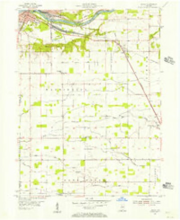
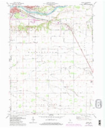
11 topographic sheets cover this place, the earliest surveyed in 1953 and the latest in 1985. It stands in Washington Township. It lies in ZIP code area 46947. The Survey maps it on the Anoka quadrangle. It stands 709 feet above sea level.
Topographic sheets covering this place
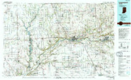
6 surveys from 11 printed sheetsMatched by testing this settlement's coordinate against the published boundary of every sheet in the United States Geological Survey's historical collection. Each opens the scanned sheet at the Survey.
- 1953 USGS Danville quadrangle1:250000, 3 printings
- 1955 USGS Anoka quadrangle1:24000
- 1955 USGS Danville quadrangle1:250000
- 1956 USGS Danville quadrangle1:250000
- 1972 USGS Anoka quadrangle1:24000, 3 printings
- 1985 USGS Logansport quadrangle1:100000, 2 printings



In the county-history sources
7,862 words on this townshipHistory of Cass County, Indiana, published 1878; History of Cass County, Indiana, from Its Earliest Settlement to the Present Time;, published 1913 names this settlement in its chapter on Washington Township. These are the passages that mention it, exactly as the scans read.
In the Fall of 1843, the entire reservation included in Washing¬ ton Township was relinquished by the Indians to the United States. The Indians at the same treaty, agreed to move within a short time to the West. By the transaction above recorded, nearly all the land in Washington, at once came into market. It so readily found pur¬ chasers, that it would be a difficult undertaking to name and locate all who came about that time and soon thereafter. The following are the principal: Josiah Butler, Frederick Ozenback, Barton R. Keep, . Charles and Almond Lyons, James Carney, Benjamin Spradcr, Artemus B. Knowlton, William Sturgeon, William De Ford, Don R. Clark, Josiah Jones, Michael Ward, Paynter West, Jacob Myres,
Passage source: History of Cass County, Indiana, published 1878.
Washington township lies immediately south of the city of Logansport and the Wabash river, in congressional townships 26 and 27 north, ranges 1 and 2 east. It is bounded on the north by the city of Logansport and the Wabash river, on the east by Tipton township, on the south by Deer Creek township, and on the west by Carroll county and Clinton township and embraces an area of about thirty-seven square miles.
Passage source: History of Cass County, Indiana, from Its Earliest Settlement to the Present Time;, published 1913.
The first settlement of the county was made in Washington township, but now a part of the city of Logansport. Alexander Chamberlain, on December 23, 1824, purchased the west half of fractional section 35, and on May 25, 1825, bought the east half of the same section, located on the south bank of the Wabash river. On the east half of this purchase, opposite the mouth of Eel river, he erected a cabin in the summer of 1826, being the first permanent settler not only in Washington township, but also the first in Cass county.
Passage source: History of Cass County, Indiana, from Its Earliest Settlement to the Present Time;, published 1913.
Machine-read from a century-old scan, so expect the errors a machine makes: misspelled names, dropped words, stray characters.
Read the whole chapter on Washington Township - it names this place 17 more 17 times.
Mines and quarries near this place
5 within 5 milesRegional context, not property-specific evidence. The federal mineral resources record lists 5 workings within 5 miles of Anoka: 4 producers, 1 past producer. 4 still produce. What was taken out: Sand and Gravel, Construction, Stone, Stone, Crushed/Broken. Distance is straight-line from the map coordinates, so a quarry counted here may appear on a neighbouring settlement's page as well.
| Where | Site | Commodity | Status | Recorded |
|---|---|---|---|---|
| Engineering Aggregate Corp.Pl. 1 | Stone, Crushed/Broken | Producer | ||
| Cass County Highway Department | Stone | Producer | ||
| Eng. Ag. Corp. Quarry #2 | Stone | Producer | ||
| Engineering Aggregates Corp. Pl. 4 | Sand and Gravel, Construction | Past Producer | ||
| Wilson Pit | Sand and Gravel, Construction | Producer |
Storms near this place
1 since 2015Regional context, not property-specific evidence. The National Weather Service names Anoka in 1 storm report in 2015: 1 thunderstorm wind. The reports record 1 injury. Each account below is quoted exactly as the forecast office filed it, from the NOAA Storm Events Database, and each date opens the federal record of that event.
| When | Event | Place named | Harm | What the report says |
|---|---|---|---|---|
| September 2015 | Thunderstorm Wind | Anoka | 1 hurt | Emergency management officials reported a car ran over a six foot long, four inch diameter tree limb in the road. The driver suffered minor injuries. |
Nearest settlements
The eight closest, with where each one stands in the county. Distances are straight-line, computed from the Geographic Names Information System coordinates.
| Map | Place | Distance | Sheets |
|---|---|---|---|
| Miami Bend | 2.2 miles | 10 | |
| Potawatomi Point | 2.2 miles | 11 | |
| Danes | 2.9 miles | 10 | |
| Lewisburg | 3.8 miles | 12 | |
| Old Adamsboro | 4.4 miles | 10 | |
| Adamsboro | 4.4 miles | 10 | |
| Logansport | 4.5 miles | 10 | |
| Walton | 4.7 miles | 12 |
Elsewhere
Matched on this settlement's Geographic Names Information System number rather than its name, so it cannot be a different place of the same name in another state.
| Wikipedia article on Anoka | An encyclopaedic summary. Its text is share-alike, so it is linked here rather than copied. |
| Wikidata item Q4769878 | The structured record the population and elevation above come from. Public domain (CC0). |
Provenance
This settlement is recorded in the Geographic Names Information System as feature 430184. The sheet list is computed by point-in-boundary test against the United States Geological Survey's historical topographic inventory. Both are works of the United States government and carry no copyright under 17 U.S.C. 105.
Mines and quarries. USGS Mineral Resources Data System (MRDS) https://mrdata.usgs.gov/mrds/ A work of the United States government, no copyright under 17 U.S.C. 105.
Storms. NOAA National Centers for Environmental Information, Storm Events Database https://www.ncei.noaa.gov/stormevents/ A work of the United States government, no copyright under 17 U.S.C. 105. Narratives are quoted verbatim from the National Weather Service report and are not edited or summarised.