 Block
From the record
16 National Register listings published here, 1 of them a National Historic Landmark.
Sources: the county history on the Internet Archive · the National Register database, National Park Service
40 topographic sheets cover 30 settlements here, and 16 properties are on the National Register of Historic Places.
16 National Register listings published here, 1 of them a National Historic Landmark.
Sources: the county history on the Internet Archive · the National Register database, National Park Service
Every property in this county listed on the National Register of Historic Places, with the year it was listed and the federal nomination document.
| Photograph | Property | Type | Listed | Reference |
|---|---|---|---|---|
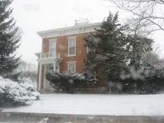 | Josephus Atkinson Farm | building | 2010 | 10000373 |
 | Bankers Row Historic District | district | 1999 | 99001149 |
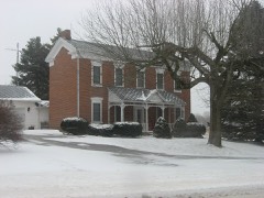 | Thompson Barnett House | building | 1986 | 86001620 |
 | Courthouse Historic District | district | 1999 | 99000294 |
 | Ferguson House | building | 1983 | 83000117 |
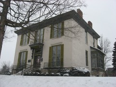 | Jerolaman-Long House | building | 1985 | 85000651 |
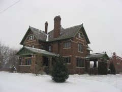 | John Keip House | building | 2004 | 04001307 |
 | Kendrick-Baldwin House | building | 1982 | 82000060 |
 | Pipe Creek Falls Resort | district | 1995 | 95001105 |
 | Willard B. Place House | building | 1998 | 98001050 |
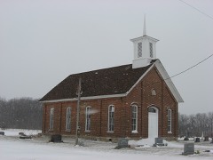 | Pleasant Hill Church | building | 1996 | 95001539 |
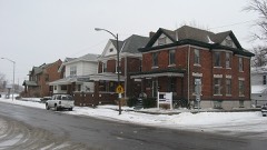 | Point Historic District | district | 1999 | 99001150 |
 | Pollard-Nelson House | building | 1975 | 75000042 |
| Riverside Historic District | district | 2022 | 100008409 | |
 | Spencer Park Dentzel Carousel | structure | 1987 | 87000838 |
 | Henry Tousley House | building | 2002 | 02001167 |
The NOAA Storm Events Database holds 350 reports for this county, causing no deaths, 19 injuries and about $5,138,754 in recorded property damage. Each settlement page carries the reports that name it.
| Kind of event | Reports |
|---|---|
| Thunderstorm Wind | 234 |
| Hail | 67 |
| Tornado | 26 |
| Flash Flood | 14 |
| Flood | 4 |
| Lightning | 3 |
| Funnel Cloud | 2 |
The most serious of them, by death, then injury, then recorded damage. The accounts are quoted exactly as the forecast office filed them.
| When | Event | Place named | Harm | What the report says |
|---|---|---|---|---|
| March 2023 | Thunderstorm Wind | Royal Center | 7 hurt, $30,000 | A tree fell onto a van. Seven injuries total, 5 minor. |
| April 1974 | Tornado (F4) | not stated | 4 hurt | no account filed |
| October 1996 | Thunderstorm Wind | Logansport | 3 hurt, $200,000 | no account filed |
| June 2010 | Tornado (EF2) | Lincoln | 1 hurt, $125,000 | After a brief break, the supercell produced one more circulation which touched down just west of the Cass/Miami county line along South County Road 1000 East. Several yards in the area had trees uprooted and limbs down (DI: TH, DOD: 4). A few residences were impacted by the trees, causing mainly roof or window damage. The circulation then went into a dense grove of trees with the circulation briefly weakening before coming back out near the Grissom Air Reserve Base. A 200 foot section of security fence on the southwest corner of the base was blown down into the adjacent roadway and portions of the nearby field before crossing into Miami County. An Automated Weather Observation System recorded a 114 mph wind gust as the circulation passed through. |
| June 2010 | Tornado (EF1) | Deacon | 1 hurt, $125,000 | This tornado developed in eastern Carroll County, Indiana, roughly four miles east-southeast of Burrows (see Storm Data for Indiana, Central) and moved into Cass County. The tornado initially was over open fields with its first impact at a residence where the western half of the roof was ripped off and the eastern half picked up and then dropped back down. Two residents were attempting to take shelter when the tornado hit. A gentleman suffered minor injuries (indirect) falling down a stairway into a basement seeking shelter. The tornado continued east-southeast over mainly open field again until it encountered a more populated area of structures along E County Road 900 S, east of S County Road 300 E. Several trees were damaged or uprooted in the area with the western half of a business being destroyed by the circulation. The circulation moved on to strike and roll a mobile home, destroying it (DI: SWMH DOD: 7). The second injury (direct) in the area occurred here where the resident was rolled with the mobile home. The female resident escaped with minor injuries. The circulation continued on causing some structure and tree damage before dissipating. The maximum width is estimated at 150 yards with a maximum wind speed estimated around 100 mph. |
| March 1956 | Tornado (F2) | not stated | 1 hurt, $25,000 | no account filed |
| September 2015 | Thunderstorm Wind | Anoka | 1 hurt | Emergency management officials reported a car ran over a six foot long, four inch diameter tree limb in the road. The driver suffered minor injuries. |
| June 1996 | Lightning | Logansport | 1 hurt | no account filed |
| July 2003 | Flash Flood | Galveston | $1,250,000 | Emergency management reported Deer Creek near Galveston was flooding with water rising rapidly. 40 to 50 homes were damaged with roads flooded throughout the county. |
| July 2017 | Flash Flood | Young America | $500,000 | Three to five inches of rain fell onto already saturated ground in the span of a few hours, resulting in rapid rises on several creeks, streams and ditches in southern parts of the county, especially from County Road 300 S down to the Howard county line. Rock and Paint Creeks as well as Tolen ditch were impacted the most with numerous roads closed due to 1 to 3 feet of flowing water over bridges. In addition, the extensive amount of water was flowing over several roads where generally flat terrain existed. Water depth approached 6 inches in spots. Emergency management officials reported at least 2 roads washed out and 1 bridge collapse. State Road 29 between Highway 218 and 18, Highway 18 between State Route 29 and US 35, Highway 218 between Highway 29 and US 35, US 35 at Anoka all closed due to high flowing water on the roads. Flooding issues continued well into the 12th, despite no further rainfall occurring. Damage amounts likely exceeded a million dollars, but no exact figures were available. |
| July 1998 | Flash Flood | Logansport | $500,000 | THE LOGANSPORT IMPLEMENT STORE WAS INUNDATED WITH WATER UP TO FOUR FEET DEEP. SEVERAL HOMES IN TOWN SUSTAINED FLOODED BASEMENTS. ONE RESIDENT IN THE TOWN OF GALVESTON HAD THEIR BASEMENT WALL COLLAPSE DUE TO THE PRESSURE OF THE WATER. |
| September 1993 | Thunderstorm Wind | Logansport | $500,000 | A microburst on the south side of Logansport ripped the roof from a warehouse. The debris was scattered downwind, and caused damage to several other buildings in the immediate area. A few people received some minor bumps and bruises. Damage was estimated at $100,000. |
| January 2008 | Flood | Dunkirk | $150,000 | Numerous roads were flooded across mainly the northwestern part of the county, generally north of US 24 and west of State Route 25. A state of emergency was declared by county officials in these areas for about a 12 hour period, restricting travel to all but essential needs. Water was reported in many basements and covering driveways. Emergency officials did have to assist with several evacuations across the area. No exact damage figures are available, but is estimated at around $150,000. |
| June 2010 | Thunderstorm Wind | New Waverly | $125,000 | A large tree fell onto a house north of New Waverly. The house was considered to be a total loss as the tree penetrated the roof and buckled three of the four outside walls. Damage to the structure alone was estimated at $125,000. Several other trees were blown down in and around New Waverly, with at least one other tree making limited contact with a house. |
| July 2006 | Thunderstorm Wind | Logansport | $125,000 | At least a dozen homes suffered damage, several of them having tree limbs fall onto part of the residence. One limb punched thorugh a roof causing extensive damage. 6 cars had tree limbs fall onto them. A brand new truck was totalled from a large limb crushing the vehicle. Numerous other trees, tree limbs and power poles were blown down in and around Logansport. Damage was estimated by Emergency Management at around $125,000. |
| July 2005 | Tornado (F2) | Onward | $100,000 | A NWS survey confirmed a tornado touched down a few hundred feet west of county road 950 E between 500 and 600 S, just southwest of Onward. Extensive damage occurred to a barn as well as numerous trees in the area. The door of the barn was open which likely aided in the destruction of the barn. Damage in the area was consistent with a tornado of F2 intensity. The tornado continued on into Miami county where additional damage was found. |
| December 1998 | Thunderstorm Wind | Logansport | $100,000 | STRONG WINDS CAUSED PART OF THE THIRD STORY OF THE TOTAL DISCOUNT STORE IN LOGANSPORT TO COLLAPSE. THE SOUTHWEST CORNER OF THE BUILDING FELL ONTO HAP'S DOWNTOWNER, A RESTAURANT LOCATED NEXT DOOR. ELECTRICAL POWER POLES WERE BROKEN, CAUSING POWER OUTAGES. NUMEROUS TREE LIMBS WERE ALSO KNOCKED DOWN, RESULTING IN DAMAGE TO TWO AUTOMOBILES. TO THE SOUTHEAST OF LOGANSPORT, IN WALTON, A GRAIN BIN WAS APPARENTLY BLOWN OVER BY THE WIND. |
| May 1995 | Tornado (F1) | Leases Corner | $100,000 | Brief tornado touchdown resulted in one house and one mobile home being destroyed. Four other homes were damaged. The tornado lifted near the town of Metea. Numerous trees and power lines were downed also. |
| June 2006 | Thunderstorm Wind | Logansport | $80,000 | About a dozen homes with trees down on them, causing structural damage. Power lines and power poles blown down resulting in widespread power outages across much of southeast Cass County. |
| August 2009 | Thunderstorm Wind | Adamsboro | $75,000 | A survey of the area indicated straight line winds, on the order of 70 to possibly 75 mph, caused a small area of scattered damage. A pole barn was destroyed near the intersection of County Roads 150 South and 850 West. Debris from the barn was carried roughly a mile and a half towards the north. A barn and several trees were damaged on the 100 block of County Road 450 East. Damage is estimated at $75,000. |
| July 2005 | Thunderstorm Wind | Walton | $75,000 | A NWS survey of the area confirmed intense straight line winds of up to 80 mph caused damage to trees, power lines and a few structures prior to and south of the F2 tornado track across Cass county. A large tree fell onto a carport north of Walton, destroying it, as well as 3 vehicles parked under it. The swath of damage from the straight line winds, associated with the rear flank downdraft of the mesocyclone reached nearly a mile wide as it crossed into Miami county. At 817 pm EST a 70 mph wind gust was recorded 7 miles south of Logansport. No injuries were reported. |
| May 2025 | Lightning | Dunkirk | $50,000 | Lightning strike caused a structure fire on the 1500 Block of Delaware Road. |
| July 2010 | Thunderstorm Wind | Logansport | $50,000 | Emergency management officials reported a large tree fell onto a house, penetrating the roof and causing significant damage. Rainfall entered the home through the opening adding to the damage. Damage is estimated at around $50,000. Other trees and tree limbs were reported down in the New Waverly area as well. |
| June 2008 | Thunderstorm Wind | Logansport | $50,000 | Emergency management officials reported numerous trees and power lines down across the county. In addition, a home in the city of Logansport had two of its windows shattered. |
| May 2025 | Thunderstorm Wind | Leases Corner | $35,000 | Barn collapsed. |
| June 2010 | Thunderstorm Wind | Logansport | $30,000 | The roof of Tom Haynes Automotive was blown onto main feeder lines for Logansport municipal utilities which caused extensive power outages in Logansport. Numerous trees were downed across town that blocked roadways. |
| August 2007 | Thunderstorm Wind | Twelve Mile | $30,000 | Numerous trees were blown down, with 2 houses suffering damage as well as the rear windows of a minivan being broken out. |
| June 2006 | Thunderstorm Wind | Logansport | $30,000 | Five homes with trees blown down on them causing structural damage. |
| May 2000 | Thunderstorm Wind | Logansport | $30,000 | Barn destroyed. Trees down on cars and homes. Power lines down. |
| August 2009 | Thunderstorm Wind | Logansport | $25,000 | The local newspaper reported a large tree falling onto a garage at a residence on 17th Street. The garage was destroyed from a combination of the tree damage and being shifted off its foundation. A Jeep was trapped in the garage, but no information on the amount of damage was given. Damage to the garage is estimated at $25,000. |
| June 2007 | Thunderstorm Wind | Logansport | $25,000 | A 20 inch tree was blown over into a house just north of Logansport. |
| May 2007 | Thunderstorm Wind | Logansport | $25,000 | Numerous trees, tree limbs, power lines reported down in and around Logansport. At least 4 homes were reported to have trees down onto them, suffering minor damage. Some structures also sustained shingle and siding damage. A tree fell onto a car as well. |
| November 1998 | Thunderstorm Wind | Logansport | $25,000 | MANY TREES...POWER LINES AND POLES WERE BLOWN DOWN IN TOWN WITH SEVERAL RESIDENTIAL STREETS BLOCKED FOR A TIME. |
| November 1978 | Tornado (F1) | not stated | $25,000 | no account filed |
| June 1958 | Tornado (F2) | not stated | $25,000 | no account filed |
| August 1956 | Tornado (F1) | not stated | $25,000 | no account filed |
| July 2008 | Thunderstorm Wind | Onward | $20,000 | Emergency management officials reported numerous trees down up to two feet in diameter as well as power poles and lines down in the county. Much of the damage was confined to two areas. One of these extended from Onward to Logansport and another near Royal Center. A portion of US Highway 35 was closed due to trees down across the road. Damage is estimated at $20,000. |
| June 2007 | Thunderstorm Wind | Lucerne | $20,000 | Numerous 6 inch trees were blown down from Royal Center to Lucerne. |
| May 2006 | Thunderstorm Wind | Logansport | $20,000 | Numerous reports were received of trees down between Logansport and Anoka. Vehicles as well as a few homes were reported damaged from falling trees in both Logansport and Anoka. Damage amounts are estimated. |
| November 2005 | Thunderstorm Wind | Countywide | $20,000 | Numerous tree limbs were blown down, with several falling onto power lines. Two utility poles were also snapped as a result of winds estimated to 65 mph. |
| March 2025 | Thunderstorm Wind | Danes | $15,000 | Two out buildings, quonsets, were damaged. |
| March 2025 | Thunderstorm Wind | Clymers | $15,000 | Emergency manager reports downed power lines. |
| March 2022 | Tornado (EF0) | Lake Cicott | $15,000 | A tornado briefly touched down south of the intersection of W CR 400 N and N CR 925 W causing damage to some trees as well as a house chimney. The tornado moved quickly northeast and ripped off a enclosed porch from a residence at the intersection of W CR 400 N and N CR 900 W, throwing it around 175 feet over the house. Some trees were damaged on the property with a hanging shed door being blown off (east facing) due to intrusion of wind on the south side from a broken window and open door. Vehicles in the shed were not damaged. An empty silo to the north of the house was thrown along the road with debris into the adjacent field (this was straight line wind related). The debris ended out in the open field on the NE side of the intersection noted above. A pine tree on the SE side of the intersection was also snapped and thrown into this same field from the SW. |
| March 2009 | Thunderstorm Wind | Logansport | $15,000 | Emergency management officials reported the back half of a roof was ripped off a local business. No injuries were reported. Damage is estimated at $15,000. |
| April 2006 | Thunderstorm Wind | Logansport | $15,000 | Numerous trees and power lines were blown down. A house was shifted off its foundation. |
| March 2025 | Thunderstorm Wind | Leases Corner | $12,500 | Numerous reports of tree damage and reports of structural damage in Cass County. Siding blown off and damage to a barn roof are some examples. |
| March 2025 | Tornado (EF0) | Logansport Muni Arpt | $11,000 | A survey of ground and aerial data revealed a weak, disorganized, tornado touched down between two homes on E CR 300 S where a TV tower was bent over, minor shingle and fence damage was noted with the debris suggesting a weak circulation. This feature moved northeast into a wooded area where tree damage was initially very limited, but then uprooted or snapped roughly 20 shallow-rooted trees with weak convergence noted. The tornado moved into an open field and deposited one piece of the fence from the touchdown location as it dissipated before reaching S CR 150 E. |
| April 2026 | Thunderstorm Wind | Adamsboro | $10,000 | Trees and powerlines down on N CR 600 E between Logansport Rd and Division Rd. |
| March 2025 | Thunderstorm Wind | Georgetown | $10,000 | Tree down onto a house on Ridgeview Way. Tree size and health is unknown. |
| May 2025 | Thunderstorm Wind | Logansport Muni Arpt | $10,000 | Power poles leaning on W County Road 300 S near CR 125 W. |
| May 2025 | Thunderstorm Wind | Lincoln | $10,000 | Large tree and power line down on the 6000 block of CR E 90 S. |
| May 2025 | Thunderstorm Wind | Georgetown | $10,000 | Power lines down on the 6700 block of W US 24. |
| June 2025 | Thunderstorm Wind | Royal Center | $10,000 | Large tree down with powerlines across roadway. |
| June 2025 | Thunderstorm Wind | Lake Cicott | $10,000 | Several trees down. Large tree fell on garage. |
| April 2025 | Thunderstorm Wind | Clymers | $10,000 | Tree down onto a garage. |
| July 2024 | Thunderstorm Wind | Logansport | $10,000 | Numerous trees and power lines down in an around Logansport. Locations include, 1225 S 800 E, High Street at Roselawn and 22nd, 250E and 125 N. |
| April 2011 | Thunderstorm Wind | Royal Center | $10,000 | Emergency management officials reported a pole barn was destroyed by strong winds. |
| May 2006 | Thunderstorm Wind | Onward | $10,000 | Trees were blown down in many parts of the county. One tree fell onto a mobile home, causing minor damage.Damage is estimated at $2,000. A teen-age girl was injured while working at a restaraunt in Galveston. It is believed that an object being thrown by the strong winds broke the window where she was standing. She received some cuts. |
| June 2005 | Thunderstorm Wind | Logansport | $10,000 | Trees and power lines were reported down in both Logansport and Walton. |
| May 2000 | Thunderstorm Wind | Countywide | $10,000 | Wind damage in southern half of county. Numerous trees and power lines down. Several houses with damage from fallen trees. Travel trailer blown down. |
The Survey's mineral resources record lists 13 workings inside this county. 8 still produce and 5 are closed or unrecorded. Each settlement page carries the workings within five miles of it.
| Commodity | Workings |
|---|---|
| Sand and Gravel, Construction | 6 |
| Stone, Crushed/Broken | 4 |
| Stone | 2 |
| Zinc | 1 |
| Sulfur | 1 |
The least common of them first, because a county's hundredth gravel pit says nothing its first ten did not.
| Where | Site | Commodity | Status | Recorded |
|---|---|---|---|---|
| Sphalerite Occurrence Z76 | Zinc, Sulfur | Occurrence | Sphalerite | |
| Cass County Highway Department | Stone | Producer | ||
| Eng. Ag. Corp. Quarry #2 | Stone | Producer | ||
| Engineering Aggregate Corp.Pl. 1 | Stone, Crushed/Broken | Producer | ||
| Engineering Aggregates Corp. Plt. 2 | Stone, Crushed/Broken | Producer | ||
| Keeport Quarry | Stone, Crushed/Broken | Prospect | ||
| Logansport Quarry | Stone, Crushed/Broken | Producer | ||
| Engineering Aggregates Corp. Pl. 4 | Sand and Gravel, Construction | Past Producer | ||
| Logansport S & G Co. | Sand and Gravel, Construction | Producer | ||
| Logansport Sand & Gravel Pit | Sand and Gravel, Construction | Past Producer | ||
| Logansport Sand & Gravel Plant | Sand and Gravel, Construction | Producer | ||
| Orr Gravel | Sand and Gravel, Construction | Past Producer | ||
| Wilson Pit | Sand and Gravel, Construction | Producer |
History of Cass County, Indiana, from Its Earliest Settlement to the Present Time; devotes a chapter to each township: its boundaries and streams, who settled it and when, the mills, the schools and the churches. All 12 are reproduced here in full. Each row shows the township's own shape and where it lies in the county, drawn from the Census Bureau's boundary. Which settlements belong to which township is computed from that same boundary, not taken from the book.
| Shape and position in the county | Township | Settlements in it | Length | Sections |
|---|---|---|---|---|
| Bethlehem Township | Metea, Mount Pleasant | 10,908 words | 0 | |
| Boone Township | Royal Center | 808 words | 1 | |
| Clay Township | Adamsboro | 2,007 words | 1 | |
| Clinton Township | Clymers | 1,053 words | 0 | |
| Deer Creek Township | Deacon, Poundstone Corner, Young America | 1,262 words | 1 | |
| Harrison Township | Leases Corner, Lucerne | 815 words | 0 | |
| Jackson Township | Galveston, Lincoln | 1,143 words | 1 | |
| Jefferson Township | Georgetown, Kenneth, Lake Cicott | 1,081 words | 0 | |
| Miami Township | Danes, Lewisburg, Miami Bend, New Waverly, Old Adamsboro | 1,433 words | 1 | |
| Noble Township | Verona | 1,127 words | 0 | |
| Tipton Township | Onward, Walton | 1,758 words | 1 | |
| Washington Township | Anoka | 7,862 words | 0 |
2 books written about this county, cut here where the book itself is cut, at its printed chapters: 51 chapters in all. Every chapter is public domain, machine-read from the scan and reproduced complete. A chapter already given under one of the county's towns is not repeated in this list.
| Chapter | Length |
|---|---|
| The whole text | 80,580 words in 6 parts |
Named settlements recorded in the Geographic Names Information System, each with the topographic sheets covering it. Villages, hamlets and abandoned places alike. Each is shown with the nearest named watercourse or landform and the survey quadrangle it falls on.
Adams township · 46947 · On Goose Creek · Twelve Mile quadrangle
13 sheets, 1951 to 1985
Eel township · 46947 · Near Biddle Island · Logansport quadrangle
10 sheets, 1953 to 1985
Miami township · 46947 · On Spring Creek · Logansport quadrangle
10 sheets, 1953 to 1985