 Block
Arcola, Indiana
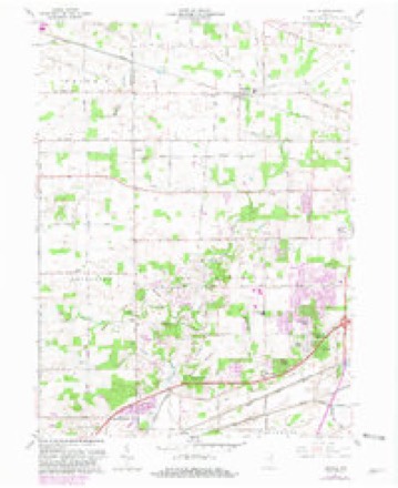
10 topographic sheets cover this place, the earliest surveyed in 1953 and the latest in 1994. It stands in Lake Township. It lies in ZIP code area 46704. The Survey maps it on the Arcola quadrangle. It stands 843 feet above sea level.
Topographic sheets covering this place
5 surveys from 10 printed sheetsMatched by testing this settlement's coordinate against the published boundary of every sheet in the United States Geological Survey's historical collection. Each opens the scanned sheet at the Survey.
- 1953 USGS Fort Wayne quadrangle1:250000, 4 printings
- 1956 USGS Fort Wayne quadrangle1:250000, 2 printings
- 1961 USGS Arcola quadrangle1:24000, 2 printings
- 1984 USGS Fort Wayne quadrangle1:100000
- 1994 USGS Fort Wayne quadrangle1:100000




In the county-history sources
3,633 words on this townshipHistory of Allen County, Indiana., published 1880; Valley of the Upper Maumee River, with Historical Account of Allen County and the City of Fort Wayne, Indiana, published 1889 has no passage naming this settlement, which was common for smaller places. Its township is covered in full.
The chapter on Lake Township covers the township.
Read the chapter on Lake Township - 3,633 words.
Storms near this place
12 since 2001Regional context, not property-specific evidence. The National Weather Service names Arcola in 12 storm reports between 2001 and 2026: 5 thunderstorm wind, 3 hail, 1 lightning, 1 flash flood. The reports record 1 death. Each account below is quoted exactly as the forecast office filed it, from the NOAA Storm Events Database, and each date opens the federal record of that event.
| When | Event | Place named | Harm | What the report says |
|---|---|---|---|---|
| June 2022 | Thunderstorm Wind | Arcola | 1 killed | The swath of damaging winds existed southeastern Whitley county and begin to intensify further, impacting the Arcola area with numerous trees, tree limbs and power lines down, some onto structures. The damage continued southeast impacting the southwest portions of Fort Wayne and surrounding areas. The hardest hit areas extended from Aboite township into Indian Village and Waynedale. Tree and tree limb damage was extensive in some areas, causing difficulties in clearing of roadways and restoration of power as numerous power lines and poles were impacted either by the winds alone or falling trees and tree limbs. The Fox Island County Park area had to be closed for an extended period due to extensive tree damage on roads and paths. A 98 mph wind gust was recorded at the Fort Wayne Regional Airport. An 89 year old female was inside her home in the 5400 block of Mason Drive when a tree crashed into her home. She was severely injured by broken glass and passed away at a local hospital despite surgery to stop the bleeding early on the morning of June 14. The fatality was compounded by first responders being unable to reach her for an extended period of time due to the extensive tree and power line debris. |
| July 2015 | Lightning | Arcola | $75,000 | House struck by lightning in 11000 block of Leesburg Road. Caused a delayed fire. The home was a total loss with damages estimated at least $75,000. |
| July 2023 | Tornado (EF0) | Arcola | $30,000 | Ground and storm spotter assisted drone surveys revealed a tornado touched down just west of the Eel River Golf course in Whitley county and tracked rapidly east-southeast crossing US 33 in Allen county before dissipating in a corn field west of Chase Road. Trees were damaged on the golf course and along the Whitley/Allen county line (County Line Road) where newly placed metal power poles were pushed over slightly. This tornado intensified further as it reached the Hildebrand/Frazier intersection with numerous trees down and a home sustained minor roof and siding damage. The tornado continued through crop fields before downing a number of tree limbs, topping trees, and even snapping trees at ground-level at a residence. The home sustained damage from fallen trees and limbs. The tornado was on the ground for approximately 2.7 miles (around 0.6 miles in Whitley county and just over two miles in Allen County). |
| June 2009 | Thunderstorm Wind | Arcola | $10,000 | A Fort Wayne television station reported a semi truck overturned. |
| July 2008 | Thunderstorm Wind | Arcola | $10,000 | The swath of scattered trees and power lines down continued into Allen County, but became more isolated by the time the winds arrived in Fort Wayne. Damage is estimated at $10,000. |
| November 2001 | Thunderstorm Wind | Arcola | $5,000 | Public reported 2 barns destroyed in Arcola. |
| June 2023 | Hail | Arcola | $1,000 | no account filed |
| May 2016 | Flash Flood | Arcola | - | Emergency management officials reported several roads were closed due to either high flowing water, partial washouts or sink holes as roads were undermined by torrential rainfall in a few hour period. Northbound Interstate 69 was closed for a period of time as the flood waters caused several accidents and submerged vehicles. The Fort Wayne airport recorded 2.29 inches of rain, with most of it falling in a two hour period. A mesonet site near Westchester (suburb of Fort Wayne) recorded 3.43 inches of rain in three hours. High water continued to cause problems into May 11th. |
| May 2016 | Flood | Arcola | - | Several roads across southern Allen county remained closed into the morning hours of May 11th from heavy rainfall that occurred during the evening hours of May 10th. Some of the roads were closed due to high water, while others remained closed after being undermined or washed out from the high water. |
| June 2013 | Thunderstorm Wind | Arcola | - | A trained spotter reported large tree limbs down on Bass Road, near Hamilton Road. |
| February 2026 | Hail | Arcola | - | no account filed |
| May 2011 | Hail | Arcola | - | no account filed |
Nearest settlements
The eight closest, with where each one stands in the county. Distances are straight-line, computed from the Geographic Names Information System coordinates.
| Map | Place | Distance | Sheets |
|---|---|---|---|
| Lake Everett | 3.7 miles | 11 | |
| Levert | 3.8 miles | 11 | |
| Westlawn | 3.9 miles | 14 | |
| Covington Dells | 4.0 miles | 14 | |
| Brierwood Hills | 4.6 miles | 14 | |
| Ansley Acres | 4.7 miles | 14 | |
| Times Corner | 4.9 miles | 14 | |
| Westmoor | 5.0 miles | 14 |
Elsewhere
Matched on this settlement's Geographic Names Information System number rather than its name, so it cannot be a different place of the same name in another state.
| Wikipedia article on Arcola | An encyclopaedic summary. Its text is share-alike, so it is linked here rather than copied. |
| Wikidata item Q4787436 | The structured record the population and elevation above come from. Public domain (CC0). |
Provenance
This settlement is recorded in the Geographic Names Information System as feature 430240. The sheet list is computed by point-in-boundary test against the United States Geological Survey's historical topographic inventory. Both are works of the United States government and carry no copyright under 17 U.S.C. 105.
Storms. NOAA National Centers for Environmental Information, Storm Events Database https://www.ncei.noaa.gov/stormevents/ A work of the United States government, no copyright under 17 U.S.C. 105. Narratives are quoted verbatim from the National Weather Service report and are not edited or summarised.