 Block
Bloomington, Indiana
25 topographic sheets cover this place, the earliest surveyed in 1908 and the latest in 1998. It stands in Bloomington Township. It lies in ZIP code area 47405. The Survey maps it on the Bloomington quadrangle. 79,168 people lived here at the 2020 count. It stands 771 feet above sea level.
Research this city
On record in Bloomington
Buildings and businesses the archive holds for this place. Each opens its own page, with the source record it came from.
On the National Register 12 of 39 shown
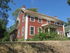 Elias Abel Houselisted 1982
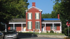 Blair-Dunning Houselisted 1983
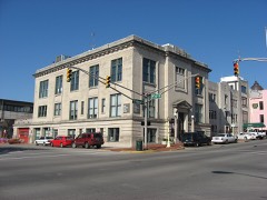 Bloomington City Halllisted 1989
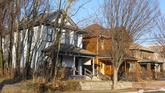 Bloomington West Side Historic Districtlisted 1997
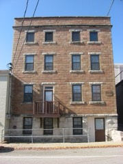 Cantol Wax Company Buildinglisted 1990
 Coca-Cola Bottling Company Plantlisted 2000
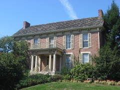 Cochran-Helton-Lindley Houselisted 1979
 Courthouse Square Historic Districtlisted 1990
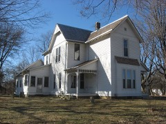 Hinkle-Garton Farmsteadlisted 2007
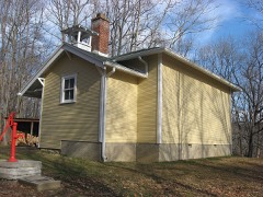 Honey Creek Schoollisted 1978
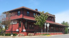 Illinois Central Railroad Freight Depotlisted 1983
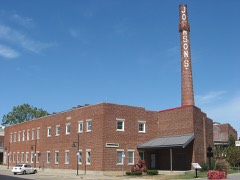 Johnson's Creamerylisted 1996
Population over time
2 figuresBloomington fell from 80,405 to 79,168 between 2010 and 2020. These are the recorded population figures Wikidata holds for this place, reached through the Geographic Names Information System number this page is keyed on rather than by name, so they belong to this place and not to another of the same name. Most are census counts, but not all are: an early figure may be a founding or settlement estimate, and an estimate published within five years of a census is left out. The change column is computed, and is left blank where more than 20 years separate a figure from the one before it, because a gap that long is not a change between two counts.
| Year | People | Change |
|---|---|---|
| 2010 | 80,405 | |
| 2020 | 79,168 | -1,237 (-2%) |
Topographic sheets covering this place
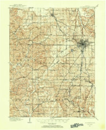
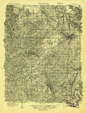
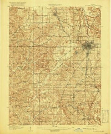
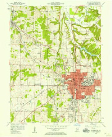
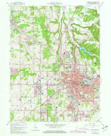
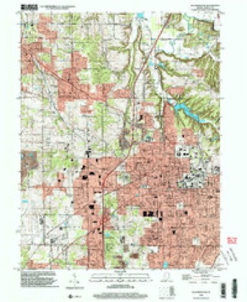
11 surveys from 25 printed sheetsMatched by testing this settlement's coordinate against the published boundary of every sheet in the United States Geological Survey's historical collection. Each opens the scanned sheet at the Survey.
- 1908 USGS Bloomington quadrangle1:62500
- 1908 USGS Bloomington quadrangle1:48000
- 1910 USGS Bloomington quadrangle1:62500, 6 printings
- 1953 USGS Indianapolis quadrangle1:250000, 4 printings
- 1956 USGS Bloomington quadrangle1:24000
- 1956 USGS Indianapolis quadrangle1:250000
- 1957 USGS Indianapolis quadrangle1:250000, 2 printings
- 1962 USGS Indianapolis quadrangle1:250000
- 1966 USGS Bloomington quadrangle1:24000, 4 printings
- 1986 USGS Bloomington quadrangle1:100000, 3 printings
- 1998 USGS Bloomington quadrangle1:24000





In the county-history sources
13,530 words on this township1884 History of Monroe County Indiana, published 1884 names this settlement in its chapter on Bloomington Township. These are the passages that mention it, exactly as the scans read.
The first man to settle permanently upon the present site of the city of Bloomington cannot be named with absolute certainty. Neither can the time of this first settlement be given. The first entries of land were as follows :
Passage source: 1884 History of Monroe County Indiana, published 1884.
At the time of the organization of the county, of course the population was sufficient to warrant such organization. Much of this population was near the center of the county, or on Township 9 north, Range 1 west, where it was known the county seat was likely to be located. As soon as the State Commissioner had bought land for the county seat of the Rogerses and Graham, the land in the vicinity of Bloomington rose suddenly in value and was in great demand. The town was laid out, not by the State Commission, but by the County Board, and while this was being done under the direction of the County Agent, many citizens of the county visited the spot. The streets running north and sauth, beginning on the west were named as follows: Poplar, Gherry, -Spring, West, Kast, Walnut, Blue and Buck, and those running east and west, beginning on the south, were Water, South, North and Washington. Some changes have since been made in these names. On the days of the first sale of lots, a large crowd of settlers of the county and speculators gathered to look on and possibly participate, and certainly to drink of the free whisky furnished by order of the County Board. Just why the sales were so large and at such a high figure cannot be stated, unless it was because it was known that Bloomington was destined to be a great educational center. One thing is historical :
Passage source: 1884 History of Monroe County Indiana, published 1884.
A. & J. Owens, Henry Batterton and J. O. Howe still continued their stores, steadily increasing the value and variety of the stock. Al kinds of goods then sold for twice or thrice as much as now. Calicoes and prints were from 25 cents to 50 cents per yard, and other articles similarly high, and what rendered the times harder was the lack of market for farm productions. Wheat, corn, oats, etc., were worth from 20 cents to 40 cents per bushel, and it was difficult to sell them at that. Money was scarce - good money. Paper money was in existence and was worth all prices below par. As the value of the bills constantly fluctuated, they were really merchantable property as gold and silver were during the last war. Silver money was scarce and gold scarcer. The smaller denominations were almost unknown except as they were created and used by mutual consent. A silver quarter was quartered or cut in half, and the pieces called " sharp shins " passed current for 6} cents or 123 cents. Money was so scarce, however, that merchants were forced to barter their goods and were compelled to do a provision, pork and grain business. Farmers could trade live or dressed hogs for goods, the demand regulating the supply and price. They could also trade their grain in the same manner. 'This forced the merchants into pork packing and grain buying, and to the construction of flat-boats for the conveyance of their products to the Southern markets. The towns along the larger streams had the advantage in these particulars, and nearly all the heavy grain and pork shipments were from such points. This accounts for the fact that extensive business in this direction was not done at Bloomington.
Passage source: 1884 History of Monroe County Indiana, published 1884.
Machine-read from a century-old scan, so expect the errors a machine makes: misspelled names, dropped words, stray characters.
Read the whole chapter on Bloomington Township - it names this place 35 more 35 times.
Fires near this place
68 since 2002Regional context, not property-specific evidence. The federal wildfire occurrence database lists 68 fires within 5 miles of Bloomington between 2002 and 2008, burning about 30 acres in total. 3 started naturally. 11 were recorded as arson. Distance is straight-line from the map coordinates, so a fire counted here may appear on a neighbouring settlement's page as well.
| Reported cause | Fires |
|---|---|
| Recreation and ceremony | 19 |
| Debris and open burning | 17 |
| Missing data/not specified/undetermined | 13 |
| Arson/incendiarism | 11 |
| Smoking | 4 |
| Natural | 3 |
| Other causes | 1 |
The most recent of them, most recent first, with the day each was reported and the service that recorded it.
| Date | Cause | Size | Reported by | Name on the report |
|---|---|---|---|---|
| 9 September 2005 | Debris and open burning | under an acre | Indiana State Fire Marshal's Office | not named |
| 3 September 2007 | Recreation and ceremony | 1.0 acres | Indiana State Fire Marshal's Office | not named |
| 18 September 2006 | Missing data/not specified/undetermined | under an acre | Indiana State Fire Marshal's Office | not named |
| 15 September 2006 | Recreation and ceremony | under an acre | Indiana State Fire Marshal's Office | not named |
| 1 September 2005 | Arson/incendiarism | under an acre | Indiana State Fire Marshal's Office | not named |
| 31 August 2007 | Missing data/not specified/undetermined | 1.0 acres | Indiana State Fire Marshal's Office | not named |
| 24 August 2007 | Smoking | under an acre | Indiana State Fire Marshal's Office | not named |
| 17 August 2007 | Debris and open burning | 1.0 acres | Indiana State Fire Marshal's Office | not named |
Settlements close enough to share some of these fires:
Mines and quarries near this place
10 of 15 shownRegional context, not property-specific evidence. The federal mineral resources record lists 15 workings within 5 miles of Bloomington: 10 past producers, 5 producers. 5 still produce. What was taken out: Limestone, Dimension, Stone. Distance is straight-line from the map coordinates, so a quarry counted here may appear on a neighbouring settlement's page as well.
| Where | Site | Commodity | Status | Recorded |
|---|---|---|---|---|
| Bloomington Limestone | Stone | Producer | ||
| Acme Quarry | Limestone, Dimension | Past Producer | ||
| Arlington Hills Quarry | Limestone, Dimension | Producer | ||
| Arlington Mill | Limestone, Dimension | Past Producer | ||
| Arlington Quarry | Limestone, Dimension | Past Producer | ||
| Ashtone Mill | Limestone, Dimension | Past Producer | ||
| Bennett Mill | Limestone, Dimension | Past Producer | ||
| Buffalo Quarry | Limestone, Dimension | Past Producer | ||
| Carl Furst Quarry | Limestone, Dimension | Past Producer | ||
| Ed Bennett Quarry | Limestone, Dimension | Past Producer |
Storms near this place
60 of 109 shownRegional context, not property-specific evidence. The National Weather Service names Bloomington in 109 storm reports between 1994 and 2026: 52 thunderstorm wind, 44 hail, 5 flash flood, 4 flood. The reports record 1 death and 3 injuries. Each account below is quoted exactly as the forecast office filed it, from the NOAA Storm Events Database, and each date opens the federal record of that event.
| When | Event | Place named | Harm | What the report says |
|---|---|---|---|---|
| October 2000 | Flash Flood | Bloomington | 1 killed | no account filed |
| June 2008 | Lightning | Bloomington | 3 hurt | Two individuals had lightning strike near them and were taken to the hospital for lighting related injuries. The cell phone of another individual was stuck while the person was talking on the phone. This individual was also taken to the hospital for treatment. |
| June 2024 | Thunderstorm Wind | Bloomington | $5,000,000 | Widespread significant tree damage across the city of Bloomington with numerous reports of property damage due to fallen trees and tree limbs. |
| April 2000 | Thunderstorm Wind | Bloomington | $200,000 | no account filed |
| May 2004 | Tornado (F0) | Bloomington | $150,000 | An F0 tornado moved across Lake Monroe southeast of Bloomington sinking several sailboats. |
| June 1998 | Thunderstorm Wind | Bloomington | $60,000 | Thunderstorm winds to 70 mph blew down dozens of trees and power lines. Up to four homes and several vehicles were damaged by fallen trees. |
| August 2004 | Thunderstorm Wind | Bloomington | $30,000 | Trees were downed in several locations across Bloomington, including one that crushed a car and another that fell on a barn. Damage amounts were estimated. |
| April 2006 | Thunderstorm Wind | Bloomington | $20,000 | Trees fell on a house. |
| May 2011 | Thunderstorm Wind | Bloomington | $15,000 | Several large trees were reported down due to damaging thunderstorm wind gusts. |
| May 2011 | Thunderstorm Wind | Bloomington | $15,000 | Multiple trees were reported down across Bloomington due to damaging thunderstorm wind gusts. |
| May 2011 | Thunderstorm Wind | Bloomington | $12,000 | Many trees and limbs were reported down due to damaging thunderstorm wind gusts. |
| September 2014 | Thunderstorm Wind | Bloomington | $10,000 | Trees were downed and a few homes sustained minor damage in an eastside Bloomington neighborhood. |
| January 2012 | Thunderstorm Wind | Bloomington | $9,000 | Three trees were blown down along State Route 45 due to damaging thunderstorm wind gusts. Two of the downed trees were at the intersection of State Route 45 and Russell Road. The other downed tree was just southwest of town. Two of the three trees looked healthy. Both instances of trees down at State Route 45 and Russell Road hit homes and caused minor roof damage. |
| August 2023 | Thunderstorm Wind | Bloomington | $5,000 | Thunderstorm winds caused tree damaged in Bloomington. |
| June 2010 | Thunderstorm Wind | Bloomington | $5,000 | Trees, up to 10 inches in diameter, were reported down due to damaging thunderstorm wind gusts on Moores Pike. |
| June 2010 | Thunderstorm Wind | Bloomington | $5,000 | Trees, up to 10 to 14 inches in diameter, were reported down due to damaging thunderstorm wind gusts in this location. |
| June 2008 | Flash Flood | Bloomington | $5,000 | Roadways were covered and previous flooding conditions were exacerbated due to heavy rainfall that caused renewed flash flooding. |
| April 1994 | Thunderstorm Wind | Bloomington | $5,000 | An automobile was totaled after a large tree fell on top of it. |
| April 2011 | Flash Flood | Bloomington | $2,000 | Multiple intersections were reported to be flooded with water up to about a foot deep. |
| June 1995 | Thunderstorm Wind | Bloomington | $2,000 | Trees and power lines were downed on the east side of Bloomington. |
| June 1995 | Thunderstorm Wind | Bloomington | $2,000 | Trees and power lines were downed in Bloomington. |
| February 2014 | Flood | Bloomington | $1,000 | Streets were reported to be flooded due to heavy thunderstorm rainfall. The campus bus routes were suspended. |
| June 2009 | Flash Flood | Bloomington | $1,000 | Streets were reported to be flooded in Bloomington due to thunderstorm heavy rainfall. |
| June 2009 | Flash Flood | Bloomington | $1,000 | Flash flooding of some county roads were reported throughout Monroe County due to thunderstorm heavy rainfall. A few intersections in Bloomington were flooded as well. The location of this event is estimated. |
| May 2002 | Thunderstorm Wind | Bloomington | $1,000 | Trees down |
| May 1996 | Thunderstorm Wind | Bloomington | $1,000 | no account filed |
| March 1996 | Thunderstorm Wind | Bloomington | $1,000 | no account filed |
| July 2008 | Thunderstorm Wind | Bloomington | $800 | Thunderstorm winds blew a tree down. |
| June 2015 | Flood | Bloomington | $500 | Some minor street flooding was reported in this location due to heavy rainfall. |
| July 2013 | Thunderstorm Wind | Bloomington | $500 | A trained spotter reported several tree branches down due to an estimated 60 mph thunderstorm wind gust. |
| January 2012 | Flood | Bloomington | $500 | Heavy thunderstorm rainfall caused 3.5 inches of standing water at the intersection of 3rd and Jordan Streets. |
| August 2004 | Tornado (F0) | Bloomington | $500 | A very small and brief tornado touched down from a thunderstorm near Bloomington, causing damage to several trees in the backyard of a residence. No one was injured, and no other significant damage was reported. |
| May 2011 | Thunderstorm Wind | Bloomington | $200 | A four inch diameter tree branch was reported down at 10th and Walnut Streets. |
| June 2025 | Thunderstorm Wind | Bloomington | - | Trained spotter estimated thunderstorm wind gusts up to 70 mph. |
| June 2024 | Thunderstorm Wind | Bloomington | - | A 60 mph thunderstorm wind gust was measured at this location. |
| April 2024 | Hail | Bloomington | - | Mainly 0.88 inch or smaller hail across Monroe County, included one golf ball sized hailstone, which was likely advected from the cluster's main updraft crossing southeastern portions of Monroe County. One-inch hail was also reported near and southeast of Bloomington. |
| June 2023 | Hail | Bloomington | - | Thunderstorm hail continued, as large as quarters in Bloomington. |
| July 2023 | Hail | Bloomington | - | Nickel sized hail on north side of Bloomington. Numerous reports of 0.50-0.75 inch hail from south of Ellettsville, through Bloomington, to near/southwest of Woodville Hills. |
| May 2017 | Hail | Bloomington | - | This report was received via Facebook. |
| March 2012 | Hail | Bloomington | - | The hail lasted for 10 minutes. |
| April 2011 | Thunderstorm Wind | Bloomington | - | A thunderstorm wind gust, estimated at 60 mph, was reported in Bloomington. |
| May 2011 | Thunderstorm Wind | Bloomington | - | A 70 to 80 mph thunderstorm wind gust was reported in this location, with much debris. |
| August 2011 | Thunderstorm Wind | Bloomington | - | An estimated 60 mph thunderstorm wind gust was observed in this location. Pea-sized hail was also observed. |
| August 2009 | Thunderstorm Wind | Bloomington | - | A spotter estimated thunderstorm wind gusts between 60 to 70 miles per hours in Bloomington. |
| January 2008 | Thunderstorm Wind | Bloomington | - | The wind gust was measured by ASOS equipment. |
| April 2007 | Thunderstorm Wind | Bloomington | - | Trees were reported down in several places due to damaging thunderstorm winds. |
| March 2006 | Flood | Bloomington | - | Two roads were closed due to high water. No property damage was reported. |
| April 2006 | Hail | Bloomington | - | No property damage estimates were available. |
| April 2006 | Hail | Bloomington | - | No property damage estimates were available. |
| May 2005 | Thunderstorm Wind | Bloomington | - | Several trees were blown down. |
| May 2005 | Thunderstorm Wind | Bloomington | - | Trees were downed near Bloomington. |
| May 2005 | Thunderstorm Wind | Bloomington | - | Power lines were blown down at the south end of Lake Monroe. |
| June 2005 | Thunderstorm Wind | Bloomington | - | Trees were blown down. |
| July 2005 | Thunderstorm Wind | Bloomington | - | Large tree limbs fell. |
| November 2005 | Thunderstorm Wind | Bloomington | - | Trees were downed. |
| July 2004 | Thunderstorm Wind | Bloomington | - | A large tree was downed. |
| July 2004 | Thunderstorm Wind | Bloomington | - | Trees were downed. |
| July 2003 | Thunderstorm Wind | Bloomington | - | Trees down in Harrodsburg |
| May 2002 | Thunderstorm Wind | Bloomington | - | Large limbs down |
| April 2002 | Hail | Bloomington | - | Hail covered the ground |
Nearest settlements
The eight closest, with where each one stands in the county. Distances are straight-line, computed from the Geographic Names Information System coordinates.
| Map | Place | Distance | Sheets |
|---|---|---|---|
| Ridgemede | 1.5 miles | 25 | |
| Arlington | 1.8 miles | 25 | |
| Cascade | 1.9 miles | 25 | |
| Broadview | 1.9 miles | 25 | |
| Hoosier Acres | 2.2 miles | 21 | |
| Sunny Slopes | 2.3 miles | 25 | |
| Eastern Heights | 2.5 miles | 21 | |
| Hunter Switch | 2.6 miles | 25 |
Elsewhere
Matched on this settlement's Geographic Names Information System number rather than its name, so it cannot be a different place of the same name in another state.
| Wikipedia article on Bloomington | An encyclopaedic summary. Its text is share-alike, so it is linked here rather than copied. |
| Wikidata item Q490385 | The structured record the population and elevation above come from. Public domain (CC0). |
Provenance
This settlement is recorded in the Geographic Names Information System as feature 431207. The sheet list is computed by point-in-boundary test against the United States Geological Survey's historical topographic inventory. Both are works of the United States government and carry no copyright under 17 U.S.C. 105.
Wildfire. Short, Karen C. 2022. Spatial wildfire occurrence data for the United States, 1992-2020 [FPA_FOD_20221014]. 6th Edition. Fort Collins, CO: Forest Service Research Data Archive. https://doi.org/10.2737/RDS-2013-0009.6 Collected with United States Government funding and usable without additional permissions or fees.
Mines and quarries. USGS Mineral Resources Data System (MRDS) https://mrdata.usgs.gov/mrds/ A work of the United States government, no copyright under 17 U.S.C. 105.
Storms. NOAA National Centers for Environmental Information, Storm Events Database https://www.ncei.noaa.gov/stormevents/ A work of the United States government, no copyright under 17 U.S.C. 105. Narratives are quoted verbatim from the National Weather Service report and are not edited or summarised.