 Block
Bluffs, Indiana
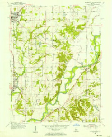
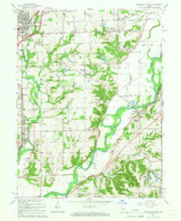
14 topographic sheets cover this place, the earliest surveyed in 1953 and the latest in 1986. It stands in Harrison Township. It lies in ZIP code area 46151. It stands on North Bluff Creek. The Survey maps it on the Mooresville East quadrangle. It stands 699 feet above sea level.
Topographic sheets covering this place
7 surveys from 14 printed sheetsMatched by testing this settlement's coordinate against the published boundary of every sheet in the United States Geological Survey's historical collection. Each opens the scanned sheet at the Survey.
- 1953 USGS Indianapolis quadrangle1:250000, 4 printings
- 1955 USGS Mooresville East quadrangle1:24000
- 1956 USGS Indianapolis quadrangle1:250000
- 1957 USGS Indianapolis quadrangle1:250000, 2 printings
- 1962 USGS Indianapolis quadrangle1:250000
- 1965 USGS Mooresville East quadrangle1:24000, 3 printings
- 1986 USGS Indianapolis quadrangle1:100000, 2 printings





In the county-history sources
33,061 words on this townshipCounties of Morgan, Monroe, and Brown, Indiana. Historical and Biographical, published 1884 names this settlement in its chapter on Harrison Township. These are the passages that mention it, exactly as the scans read.
In the summer of 1818, before the lands of the New Purchase had been ceded to the Government by the Indians, Jacob Whetzel, brother to the famous Indian fighter, Lewis Whetzel, and an Indian fighter himself, went to the camp of the Delaware chief, Anderson, whose principal village was where the city of Anderson now stands, to get permission to cut a trace from White Water River in the eastern part of the State to the BluflFs* on White River, the object being to secure a road from such eastern point to the Bluffs, the remainder of the way to Vincennes to be by the river. Mr. Whetzel had in view then a permanent location at or near Vincennes. Permission was granted by Anderson, and the following autumn Mr. Whetzel, accompanied by his son Cyrus, and supplied with the necessary axes, guns, provisions, etc., blazed this route through to the Bluffs. This blazed road through the wilderness was probably the first in this part of the State, and became a famous highway for families seeking homes in the New Purchase. It may yet be seen in some places, and is still known as " Whetzel's Trace." Mr. Whetzel was so pleased with the Bluffs and the surrounding country that he resolved to go no farther toward Vincennes with a view of settlement, whereupon he selected a piece of land in the valley of White River a short distance north of the present residence of his grandson-iii-law, Mr. McKenzie, and resolved to send out his son, Cyrus, the following spring to clear a small tract and raise a crop. Early the next spring (March, 1819), Jacob and his. son Cyrus, with the necessary seeds, implements and arms, came via Whetzel's Trace to the Bluffs, estab- lished with stakes the permaaent boundary of about sixty acres of land just below Waverly, and after erecting a rude log cabin the father went back to his family, leaving Cyrus to clear immediately a few acres for a crop of corn, wheat and vegetables, and to deaden a larger tract during the summer. The second night after the father had gone, a heavy snow fell, and Cyrus built a large fire to drive off the wolves and the cold. During the night, he felt something creep under the blanket under which he was sleeping, but was too unconcerned to make further discoveries until the next morning when he was somewhat surprised to learn that his sleeping companion was none other than a huge Delaware Indian. This discovery was not sufficient to scare vfery perceptibly a man in whose veins ran the distinguished blood of the Whetzels. Cyrus was but eighteen years of age, yet he felt no fear in the wilderness, though surrounded with wild and dangerous animals, and with the scarcely less wild and dangerous Indians.
Passage source: Counties of Morgan, Monroe, and Brown, Indiana. Historical and Biographical, published 1884.
The Bluffs were known before there was a solitary settler in the county. Frenchmen from Vincennes and vicinity had come up the river before the war of 1812 ; and if tradition is correct had established temporary trading stations with the Delaware Indians, who then occupied the country. Various adventurers and speculators had visited the spot, and it became called The Bluffs. It is likely that Christopher Ladd was the first white settler at the point. He located there either in 1819 or early in 1820. He it was who claimed the location of the capital of the State at the Bluffs. Several of. the Commissioners appointed by the Legislature to permanently fix the capital voted in favor of the Bluffs. Mr. Ladd began keeping tavern there before the county was organized, and was the first man in the county to take out the necessary license to keep tavern and sell liquor. The corpse of a man was found on the river bottom near his house, and Mr. Ladd was arrested and tried for the murder, but not a shadow of substantial evidence was found against him. He was acquitted, and his lack of means only prevented him from prosecuting his defamers, as they no doubt deserved. This was the first noteworthy trial of the county. Cyrus Whetzel and Mr. Ladd were intimate friends, and the former always insisted on the latter's innocence. Mr. Whetzel always suspected an Indian, who, after the murder, was found in possession of a horse and saddle, a black silk handkerchief, a red morocco pocket-book, etc., of which he failed to give a satisfactory account. No doubt the murdered man had come out to buy land, and falling in with the Indian was foully murdered for his effects.
Passage source: Counties of Morgan, Monroe, and Brown, Indiana. Historical and Biographical, published 1884.
The Bluffs, or Port Royal, as it became called afterward, attracted settlers early. Ladd was the first. Robert Bradshaw was probably the second. Daniel Allen was about the third. He was the first tailor. He sold liquor in 1827 and merchandise in 1828. Bradshaw sold liquor in 1826. Ladd's tavern was a great rendezvous for those who loved the flowing bowl. It was a great pleasure for the early settlers at Port Royal to gather round his blazing bar-room fire when the nights were icy cold and the bitter wind dashed the falling snow in eddies around the old log tavern, to listen to the stories of the travelers who stopped there for rest. It became a famous place. The early members of the Legislature from the southern part of the State would make Ladd's tavern their last stopping place before reaching the capital and the first place after leavTng it. Mrs. Ladd was a genial, hospitable woman, a good conversationalist, and a woman who could not be excelled in the manufacture of good tea and cofiee. Her guests discovered this latter fact, and a word of praise was sufficient to insure a beverage rarely found in the backwoods. On one occasion, her supply failed so nearly that she was obliged to mix tea and coffee as a last desperate resort. A traveler sipped the steaming beverage, raised his eyebrows, curled up the corners of his mouth in a sagacious smile, and speaking to his hostess, said, " Mrs. Ladd, if this is tea bring me coffee, and if it's coff'ee bring me tea." The good lady was obliged to explain the situation, which satisfied the polite traveler, who resumed his meal.
Passage source: Counties of Morgan, Monroe, and Brown, Indiana. Historical and Biographical, published 1884.
Machine-read from a century-old scan, so expect the errors a machine makes: misspelled names, dropped words, stray characters.
Mines and quarries near this place
8 within 5 milesRegional context, not property-specific evidence. The federal mineral resources record lists 8 workings within 5 miles of Bluffs: 6 producers, 2 past producers. 6 still produce. What was taken out: Sand and Gravel, Construction, Flagstone. Distance is straight-line from the map coordinates, so a quarry counted here may appear on a neighbouring settlement's page as well.
| Where | Site | Commodity | Status | Recorded |
|---|---|---|---|---|
| High Bluff Quarry | Flagstone | Past Producer | ||
| Central Aggregates Pit | Sand and Gravel, Construction | Producer | ||
| Central Aggregates Pit | Sand and Gravel, Construction | Producer | ||
| Hill #1 | Sand and Gravel, Construction | Producer | ||
| Hoosier Dredge | Sand and Gravel, Construction | Producer | ||
| Hoosier Gravel Pit | Sand and Gravel, Construction | Producer | ||
| Port Royal Pit | Sand and Gravel, Construction | Past Producer | ||
| Waverly Sand & Gravel | Sand and Gravel, Construction | Producer |
Nearest settlements
The eight closest, with where each one stands in the county. Distances are straight-line, computed from the Geographic Names Information System coordinates.
| Map | Place | Distance | Sheets |
|---|---|---|---|
| Waverly | 1.4 miles | 14 | |
| Waverly Woods | 1.6 miles | 14 | |
| Fox Hill | 2.8 miles | 14 | |
| Banta | 3.1 miles | 14 | |
| Landersdale | 3.5 miles | 14 | |
| Five Points | 3.6 miles | 14 | |
| Crestview Heights | 3.6 miles | 14 | |
| Wiser | 3.7 miles | 14 |
Elsewhere
Matched on this settlement's Geographic Names Information System number rather than its name, so it cannot be a different place of the same name in another state.
| Wikidata item Q4930686 | The structured record the population and elevation above come from. Public domain (CC0). |
Provenance
This settlement is recorded in the Geographic Names Information System as feature 431263. The sheet list is computed by point-in-boundary test against the United States Geological Survey's historical topographic inventory. Both are works of the United States government and carry no copyright under 17 U.S.C. 105.
Mines and quarries. USGS Mineral Resources Data System (MRDS) https://mrdata.usgs.gov/mrds/ A work of the United States government, no copyright under 17 U.S.C. 105.