 Block
Waverly, Indiana
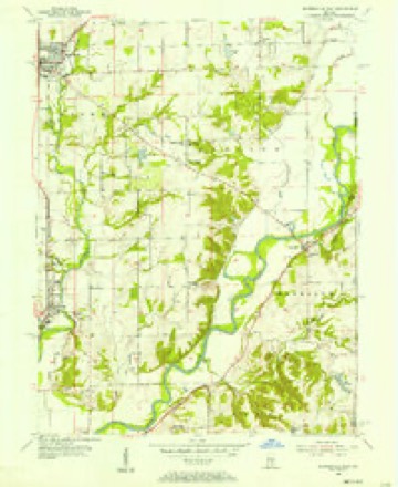
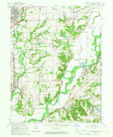
14 topographic sheets cover this place, the earliest surveyed in 1953 and the latest in 1986. It stands in Harrison Township. It lies in ZIP code area 46151. It stands on Bluff Creek. The Survey maps it on the Mooresville East quadrangle. It stands 643 feet above sea level.
Topographic sheets covering this place
7 surveys from 14 printed sheetsMatched by testing this settlement's coordinate against the published boundary of every sheet in the United States Geological Survey's historical collection. Each opens the scanned sheet at the Survey.
- 1953 USGS Indianapolis quadrangle1:250000, 4 printings
- 1955 USGS Mooresville East quadrangle1:24000
- 1956 USGS Indianapolis quadrangle1:250000
- 1957 USGS Indianapolis quadrangle1:250000, 2 printings
- 1962 USGS Indianapolis quadrangle1:250000
- 1965 USGS Mooresville East quadrangle1:24000, 3 printings
- 1986 USGS Indianapolis quadrangle1:100000, 2 printings





In the county-history sources
33,061 words on this townshipCounties of Morgan, Monroe, and Brown, Indiana. Historical and Biographical, published 1884 names this settlement in its chapter on Harrison Township. These are the passages that mention it, exactly as the scans read.
NO. Other portion of Morgan County is surrounded with greater historical interest than Waverly and vicinity. Here it was that the first settlement in the county was made while the Indians were yet occupying the soil, and while all the species of wild animals of this latitude yet roamed almost wholly unmolested m the trackless forest. The "New Purchase," of which Morgan County was a part, was secured from the Indians by the treaty of St. Mary's, Ohio, in October, 1818 ; but by the provisions of the treaty, the natives were to have the privilege of residing upon the soil and of hunting thereon until 1820. The land could not be formally thrown upon the market until after the expiration of this privilege of occupancy, but the whites could enter the territory, select their farms and improve the same, and be in readiness to purchase when the land became marketable. This was done in Morgan County to a limited extent.
Passage source: Counties of Morgan, Monroe, and Brown, Indiana. Historical and Biographical, published 1884.
In the summer of 1818, before the lands of the New Purchase had been ceded to the Government by the Indians, Jacob Whetzel, brother to the famous Indian fighter, Lewis Whetzel, and an Indian fighter himself, went to the camp of the Delaware chief, Anderson, whose principal village was where the city of Anderson now stands, to get permission to cut a trace from White Water River in the eastern part of the State to the BluflFs* on White River, the object being to secure a road from such eastern point to the Bluffs, the remainder of the way to Vincennes to be by the river. Mr. Whetzel had in view then a permanent location at or near Vincennes. Permission was granted by Anderson, and the following autumn Mr. Whetzel, accompanied by his son Cyrus, and supplied with the necessary axes, guns, provisions, etc., blazed this route through to the Bluffs. This blazed road through the wilderness was probably the first in this part of the State, and became a famous highway for families seeking homes in the New Purchase. It may yet be seen in some places, and is still known as " Whetzel's Trace." Mr. Whetzel was so pleased with the Bluffs and the surrounding country that he resolved to go no farther toward Vincennes with a view of settlement, whereupon he selected a piece of land in the valley of White River a short distance north of the present residence of his grandson-iii-law, Mr. McKenzie, and resolved to send out his son, Cyrus, the following spring to clear a small tract and raise a crop. Early the next spring (March, 1819), Jacob and his. son Cyrus, with the necessary seeds, implements and arms, came via Whetzel's Trace to the Bluffs, estab- lished with stakes the permaaent boundary of about sixty acres of land just below Waverly, and after erecting a rude log cabin the father went back to his family, leaving Cyrus to clear immediately a few acres for a crop of corn, wheat and vegetables, and to deaden a larger tract during the summer. The second night after the father had gone, a heavy snow fell, and Cyrus built a large fire to drive off the wolves and the cold. During the night, he felt something creep under the blanket under which he was sleeping, but was too unconcerned to make further discoveries until the next morning when he was somewhat surprised to learn that his sleeping companion was none other than a huge Delaware Indian. This discovery was not sufficient to scare vfery perceptibly a man in whose veins ran the distinguished blood of the Whetzels. Cyrus was but eighteen years of age, yet he felt no fear in the wilderness, though surrounded with wild and dangerous animals, and with the scarcely less wild and dangerous Indians.
Passage source: Counties of Morgan, Monroe, and Brown, Indiana. Historical and Biographical, published 1884.
Mr. Whetzel one day loaned a Delaware his " gig " to spear fish, and when it was returned one of the prongs was gone, the Indian stating that he had broken it off in a log. A few days later, Mr. Whetzel came upon the same Indian on the river where he had speared a wagon load of the finest fish, with a gig made from the broken prong, which had been driven into the end of a tough slender pole. This Indian was engaged in drying the fish. He was so expert that he could strike a fish eight or ten yards away. Many years ago, the Whetzels discovered about a half bushel of bullets of all sizes from a shot to a half-ounce ball on the bottom near Waverly. They had been scattered out over several rods, by the action of the water no doubt, but how they came there is a mystery yet to be solved.
Passage source: Counties of Morgan, Monroe, and Brown, Indiana. Historical and Biographical, published 1884.
Machine-read from a century-old scan, so expect the errors a machine makes: misspelled names, dropped words, stray characters.
Read the whole chapter on Harrison Township - it names this place 5 more 5 times.
Mines and quarries near this place
10 within 5 milesRegional context, not property-specific evidence. The federal mineral resources record lists 10 workings within 5 miles of Waverly: 8 producers, 2 past producers. 8 still produce. What was taken out: Sand and Gravel, Construction, Clay, Flagstone. Distance is straight-line from the map coordinates, so a quarry counted here may appear on a neighbouring settlement's page as well.
| Where | Site | Commodity | Status | Recorded |
|---|---|---|---|---|
| Brooklyn | Clay | Producer | ||
| High Bluff Quarry | Flagstone | Past Producer | ||
| Central Aggregates Pit | Sand and Gravel, Construction | Producer | ||
| Central Aggregates Pit | Sand and Gravel, Construction | Producer | ||
| Hill #1 | Sand and Gravel, Construction | Producer | ||
| Hoosier Dredge | Sand and Gravel, Construction | Producer | ||
| Hoosier Gravel Pit | Sand and Gravel, Construction | Producer | ||
| Port Royal | Sand and Gravel, Construction | Producer | ||
| Port Royal Pit | Sand and Gravel, Construction | Past Producer | ||
| Waverly Sand & Gravel | Sand and Gravel, Construction | Producer |
Storms near this place
4 since 1996Regional context, not property-specific evidence. The National Weather Service names Waverly in 4 storm reports between 1996 and 2011: 4 thunderstorm wind. No death or injury is recorded in these reports. Each account below is quoted exactly as the forecast office filed it, from the NOAA Storm Events Database, and each date opens the federal record of that event.
| When | Event | Place named | Harm | What the report says |
|---|---|---|---|---|
| May 1996 | Thunderstorm Wind | Waverly | $30,000 | no account filed |
| June 1998 | Thunderstorm Wind | Waverly | $20,000 | Thunderstorm winds damaged a trucking building and blew a worker out of the building. He was not reported to be injured. |
| June 2011 | Thunderstorm Wind | Waverly | - | Damaging thunderstorm wind gusts estimated at 55 to 60 mph occurred in this location. |
| June 2010 | Thunderstorm Wind | Waverly | - | This 64 mph wind gust was measured at the intersection of State Routes 144 and 37. |
Nearest settlements
The eight closest, with where each one stands in the county. Distances are straight-line, computed from the Geographic Names Information System coordinates.
| Map | Place | Distance | Sheets |
|---|---|---|---|
| Waverly Woods | 0.4 miles | 14 | |
| Bluffs | 1.4 miles | 14 | |
| Banta | 2.5 miles | 14 | |
| Five Points | 2.9 miles | 14 | |
| Crestview Heights | 3.1 miles | 14 | |
| Fox Hill | 3.1 miles | 14 | |
| Fields | 3.4 miles | 14 | |
| Wiser | 4.0 miles | 14 |
Elsewhere
Matched on this settlement's Geographic Names Information System number rather than its name, so it cannot be a different place of the same name in another state.
| Wikipedia article on Waverly | An encyclopaedic summary. Its text is share-alike, so it is linked here rather than copied. |
| Wikidata item Q7975454 | The structured record the population and elevation above come from. Public domain (CC0). |
Provenance
This settlement is recorded in the Geographic Names Information System as feature 445565. The sheet list is computed by point-in-boundary test against the United States Geological Survey's historical topographic inventory. Both are works of the United States government and carry no copyright under 17 U.S.C. 105.
Mines and quarries. USGS Mineral Resources Data System (MRDS) https://mrdata.usgs.gov/mrds/ A work of the United States government, no copyright under 17 U.S.C. 105.
Storms. NOAA National Centers for Environmental Information, Storm Events Database https://www.ncei.noaa.gov/stormevents/ A work of the United States government, no copyright under 17 U.S.C. 105. Narratives are quoted verbatim from the National Weather Service report and are not edited or summarised.