 Block
Boonville, Indiana
19 topographic sheets cover this place, the earliest surveyed in 1902 and the latest in 1986. It stands in Boon Township. It lies in ZIP code area 47601. The Survey maps it on the Boonville quadrangle. 6,712 people lived here at the 2020 count. It stands 423 feet above sea level.
On record in Boonville
Buildings and businesses the archive holds for this place. Each opens its own page, with the source record it came from.
On the National Register 2 records
 Boonville Public Square Historic Districtlisted 1987
 Old Warrick County Jaillisted 1979
Population over time
2 figuresBoonville grew from 6,246 to 6,712 between 2010 and 2020. These are the recorded population figures Wikidata holds for this place, reached through the Geographic Names Information System number this page is keyed on rather than by name, so they belong to this place and not to another of the same name. Most are census counts, but not all are: an early figure may be a founding or settlement estimate, and an estimate published within five years of a census is left out. The change column is computed, and is left blank where more than 20 years separate a figure from the one before it, because a gap that long is not a change between two counts.
| Year | People | Change |
|---|---|---|
| 2010 | 6,246 | |
| 2020 | 6,712 | +466 (+7%) |
Topographic sheets covering this place
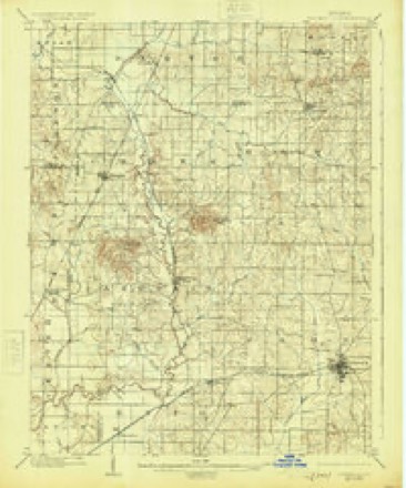
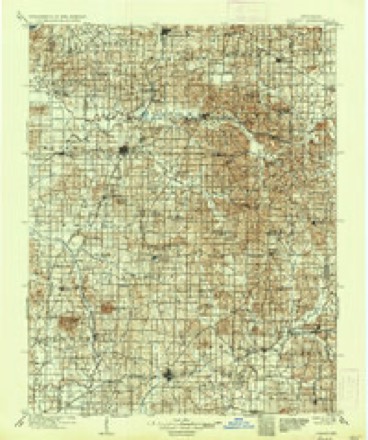
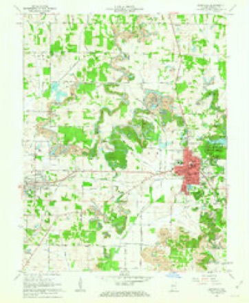
7 surveys from 19 printed sheetsMatched by testing this settlement's coordinate against the published boundary of every sheet in the United States Geological Survey's historical collection. Each opens the scanned sheet at the Survey.
- 1902 USGS Boonville quadrangle1:62500, 4 printings
- 1902 USGS Ditney quadrangle1:125000, 3 printings
- 1956 USGS Vincennes quadrangle1:250000, 4 printings
- 1957 USGS Vincennes quadrangle1:250000
- 1958 USGS Vincennes quadrangle1:250000, 2 printings
- 1961 USGS Boonville quadrangle1:24000, 3 printings
- 1986 USGS Princeton quadrangle1:100000, 2 printings




In the county-history sources
94 words on this townshipWarrick and Its Prominent People : a History of Warrick County, Indiana, from the Time of Its Organization and Settlement, with Biographical Sketches of Some of Its Prominent People of the Past and Present, published 1881 has no passage naming this settlement, which was common for smaller places. Its township is covered in full.
The chapter on Boon Township covers the township.
Read the chapter on Boon Township - 94 words.
Mines and quarries near this place
1 within 5 milesRegional context, not property-specific evidence. The federal mineral resources record lists 1 working within 5 miles of Boonville: 1 producer. All of them still produce. What was taken out: Stone. Distance is straight-line from the map coordinates, so a quarry counted here may appear on a neighbouring settlement's page as well.
| Where | Site | Commodity | Status | Recorded |
|---|---|---|---|---|
| Warrick Co. Hwy. Dept. | Stone | Producer |
Storms near this place
58 since 1996Regional context, not property-specific evidence. The National Weather Service names Boonville in 58 storm reports between 1996 and 2025: 23 thunderstorm wind, 15 hail, 9 flash flood, 4 flood. The reports record 2 injuries. Each account below is quoted exactly as the forecast office filed it, from the NOAA Storm Events Database, and each date opens the federal record of that event.
| When | Event | Place named | Harm | What the report says |
|---|---|---|---|---|
| April 1996 | Flash Flood | Boonville | 1 hurt, $80,000 | no account filed |
| May 2011 | Thunderstorm Wind | Boonville | 1 hurt, $50,000 | A large tree fell on a home, injuring one person. Multiple large trees were down on the south side of town. |
| April 2015 | Thunderstorm Wind | Boonville | $105,000 | A microburst containing winds estimated near 85 mph tracked north and northeast of Boonville. More than a dozen homes and other structures lost shingles or pieces of siding. Dozens of trees were uprooted. Many tree limbs were blown down. The microburst was about one mile wide on average. |
| April 2011 | Tornado (EF2) | Boonville | $90,000 | At the initial damage point just southwest of Greenbrier, many trees were snapped or uprooted. As the tornado crossed Highway 61, it demolished a barn and tossed the debris about 50 to 75 yards. Another barn was damaged, and numerous large trees were uprooted and snapped. Several homes suffered roof damage from both the wind and from trees or large branches falling on them. Three telephone poles were snapped on Highway 61. Parts of the damage path were over inaccessible, roadless coal mine property. Peak winds were estimated near 120 mph. The average path width was 300 yards. |
| April 2024 | Thunderstorm Wind | Boonville | $70,000 | A microburst with 70-90 mph winds occurred in Warrick County south of Boonville, Indiana on the morning of April 2, 2024. The swath of damage was about 5 miles in length and 0.75 miles in width, stretching from Geneva Way to Metz Road, south of Maple Grove Road. Trees were uprooted and minor damage occurred to several homes including some fascia, siding, and shingle damage. |
| July 2024 | Thunderstorm Wind | Boonville | $50,000 | Several trees and powerlines were downed in Boonville and a front porch was shifted as a powerful surge in the storm line moved southeastward through the town. |
| September 2009 | Flash Flood | Boonville | $30,000 | Many low-lying areas of Boonville were under water. Some roads were under as much as four feet of water. Numerous roads were flooded, with stranded cars. Some homes were flooded. A CoCoRahs (Community Collaborative Rain, Hail, and Snow) Network observer reported 1.57 inches of rain about a mile north of the city. The ground was already very moist from between 3 and 4 inches of rain that fell on the 20th. |
| August 2023 | Flash Flood | Boonville | $25,000 | Numerous main roads were closed around Boonville. Cars stalled due to flash flooding. |
| April 2007 | Thunderstorm Wind | Boonville | $15,000 | Three utility poles were snapped. A tree and numerous branches were blown down. |
| June 2011 | Thunderstorm Wind | Boonville | $10,000 | About a dozen trees were blown down at a country club on the northwest side of town. |
| January 2008 | Thunderstorm Wind | Boonville | $10,000 | Traffic signals and signs were blown down. |
| July 1997 | Thunderstorm Wind | Boonville | $10,000 | Trees and power lines were blown down throughout the county. |
| September 2012 | Thunderstorm Wind | Boonville | $9,000 | A roof was partially blown off a car wash. Two trees were blown down. |
| February 2008 | Thunderstorm Wind | Boonville | $5,000 | A few trees and power lines were down. |
| August 2001 | Thunderstorm Wind | Boonville | $5,000 | Numerous trees and power lines were blown down. |
| June 1998 | Flash Flood | Boonville | $5,000 | no account filed |
| June 1999 | Thunderstorm Wind | Boonville | $3,000 | Trees were down. |
| June 1998 | Thunderstorm Wind | Boonville | $3,000 | Power lines were down. |
| September 2005 | Thunderstorm Wind | Boonville | $2,000 | Several trees were blown down. A small billboard was blown down in front of the American Legion building. |
| April 2024 | Thunderstorm Wind | Boonville | $1,000 | A thunderstorm wind gust of 58 mph was measured on the SE side of Boonville. |
| March 2025 | Hail | Boonville | - | Hail up to the size of quarters fell just south of Boonville. |
| July 2025 | Flood | Boonville | - | Brief minor flooding of several roads occurred in Boonville as heavy rainfall produced approximately an inch of rain in 45 minutes. Lack of additional storms kept flooding issues from worsening. |
| July 2024 | Flash Flood | Boonville | - | Localized flash flooding occurred in and around Boonville. A measured 2.32 inches of rainfall occurred primarily between 1745-1900CST. |
| June 2023 | Thunderstorm Wind | Boonville | - | A greenhouse was damaged where a wind gust was measured at 68 mph. |
| June 2013 | Heavy Rain | Boonville | - | Water was reported over a couple of intersections. |
| July 2013 | Heavy Rain | Boonville | - | A trained spotter reported three inches of rain during the early evening hours. |
| June 2013 | Heavy Rain | Boonville | - | A co-operative observer reported a storm-total rainfall of 5.03 inches. |
| March 2012 | Thunderstorm Wind | Boonville | - | A tree was blown down across Highway 61 just north of Boonville. |
| April 2011 | Hail | Boonville | - | Hail up to the size of golf balls covered the ground. This hailstorm was the same storm that struck Newburgh a short time earlier. |
| June 2008 | Thunderstorm Wind | Boonville | - | A spotter estimated wind gusts to 60 mph. No damage was reported. |
| April 2007 | Hail | Boonville | - | Penny to quarter size hail was reported with the storm. The penny-size hail fell in Paradise, with quarter-size hail in Boonville. |
| March 2006 | Thunderstorm Wind | Boonville | - | Some tree limbs and whole trees were blown down. A trained spotter estimated wind gusts up to 60 MPH. |
| April 2006 | Hail | Boonville | - | Quarter size hail fell in Tennyson, and dime size hail fell several miles south of Boonville. |
| May 2006 | Hail | Boonville | - | Golf-ball size hail fell four miles north of Boonville. Nickel-size hail fell in Folsomville. |
| May 2006 | Funnel Cloud | Boonville | - | A spotter reported a cold air funnel cloud was undulating from the cloud base. |
| May 2005 | Hail | Boonville | - | Hail fell for less than one minute. |
| August 2005 | Heavy Rain | Boonville | - | About five inches of water was on Main Street, and a few other side streets had water over them. |
| March 2004 | Flash Flood | Boonville | - | Slow-moving thunderstorms produced heavy rainfall. Water was over U.S. Highway 62 at Boonville. |
| May 2003 | Thunderstorm Wind | Boonville | - | Small trees were uprooted near Highway 61 in the Turpin Hill area. |
| April 2003 | Hail | Boonville | - | A severe thunderstorm moved east across Warrick County, producing very large hail near Boonville. Hail was reported to be 2.5 inches in diameter, nearly baseball size, just north of Boonville. The hail broke windows and damaged vehicles. |
| April 2002 | Thunderstorm Wind | Boonville | - | Two trees were down on Yankeetown Highway. |
| September 2002 | Flood | Boonville | - | The remnants of Tropical Storm Isidore moved slowly north from the Louisiana coast, passing through central Kentucky around daybreak on the 27th. Rainfall amounts were in the 2 to 4 inch range across Warrick County. A spotter reported 3.8 inches of rain at Boonville, causing minor flooding of streets, yards, and flood-prone areas. The region was in the midst of a drought, which allowed the ground to soak up the rainfall efficiently. |
| August 2001 | Flash Flood | Boonville | - | Slow-moving thunderstorms produced very heavy rainfall that flooded Highway 662. Spotters reported water 2 inches deep in parts of Boonville, and more thunderstorms were on the way at the time of the report. |
| October 2001 | Hail | Boonville | - | Dime size hail was reported from Boonville to the Spencer County line, several miles southeast of Boonville. |
| July 2000 | Flood | Boonville | - | Minor street flooding occurred in the city of Boonville. About 2 inches of water was on 4th Street, with water also noted on Highway 61 north and Highway 62. The flooding was the result of thunderstorms producing an estimated one to 1.5 inches of rain. |
| August 1998 | Flood | Boonville | - | Spotters reported up to 3 inches of rain from thunderstorms. |
| November 2019 | Hail | Boonville | - | no account filed |
| May 2014 | Hail | Boonville | - | no account filed |
| April 2011 | Funnel Cloud | Boonville | - | no account filed |
| October 2010 | Hail | Boonville | - | no account filed |
| February 2008 | Hail | Boonville | - | no account filed |
| May 2005 | Hail | Boonville | - | no account filed |
| May 2004 | Flash Flood | Boonville | - | no account filed |
| May 2003 | Thunderstorm Wind | Boonville | - | no account filed |
| April 2002 | Flash Flood | Boonville | - | no account filed |
| May 2002 | Hail | Boonville | - | no account filed |
| August 2001 | Hail | Boonville | - | no account filed |
| July 1996 | Thunderstorm Wind | Boonville | - | no account filed |
Nearest settlements
The eight closest, with where each one stands in the county. Distances are straight-line, computed from the Geographic Names Information System coordinates.
| Map | Place | Distance | Sheets |
|---|---|---|---|
| Rolling Acres | 1.2 miles | 19 | |
| Center | 3.7 miles | 19 | |
| Pelzer | 4.2 miles | 17 | |
| De Gonia Springs | 4.7 miles | 17 | |
| Ash Iron Springs | 4.7 miles | 17 | |
| New Hope | 4.9 miles | 16 | |
| Greenbrier | 5.0 miles | 19 | |
| Chandler | 5.0 miles | 19 |
Elsewhere
Matched on this settlement's Geographic Names Information System number rather than its name, so it cannot be a different place of the same name in another state.
| Wikipedia article on Boonville | An encyclopaedic summary. Its text is share-alike, so it is linked here rather than copied. |
| Wikidata item Q2799024 | The structured record the population and elevation above come from. Public domain (CC0). |
Provenance
This settlement is recorded in the Geographic Names Information System as feature 431342. The sheet list is computed by point-in-boundary test against the United States Geological Survey's historical topographic inventory. Both are works of the United States government and carry no copyright under 17 U.S.C. 105.
Mines and quarries. USGS Mineral Resources Data System (MRDS) https://mrdata.usgs.gov/mrds/ A work of the United States government, no copyright under 17 U.S.C. 105.
Storms. NOAA National Centers for Environmental Information, Storm Events Database https://www.ncei.noaa.gov/stormevents/ A work of the United States government, no copyright under 17 U.S.C. 105. Narratives are quoted verbatim from the National Weather Service report and are not edited or summarised.