 Block
Boswell, Indiana
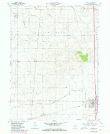
9 topographic sheets cover this place, the earliest surveyed in 1953 and the latest in 1990. It stands in Grant Township. It lies in ZIP code area 47921. The Survey maps it on the Boswell quadrangle.
Topographic sheets covering this place
6 surveys from 9 printed sheetsMatched by testing this settlement's coordinate against the published boundary of every sheet in the United States Geological Survey's historical collection. Each opens the scanned sheet at the Survey.
- 1953 USGS Danville quadrangle1:250000, 3 printings
- 1955 USGS Danville quadrangle1:250000
- 1956 USGS Danville quadrangle1:250000
- 1962 USGS Boswell quadrangle1:24000, 2 printings
- 1984 USGS Watseka quadrangle1:100000
- 1990 USGS Watseka quadrangle1:100000



In the county-history sources
1,926 words on this townshipProgress of Education in Benton County, Indiana : with an Explanation of the Indiana School System and the Duties of School Officers, Patrons and Pupils, published 1906 names this settlement in its chapter on Grant Township. These are the passages that mention it, exactly as the scans read.
Lilly D. Wattles, Annie Wliinery, Ratia O'Dowd, Charles Johnson and Luther Perigo were among the teachers in the eighties. There are 8G0 books in the school libraries of Grant. Nearly all of the common school graduates enter the Boswell high school, where many of them remain to complete the four years' course. The school spirit is so good in Grant that the township took first place in regularity of attendance in 1904-5, and Mr. Cooper hopes to maintain this interest and generally improve the schools.
Passage source: Progress of Education in Benton County, Indiana : with an Explanation of the Indiana School System and the Duties of School Officers, Patrons and Pupils, published 1906.
Machine-read from a century-old scan, so expect the errors a machine makes: misspelled names, dropped words, stray characters.
Read the whole chapter on Grant Township - it names this place 1 more 1 time.
Storms near this place
30 since 1994Regional context, not property-specific evidence. The National Weather Service names Boswell in 30 storm reports between 1994 and 2025: 15 thunderstorm wind, 14 hail, 1 tornado. No death or injury is recorded in these reports. Each account below is quoted exactly as the forecast office filed it, from the NOAA Storm Events Database, and each date opens the federal record of that event.
| When | Event | Place named | Harm | What the report says |
|---|---|---|---|---|
| June 2010 | Hail | Boswell | $500,000 | Hail as large as softballs produced catastrophic damage to crops from near Boswell east and southeast to the Warren County line south of Templeton. An estimated 5,000 acres of corn crop was destroyed. The hail also caused significant roof damage to many houses. |
| June 2010 | Thunderstorm Wind | Boswell | $100,000 | Severe winds of 60 mph to 75 mph developed just north of Boswell and continued east and southeast to the Warren County line south of Oxford. There were two areas of more intense wind damage found along Highway 352 between Boswell and Oxford. The first area of intense damage was near Chase where a large hardwood tree was snapped at the base with other trees and large tree limbs blown down in a few mile wide area around Chase. The most intense damage in this area was consistent with winds of 90 to 100 mph. The second area of intense damage was located farther east on Highway 352 just west of Oxford. A well built barn was partially destroyed in this location with debris from the barn spread several hundred yards down stream. Several trees were blown down in the area with some minor roof damage to a nearby home. The most intense damage was consistent with winds of 90 to 100 mph. |
| June 2011 | Thunderstorm Wind | Boswell | $5,000 | Numerous trees and power lines were blown down across southern Benton County. |
| August 2008 | Thunderstorm Wind | Boswell | $2,000 | Utility poles were blown down at the Benton County Fairgrounds. |
| March 2025 | Thunderstorm Wind | Boswell | - | Metal roofing panels were peeled from a farm outbuilding at the Benton County Fairgrounds. |
| August 2022 | Thunderstorm Wind | Boswell | - | A tree was reported on power lines near County Roads 400 W and 700 S. |
| July 2015 | Tornado (EF0) | Boswell | - | A short lived tornado touched down and was on the ground for around a minute. The tornado occurred in an open area with no damage. |
| May 2013 | Thunderstorm Wind | Boswell | - | Trees were blown down and a shed was damaged. |
| August 2011 | Hail | Boswell | - | Two inch diameter hail was reported near the intersection of 500S and 500W. |
| July 2010 | Thunderstorm Wind | Boswell | - | Large tree limbs were blown down. |
| June 2008 | Thunderstorm Wind | Boswell | - | Numerous trees were blown down. |
| August 2008 | Thunderstorm Wind | Boswell | - | Wind damage was evident beginning one mile south of Boswell near U.S. 41 and extending southeast along a fairly continous path for about 3 miles. Most of the damage was due to straight line winds, likely from a microburst. Twenty pine trees, 18 to 24 inches in diameter, were snapped off. Damage extended southeast to Meridian Road near 850 South. |
| April 2006 | Hail | Boswell | - | Golfball size hail reported south of Boswell near the county line. |
| July 2006 | Thunderstorm Wind | Boswell | - | Winds gusted to 58 mph. |
| May 2005 | Thunderstorm Wind | Boswell | - | Several trees were uprooted and numerous tree limbs were blown down. One barn and one house trailer were leveled. A parked tractor trailer was blown over. Several barns suffered roof damage. |
| May 2004 | Thunderstorm Wind | Boswell | - | Six to 8 inch diameter tree limbs were blown down. |
| May 2001 | Thunderstorm Wind | Boswell | - | Thunderstorm winds damaged a barn and damaged racetrack grandstands at the Benton County Fairgrounds. |
| March 2025 | Thunderstorm Wind | Boswell | - | no account filed |
| June 2009 | Hail | Boswell | - | no account filed |
| June 2009 | Hail | Boswell | - | no account filed |
| April 2006 | Hail | Boswell | - | no account filed |
| July 2006 | Hail | Boswell | - | no account filed |
| May 2005 | Hail | Boswell | - | no account filed |
| May 2004 | Hail | Boswell | - | no account filed |
| March 2003 | Hail | Boswell | - | no account filed |
| July 2003 | Hail | Boswell | - | no account filed |
| August 2001 | Hail | Boswell | - | no account filed |
| May 2000 | Thunderstorm Wind | Boswell | - | no account filed |
| April 1994 | Hail | Boswell | - | no account filed |
| July 1994 | Hail | Boswell | - | no account filed |
Nearest settlements
The eight closest, with where each one stands in the county. Distances are straight-line, computed from the Geographic Names Information System coordinates.
| Map | Place | Distance | Sheets |
|---|---|---|---|
| Chase | 1.9 miles | 9 | |
| Talbot | 4.2 miles | 9 | |
| Handy | 5.1 miles | 9 | |
| Fargo | 5.2 miles | 9 | |
| Dunn | 5.4 miles | 9 | |
| Dunnington | 6.7 miles | 9 | |
| Swanington | 6.9 miles | 9 | |
| Oxford | 6.9 miles | 9 |
Provenance
This settlement is recorded in the Geographic Names Information System as feature 431372. The sheet list is computed by point-in-boundary test against the United States Geological Survey's historical topographic inventory. Both are works of the United States government and carry no copyright under 17 U.S.C. 105.
Storms. NOAA National Centers for Environmental Information, Storm Events Database https://www.ncei.noaa.gov/stormevents/ A work of the United States government, no copyright under 17 U.S.C. 105. Narratives are quoted verbatim from the National Weather Service report and are not edited or summarised.