 Block
Clarksburg, Indiana
10 topographic sheets cover this place, the earliest surveyed in 1953 and the latest in 1986. It stands in Fugit Township. It lies in ZIP code area 47225. The Survey maps it on the Clarksburg quadrangle. 127 people lived here at the 2020 count. It stands 1,056 feet above sea level.
Population over time
2 figuresClarksburg fell from 149 to 127 between 2010 and 2020. These are the recorded population figures Wikidata holds for this place, reached through the Geographic Names Information System number this page is keyed on rather than by name, so they belong to this place and not to another of the same name. Most are census counts, but not all are: an early figure may be a founding or settlement estimate, and an estimate published within five years of a census is left out. The change column is computed, and is left blank where more than 20 years separate a figure from the one before it, because a gap that long is not a change between two counts.
| Year | People | Change |
|---|---|---|
| 2010 | 149 | |
| 2020 | 127 | -22 (-15%) |
Topographic sheets covering this place
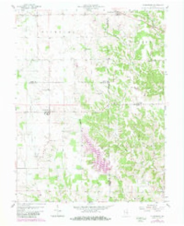
4 surveys from 10 printed sheetsMatched by testing this settlement's coordinate against the published boundary of every sheet in the United States Geological Survey's historical collection. Each opens the scanned sheet at the Survey.
- 1953 USGS Cincinnati quadrangle1:250000, 3 printings
- 1957 USGS Cincinnati quadrangle1:250000
- 1958 USGS Clarksburg quadrangle1:24000, 4 printings
- 1986 USGS Greensburg quadrangle1:100000, 2 printings



In the county-history sources
6,388 words on this townshipHistory of Decatur County, Indiana : Its People, Industries and Institutions, published 1915 names this settlement in its chapter on Fugit Township. These are the passages that mention it, exactly as the scans read.
It is taken hy common consent that the Fugit family were the first real settlers in what is now the townshi]) bearing their name. John F"ugit, and his two children, John and Mary, came to the township in the latter part of February, 1819. They selected a site for their cabin and, while engaged in putting it up, were joined by Griffy Griffith, his wife and son, Ishmael. The Griffiths located one mile west of Clarksburg, where they lived until the death of the father and mother.
Passage source: History of Decatur County, Indiana : Its People, Industries and Institutions, published 1915.
After Fugit and his son had their rude caiiin ready for occupancy, the whole family, consisting of the father, mother, four sons and two daughters, made this township their permanent home for a number of years. The Fugits entered no land and citizens of the township have never agreed as to the exact spot where the old Fugit cabin stood. Some have maintained that they settled northeast of Clarksburg, while others hold that they located one mile east of Clarksburg on land later entered by Benjamin Snelling. Still others believe that the F'ugits squatted on the old Luther Donnell place. Strange to say, neither James L. Fugit, one of the sons of the old pioneer, nor Mary, a daughter (who became the wife of David Garrison), could identify the exact spot where their father had settled. They had removed to Clay township in 1825 and when they revisited their first home in the county, several years later, the surroundings were so changed that they were unable to agree as to where the family cabin had stood. It is probable that it was on the Donnell farm, which had been entered by Thomas Donnell, Sr., in 1822. They douljtless purchased the impro\'ements on the place from Fugit.
Passage source: History of Decatur County, Indiana : Its People, Industries and Institutions, published 1915.
It might be well at this point to make mention of the colored settlement in Fugit township. Early in the forties a few colored families located a few miles east of Clarksburg and by 1852 they numbered about seventy-five souls. Some of them owned small farms, but the most of them depended for a livelihood on working on the farms of the white citizens. They took an active part in helping fugitives slaves to make their way across the county and over into Union count}^ Their participation in the "underground railroad" enterprise is mentioned elsewhere in this volume. When the fugitive slave law of 1852 was passed many of them left the county, some going to other parts of the state and many of them finally reaching Canada. There is now only one left in the township, Margaret Wilson, of Kingston.
Passage source: History of Decatur County, Indiana : Its People, Industries and Institutions, published 1915.
Machine-read from a century-old scan, so expect the errors a machine makes: misspelled names, dropped words, stray characters.
Read the whole chapter on Fugit Township - it names this place 7 more 7 times.
Fires near this place
1 since 2004Regional context, not property-specific evidence. The federal wildfire occurrence database lists 1 fire within 5 miles of Clarksburg in 2004, burning about 3 acres in total. None started naturally. None was recorded as arson. Distance is straight-line from the map coordinates, so a fire counted here may appear on a neighbouring settlement's page as well.
| Reported cause | Fires |
|---|---|
| Recreation and ceremony | 1 |
The most recent of them, most recent first, with the day each was reported and the service that recorded it.
| Date | Cause | Size | Reported by | Name on the report |
|---|---|---|---|---|
| 31 October 2004 | Recreation and ceremony | 3.0 acres | Indiana State Fire Marshal's Office | not named |
Storms near this place
6 since 2005Regional context, not property-specific evidence. The National Weather Service names Clarksburg in 6 storm reports between 2005 and 2018: 4 hail, 2 thunderstorm wind. No death or injury is recorded in these reports. Each account below is quoted exactly as the forecast office filed it, from the NOAA Storm Events Database, and each date opens the federal record of that event.
| When | Event | Place named | Harm | What the report says |
|---|---|---|---|---|
| August 2018 | Thunderstorm Wind | Clarksburg | $10,000 | A tree was downed onto a house due to damaging thunderstorm wind gusts. This was reported by the Clarksburg Fire Department. |
| November 2013 | Thunderstorm Wind | Clarksburg | $2,000 | Power lines were downed in this location due to damaging thunderstorm wind gusts. |
| April 2006 | Hail | Clarksburg | - | No damage estimates were available. |
| April 2005 | Hail | Clarksburg | - | no account filed |
| April 2005 | Hail | Clarksburg | - | no account filed |
| June 2005 | Hail | Clarksburg | - | no account filed |
Nearest settlements
The eight closest, with where each one stands in the county. Distances are straight-line, computed from the Geographic Names Information System coordinates.
| Map | Place | Distance | Sheets |
|---|---|---|---|
| Springhill (historical) | 3.9 miles | 10 | |
| Kingston | 4.3 miles | 10 | |
| Saint Maurice | 4.7 miles | 12 | |
| Williamstown | 6.6 miles | 10 | |
| Mechanicsburg | 6.7 miles | 12 | |
| Sandusky | 7.0 miles | 10 | |
| Rossburg | 7.5 miles | 12 | |
| Smiths Crossing | 8.1 miles | 12 |
Elsewhere
Matched on this settlement's Geographic Names Information System number rather than its name, so it cannot be a different place of the same name in another state.
| Wikipedia article on Clarksburg | An encyclopaedic summary. Its text is share-alike, so it is linked here rather than copied. |
| Wikidata item Q5127590 | The structured record the population and elevation above come from. Public domain (CC0). |
Provenance
This settlement is recorded in the Geographic Names Information System as feature 432573. The sheet list is computed by point-in-boundary test against the United States Geological Survey's historical topographic inventory. Both are works of the United States government and carry no copyright under 17 U.S.C. 105.
Wildfire. Short, Karen C. 2022. Spatial wildfire occurrence data for the United States, 1992-2020 [FPA_FOD_20221014]. 6th Edition. Fort Collins, CO: Forest Service Research Data Archive. https://doi.org/10.2737/RDS-2013-0009.6 Collected with United States Government funding and usable without additional permissions or fees.
Storms. NOAA National Centers for Environmental Information, Storm Events Database https://www.ncei.noaa.gov/stormevents/ A work of the United States government, no copyright under 17 U.S.C. 105. Narratives are quoted verbatim from the National Weather Service report and are not edited or summarised.