 Block
Kingston, Indiana
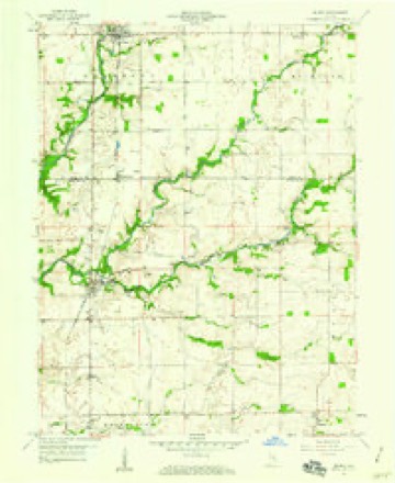
10 topographic sheets cover this place, the earliest surveyed in 1953 and the latest in 1986. It stands in Fugit Township. It lies in ZIP code area 47240. The Survey maps it on the Milroy quadrangle.
Topographic sheets covering this place
4 surveys from 10 printed sheetsMatched by testing this settlement's coordinate against the published boundary of every sheet in the United States Geological Survey's historical collection. Each opens the scanned sheet at the Survey.
- 1953 USGS Cincinnati quadrangle1:250000, 3 printings
- 1957 USGS Cincinnati quadrangle1:250000
- 1959 USGS Milroy quadrangle1:24000, 4 printings
- 1986 USGS Greensburg quadrangle1:100000, 2 printings



In the county-history sources
6,388 words on this townshipHistory of Decatur County, Indiana : Its People, Industries and Institutions, published 1915 names this settlement in its chapter on Fugit Township. These are the passages that mention it, exactly as the scans read.
Jesse lived until his death. George Cain emigrated to the west and within a few years the family name disappears from the records of both Decatur and Rush counties. McCoy first located near Grififith and then moved over into what is now Adams township north of Downeyville. The McCoy family have been prominently identified with the history of the county from its beginning down to the present time. Ishmael Grififith married a daughter of William Walters, near Kingston, and at his death left two sons, John and James. John was accidentally killed near Downeyville and James served in the Civil War as a member of Company F, Seventh Indiana Volunteer Infantry. This disposes of all the important incidents connected with the immigrants of 1819.
Passage source: History of Decatur County, Indiana : Its People, Industries and Institutions, published 1915.
It might be well at this point to make mention of the colored settlement in Fugit township. Early in the forties a few colored families located a few miles east of Clarksburg and by 1852 they numbered about seventy-five souls. Some of them owned small farms, but the most of them depended for a livelihood on working on the farms of the white citizens. They took an active part in helping fugitives slaves to make their way across the county and over into Union count}^ Their participation in the "underground railroad" enterprise is mentioned elsewhere in this volume. When the fugitive slave law of 1852 was passed many of them left the county, some going to other parts of the state and many of them finally reaching Canada. There is now only one left in the township, Margaret Wilson, of Kingston.
Passage source: History of Decatur County, Indiana : Its People, Industries and Institutions, published 1915.
The first store in the township, and perhaps in the county, was started at Spring Hill by James Conwell, of Laurel (Franklin county), in 1823. Conwell was a thrifty trader and established the store here as a branch of his large store in Laurel. He placed Martin Benson in charge of the store at Spring Hill. The first postot^ce was at this place and John Bryson became the first postmaster. Bryson was later an associate judge. Nathan Lewis had a corn-cracker, operated by horse-power, early in the twenties. Later Lewis converted his mill into a bark grindery and pulverized slippery elm, dogwood and sassafras barks for the Eastern markets. Edward Jackman was the first to install a carding machine and found plenty of husiness to keep him busy. William Henderson was interested in a number of enterprises; he operated a grist-mill, a carding factory and a distillery and found a ready sale for the products of all three establishments. He was located a short distance east of Spring Hill. A grist-mil! was operated at an early date about a mile south of Kingston by a man named Smith. Lewis Lacker opened up a tan yard on the farm later owned by Everett Hamilton and furnished the community with leather for several years. Joseph Henderson opened the first tavern in the township a short distance east of Spring Hill.
Passage source: History of Decatur County, Indiana : Its People, Industries and Institutions, published 1915.
Machine-read from a century-old scan, so expect the errors a machine makes: misspelled names, dropped words, stray characters.
Read the whole chapter on Fugit Township - it names this place 6 more 6 times.
Mines and quarries near this place
1 within 5 milesRegional context, not property-specific evidence. The federal mineral resources record lists 1 working within 5 miles of Kingston: 1 producer. All of them still produce. What was taken out: Stone, Crushed/Broken. Distance is straight-line from the map coordinates, so a quarry counted here may appear on a neighbouring settlement's page as well.
| Where | Site | Commodity | Status | Recorded |
|---|---|---|---|---|
| New Point Quarry | Stone, Crushed/Broken | Producer |
Storms near this place
7 since 1997Regional context, not property-specific evidence. The National Weather Service names Kingston in 7 storm reports between 1997 and 2021: 4 thunderstorm wind, 2 hail, 1 flood. No death or injury is recorded in these reports. Each account below is quoted exactly as the forecast office filed it, from the NOAA Storm Events Database, and each date opens the federal record of that event.
| When | Event | Place named | Harm | What the report says |
|---|---|---|---|---|
| June 2021 | Thunderstorm Wind | Kingston | $10,000 | General location of an area of trees that were downed by thunderstorm wind gusts across much of northeastern Decatur county. |
| May 2011 | Thunderstorm Wind | Kingston | $3,000 | Trees, 8 to 12 inches in diameter, were uprooted at County Roads 300 North and 400 East. |
| November 2017 | Thunderstorm Wind | Kingston | $1,500 | A tree was downed on power lines near the intersection of County Roads 300 North and 400 East due to damaging thunderstorm wind gusts. |
| June 2010 | Flood | Kingston | $500 | Several roads were reported flooded, especially in low lying areas. |
| July 1997 | Thunderstorm Wind | Kingston | $200 | Thunderstorm winds blew down a 10 inch diameter tree. |
| August 2018 | Hail | Kingston | - | no account filed |
| June 2005 | Hail | Kingston | - | no account filed |
Nearest settlements
The eight closest, with where each one stands in the county. Distances are straight-line, computed from the Geographic Names Information System coordinates.
| Map | Place | Distance | Sheets |
|---|---|---|---|
| Saint Maurice | 3.0 miles | 12 | |
| Mechanicsburg | 3.1 miles | 12 | |
| McCoy | 4.1 miles | 10 | |
| Springhill (historical) | 4.1 miles | 10 | |
| Clarksburg | 4.3 miles | 10 | |
| Smiths Crossing | 4.5 miles | 12 | |
| Middle Branch | 4.9 miles | 10 | |
| Rossburg | 4.9 miles | 12 |
Provenance
This settlement is recorded in the Geographic Names Information System as feature 437339. The sheet list is computed by point-in-boundary test against the United States Geological Survey's historical topographic inventory. Both are works of the United States government and carry no copyright under 17 U.S.C. 105.
Mines and quarries. USGS Mineral Resources Data System (MRDS) https://mrdata.usgs.gov/mrds/ A work of the United States government, no copyright under 17 U.S.C. 105.
Storms. NOAA National Centers for Environmental Information, Storm Events Database https://www.ncei.noaa.gov/stormevents/ A work of the United States government, no copyright under 17 U.S.C. 105. Narratives are quoted verbatim from the National Weather Service report and are not edited or summarised.