 Block
Clear Spring, Indiana
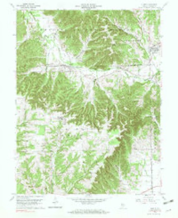
16 topographic sheets cover this place, the earliest surveyed in 1956 and the latest in 1990. It stands in Owen Township. It lies in ZIP code area 47264. The Survey maps it on the Kurtz quadrangle. It stands 879 feet above sea level.
Topographic sheets covering this place
6 surveys from 16 printed sheetsMatched by testing this settlement's coordinate against the published boundary of every sheet in the United States Geological Survey's historical collection. Each opens the scanned sheet at the Survey.
- 1956 USGS Vincennes quadrangle1:250000, 4 printings
- 1957 USGS Vincennes quadrangle1:250000
- 1958 USGS Vincennes quadrangle1:250000, 2 printings
- 1959 USGS Kurtz quadrangle1:24000, 7 printings
- 1986 USGS Bedford quadrangle1:100000
- 1990 USGS Bedford quadrangle1:100000



What happened here
An account from the chapter on Owen township. The inset identifies its exact source book and publication year.
Murder Of Marian Cuttor
The writer extracts the following account of the murder of Mrs. Marian Cuttor, and the lynching of the murderers, from the Brownstown Banner: "In the deep stillness of the night of De¬ cember 29, 1863, two men by the name of John Tally and John Brooks, entered the house of a lone widow, living about one-half mile from the village of Clear Springs, by the name of Marian Cuttor, murdered and robbed her.
In the county-history sources
4,759 words on this townshipHistory of Jackson County, Indiana, published 1886 names this settlement in its chapter on Owen Township. These are the passages that mention it, exactly as the scans read.
In the early days of Owen Township the milling was all done at Leesville, now in Lawrence County. In a few years the home demand was sufficient to induce Jacob Wells to embark in this enterprise, and consequently built a horse-mill in the early part of the twenties. This was doubtless the first mill built in Owen Township. It was built of logs and stood on land now owned by Christian Brannaman, and was for many years the principal mill in this section of the country. After this other mills were built in various parts of the township. A water-mill was built some time in the thirties by Daniel Cummings, on the Muddy Fork of Salt Creek. For a time this mill did quite a prosperous business, grinding both wheat and corn. Another horse-mill was erected by Samuel Davis, about two miles and a half east of Clear Spring. This was succeeded by a water-mill that was built and operated by James Mahan. It stood on Guthrie's Creek about two miles southwest of Clear Spring. Other small mills were at different times operated in this township.
Passage source: History of Jackson County, Indiana, published 1886.
One of the first church organizations of this township was that of the Dunkards, a peculiar religious sect that is to-day entirely absent from this section. They never erected a church building, in this township but held their meetings at the residences of the members. Two ministers, Carleton and Hostettler, are especially remembered by the old settlers. The Prathers and the Scotts were the most prominent families. In the early settlement the Baptists had no church building in Owen Township, but were members of Guthrie's Creek and Gilgal, classes which are now in Lawrence County. When the settlements in the different parts of the township had a sufficient number of church members, a minister wAs frequently brought to the neighborhood and services held in the log-hut residence ; then the schoolhouse was used, and finally two or three log churches were built; but those old edifices are now gone. A large per cent of the early settlers were mem¬ bers of the Baptist Church, and it is in consequence the strongest church organization ip the township at present. A Baptist Church was organized in the neighborhood of Clear Spring about 1847, and their meetings were held in an old log schoolhouse. Some of the most prominent families were the Brannamans, Hamiltons, Hinkles, Owenses, Kindreds, Johnsons and Boyatts.
Passage source: History of Jackson County, Indiana, published 1886.
In 1852 a small frame church building was erected onefourth of a mile south of Clear Spring ; this served as a place of worship until 1868, when the erection of the present large frame building in Clear Spring was begun. This was completed in 1870, at a cost of about $2,000. In 1871 an arm of this church was extended to a young neighborhood, and under the supervision of Elder McCoy another class was organized. The following is a partial list of the ministers who have served in these two charges: T. J. Hanna, John Bell, John R. McCoy, William Gillaspy, George W. Sweeney and Isaac Coker; deacons: Abra¬ ham Brannaman, William Hinkle, Christian Brannaman, Daniel Sanders, James K. Matlock. It is said that so many members of this church went out in defense of their country that at one time there was not a sufficient number left to hold services.
Passage source: History of Jackson County, Indiana, published 1886.
Machine-read from a century-old scan, so expect the errors a machine makes: misspelled names, dropped words, stray characters.
Read the whole chapter on Owen Township - it names this place 7 more 7 times.
Fires near this place
17 since 2000Regional context, not property-specific evidence. The federal wildfire occurrence database lists 17 fires within 5 miles of Clear Spring between 2000 and 2016, burning about 118 acres in total. None started naturally. 5 were recorded as arson. Distance is straight-line from the map coordinates, so a fire counted here may appear on a neighbouring settlement's page as well.
| Reported cause | Fires |
|---|---|
| Debris and open burning | 10 |
| Arson/incendiarism | 5 |
| Misuse of fire by a minor | 1 |
| Missing data/not specified/undetermined | 1 |
The most recent of them, most recent first, with the day each was reported and the service that recorded it.
| Date | Cause | Size | Reported by | Name on the report |
|---|---|---|---|---|
| 6 September 2002 | Arson/incendiarism | under an acre | Hoosier National Forest | TAYLOR |
| 11 June 2012 | Debris and open burning | 1.0 acres | Hoosier National Forest | 58 BALE |
| 8 April 2009 | Arson/incendiarism | under an acre | Hoosier National Forest | POLK PATCH FIRE |
| 5 April 2001 | Debris and open burning | 7.0 acres | Hoosier National Forest | FUEL |
| 17 April 2016 | Missing data/not specified/undetermined | 1.5 acres | Hoosier National Forest | FREETOWN |
| 14 April 2010 | Debris and open burning | under an acre | Hoosier National Forest | MOON FIRE |
| 8 March 2000 | Arson/incendiarism | 47 acres | Hoosier National Forest | LUMPFORD |
| 7 March 2009 | Debris and open burning | 1.5 acres | Hoosier National Forest | SAWMILL FIRE |
Settlements close enough to share some of these fires:
Nearest settlements
The eight closest, with where each one stands in the county. Distances are straight-line, computed from the Geographic Names Information System coordinates.
| Map | Place | Distance | Sheets |
|---|---|---|---|
| Kurtz | 2.5 miles | 16 | |
| Norman | 3.9 miles | 17 | |
| Pleasantville | 4.3 miles | 13 | |
| Freetown | 5.4 miles | 16 | |
| Weddleville | 6.0 miles | 13 | |
| Houston | 6.4 miles | 21 | |
| Bald Knobs | 6.9 miles | 21 | |
| Maumee | 7.2 miles | 19 |
Elsewhere
Matched on this settlement's Geographic Names Information System number rather than its name, so it cannot be a different place of the same name in another state.
| Wikipedia article on Clear Spring | An encyclopaedic summary. Its text is share-alike, so it is linked here rather than copied. |
| Wikidata item Q5130775 | The structured record the population and elevation above come from. Public domain (CC0). |
Provenance
This settlement is recorded in the Geographic Names Information System as feature 450782. The sheet list is computed by point-in-boundary test against the United States Geological Survey's historical topographic inventory. Both are works of the United States government and carry no copyright under 17 U.S.C. 105.
Wildfire. Short, Karen C. 2022. Spatial wildfire occurrence data for the United States, 1992-2020 [FPA_FOD_20221014]. 6th Edition. Fort Collins, CO: Forest Service Research Data Archive. https://doi.org/10.2737/RDS-2013-0009.6 Collected with United States Government funding and usable without additional permissions or fees.