 Block
Clinton, Indiana
14 topographic sheets cover this place, the earliest surveyed in 1951 and the latest in 1986. It stands in Clinton Township. It lies in ZIP code area 47842. It stands on Feather Creek. The Survey maps it on the Clinton quadrangle. 4,831 people lived here at the 2020 count. It stands 492 feet above sea level.
Research this city
On record in Clinton
Buildings and businesses the archive holds for this place. Each opens its own page, with the source record it came from.
On the National Register 3 records
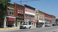 Clinton Downtown Historic Districtlisted 2000
 Hill Crest Community Centerlisted 1997
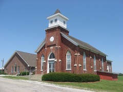 Salem Methodist Episcopal Churchlisted 1979
Population over time
2 figuresClinton fell from 4,893 to 4,831 between 2010 and 2020. These are the recorded population figures Wikidata holds for this place, reached through the Geographic Names Information System number this page is keyed on rather than by name, so they belong to this place and not to another of the same name. Most are census counts, but not all are: an early figure may be a founding or settlement estimate, and an estimate published within five years of a census is left out. The change column is computed, and is left blank where more than 20 years separate a figure from the one before it, because a gap that long is not a change between two counts.
| Year | People | Change |
|---|---|---|
| 2010 | 4,893 | |
| 2020 | 4,831 | -62 (-1%) |
Topographic sheets covering this place
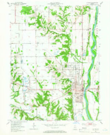
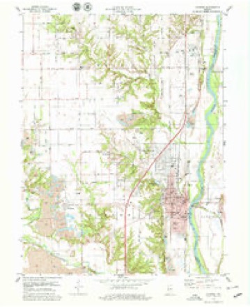
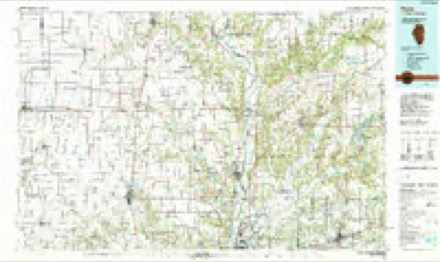
7 surveys from 14 printed sheetsMatched by testing this settlement's coordinate against the published boundary of every sheet in the United States Geological Survey's historical collection. Each opens the scanned sheet at the Survey.
- 1951 USGS Clinton quadrangle1:24000, 2 printings
- 1953 USGS Indianapolis quadrangle1:250000, 4 printings
- 1956 USGS Indianapolis quadrangle1:250000
- 1957 USGS Indianapolis quadrangle1:250000, 2 printings
- 1962 USGS Indianapolis quadrangle1:250000
- 1978 USGS Clinton quadrangle1:24000, 2 printings
- 1986 USGS Paris quadrangle1:100000, 2 printings




In the county-history sources
8,785 words on this townshipBiographical and Historical Record of Vermillion County, Indiana : Containing Portraits of All the Presidents of the United States from Washington to Cleveland, with Accompanying Biographies of Each; a Condensed History of the State of Indiana; Portraits and Biographies of Some of the Prominent Men of the State; Engravings of Prominent Citizens in Vermillion County, with Personal Histories of Many of the Leading Families, and a Concise History of the County and Its Villages, published 1888 names this settlement in its chapter on Clinton Township. These are the passages that mention it, exactly as the scans read.
Major Chunn, an officer in the regular array, came here from Terre Haute some time previous to 1820, and was an efficient soldier in driving away the Indians; was also a participant in the battle of Tippecanoe. He was a justice of the peace here for many years. His son Thomas is still a resident of this township.
Captain AVilliam Swan was born in Pennsylvania in 1802, settled in Clinton Township in 1823, was a member of the first jury in tlie county, followed the river, making over sixty trips to New Orleans on both rafts and flats, was a Universalist in his religious belief, and a Freemason, and died January 29, 1887, at Clinton.
Benjamin K. Whitcomb, born in Vermont in 1798, and his cousin and business partner, John Whitcomb, came in 1828, .settling in the village of Clinton, where they were among the first merchants, pork packers, etc. John died August 29, 1830, aged forty-one years. Benjamin H. died April 23, 18G1, and his wife, Anna S., died May 21, 1800, at the age of fifty-five and a half years. John R. Whitcoinb, another merchant, born in Ohio in 1804, first settled in Edgar County, Illinois, in 1832, and in the village of Clinton in 1834. He died in March, 1873, leaving a widow (third wife), who is living a half mile west of town. His first wife, Eunice, died May 15, 1832, aged only twentythree years.
Machine-read from a century-old scan, so expect the errors a machine makes: misspelled names, dropped words, stray characters.
Read the whole chapter on Clinton Township - it names this place 42 more 42 times.
Mines and quarries near this place
2 within 5 milesRegional context, not property-specific evidence. The federal mineral resources record lists 2 workings within 5 miles of Clinton: 2 producers. All of them still produce. What was taken out: Sand and Gravel, Construction. Distance is straight-line from the map coordinates, so a quarry counted here may appear on a neighbouring settlement's page as well.
| Where | Site | Commodity | Status | Recorded |
|---|---|---|---|---|
| Clinton Sand Pit | Sand and Gravel, Construction | Producer | ||
| D. Robertson Gravel Company Pit | Sand and Gravel, Construction | Producer |
Storms near this place
42 since 1995Regional context, not property-specific evidence. The National Weather Service names Clinton in 42 storm reports between 1995 and 2024: 19 thunderstorm wind, 12 hail, 4 flash flood, 4 flood. The reports record 1 injury. Each account below is quoted exactly as the forecast office filed it, from the NOAA Storm Events Database, and each date opens the federal record of that event.
| When | Event | Place named | Harm | What the report says |
|---|---|---|---|---|
| June 2009 | Lightning | Clinton | 1 hurt | A woman from Clinton was taken to the hospital for burns after she was struck by lightning. The Daily Clintonian newspaper reported that she was standing under a tree when the event occurred. She was transported to Union Hospital Clinton and later taken, by ground, to Methodist Hospital in Indianapolis for burns. |
| May 2002 | Flash Flood | Clinton | $150,000 | no account filed |
| June 2008 | Flash Flood | Clinton | $100,000 | Flooded Brouilletts Creek engulfed State Road 63 and washed portion of it away. Rangeline Road had chunks of the road washed out. In Clinton, Feather Creek overflowed its banks and forced residents from their homes. 150 to 175 residents were affected by flooding. |
| March 2006 | Flood | Clinton | $100,000 | no account filed |
| July 2008 | Thunderstorm Wind | Clinton | $50,000 | Thunderstorm winds uprooted a large tree, which landed on top of a small single-story house near McDonald Lake near Clinton. The impact caused the house to split in half and a female occupant to hit the ceiling before she became entrapped by bedroom furniture. The tree itself landed about 6 feet away from the occupant. A newly purchased cell phone was within reach and she was able to summon help to extricate her from the now uninhabitable dwelling. The tree killed a kitten that she had rescued during June flooding. Another cat was injured. The fire department that has jurisdiction could not reach the house due to other fallen trees blocking the route, thus others had to called in. |
| June 2007 | Lightning | Clinton | $40,000 | Lightning struck the Daily Clintonian building in the 400 block of South Main Street. The fire was on the understructure of the roof. Some of the damage included 13 computers. |
| June 2009 | Thunderstorm Wind | Clinton | $20,000 | The Daily Clintonian reported thunderstorm wind gust damage in the south end of Clinton. A metal storage building was blown over in the 1500 block of South Fourth Street. Also, a tree was knocked down onto a trailer and house windows were also broken out in the same location. Trees and power lines were reported to be downed across much of southern Vermillion County. |
| January 2008 | Flood | Clinton | $20,000 | Flooding occurred along the Wabash River in Vermillion County, including near Clinton, due to heavy rain and snow melt. |
| June 2008 | Flash Flood | Clinton | $20,000 | Flash flooding occurred as water covered South Main Street in Clinton due to heavy rain. Flash flooding had damaged numerous homes, buildings, bridges, and roads. Feather Creek flooded. |
| July 2001 | Lightning | Clinton | $20,000 | A lightning strike caused damage to equipment at a police station. |
| June 1998 | Thunderstorm Wind | Clinton | $10,000 | no account filed |
| July 2014 | Thunderstorm Wind | Clinton | $7,000 | Numerous large trees and power lines were downed in this location due to damaging thunderstorm wind gusts. |
| April 2020 | Thunderstorm Wind | Clinton | $5,000 | Pictures received via twitter of tree limbs and power limbs downed due to thunderstorm wind gusts. |
| July 2008 | Thunderstorm Wind | Clinton | $5,000 | Tree limbs and utility lines were blown down by thunderstorm winds. |
| December 2006 | Flood | Clinton | $5,000 | The Wabash River flooded in Vermillion County. Water remained high into January. |
| December 2006 | Flood | Clinton | $5,000 | The Wabash River flooded in Vermillion County. The river crested at over 6 feet above flood stage. |
| July 2009 | Thunderstorm Wind | Clinton | $4,000 | Trees and power lines were downed by damaging thunderstorm wind gusts. |
| July 2008 | Thunderstorm Wind | Clinton | $2,000 | Tree limbs and utility lines were blown down by thunderstorm winds. |
| February 2008 | Thunderstorm Wind | Clinton | $2,000 | Numerous trees and power lines were reported down due to damaging thunderstorm winds. |
| July 2008 | Thunderstorm Wind | Clinton | $2,000 | Thunderstorm winds blew down 3 trees and a utility line. |
| August 2007 | Thunderstorm Wind | Clinton | $2,000 | Trees and limbs were blown down due to damaging thunderstorm winds. Minor structural damage also occurred. |
| April 2015 | Hail | Clinton | - | Hail size was estimated from a picture. |
| May 2011 | Thunderstorm Wind | Clinton | - | A 60 mph thunderstorm wind gust was reported in this location. Pea sized hail was also reported. |
| July 2008 | Thunderstorm Wind | Clinton | - | Many streets south of Elm Street were impassable because of downed trees. Firefighters, police, and street department employees worked through the night to clear streets and provide traffic control because of downed power lines. The local Fire Chief estimated that 100 to 200 trees had fallen from the storm. Several homes and cars were hit by trees. |
| June 2008 | Thunderstorm Wind | Clinton | - | Trees were reported down due to damaging thunderstorm winds. |
| June 2005 | Thunderstorm Wind | Clinton | - | Trees and power lines were blown down in Clinton. One tree fell on a house. |
| June 1995 | Thunderstorm Wind | Clinton | - | Winds were reported to 75 mph. |
| March 2024 | Hail | Clinton | - | no account filed |
| May 2019 | Hail | Clinton | - | no account filed |
| April 2016 | Hail | Clinton | - | no account filed |
| June 2008 | Hail | Clinton | - | no account filed |
| July 2008 | Hail | Clinton | - | no account filed |
| April 2006 | Hail | Clinton | - | no account filed |
| July 2006 | Hail | Clinton | - | no account filed |
| May 2004 | Hail | Clinton | - | no account filed |
| May 2003 | Thunderstorm Wind | Clinton | - | no account filed |
| July 2003 | Thunderstorm Wind | Clinton | - | no account filed |
| July 2003 | Hail | Clinton | - | no account filed |
| April 2002 | Flash Flood | Clinton | - | no account filed |
| May 2000 | Hail | Clinton | - | no account filed |
| August 2000 | Thunderstorm Wind | Clinton | - | no account filed |
| April 1996 | Hail | Clinton | - | no account filed |
Nearest settlements
The eight closest, with where each one stands in the county. Distances are straight-line, computed from the Geographic Names Information System coordinates.
| Map | Place | Distance | Sheets |
|---|---|---|---|
| Crompton Hill | 1.1 miles | 14 | |
| Fairview Park | 1.9 miles | 14 | |
| Klondyke | 2.2 miles | 14 | |
| Needmore | 2.7 miles | 17 | |
| Syndicate | 2.9 miles | 17 | |
| Sandytown | 3.1 miles | 14 | |
| Rhodes | 3.4 miles | 17 | |
| Universal | 3.7 miles | 17 |
Elsewhere
Matched on this settlement's Geographic Names Information System number rather than its name, so it cannot be a different place of the same name in another state.
| Wikipedia article on Clinton | An encyclopaedic summary. Its text is share-alike, so it is linked here rather than copied. |
| Wikidata item Q541209 | The structured record the population and elevation above come from. Public domain (CC0). |
Provenance
This settlement is recorded in the Geographic Names Information System as feature 432671. The sheet list is computed by point-in-boundary test against the United States Geological Survey's historical topographic inventory. Both are works of the United States government and carry no copyright under 17 U.S.C. 105.
Mines and quarries. USGS Mineral Resources Data System (MRDS) https://mrdata.usgs.gov/mrds/ A work of the United States government, no copyright under 17 U.S.C. 105.
Storms. NOAA National Centers for Environmental Information, Storm Events Database https://www.ncei.noaa.gov/stormevents/ A work of the United States government, no copyright under 17 U.S.C. 105. Narratives are quoted verbatim from the National Weather Service report and are not edited or summarised.