 Block
Crandall, Indiana
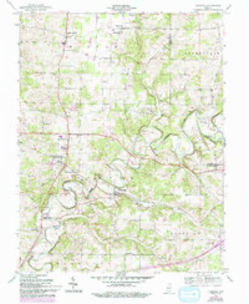
13 topographic sheets cover this place, the earliest surveyed in 1954 and the latest in 1994. It stands in Jackson Township. It lies in ZIP code area 47114. It stands on Crandall Branch. The Survey maps it on the Crandall quadrangle. 134 people lived here at the 2020 count. It stands 653 feet above sea level.
Population over time
2 figuresCrandall fell from 152 to 134 between 2010 and 2020. These are the recorded population figures Wikidata holds for this place, reached through the Geographic Names Information System number this page is keyed on rather than by name, so they belong to this place and not to another of the same name. Most are census counts, but not all are: an early figure may be a founding or settlement estimate, and an estimate published within five years of a census is left out. The change column is computed, and is left blank where more than 20 years separate a figure from the one before it, because a gap that long is not a change between two counts.
| Year | People | Change |
|---|---|---|
| 2010 | 152 | |
| 2020 | 134 | -18 (-12%) |
Topographic sheets covering this place
6 surveys from 13 printed sheetsMatched by testing this settlement's coordinate against the published boundary of every sheet in the United States Geological Survey's historical collection. Each opens the scanned sheet at the Survey.
- 1954 USGS Crandall quadrangle1:24000, 4 printings
- 1956 USGS Vincennes quadrangle1:250000, 4 printings
- 1957 USGS Vincennes quadrangle1:250000
- 1958 USGS Vincennes quadrangle1:250000, 2 printings
- 1986 USGS Jasper quadrangle1:100000
- 1994 USGS Jasper quadrangle1:100000



Mines and quarries near this place
2 within 5 milesRegional context, not property-specific evidence. The federal mineral resources record lists 2 workings within 5 miles of Crandall: 2 occurrences. None of them still produces. What was taken out: Fluorine-Fluorite. Distance is straight-line from the map coordinates, so a quarry counted here may appear on a neighbouring settlement's page as well.
| Where | Site | Commodity | Status | Recorded |
|---|---|---|---|---|
| Fluorite Occurrence #1 | Fluorine-Fluorite | Occurrence | ||
| Fluorite Occurrence #1 | Fluorine-Fluorite | Occurrence |
Storms near this place
9 since 1996Regional context, not property-specific evidence. The National Weather Service names Crandall in 9 storm reports between 1996 and 2024: 3 thunderstorm wind, 2 flood, 2 hail, 1 flash flood. No death or injury is recorded in these reports. Each account below is quoted exactly as the forecast office filed it, from the NOAA Storm Events Database, and each date opens the federal record of that event.
| When | Event | Place named | Harm | What the report says |
|---|---|---|---|---|
| April 2024 | Tornado (EF1) | Crandall | - | The National Weather Service in Louisville conducted a damage assessment survey of a tornado that started at a property off of Hidden Springs Drive in far eastern Harrison County, Indiana and ended near Watts Road, just south of Georgetown, in Floyd County. Video clearly showed the tornado touching down multiple times. ||The tornado initially touched down and damaged a house off of Hidden Springs Drive. Much of the landscaping around the house wasn't disturbed. An outdoor hot tub on the northern end of the west side of the house had its heavy cover broke and thrown to the |southwest. The southwest side of this well constructed house had a section of its roof decking torn off and thrown which can be seen in the video. Wind speeds were estimated at 95 mph based on this damage. In one area of the house, the damage penetrated the ceiling. In other parts, the ceiling has been lifted away from the walls. Much of the soffit around the house has been sucked in or blown out. Some insulation from the attic is stuck to the east side of the house with additional amounts on the south facing exposed surfaces like door jambs and light fixtures. This is evidence of cyclonic flow. A patio chair that was sitting behind the house was found approximately 133 yards away in the woods. ||Approximately 100 yards east of the house, a few mature trees have been snapped on the edge of the woods. Farther in the woods, roofing debris was found on the ground and in trees as far 380 yards from where it came. The main section of roof that was |thrown, and can been seen on video, wasn't located. Many trees were freshly damaged or uprooted in the woods, but many of those were already dead. ||The video showed the tornado strengthening and weakening with a condensation funnel barely visible at times. It showed inflow being pulled into the tornado which was strong enough to bring down compromised trees. The tornado can also be seen dropping and lifting very small vortices as it approached Georgetown. Minor tree damage was found off of Georges Hill Road and west of Georgetown County Line Road before the tornado cross into Floyd County. |
| April 2017 | Flood | Crandall | - | The Harrison County COOP observer reported 1.5 feet of water over Tee Road, and Big Indian Creek was flooded. |
| August 2009 | Flood | Crandall | - | Big Indian Creek was flooding well out of its banks. |
| July 2008 | Thunderstorm Wind | Crandall | - | Power poles were reported down. |
| October 2007 | Thunderstorm Wind | Crandall | - | Trees were downed. |
| April 2002 | Flash Flood | Crandall | - | The eastbound lane of State Road 64 was covered with water. |
| April 2012 | Hail | Crandall | - | no account filed |
| April 2012 | Hail | Crandall | - | no account filed |
| November 1996 | Thunderstorm Wind | Crandall | - | no account filed |
Nearest settlements
The eight closest, with where each one stands in the county. Distances are straight-line, computed from the Geographic Names Information System coordinates.
| Map | Place | Distance | Sheets |
|---|---|---|---|
| Mott Station | 1.5 miles | 13 | |
| Corydon Junction | 2.1 miles | 13 | |
| New Salisbury | 2.4 miles | 13 | |
| Byrneville | 3.0 miles | 13 | |
| Breckenridge | 5.1 miles | 21 | |
| Ramsey | 5.3 miles | 14 | |
| Harrison Grange (historical) | 5.3 miles | 21 | |
| Lanesville | 5.5 miles | 19 |
Elsewhere
Matched on this settlement's Geographic Names Information System number rather than its name, so it cannot be a different place of the same name in another state.
| Wikipedia article on Crandall | An encyclopaedic summary. Its text is share-alike, so it is linked here rather than copied. |
| Wikidata item Q432502 | The structured record the population and elevation above come from. Public domain (CC0). |
Provenance
This settlement is recorded in the Geographic Names Information System as feature 433086. The sheet list is computed by point-in-boundary test against the United States Geological Survey's historical topographic inventory. Both are works of the United States government and carry no copyright under 17 U.S.C. 105.
Mines and quarries. USGS Mineral Resources Data System (MRDS) https://mrdata.usgs.gov/mrds/ A work of the United States government, no copyright under 17 U.S.C. 105.
Storms. NOAA National Centers for Environmental Information, Storm Events Database https://www.ncei.noaa.gov/stormevents/ A work of the United States government, no copyright under 17 U.S.C. 105. Narratives are quoted verbatim from the National Weather Service report and are not edited or summarised.