 Block
From the record
6 National Register listings published here.
Sources: the county history on the Internet Archive · the National Register database, National Park Service
116 topographic sheets cover 53 settlements here, and 6 properties are on the National Register of Historic Places.
6 National Register listings published here.
Sources: the county history on the Internet Archive · the National Register database, National Park Service
Every property in this county listed on the National Register of Historic Places, with the year it was listed and the federal nomination document.
| Photograph | Property | Type | Listed | Reference |
|---|---|---|---|---|
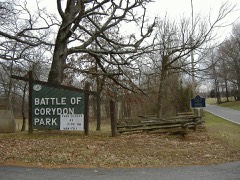 | Corydon Battle Site | site | 1979 | 79000017 |
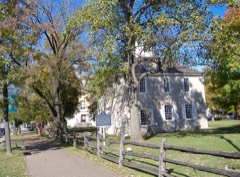 | Corydon Historic District | district | 1973 | 73000017 |
| Corydon Historic District (Boundary Increase) | district | 1989 | 89000243 | |
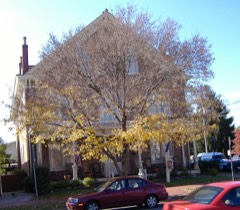 | Kintner House Hotel | building | 1987 | 87000099 |
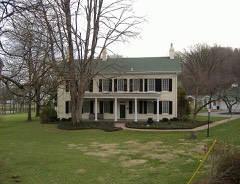 | Kintner-McGrain House | building | 1983 | 83000032 |
 | Kintner-Withers House | building | 1980 | 80000039 |
Every wildfire the federal occurrence database records inside this county: 4 of them, burning about 85 acres. None started naturally and none was recorded as arson. Each settlement page carries the fires within five miles of it.
| Reported cause | Fires |
|---|---|
| Missing data/not specified/undetermined | 2 |
| Recreation and ceremony | 2 |
The five largest, by the area the report gives. None of them was recorded as arson.
| Date | Cause | Size | Reported by | Name on the report |
|---|---|---|---|---|
| 10 April 2017 | Missing data/not specified/undetermined | 76 acres | Hoosier National Forest | JENNY HOLLOW |
| 16 February 2002 | Recreation and ceremony | 7.0 acres | Indiana State Fire Marshal's Office | not named |
| 28 February 2016 | Recreation and ceremony | 1.0 acres | Hoosier National Forest | LILY |
| 6 July 2007 | Missing data/not specified/undetermined | under an acre | Indiana State Fire Marshal's Office | not named |
Every settlement page carries the fires within five miles of it - see the settlement index below.
The NOAA Storm Events Database holds 403 reports for this county, causing 4 deaths, 41 injuries and about $2,588,000 in recorded property damage. Each settlement page carries the reports that name it.
| Kind of event | Reports |
|---|---|
| Thunderstorm Wind | 213 |
| Hail | 100 |
| Flash Flood | 39 |
| Tornado | 25 |
| Flood | 20 |
| Heavy Rain | 5 |
| Funnel Cloud | 1 |
The most serious of them, by death, then injury, then recorded damage. The accounts are quoted exactly as the forecast office filed them.
| When | Event | Place named | Harm | What the report says |
|---|---|---|---|---|
| April 1974 | Tornado (F5) | not stated | 2 killed, 34 hurt | no account filed |
| May 1971 | Tornado (F1) | not stated | 1 killed, 2 hurt, $25,000 | no account filed |
| October 1977 | Tornado (F1) | not stated | 1 killed, 1 hurt, $25,000 | no account filed |
| June 1990 | Tornado (F1) | not stated | 2 hurt, $25,000 | no account filed |
| April 1971 | Tornado (F1) | not stated | 2 hurt, $25,000 | no account filed |
| July 2018 | Tornado (EF1) | Hillgrove | $600,000 | A tornado was confirmed of EF1 scale with a maximum wind speed of 105 mph. The tornado first touched down along Justin`s Trail in the Southwind Estates subdivision. There was significant tree damage along Pleasure Ridge Road where a large tree fell on a garage. Farther east along Pleasure Ridge Road, several small funnels from the main funnel did extensive damage. A 2 x 8 impaled a concrete grain silo. At least four big barns received extensive damage, including a turkey barn. Further east, several funnels congealed into one main tornado doing extensive damage to hardwood trees and significant roof damage to several homes. Along South Pleasant Road, one home had mud spatter on the back east side of the house where several pieces of wood were impaled in the ground. At that property, a pole barn was completely destroyed and thrown in different directions. A truck and horse trailer was moved and twisted 50 feet. The wind speeds in this area were the strongest at 105 mph and the maximum width was 250 yards. ||At the end of Sarabeth Way, there was extensive hardwood tree damage which included uprooted, twisted, and mangled trees. This included several healthy hickory trees which were snapped. Further east on Sinker Road, there was impressive cyclonic crop damage across a corn field with corn laying in every direction. On Simler Road, there was consistent snapped tree damage and we observed a camper that had been tossed and flipped over and several barns received extensive damage. During the final stages of the tornado, it struck homes along Peyton Road flipping over single wide trailers, lifting the roof of a barn, and doing extensive tree damage. Parts of the barn, including insulation and sheet metal, were thrown into the trees.||According to a local TV news broadcast, a New Middletown Volunteer Fire Department member suffered a minor injury. ||The tornado was captured on video by a security camera and a resident's cell phone in the Southwind Estates, which were circulated on social media. These videos showed an extremely small but visible vortex (one to three feet in diameter) on the ground going through a grassy area and splitting a tree in front of a home. One of the videos continued to show the tornado after this, where it grew in size. |
| March 2008 | Flash Flood | Laconia | $500,000 | Numerous roads in the county were flooded, including portions of Indiana Highway 11. Big Indian Creek near Corydon was flooding, with trailers and vehicles under water. Flood waters from Big Indian Creek were close to Indiana Highway 335. |
| June 1990 | Tornado (F2) | not stated | $250,000 | no account filed |
| August 2020 | Flash Flood | Corydon | $150,000 | Flood waters made it into numerous homes and businesses, and a water rescue took place on Budd Road. Cost of damages estimated. |
| October 2001 | Thunderstorm Wind | Elizabeth | $100,000 | no account filed |
| May 2004 | Thunderstorm Wind | Countywide | $75,000 | Trees were downed county wide. In the city of Corydon, trees were blown on to two homes, doing extensive damage. No serious injuries were reported, however. |
| February 2002 | Thunderstorm Wind | Lanesville | $60,000 | A mobile home was overturned. Several porches were blown off. |
| March 2017 | Thunderstorm Wind | Lanesville | $50,000 | An off duty NWS employee reported 6 power poles down on Crandall-Lanesville Road. |
| July 2016 | Thunderstorm Wind | Depauw | $50,000 | Local law enforcement reported trees down in the area along with transformers blown. |
| May 2003 | Tornado (F0) | New Amsterdam | $50,000 | There was major roof damage to a barn just south of New Amsterdam. A mobile home in New Amsterdam was tossed about a hundred yards into the Ohio River. Witnesses spotted a tornado before the mobile home was blown away. |
| April 1993 | Thunderstorm Wind | not stated | $50,000 | Trees were blown down throughout the county. |
| May 2017 | Hail | Depauw | $50,000 | no account filed |
| January 2013 | Tornado (EF0) | Sugar Grove | $40,000 | A weak EF-0 tornado developed 3.2 miles east of Elizabeth, Indiana. It stayed on the ground for nearly 3 miles while crossing the Ohio River and entering southwestern Louisville, Kentucky. While in Indiana, this tornado covered around seven tenths of a mile. In Indiana, four homes and two barns were damaged along Highway 111. The porch of one home was lifted and thrown 30 feet. The walls of one of the barns collapsed in multiple directions. Several trees were downed along the banks of the Ohio River. |
| June 2015 | Flash Flood | Lanesville | $30,000 | The Harrison County emergency manager reported that a residence on Barren Avenue in Lanesville had 3 feet of water inside as a result of torrential rainfall and slow moving thunderstorms. |
| April 2003 | Thunderstorm Wind | Corydon | $30,000 | A tree was blown on to a house. Another tree was blown on to power lines. Part of a garage roof was blown off. |
| March 2017 | Thunderstorm Wind | Ramsey | $25,000 | A trained spotter reported a roof was blown off a concrete block dugout at a youth softball field behind North Harrison High School. |
| June 2008 | Tornado (EF0) | Central Barren | $25,000 | A weak tornado hit the south side of a farm on Gettlefinger Road collapsing a milk barn and tearing several panels off of a large metal outbuilding in addition to snapping trees in wooded areas on either side of the farm. |
| April 2006 | Thunderstorm Wind | Central Portion | $25,000 | Interstate 64 west of Corydon was closed due to downed power lines. Indiana Highway 62 was closed one half mile east of Corydon due to downed trees. A discount store in downtown Corydon sustained roof damage. |
| July 1987 | Tornado (F0) | not stated | $25,000 | no account filed |
| April 1985 | Tornado (F2) | not stated | $25,000 | no account filed |
| January 1976 | Tornado (F0) | not stated | $25,000 | no account filed |
| April 1974 | Tornado (F5) | not stated | $25,000 | no account filed |
| December 2018 | Tornado (EF1) | Dogwood | $20,000 | A National Weather Service damage survey team determined an intermittent skipping tornado varying in width, size and speed had a maximum wind speed of 100 mph along with a max width of 140 yards.||The tornado initially touched down at 7231 IN-337. At this location, a heavy metal chain fence weighing several hundred pounds was picked up and thrown 30 yards into the back of the house causing significant damage to the house. A chicken house weighing hundreds of pounds was rolled over and moved several feet. A purple Martin house was bent over 60 degrees facing east. Shingles and yard decorations were thrown in various directions east of the house along with driveway gravel thrown in every direction. A swing set was thrown from the back of the house to the front. Throughout the property there were twisted and uprooted trees.||Just before crossing the highway, the tornado increased from 75 yards to 140 yards in width and picked up hundreds of cornstalks tossing them in various directions across the road up to 300 yards away. Across the street at 7768 IN-337 there was significant cedar tree damage along with a 30 by 40 foot barn that was destroyed. The tornado twisted and snapped several cedar trees before going across the farmers field. The tornado narrowed and went to about 50 yards in width.||At 4368 Rogers Campground Road there were several trees twisted and snapped. One single-wide mobile home had siding panels blown out in several spots. An older, well-built barn with sturdy cedar poles sustained significant side panel damage. The metal sheeting was thrown in a northwesterly to northeasterly direction. One 2x4 wood pole was embedded in the ground. The tornado was very narrow along Rogers Campground Road, likely no more than 50 yards wide. |
| October 2007 | Thunderstorm Wind | Palmyra | $20,000 | Trees were blown on to vehicles in Palmyra. |
| May 2006 | Thunderstorm Wind | Corydon | $20,000 | The roof was blown off a barn. |
| March 2002 | Thunderstorm Wind | Mauckport | $20,000 | no account filed |
| November 2002 | Thunderstorm Wind | Palmyra | $15,000 | The roof was torn off a barn. Power lines and several trees were downed. |
| May 2018 | Thunderstorm Wind | Mauckport | $10,000 | The media reported that shingles were blown off roofs in Harrison County, Indiana. |
| July 2012 | Thunderstorm Wind | Elizabeth | $10,000 | A spotter located along O'Bannon road in eastern Harrison County reported that several trees were toppled, including one that fell onto a car. |
| October 2007 | Thunderstorm Wind | Corydon | $10,000 | A tree was blown on to a house in Corydon. |
| August 2007 | Thunderstorm Wind | Kings Cave | $10,000 | Thunderstorm wind damage was reported midway between Corydon and Central on state highway 135. A plate glass picture window was blown out of a house, and a home air conditioning unit was blown off its base. Twenty trees were downed. |
| November 2006 | Thunderstorm Wind | Elizabeth | $10,000 | Eight or nine pine trees were downed by thunderstorm winds. One fell on and damaged a mobile home, but no occupants were injured. |
| March 2002 | Thunderstorm Wind | Mauckport | $10,000 | Trees were downed and roofs were blown off buildings. |
| January 2000 | Thunderstorm Wind | Corydon | $10,000 | Several barns destroyed |
| July 1996 | Tornado (F1) | Corydon | $10,000 | no account filed |
| April 2018 | Thunderstorm Wind | Elizabeth | $5,000 | The public reported that a shed was destroyed with a person inside. No injuries were reported. |
| May 2018 | Thunderstorm Wind | Lanesville | $5,000 | Dispatch reported power lines down blocking one lane of traffic on State Road 62 NE. |
| April 2016 | Thunderstorm Wind | Hillcrest | $5,000 | A Harrison County official reported trees and power poles down resulting in several power outages across the area. |
| June 2015 | Thunderstorm Wind | Corydon | $5,000 | The Harrison County emergency manager reported that severe thunderstorm winds brought down power lines on State Road 62 approximately 1/2 mile east of Corydon. |
| July 2012 | Thunderstorm Wind | New Salisbury | $5,000 | Local emergency management reported that a portion of a metal roof was blown across a road. |
| June 2011 | Tornado (EF0) | New Middletown | $5,000 | Touching down in the 3900 block of Elizabeth-New Middletown Road, this weak EF-0 tornado damaged a row of trees next to a home. It also removed some flashing from this home before crossing Elizabeth-New Middletown Road and entering a wooded area. Several large limbs were broken off within the forest canopy before the tornado lifted. The same storm later spawned a tornado 15 miles east that damaged several horse barns at Churchill Downs in Louisville, Kentucky. |
| May 2001 | Hail | Sugar Grove | $5,000 | Several cars were damaged by hail. |
| June 2001 | Thunderstorm Wind | Corydon | $5,000 | Trees were uprooted, and trailer underpinnings were torn out. |
| August 2005 | Thunderstorm Wind | New Salisbury | $5,000 | no account filed |
| September 2009 | Thunderstorm Wind | Corydon | $2,000 | Some trees were downed with pea size hail. Wind speed estimate from radar. |
| February 1996 | Thunderstorm Wind | Corydon | $2,000 | no account filed |
| May 2016 | Thunderstorm Wind | Corydon Jct | $1,000 | The public reported structural damage to a porch due to a fallen tree. |
| June 2008 | Tornado (EF0) | Hillgrove | $1,000 | A weak squall-line tornado briefly touched down along Indiana Highway 135, doing minor damage to several residences and downing several trees. |
| May 2004 | Hail | Corydon | $1,000 | Branches were downed and windows were broken by golf ball size hail. |
| August 2018 | Thunderstorm Wind | Corydon Jct | $500 | There was a tree reported down on the 6300 block of Circle Road. |
| July 1994 | Thunderstorm Wind | not stated | $500 | State police reported that five trees had been blown down. |
| April 2026 | Thunderstorm Wind | Depauw | - | Two foot diameter trees were blown down near Milltown. |
| April 2026 | Thunderstorm Wind | Ramsey | - | Multiple trees were down across northern Harrison County. |
| March 2026 | Hail | New Middletown | - | Dime sized hail reported near New Middletown. |
| February 2026 | Hail | New Middletown | - | There was dime to quarter size hail reported. |
The Survey's mineral resources record lists 14 workings inside this county. 8 still produce and 6 are closed or unrecorded. Each settlement page carries the workings within five miles of it.
| Commodity | Workings |
|---|---|
| Fluorine-Fluorite | 5 |
| Stone, Crushed/Broken | 5 |
| Sand and Gravel, Construction | 2 |
| Stone | 1 |
| Silica | 1 |
The least common of them first, because a county's hundredth gravel pit says nothing its first ten did not.
| Where | Site | Commodity | Status | Recorded |
|---|---|---|---|---|
| Gem Silica Elizabeth Plant | Silica | Producer | ||
| Harrison Co. Hwy. Dept. | Stone | Producer | ||
| Lucas Corp. Pit | Sand and Gravel, Construction | Producer | ||
| Neely Pit #1 | Sand and Gravel, Construction | Producer | ||
| Corydon Stone Quarry | Stone, Crushed/Broken | Producer | ||
| Fluorite Occurrence #1 | Fluorine-Fluorite | Occurrence | ||
| Fluorite Occurrence #1 | Fluorine-Fluorite | Occurrence | ||
| Fluorite Occurrence #2 | Fluorine-Fluorite | Occurrence | ||
| Fluorite Occurrence #2 | Fluorine-Fluorite | Occurrence | ||
| John S. Davis Pit | Stone, Crushed/Broken | Producer | ||
| Louisville Cement Co Quarry | Stone, Crushed/Broken | Past Producer | ||
| Mathes Stone Quarry | Stone, Crushed/Broken | Producer | ||
| Milltown Rock Quarry | Stone, Crushed/Broken | Producer | ||
| Unnamed Fluorite Occurrence | Fluorine-Fluorite | Occurrence | Fluorite |
Named settlements recorded in the Geographic Names Information System, each with the topographic sheets covering it. Villages, hamlets and abandoned places alike. Each is shown with the nearest named watercourse or landform and the survey quadrangle it falls on.
Taylor township · 47117 · Near Lamb Ridge · Kosmosdale quadrangle
20 sheets, 1909 to 1986
Harrison township · 47112 · On Little Indian Creek · Corydon East quadrangle
21 sheets, 1931 to 1994
Jackson township · 47161 · On Crandall Branch · Crandall quadrangle
13 sheets, 1954 to 1994
Jackson township · 47114 · On Crandall Branch · Crandall quadrangle
13 sheets, 1954 to 1994
Blue River township · 47115 · Near Schoolhouse Hill · Depauw quadrangle
14 sheets, 1946 to 1994
Harrison township · 47112 · Near Devils Backbone · Corydon West quadrangle
22 sheets, 1931 to 1994
Webster township · 47135 · On South Fork Buck Creek · Laconia quadrangle
20 sheets, 1931 to 1994
Taylor township · 47117 · Near Rabbit Hash Ridge · Kosmosdale quadrangle
20 sheets, 1909 to 1986
Spencer township · 47115 · Near Opossum Trial Ridge · Depauw quadrangle
14 sheets, 1946 to 1994
Taylor township · 47117 · On Eversole Creek · Kosmosdale quadrangle
20 sheets, 1909 to 1986
Blue River township · 47115 · Near Brunner Hill · Fredericksburg quadrangle
14 sheets, 1953 to 1994
Taylor township · 47117 · Near Lamb Ridge · Kosmosdale quadrangle
20 sheets, 1909 to 1986
Harrison township · 47112 · On Little Indian Creek · Corydon East quadrangle
21 sheets, 1931 to 1994
No longer a settlement
Harrison township · 47112 · On Little Indian Creek · Corydon East quadrangle
21 sheets, 1931 to 1994
Franklin township · 47136 · On Little Indian Creek · Lanesville quadrangle
19 sheets, 1909 to 1986
Spencer township · 47115 · Near Buzzard Roost Hill · Depauw quadrangle
14 sheets, 1946 to 1994
Posey township · 47117 · Near Backbone Ridge · Lanesville quadrangle
19 sheets, 1909 to 1986
Heth township · 47135 · On Buck Creek · Mauckport quadrangle
21 sheets, 1931 to 1994
Jackson township · 47161 · On Crandall Branch · Crandall quadrangle
13 sheets, 1954 to 1994
Washington township · 47110 · Near Blue Spring Hollow · New Amsterdam quadrangle
15 sheets, 1950 to 1994
Taylor township · 47117 · On Little Mosquito Creek · Rock Haven quadrangle
16 sheets, 1941 to 1998
Webster township · 47160 · On Middle Fork Buck Creek · Corydon East quadrangle
21 sheets, 1931 to 1994
Jackson township · 47166 · Near Opossum Trial Ridge · Depauw quadrangle
14 sheets, 1946 to 1994
Taylor township · 47117 · On Macauley Creek · Kosmosdale quadrangle
20 sheets, 1909 to 1986
Posey township · 47117 · On Union Creek · Lanesville quadrangle
19 sheets, 1909 to 1986
Posey township · 47117 · Near McHarry Hill · Kosmosdale quadrangle
20 sheets, 1909 to 1986
Washington township · 47142 · Near Wolfpen Ridge · Mauckport quadrangle
21 sheets, 1931 to 1994
Harrison township · 47112 · On Hickman Branch · Corydon West quadrangle
22 sheets, 1931 to 1994
47145 · Near Buzzard Roost Hill · Milltown quadrangle
14 sheets, 1948 to 1994
No longer a settlement
The vanished settlements of Harrison County: the places named above that are no longer on the map.