 Block
Crawfordsville, Indiana
9 topographic sheets cover this place, the earliest surveyed in 1953 and the latest in 1984. It stands in Union Township. It lies in ZIP code area 47933. It stands on Little Sugar Creek. The Survey maps it on the Darlington quadrangle. 16,306 people lived here at the 2020 count. It stands 787 feet above sea level.
Research this city
On record in Crawfordsville
Buildings and businesses the archive holds for this place. Each opens its own page, with the source record it came from.
On the National Register 12 of 15 shown
 Montgomery County Jail and Sheriff's ResidenceNational Historic Landmark · listed 1975
 Gen. Lew Wallace StudyNational Historic Landmark · listed 1976
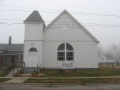 Bethel AME Church of Crawfordsvillelisted 2001
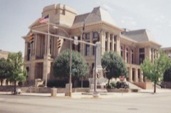 Crawfordsville Commercial Historic Districtlisted 1992
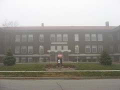 Crawfordsville High Schoollisted 2003
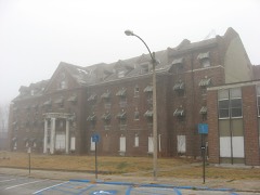 Culver Union Hospitallisted 2001
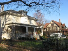 Elston Grove Historic Districtlisted 1992
 Col. Isaac C. Elston Houselisted 1982
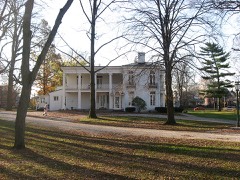 Henry S. Lane Houselisted 1981
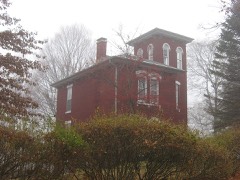 McClelland-Layne Houselisted 1985
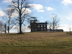 Abijah II O'Neall Houselisted 2005
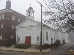 Saint John's Episcopal Churchlisted 1985
Population over time
3 figuresCrawfordsville grew from 15,243 to 16,306 between 2000 and 2020. These are the recorded population figures Wikidata holds for this place, reached through the Geographic Names Information System number this page is keyed on rather than by name, so they belong to this place and not to another of the same name. Most are census counts, but not all are: an early figure may be a founding or settlement estimate, and an estimate published within five years of a census is left out. The change column is computed, and is left blank where more than 20 years separate a figure from the one before it, because a gap that long is not a change between two counts.
| Year | People | Change |
|---|---|---|
| 2000 | 15,243 | |
| 2010 | 15,915 | +672 (+4%) |
| 2020 | 16,306 | +391 (+2%) |
Topographic sheets covering this place
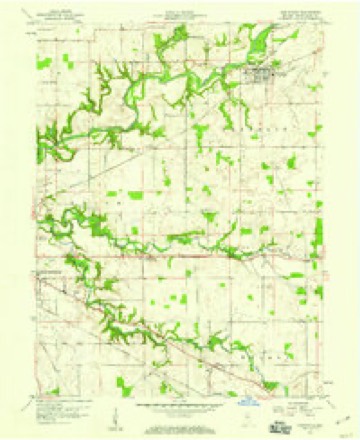
5 surveys from 9 printed sheetsMatched by testing this settlement's coordinate against the published boundary of every sheet in the United States Geological Survey's historical collection. Each opens the scanned sheet at the Survey.
- 1953 USGS Danville quadrangle1:250000, 3 printings
- 1955 USGS Danville quadrangle1:250000
- 1956 USGS Danville quadrangle1:250000
- 1958 USGS Darlington quadrangle1:24000, 2 printings
- 1984 USGS Lafayette quadrangle1:100000, 2 printings




Mines and quarries near this place
8 within 5 milesRegional context, not property-specific evidence. The federal mineral resources record lists 8 workings within 5 miles of Crawfordsville: 5 producers, 3 past producers. 5 still produce. What was taken out: Sand and Gravel, Construction, Clay, Stone, Perlite. Distance is straight-line from the map coordinates, so a quarry counted here may appear on a neighbouring settlement's page as well.
| Where | Site | Commodity | Status | Recorded |
|---|---|---|---|---|
| Crawfordsville Plant | Perlite | Past Producer | ||
| Montgomery Co. Hwy. Dept. | Stone | Producer | ||
| Logan Clay Shale Pit | Clay | Producer | ||
| U.S. Aggregates-Crawfordsvil | Clay | Producer | ||
| Blackford Ray Gravel Pit | Sand and Gravel, Construction | Past Producer | ||
| Kitts Gravel, Inc. | Sand and Gravel, Construction | Producer | ||
| Northcutt Gravel Pit | Sand and Gravel, Construction | Producer | ||
| Northcutt Gravel Pit | Sand and Gravel, Construction | Past Producer |
Storms near this place
60 of 91 shownRegional context, not property-specific evidence. The National Weather Service names Crawfordsville in 91 storm reports between 1994 and 2025: 56 thunderstorm wind, 22 hail, 5 flash flood, 4 tornado. The reports record 4 deaths and 6 injuries. Each account below is quoted exactly as the forecast office filed it, from the NOAA Storm Events Database, and each date opens the federal record of that event.
| When | Event | Place named | Harm | What the report says |
|---|---|---|---|---|
| May 1995 | Tornado (F2) | Crawfordsville | 3 killed, 5 hurt, $3,500,000 | The tornado touched down near Ladoga Road and County Road 400S damaging a home. The tornado continued east near Linnsburg and New Ross destroying eight homes and damaging eight others. Two businesses were destroyed and an elementary school received major damage. The fatalities occurred in prefabricated homes of rural Montgomery County, just west and south of Linnsburg. The tornado exited the county near Interstate 74 and County Road 400S at 0008 EST. (M42P, F36P, M94P) |
| August 1998 | Thunderstorm Wind | Crawfordsville | 1 killed, $15,000 | Tree fell on car killing occupant. Occurred on US 136. |
| June 2008 | Thunderstorm Wind | Crawfordsville | 1 hurt | A 32-year-old male was struck in the head by a falling tree limb as a result of thunderstorm winds. He was attempting to get to his vehicle from Weliever Field in Milligan Park. |
| May 2000 | Hail | Crawfordsville | $5,000,000 | no account filed |
| April 1994 | Thunderstorm Wind | Crawfordsville | $500,000 | A Subway Sandwich Shop roof was blown off by thunderstorm winds. The blowing debris also caused minor damage at an adjacent store. |
| October 2001 | Thunderstorm Wind | Crawfordsville | $100,000 | no account filed |
| August 2016 | Tornado (EF2) | Crawfordsville | $75,000 | This EF-2 tornado, with maximum wind speeds of 120 mph, largely tracked over open country. Major damage to homes and barns occurred near Linnsburg. Numerous trees damaged. Emergency responders reported 30 homes with damage as a result of this tornado. |
| February 2014 | Tornado (EF0) | Crawfordsville | $75,000 | A National Weather Service Indianapolis survey team identified weak tornado damage in the Crawfordsville area which occurred during the severe weather on February 20. The survey team rated this tornado an EF0 with winds estimated around 80 mph. The tornado began around 740 PM near County Road 150 South and County Road 200 East on the southeast side of Crawfordsville, and continued a path northeast to near Darlington, lifting around 748 PM. During that time the tornado damaged numerous outbuildings, removed shingles from homes, damaged a part of the Pilot truck stop canopy, and sheared off numerous tree tops. |
| April 2006 | Thunderstorm Wind | Crawfordsville | $50,000 | A building on the Wabash College campus lost a portion of its roof, and widely scattered tree damage occurred throughout Crawfordsville. |
| April 2011 | Thunderstorm Wind | Crawfordsville | $43,000 | A thunderstorm wind gust, estimated at 80 mph, downed trees in Crawfordsville. Also, the Trinity Mission facility garage and shed was destroyed, along with a flag pole and some damage to the main building. |
| March 2022 | Thunderstorm Wind | Crawfordsville | $30,000 | Thunderstorm winds downed trees and power lines across Montgomery County. |
| April 1998 | Tornado (F1) | Crawfordsville | $30,000 | Tornado touched down at CR 700S 1.8 miles west of SR47. Garage and Pole barn destroyed; barn roof damaged; trees downed |
| May 2003 | Lightning | Crawfordsville | $30,000 | no account filed |
| March 2025 | Thunderstorm Wind | Crawfordsville | $15,000 | Multiple reports of thunderstorm winds downing trees and or power poles in Crawfordsville along with minor roof damage on a house on Ladoga Road. |
| April 1998 | Thunderstorm Wind | Crawfordsville | $10,000 | Thunderstorm winds damaged a garage. |
| June 1995 | Thunderstorm Wind | Crawfordsville | $10,000 | Tree fell on garage. |
| October 2001 | Thunderstorm Wind | Crawfordsville | $10,000 | no account filed |
| June 2008 | Thunderstorm Wind | Crawfordsville | $8,000 | A portion of a roof was blown onto the roadway at US 231 and US 136. |
| May 2017 | Thunderstorm Wind | Crawfordsville | $7,000 | Several reports of trees of up to 12 inches in diameter were downed across Crawfordsville due to damaging thunderstorm wind gusts. |
| July 2009 | Thunderstorm Wind | Crawfordsville | $6,000 | A county official reported a few trees and tree limbs downed countywide due to thunderstorm wind gusts. |
| May 2017 | Thunderstorm Wind | Crawfordsville | $5,000 | Tree limbs were snapped and several large signs were blown over, including a gas station price sign, due to damaging thunderstorm wind gusts. Power was out for approximately 10 minutes. |
| April 2013 | Flood | Crawfordsville | $5,000 | Flooding was reported on Lafayette Avenue near Sugar Creek due to thunderstorm heavy rainfall. The Lafayette Avenue bridge was closed to vehicular traffic. Nearby softball diamonds were under water and the Creekside Restaurant was inaccessible. |
| May 2011 | Thunderstorm Wind | Crawfordsville | $5,000 | Trees were reported down in this location due to damaging thunderstorm wind gusts. |
| June 2010 | Thunderstorm Wind | Crawfordsville | $5,000 | A few medium-sized trees were reported down on city streets. |
| March 1996 | Thunderstorm Wind | Crawfordsville | $5,000 | no account filed |
| October 1996 | Thunderstorm Wind | Crawfordsville | $5,000 | no account filed |
| July 2015 | Thunderstorm Wind | Crawfordsville | $3,000 | Trees or tree limbs were downed due to damaging thunderstorm wind gusts. This event was reported via Twitter. |
| May 2025 | Thunderstorm Wind | Crawfordsville | $2,000 | Thunderstorm winds downed trees of unknown size. |
| January 2008 | Thunderstorm Wind | Crawfordsville | $2,000 | Restaurant signs were knocked down and damaged due to damaging thunderstorm winds. |
| June 2015 | Thunderstorm Wind | Crawfordsville | $1,000 | Tree limbs equal to or greater than 2 inches were downed due to damaging thunderstorm wind gusts. |
| August 2014 | Flood | Crawfordsville | $1,000 | The Montgomery dispatch reported some localized street flooding in Crawfordsville due to heavy thunderstorm rainfall. Flooding mainly occurred at intersections. |
| January 2013 | Thunderstorm Wind | Crawfordsville | $1,000 | A 60 mph thunderstorm wind gust was observed with a tree down on Highway 136, east of Crawfordsville. |
| May 1994 | Thunderstorm Wind | Crawfordsville | $500 | Several trees and power lines were blown down. |
| October 1996 | Thunderstorm Wind | Crawfordsville | $500 | no account filed |
| April 2017 | Hail | Crawfordsville | - | Some minor street flooding was also observed. |
| June 2011 | Hail | Crawfordsville | - | Dime to penny sized hail was reported in Crawfordsville. |
| June 2011 | Thunderstorm Wind | Crawfordsville | - | Damaging thunderstorm wind gusts estimated at 60 mph occurred in this location. |
| March 2011 | Hail | Crawfordsville | - | One and a quarter inch hail was reported in this location, as well as a wall cloud. |
| May 2009 | Thunderstorm Wind | Crawfordsville | - | One-inch hail was also reported and is documented separately within this publication. |
| May 2009 | Hail | Crawfordsville | - | Estimated thunderstorm wind gusts up to 70 MPH were reported as well in addition to the hail. This wind event is also documented separately within this publication. |
| June 2008 | Thunderstorm Wind | Crawfordsville | - | Thunderstorm winds blew a tree down near US 36 and 400 W. Numerous 10- to 15-inch tree limbs were down around the area. |
| August 2007 | Thunderstorm Wind | Crawfordsville | - | A large tree and limbs fell due to damaging thunderstorm winds. |
| February 2006 | Thunderstorm Wind | Crawfordsville | - | A tree was downed. |
| June 2006 | Thunderstorm Wind | Crawfordsville | - | Trees were downed. |
| August 2006 | Thunderstorm Wind | Crawfordsville | - | Several trees were downed. |
| July 2005 | Thunderstorm Wind | Crawfordsville | - | Trees were blown down. |
| November 2005 | Thunderstorm Wind | Crawfordsville | - | Large limbs were downed. |
| March 2024 | Hail | Crawfordsville | - | no account filed |
| March 2017 | Hail | Crawfordsville | - | no account filed |
| March 2017 | Hail | Crawfordsville | - | no account filed |
| April 2011 | Hail | Crawfordsville | - | no account filed |
| June 2010 | Thunderstorm Wind | Crawfordsville | - | no account filed |
| June 2008 | Thunderstorm Wind | Crawfordsville | - | no account filed |
| June 2008 | Thunderstorm Wind | Crawfordsville | - | no account filed |
| March 2006 | Hail | Crawfordsville | - | no account filed |
| May 2006 | Hail | Crawfordsville | - | no account filed |
| January 2005 | Flash Flood | Crawfordsville | - | no account filed |
| May 2005 | Hail | Crawfordsville | - | no account filed |
| July 2005 | Hail | Crawfordsville | - | no account filed |
| September 2003 | Thunderstorm Wind | Crawfordsville | - | no account filed |
Nearest settlements
The eight closest, with where each one stands in the county. Distances are straight-line, computed from the Geographic Names Information System coordinates.
| Map | Place | Distance | Sheets |
|---|---|---|---|
| Ames | 0.9 miles | 11 | |
| Fiskville | 1.2 miles | 11 | |
| Smartsburg | 2.5 miles | 9 | |
| Garfield | 3.9 miles | 9 | |
| Manchester | 4.2 miles | 11 | |
| Mace | 4.7 miles | 9 | |
| Linnsburg | 4.8 miles | 9 | |
| North Union | 5.4 miles | 13 |
Elsewhere
Matched on this settlement's Geographic Names Information System number rather than its name, so it cannot be a different place of the same name in another state.
| Wikipedia article on Crawfordsville | An encyclopaedic summary. Its text is share-alike, so it is linked here rather than copied. |
| Wikidata item Q986629 | The structured record the population and elevation above come from. Public domain (CC0). |
Provenance
This settlement is recorded in the Geographic Names Information System as feature 433103. The sheet list is computed by point-in-boundary test against the United States Geological Survey's historical topographic inventory. Both are works of the United States government and carry no copyright under 17 U.S.C. 105.
Mines and quarries. USGS Mineral Resources Data System (MRDS) https://mrdata.usgs.gov/mrds/ A work of the United States government, no copyright under 17 U.S.C. 105.
Storms. NOAA National Centers for Environmental Information, Storm Events Database https://www.ncei.noaa.gov/stormevents/ A work of the United States government, no copyright under 17 U.S.C. 105. Narratives are quoted verbatim from the National Weather Service report and are not edited or summarised.