Block
From the record
22 National Register listings published here, 2 of them National Historic Landmarks.
Sources: the county history on the Internet Archive · the National Register database, National Park Service
53 topographic sheets cover 38 settlements here, and 22 properties are on the National Register of Historic Places.
22 National Register listings published here, 2 of them National Historic Landmarks.
Sources: the county history on the Internet Archive · the National Register database, National Park Service
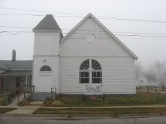
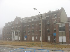
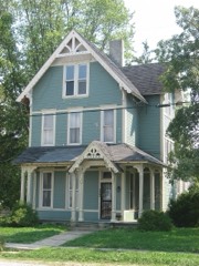
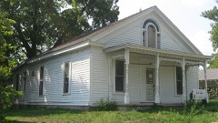
Every property in this county listed on the National Register of Historic Places, with the year it was listed and the federal nomination document.
Montgomery County has 1 covered bridge on the National Register. Each is a listed structure with a federal nomination on file.
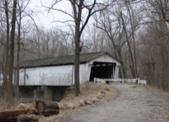 | Darlington Covered Bridge | Listed 1990 |
Every wildfire the federal occurrence database records inside this county: 11 of them, burning about 15 acres. None started naturally and 3 were recorded as arson. Each settlement page carries the fires within five miles of it.
| Reported cause | Fires |
|---|---|
| Missing data/not specified/undetermined | 5 |
| Debris and open burning | 3 |
| Arson/incendiarism | 3 |
The five largest, by the area the report gives. Two of them were set deliberately.
| Date | Cause | Size | Reported by | Name on the report |
|---|---|---|---|---|
| 4 October 2004 | Missing data/not specified/undetermined | 8.0 acres | Indiana State Fire Marshal's Office | not named |
| 2 December 2002 | Missing data/not specified/undetermined | 5.0 acres | Indiana State Fire Marshal's Office | not named |
| 7 November 2004 | Debris and open burning | 1.0 acres | Indiana State Fire Marshal's Office | not named |
| 13 March 2004 | Missing data/not specified/undetermined | under an acre | Indiana State Fire Marshal's Office | not named |
| 17 October 2003 | Arson/incendiarism | under an acre | Indiana State Fire Marshal's Office | not named |
| 30 August 2003 | Arson/incendiarism | under an acre | Indiana State Fire Marshal's Office | not named |
| 14 March 2005 | Missing data/not specified/undetermined | under an acre | Indiana State Fire Marshal's Office | not named |
| 1 December 2002 | Debris and open burning | under an acre | Indiana State Fire Marshal's Office | not named |
Every settlement page carries the fires within five miles of it - see the settlement index below.
The NOAA Storm Events Database holds 326 reports for this county, causing 7 deaths, 56 injuries and about $43,574,500 in recorded property damage. Each settlement page carries the reports that name it.
| Kind of event | Reports |
|---|---|
| Thunderstorm Wind | 172 |
| Hail | 92 |
| Tornado | 28 |
| Flash Flood | 20 |
| Flood | 11 |
| Lightning | 2 |
| Funnel Cloud | 1 |
The most serious of them, by death, then injury, then recorded damage. The accounts are quoted exactly as the forecast office filed them.
| When | Event | Place named | Harm | What the report says |
|---|---|---|---|---|
| May 1995 | Tornado (F2) | Crawfordsville | 3 killed, 5 hurt, $3,500,000 | The tornado touched down near Ladoga Road and County Road 400S damaging a home. The tornado continued east near Linnsburg and New Ross destroying eight homes and damaging eight others. Two businesses were destroyed and an elementary school received major damage. The fatalities occurred in prefabricated homes of rural Montgomery County, just west and south of Linnsburg. The tornado exited the county near Interstate 74 and County Road 400S at 0008 EST. (M42P, F36P, M94P) |
| April 1965 | Tornado (F4) | not stated | 2 killed, 13 hurt, $25,000,000 | no account filed |
| June 1980 | Tornado (F3) | not stated | 1 killed, 16 hurt, $2,500,000 | no account filed |
| August 1998 | Thunderstorm Wind | Crawfordsville | 1 killed, $15,000 | Tree fell on car killing occupant. Occurred on US 136. |
| June 1990 | Tornado (F2) | not stated | 12 hurt, $2,500,000 | no account filed |
| May 2000 | Thunderstorm Wind | Waynetown | 3 hurt | no account filed |
| January 1965 | Tornado (F1) | not stated | 2 hurt, $25,000 | no account filed |
| April 1988 | Thunderstorm Wind | not stated | 2 hurt | no account filed |
| November 1992 | Tornado (F1) | not stated | 1 hurt, $250,000 | no account filed |
| June 2008 | Thunderstorm Wind | Crawfordsville | 1 hurt | A 32-year-old male was struck in the head by a falling tree limb as a result of thunderstorm winds. He was attempting to get to his vehicle from Weliever Field in Milligan Park. |
| August 1985 | Thunderstorm Wind | not stated | 1 hurt | no account filed |
| May 2000 | Hail | Crawfordsville | $5,000,000 | no account filed |
| November 1992 | Tornado (F3) | not stated | $2,500,000 | no account filed |
| April 1994 | Thunderstorm Wind | Crawfordsville | $500,000 | A Subway Sandwich Shop roof was blown off by thunderstorm winds. The blowing debris also caused minor damage at an adjacent store. |
| May 1991 | Tornado (F1) | not stated | $250,000 | no account filed |
| June 2023 | Thunderstorm Wind | Ladoga | $150,000 | Power pole and tree snapped by thunderstorm wind gusts. Extensive damage reported across much of the county with over 4000 power outages. |
| January 1999 | Flash Flood | Countywide | $100,000 | 3 to 4 inches of rain fell across the county causing two basements to flood and collapse, while part of State Road 47 was washed away causing a car to be totalled. Several homes also received minor damage with leaky roofs. |
| October 2001 | Thunderstorm Wind | Crawfordsville | $100,000 | no account filed |
| July 1996 | Thunderstorm Wind | Waveland | $100,000 | no account filed |
| August 2016 | Tornado (EF2) | Crawfordsville | $75,000 | This EF-2 tornado, with maximum wind speeds of 120 mph, largely tracked over open country. Major damage to homes and barns occurred near Linnsburg. Numerous trees damaged. Emergency responders reported 30 homes with damage as a result of this tornado. |
| February 2014 | Tornado (EF0) | Crawfordsville | $75,000 | A National Weather Service Indianapolis survey team identified weak tornado damage in the Crawfordsville area which occurred during the severe weather on February 20. The survey team rated this tornado an EF0 with winds estimated around 80 mph. The tornado began around 740 PM near County Road 150 South and County Road 200 East on the southeast side of Crawfordsville, and continued a path northeast to near Darlington, lifting around 748 PM. During that time the tornado damaged numerous outbuildings, removed shingles from homes, damaged a part of the Pilot truck stop canopy, and sheared off numerous tree tops. |
| April 2023 | Tornado (EF0) | New Ross | $50,000 | The tornado touched down on the west side of County Road 1050 East|just south of US Route 136. At this location, roof panels were|peeled back on a garage and center cut roofing material was thrown|500 yards. Some siding was peeled off the house.||The tornado moved northeast and crossed US Route 136 with|additional damage to two structures along East New Ross Road, a|house and an outbuilding. The wind entered the open door of the|outbuilding, blew out a wall panel and pulled nails straight out.|A short distance to the north, the house had its eastern garage wall blown out|after the corner of the structure bent inwards. A grill was|thrown to the east-northeast about 20 yards. |
| April 2006 | Thunderstorm Wind | Crawfordsville | $50,000 | A building on the Wabash College campus lost a portion of its roof, and widely scattered tree damage occurred throughout Crawfordsville. |
| May 2002 | Flash Flood | North Portion | $50,000 | no account filed |
| May 2012 | Tornado (EF1) | Linnsburg | $48,000 | The same storm that produced the Yeddo tornado went on to produce this EF-1 tornado in Montgomery County, near the town of New Ross. The tornado touched down at 7:36 PM EDT and was on the ground for about a minute. Wind speeds for the tornado were 100-110 mph, and the width was 150 yards. The tornado was on the ground for about a half mile as it hit a house, destroyed a barn, and downed trees onto a house and two cars. |
| April 2011 | Thunderstorm Wind | Crawfordsville | $43,000 | A thunderstorm wind gust, estimated at 80 mph, downed trees in Crawfordsville. Also, the Trinity Mission facility garage and shed was destroyed, along with a flag pole and some damage to the main building. |
| April 2006 | Thunderstorm Wind | Ladoga | $40,000 | A trailer was flipped and destroyed by straight line winds. |
| April 2026 | Thunderstorm Wind | New Ross | $30,000 | Thunderstorm wind gusts downed trees and powerlines. |
| March 2022 | Thunderstorm Wind | Crawfordsville | $30,000 | Thunderstorm winds downed trees and power lines across Montgomery County. |
| November 2013 | Tornado (EF1) | New Richmond | $30,000 | At 1447EST, this EF-1 tornado touched down 3 miles southeast of New Richmond. The tornado hit two metal buildings near the Weaver Popcorn plant. Metal debris, insulation, and 2x4s from the buildings were scattered to the northeast along a path just under two miles long. The tornado lifted 1.5 miles west of Linden at 1450EST. |
| May 2002 | Thunderstorm Wind | Waveland | $30,000 | Roof blown off a home and a garage was damaged |
| April 1998 | Tornado (F1) | Crawfordsville | $30,000 | Tornado touched down at CR 700S 1.8 miles west of SR47. Garage and Pole barn destroyed; barn roof damaged; trees downed |
| May 2003 | Lightning | Crawfordsville | $30,000 | no account filed |
| August 2002 | Flash Flood | Countywide | $30,000 | no account filed |
| March 2023 | Tornado (EF1) | Bowers | $25,000 | This squall line tornado began in far northeastern Montgomery County, approximately midway between the communities of Darlington and Colfax, (while, a weaker EF0 tornado was simultaneously spawned about 1.5 miles to the southeast). The tornado first downed trees (uprooted hardwood and snapped pines) in a distinct 0.5-mile long patch along Withe Creek prior to crossing East Bowers Road, consistent with EF1-intensity winds as high as 94 mph. The tornado then continued into Boone and Clinton Counties where it would ultimately reach EF2 intensity. |
| May 2019 | Thunderstorm Wind | Waynetown | $25,000 | Several large trees were uprooted in and around the Waynetown area due to damaging thunderstorm wind gusts. Power was also out across portions of the town. There were also sporadic trees down across the rest of the county. |
| June 2006 | Flash Flood | Linnsburg | $25,000 | A portion of county road 600 east collapsed. No one was injured. |
| May 1983 | Tornado (F0) | not stated | $25,000 | no account filed |
| March 1976 | Tornado (F0) | not stated | $25,000 | no account filed |
| December 1966 | Tornado (F2) | not stated | $25,000 | no account filed |
| June 1958 | Tornado (F2) | not stated | $25,000 | no account filed |
| October 1996 | Thunderstorm Wind | New Market | $20,000 | no account filed |
| March 2025 | Thunderstorm Wind | Crawfordsville | $15,000 | Multiple reports of thunderstorm winds downing trees and or power poles in Crawfordsville along with minor roof damage on a house on Ladoga Road. |
| April 2011 | Tornado (EF0) | Alamo | $15,000 | An EF-1 tornado touched down at 9:10PM EDT in central Vermillion County and traveled northeast through northwest Parke, southeast Fountain, and west-central Montgomery Counties. This tornado formed 2.72 miles southwest of Cayuga and tracked northeast for approximately 4 miles before exiting Vermillion County about 2.36 miles east, southeast of Cayuga at 9:16PM EDT. The tornado continued northeast into Parke County, around 1.51 miles west of Waterman, for another 8.6 miles before leaving the county 3.53 miles northeast of Sylvania at 9:22PM EDT. The tornado continued northeast into Fountain County, around 1.69 miles east, southeast of Kingman, for another 9.3 miles before pushing into Montgomery County at 9:32PM EDT, 2.75 miles northwest of Alamo, for another 9.23 miles and dissipating about 1.89 miles northwest of Crawfordsville at 9:40PM EDT. Multiple trees and power lines were reported down along the path, as well as siding and shingles ripped off homes. A shed was destroyed in Vermillion County and another structure sustained damage in Parke County. The tornado was rated an EF-1 along most of its path, except in Montgomery County where EF-0 damage was found. The maximum width along the path was 100 yards. |
| November 2017 | Thunderstorm Wind | Kirkpatrick | $12,000 | Trees were downed across the road from where two pole barns were damaged due to damaging thunderstorm wind gusts. |
| March 2023 | Tornado (EF0) | Thorntown | $10,000 | This secondary and weaker squall line tornado began just west of the Montgomery-Boone County line (tracking just southeast of the nearby, multi-county EF2 tornado). A barn just inside Montgomery County was partially destroyed by 85 mph winds with debris thrown into Boone County and blown one-quarter of a mile to the northeast. The tornado also downed utility poles along the county line road before continuing into Boone County. |
| May 1998 | Thunderstorm Wind | New Richmond | $10,000 | Large tree blown down on house causing extensive roof damage. |
| April 1998 | Thunderstorm Wind | Crawfordsville | $10,000 | Thunderstorm winds damaged a garage. |
| June 1995 | Thunderstorm Wind | Crawfordsville | $10,000 | Tree fell on garage. |
| October 2001 | Thunderstorm Wind | Crawfordsville | $10,000 | no account filed |
| July 2017 | Thunderstorm Wind | Ladoga | $8,000 | An estimated 60 mph thunderstorm wind gust was reported near the Montgomery/Putnam county line. Five to fifteen trees were damaged. |
| June 2008 | Thunderstorm Wind | Crawfordsville | $8,000 | A portion of a roof was blown onto the roadway at US 231 and US 136. |
| May 2017 | Thunderstorm Wind | Crawfordsville | $7,000 | Several reports of trees of up to 12 inches in diameter were downed across Crawfordsville due to damaging thunderstorm wind gusts. |
| May 2011 | Thunderstorm Wind | New Ross | $6,000 | A roof was torn off a barn at County Road 500 South and State Route 136 due to damaging thunderstorm wind gusts. |
| July 2009 | Thunderstorm Wind | Crawfordsville | $6,000 | A county official reported a few trees and tree limbs downed countywide due to thunderstorm wind gusts. |
| May 2025 | Thunderstorm Wind | Smartsburg | $5,000 | Trees downed by thunderstorm wind gusts. |
| May 2024 | Thunderstorm Wind | Linnsburg | $5,000 | Several reports from dispatch of trees and powerlines downed by thunderstorm wind gusts across the eastern portion of the county. |
| June 2024 | Thunderstorm Wind | Browns Vly | $5,000 | Thunderstorm winds downed multiple trees. |
| July 2023 | Thunderstorm Wind | Darlington | $5,000 | Several large tree limbs snapped by thunderstorm wind gusts. A boat on a trailer was also flipped. |
| December 2021 | Thunderstorm Wind | Ladoga | $5,000 | Trees and large branches blown down by thunderstorm wind gusts. |
The Survey's mineral resources record lists 10 workings inside this county. 6 still produce and 4 are closed or unrecorded. Each settlement page carries the workings within five miles of it.
| Commodity | Workings |
|---|---|
| Sand and Gravel, Construction | 6 |
| Clay | 2 |
| Stone | 1 |
| Perlite | 1 |
The least common of them first, because a county's hundredth gravel pit says nothing its first ten did not.
| Where | Site | Commodity | Status | Recorded |
|---|---|---|---|---|
| Crawfordsville Plant | Perlite | Past Producer | ||
| Montgomery Co. Hwy. Dept. | Stone | Producer | ||
| Logan Clay Shale Pit | Clay | Producer | ||
| U.S. Aggregates-Crawfordsvil | Clay | Producer | ||
| Blackford Ray Gravel Pit | Sand and Gravel, Construction | Past Producer | ||
| Kitts Gravel, Inc. | Sand and Gravel, Construction | Producer | ||
| L.E. Smith Sand and Gravel Pit | Sand and Gravel, Construction | Past Producer | ||
| Morgan & Chesterson Gravel Co. | Sand and Gravel, Construction | Producer | ||
| Northcutt Gravel Pit | Sand and Gravel, Construction | Producer | ||
| Northcutt Gravel Pit | Sand and Gravel, Construction | Past Producer |
One book written about this county, cut here where the book itself is cut, at its printed chapters: 1 chapter in all. Every chapter is public domain, machine-read from the scan and reproduced complete. A chapter already given under one of the county's towns is not repeated in this list.
| Chapter | Length |
|---|---|
| Biographical sketches | 215,227 words in 14 parts |
Named settlements recorded in the Geographic Names Information System, each with the topographic sheets covering it. Villages, hamlets and abandoned places alike. Each is shown with the nearest named watercourse or landform and the survey quadrangle it falls on.
Union township · 47933 · On Little Sugar Creek · Darlington quadrangle
9 sheets, 1953 to 1984
Franklin township · 47940 · On Honey Creek · Darlington quadrangle
9 sheets, 1953 to 1984
Franklin township · 47933 · On Lye Creek · Darlington quadrangle
9 sheets, 1953 to 1984
Union township · 47933 · On Walnut Fork Sugar Creek · Crawfordsville quadrangle
11 sheets, 1953 to 1984
Ripley township · 47933 · On Rattlesnake Creek · Waynetown quadrangle
9 sheets, 1953 to 1987
Ripley township · 47933 · Near Devils Backbone · Alamo quadrangle
14 sheets, 1949 to 1986
Ripley township · 47933 · On Mill Creek · Crawfordsville quadrangle
11 sheets, 1953 to 1984