 Block
Cumberland, Indiana
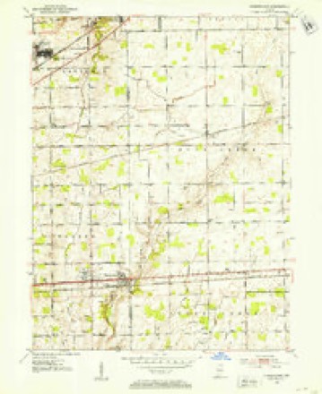
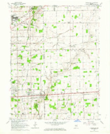
12 topographic sheets cover this place, the earliest surveyed in 1952 and the latest in 1986. It stands in Warren Township. It lies in ZIP code area 46229. It stands on Cumberland Creek. The Survey maps it on the Cumberland quadrangle. 5,954 people lived here at the 2020 count. It stands 853 feet above sea level.
On record in Cumberland
Buildings and businesses the archive holds for this place. Each opens its own page, with the source record it came from.
On the National Register 1 record
 Cumberland Historic Districtlisted 2001
Population over time
2 figuresCumberland grew from 5,169 to 5,954 between 2010 and 2020. These are the recorded population figures Wikidata holds for this place, reached through the Geographic Names Information System number this page is keyed on rather than by name, so they belong to this place and not to another of the same name. Most are census counts, but not all are: an early figure may be a founding or settlement estimate, and an estimate published within five years of a census is left out. The change column is computed, and is left blank where more than 20 years separate a figure from the one before it, because a gap that long is not a change between two counts.
| Year | People | Change |
|---|---|---|
| 2010 | 5,169 | |
| 2020 | 5,954 | +785 (+15%) |
Topographic sheets covering this place
5 surveys from 12 printed sheetsMatched by testing this settlement's coordinate against the published boundary of every sheet in the United States Geological Survey's historical collection. Each opens the scanned sheet at the Survey.
- 1952 USGS Cumberland quadrangle1:24000
- 1953 USGS Cincinnati quadrangle1:250000, 3 printings
- 1957 USGS Cincinnati quadrangle1:250000
- 1962 USGS Cumberland quadrangle1:24000, 5 printings
- 1986 USGS New Castle quadrangle1:100000, 2 printings



In the county-history sources
5,350 words on this townshipHistory of Indianapolis and Marion County, Indiana, published 1884 names this settlement in its chapter on Warren Township. These are the passages that mention it, exactly as the scans read.
Joseph S. Mix and wife came from Hamilton County, Ohio, in the year 1833, and settled in the east part of Warren township, in a perfect wilderness, where the only clearing was where the logs were cut for erecting his cabin, which was (as was usual in those days) of only one room, with puncheon floor, and quilts or blankets hung up at the door and windows. For three years he kept a store in Cumberland for Nicholas McCarty, and when he closed at night would take the money in a basket on his ^rm and go to his home, a mile distant through the woods. There he hung his basket (with the money in it) on a peg for the night, without the least doubt that it was perfectly safe, as it was. He was afterwards in the hemp business with Mr. McCarty. The farm on which he settled in 1833, and where he still lives, is situated one mile southeast of the village of Cumberland.
Passage source: History of Indianapolis and Marion County, Indiana, published 1884.
The first steam-mill was built on the National road, about two miles west of Cumberland. The exact date of the building of this mill is not known, but it sawed the lumber for planking the Cumberland plank road, now the National gravel road. At present there are three steam saw- mills in the township and one steam grist-mill. There are no waterpower mills.
Passage source: History of Indianapolis and Marion County, Indiana, published 1884.
An early tavern was kept by Samuel Fullen, on the Centreville road. When that road was vacated he moved to Cumberland, and kept the first tavern there. Henry Brady kept tavern six miles east of Indianapolis as early as 1824. John Wilson kept on the Centreville road, near the present site of Butler University, three and a half miles east of Indianapolis. When the National road was located he moved to it and kept tavern there. Rufus Jennison kept tavern five and a half miles east of Indianapolis, on the National road. James Ferguson kept six miles east of Indianapolis, on the National road. He kept tavern as early as 1825. David Woods kept ten miles east of Indianapolis, on the Brookville road, at a very early date. Nathan Harlan kept on Brookville road from 1833 to 1844, for accommodation of stage travelers. This was about nine miles east of Indianapolis. At present there is but one hotel in the township, kept by Ingram Little at Cumberland.
Passage source: History of Indianapolis and Marion County, Indiana, published 1884.
Machine-read from a century-old scan, so expect the errors a machine makes: misspelled names, dropped words, stray characters.
Read the whole chapter on Warren Township - it names this place 7 more 7 times.
Mines and quarries near this place
1 within 5 milesRegional context, not property-specific evidence. The federal mineral resources record lists 1 working within 5 miles of Cumberland: 1 producer. All of them still produce. What was taken out: Sand and Gravel, Construction. Distance is straight-line from the map coordinates, so a quarry counted here may appear on a neighbouring settlement's page as well.
| Where | Site | Commodity | Status | Recorded |
|---|---|---|---|---|
| Indianapolis Aggregates Division | Sand and Gravel, Construction | Producer |
Storms near this place
9 since 1996Regional context, not property-specific evidence. The National Weather Service names Cumberland in 9 storm reports between 1996 and 2024: 5 hail, 2 tornado, 1 thunderstorm wind, 1 lightning. The reports record 3 injuries. Each account below is quoted exactly as the forecast office filed it, from the NOAA Storm Events Database, and each date opens the federal record of that event.
| When | Event | Place named | Harm | What the report says |
|---|---|---|---|---|
| June 1998 | Tornado (F3) | Cumberland | 3 hurt, $1,500,000 | no account filed |
| June 2006 | Lightning | Cumberland | $100,000 | A new house, which was unoccupied, was struck by lightning and heavily damaged by the ensuing fire. Firefighters escaped just minutes before the second floor, on which they were standing to fight the blaze, collapsed. |
| April 2012 | Hail | Cumberland | - | Quarter-sized hail was covering the ground. |
| June 2002 | Tornado (F0) | Cumberland | - | Trained spotter reported a brief F0 touchdown in a corn field. No damage. |
| May 2024 | Hail | Cumberland | - | no account filed |
| April 2012 | Hail | Cumberland | - | no account filed |
| September 2012 | Hail | Cumberland | - | no account filed |
| May 1999 | Thunderstorm Wind | Cumberland | - | no account filed |
| April 1996 | Hail | Cumberland | - | no account filed |
Nearest settlements
The eight closest, with where each one stands in the county. Distances are straight-line, computed from the Geographic Names Information System coordinates.
| Map | Place | Distance | Sheets |
|---|---|---|---|
| Warren Hills | 2.2 miles | 12 | |
| Julietta | 2.7 miles | 11 | |
| Ivanhoe | 3.0 miles | 17 | |
| Burge Terrace | 3.1 miles | 11 | |
| Washington Place | 3.1 miles | 17 | |
| Sun Down | 3.9 miles | 11 | |
| Belle Arbor | 4.2 miles | 11 | |
| Willow Lakes | 4.5 miles | 17 |
Elsewhere
Matched on this settlement's Geographic Names Information System number rather than its name, so it cannot be a different place of the same name in another state.
| Wikipedia article on Cumberland | An encyclopaedic summary. Its text is share-alike, so it is linked here rather than copied. |
| Wikidata item Q958240 | The structured record the population and elevation above come from. Public domain (CC0). |
Provenance
This settlement is recorded in the Geographic Names Information System as feature 433243. The sheet list is computed by point-in-boundary test against the United States Geological Survey's historical topographic inventory. Both are works of the United States government and carry no copyright under 17 U.S.C. 105.
Mines and quarries. USGS Mineral Resources Data System (MRDS) https://mrdata.usgs.gov/mrds/ A work of the United States government, no copyright under 17 U.S.C. 105.
Storms. NOAA National Centers for Environmental Information, Storm Events Database https://www.ncei.noaa.gov/stormevents/ A work of the United States government, no copyright under 17 U.S.C. 105. Narratives are quoted verbatim from the National Weather Service report and are not edited or summarised.