 Block
Deputy, Indiana
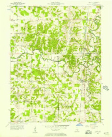
9 topographic sheets cover this place, the earliest surveyed in 1956 and the latest in 1990. It stands in Graham Township. It lies in ZIP code area 47230. The Survey maps it on the Deputy quadrangle. 86 people lived here at the 2020 count. It stands 627 feet above sea level.
Population over time
2 figuresDeputy grew from 86 to 86 between 2010 and 2020. These are the recorded population figures Wikidata holds for this place, reached through the Geographic Names Information System number this page is keyed on rather than by name, so they belong to this place and not to another of the same name. Most are census counts, but not all are: an early figure may be a founding or settlement estimate, and an estimate published within five years of a census is left out. The change column is computed, and is left blank where more than 20 years separate a figure from the one before it, because a gap that long is not a change between two counts.
| Year | People | Change |
|---|---|---|
| 2010 | 86 | |
| 2020 | 86 | 0 (0%) |
Topographic sheets covering this place
6 surveys from 9 printed sheetsMatched by testing this settlement's coordinate against the published boundary of every sheet in the United States Geological Survey's historical collection. Each opens the scanned sheet at the Survey.
- 1956 USGS Deputy quadrangle1:24000
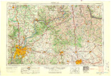
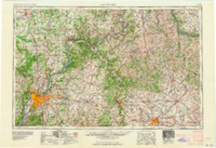
- 1956 USGS Louisville quadrangle1:250000, 2 printings
- 1964 USGS Louisville quadrangle1:250000
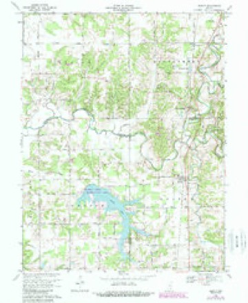
- 1968 USGS Deputy quadrangle1:24000, 3 printings
- 1986 USGS Madison quadrangle1:100000
- 1990 USGS Madison quadrangle1:100000
Storms near this place
46 since 1996Regional context, not property-specific evidence. The National Weather Service names Deputy in 46 storm reports between 1996 and 2025: 22 flood, 17 thunderstorm wind, 4 hail, 2 tornado. No death or injury is recorded in these reports. Each account below is quoted exactly as the forecast office filed it, from the NOAA Storm Events Database, and each date opens the federal record of that event.
| When | Event | Place named | Harm | What the report says |
|---|---|---|---|---|
| August 2002 | Tornado (F1) | Deputy | $100,000 | The tornado path was mainly through a rural section of Jefferson County. F1 damage was noted in and around the town of Deputy, with estimated wind speeds of 100 mph. Several roofs were lifted off structures, and eye witnesses reported debris swirling in the air around the tornado. Debris consisted primarily of boards and limbs. Numerous trees were torn down and laid in varying directions along the tornado path. |
| August 2002 | Thunderstorm Wind | Deputy | $100,000 | Roofs were blown off several houses in Deputy. |
| May 1996 | Thunderstorm Wind | Deputy | $50,000 | no account filed |
| August 2002 | Thunderstorm Wind | Deputy | $40,000 | Trees were blown on to a house in Deputy. |
| March 2008 | Flash Flood | Deputy | $30,000 | Sections of State Road 250 and Deputy Pike were closed due to high water. Three vehicles were submerged in high waters. The occupants were rescued. |
| April 2025 | Thunderstorm Wind | Deputy | - | There were multiple trees down on the 1200 block of 1400 West. |
| June 2021 | Thunderstorm Wind | Deputy | - | A social media post said there was lots of debris and trees down on Blake Road, south of Deputy. |
| February 2018 | Flood | Deputy | - | The Muscatatuck River at Deputy went into minor flood, cresting at 26.61 feet. This is 1.61 feet above flood stage. |
| March 2017 | Flood | Deputy | - | Widespread thunderstorms over the area brought the Muscatatuck River at Deputy into minor flood stage. The river crested at 26.16 feet. |
| July 2017 | Thunderstorm Wind | Deputy | - | Local law enforcement reported large trees blocking the roadway. |
| April 2015 | Flood | Deputy | - | Between 4 and 6 inches of rain quickly brought the Muscatatuck River at Deputy into flood. The river crested at 25.63 feet during the afternoon of April 3rd, then fell below flood stage later that evening. |
| April 2015 | Thunderstorm Wind | Deputy | - | Emergency management reported 2 large trees down on Deputy Pike. |
| July 2015 | Thunderstorm Wind | Deputy | - | A Jefferson County law enforcement official reported trees down across much of the county due to severe thunderstorm winds. |
| January 2012 | Flood | Deputy | - | Heavy rains from a squall line the previous day caused a quick rise on the Muscatatuck River at Deputy. Flood stage at Deputy is 20 feet. The river crested around 20.2 feet at 1 AM EST on January 18. Minor flooding occurs at this level. |
| January 2012 | Flood | Deputy | - | The Muscatatuck River at Deputy crested around 21.7 feet at 630 AM EST on January 27. Flood stage at Deputy is 20 feet. Minor flooding occurs at this level. After consultation with area officials, the flood stage at Deputy has since been raised to 25 feet. |
| July 2012 | Thunderstorm Wind | Deputy | - | Estimated winds of 60 mph near Deputy downed quite a few large limbs. |
| May 2011 | Flood | Deputy | - | The Muscatatuck River near Deputy crested around 24.6 feet at 215 PM EST on May 2. Flood stage at Deputy is 20 feet. Minor flooding occurs at this level, with some area county roads flooded. |
| April 2011 | Flood | Deputy | - | The Muscatatuck River at Deputy crested at 22.6 feet around 1015 AM EST on April 12. Flood stage at Deputy is 20 feet. Minor flooding occurs at this level. |
| April 2011 | Tornado (EF0) | Deputy | - | An NWS storm survey confirmed an EF-0 tornado with wind speeds up to 80 mph moved into Jefferson County from Scott County. The tornado, which touched down in Scottsburg, crossed the county line a half mile north of Highway 256 southwest of Deputy. it continued to the northeast over rural countryside, snapping and uprooting numerous trees and heavily damaging a hog barn and other outbuildings before lifting approximately 2.5 miles east of Deputy along Deputy Pike Road. |
| April 2011 | Thunderstorm Wind | Deputy | - | Damage to a barn and garage near state road 3 in Deputy was reported. Trees and power lines were also downed county-wide in Jefferson county. |
| April 2011 | Flood | Deputy | - | The Muscatatuck River at Deputy crested around 24.9 feet at 11 PM EST on April 23. Flood stage at Deputy is 20 feet. Minor flooding occurs at this level. |
| April 2011 | Flood | Deputy | - | The Muscatatuck River at Deputy crested around 25.7 feet around 645 PM EST on April 19. Flood stage at Deputy is 20 feet. Minor flooding occurs at this level. |
| March 2011 | Thunderstorm Wind | Deputy | - | In addition to the wind hail was covering the ground with vehicles dented. |
| June 2011 | Flood | Deputy | - | Heavy rains brought minor flooding to the Muscatatuck River at Deputy on the 26th of June. The river crested at 25.3 feet during the afternoon of the 26th. Flood stage is 20 feet. |
| December 2011 | Flood | Deputy | - | Heavy prolonged rain brought the Muscatatuck River into flood. The river crested at 25.3 feet shortly before midnight on December 5th. This is considered a moderate flood. Flood stage is 20 feet. |
| June 2011 | Flood | Deputy | - | The Muscatatuck River at Deputy, IN crested at 25.3 feet around 3 PM EST on June 26. Flood stage at Deputy is 20 feet. Minor flooding occurs at this level, with some county roads under water in northeastern Jefferson County, IN. |
| March 2011 | Hail | Deputy | - | Hail was covering the ground and vehicles were dented. |
| May 2010 | Flood | Deputy | - | The Muscatatuck River at Deputy crested around 20.8 feet around 230 AM EST on May 3. Flood stage at Deputy is 20 feet. At this level, some county roads are under water in northeastern Jefferson County. |
| May 2010 | Flood | Deputy | - | The Muscatatuck River at Deputy crested around 22.1 feet at 10 PM EST on May 12. Flood stage at Deputy is 20 feet. Minor flooding occurs at this level, with some county roads under water in northwest Jefferson County. |
| August 2010 | Thunderstorm Wind | Deputy | - | Jefferson county dispatch reported a tree down just north of Deputy. |
| March 2008 | Flood | Deputy | - | The Muscatatuck River at Deputy crested at 22.0 feet around noon EST on March 28. Minor flooding occurs at this level, with some county roads closed in the area. |
| April 2008 | Flood | Deputy | - | The Muscatatuck River at Deputy crested at 21.5 feet around 145 PM EST on April 4. Flood stage at Deputy is 20 feet. Minor flooding occurs at this level, with some county roads under water in northeast Jefferson County. |
| June 2008 | Hail | Deputy | - | COOP observer reported penny sized hail in Deputy, IN. |
| June 2008 | Hail | Deputy | - | Trained spotter reported one inch sized hail 3 miles southeast of Deputy, IN. |
| February 2008 | Flood | Deputy | - | The Muscatatuck River at Deputy crested around 23.4 feet at 11 AM EST on February 6. Flood stage at Deputy is 20 feet. Minor flooding occurs at this level, with some county roads under water in northeastern Jefferson County. |
| March 2008 | Flood | Deputy | - | The Muscatatuck River at Deputy crested at 30.5 feet around 830 AM EST on March 19. Flood stage at Deputy is 20 feet. At this level, water is over the county bridge were the gage is located. |
| March 2008 | Flood | Deputy | - | The Muscatatuck River at Deputy crested at 23.1 feet around 330 PM EST on March 4. Flood stage at Deputy is 20 feet. Minor flooding occurs at this level, with some county roads under water. |
| January 2007 | Flood | Deputy | - | The Muscatatuck River at Deputy crested at 23.2 feet around 615 PM EST on January 15. Flood stage at Deputy is 20 feet. Minor flooding occurs at this level, with some county roads under water in northeastern Jefferson County, Indiana. |
| August 2007 | Thunderstorm Wind | Deputy | - | The public reported a 70 MPH wind gust in Deputy. The ground was covered with marble size hail. |
| April 2007 | Thunderstorm Wind | Deputy | - | Trees and power lines were downed. Some roads were blocked by debris and closed. |
| March 2006 | Flood | Deputy | - | The Muscatatuck River at Deputy crested around 23.09 feet at 545 AM EST on March 10. Flood stage at Deputy is 20 feet. Minor flooding occurs at this level, with county roads under water in the Crothersville Bottoms area. |
| March 2006 | Flood | Deputy | - | The Muscatatuck River at Deputy crested around 25.82 feet at 445 PM EST on March 12. Flood stage at Deputy is 20 feet. Minor flooding occurs at this level. County roads in the Crothersville Bottoms area are under water. |
| July 2004 | Thunderstorm Wind | Deputy | - | Power lines were blown down. |
| May 1999 | Thunderstorm Wind | Deputy | - | Trees down |
| April 2006 | Hail | Deputy | - | no account filed |
| May 2003 | Thunderstorm Wind | Deputy | - | no account filed |
Nearest settlements
The eight closest, with where each one stands in the county. Distances are straight-line, computed from the Geographic Names Information System coordinates.
| Map | Place | Distance | Sheets |
|---|---|---|---|
| Parkers Station | 2.2 miles | 9 | |
| Wakefield | 5.0 miles | 8 | |
| Kent | 7.2 miles | 9 | |
| Volga | 7.2 miles | 8 | |
| Neavill Grove | 7.5 miles | 8 | |
| Lancaster | 7.6 miles | 8 | |
| Five Points | 8.4 miles | 8 | |
| Swanville | 9.0 miles | 9 |
Elsewhere
Matched on this settlement's Geographic Names Information System number rather than its name, so it cannot be a different place of the same name in another state.
| Wikipedia article on Deputy | An encyclopaedic summary. Its text is share-alike, so it is linked here rather than copied. |
| Wikidata item Q5260995 | The structured record the population and elevation above come from. Public domain (CC0). |
Provenance
This settlement is recorded in the Geographic Names Information System as feature 433488. The sheet list is computed by point-in-boundary test against the United States Geological Survey's historical topographic inventory. Both are works of the United States government and carry no copyright under 17 U.S.C. 105.
Storms. NOAA National Centers for Environmental Information, Storm Events Database https://www.ncei.noaa.gov/stormevents/ A work of the United States government, no copyright under 17 U.S.C. 105. Narratives are quoted verbatim from the National Weather Service report and are not edited or summarised.