 Block
Eminence, Indiana
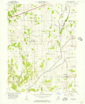
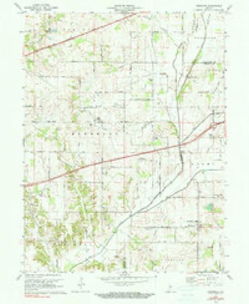
13 topographic sheets cover this place, the earliest surveyed in 1953 and the latest in 1986. It stands in Adams Township. It lies in ZIP code area 46125. It lies near Shumaker Ridge. The Survey maps it on the Eminence quadrangle. It stands 791 feet above sea level.
Topographic sheets covering this place
7 surveys from 13 printed sheetsMatched by testing this settlement's coordinate against the published boundary of every sheet in the United States Geological Survey's historical collection. Each opens the scanned sheet at the Survey.
- 1953 USGS Indianapolis quadrangle1:250000, 4 printings
- 1956 USGS Eminence quadrangle1:24000
- 1956 USGS Indianapolis quadrangle1:250000
- 1957 USGS Indianapolis quadrangle1:250000, 2 printings
- 1962 USGS Indianapolis quadrangle1:250000
- 1970 USGS Eminence quadrangle1:24000, 2 printings
- 1986 USGS Indianapolis quadrangle1:100000, 2 printings





In the county-history sources
1,949 words on this townshipCounties of Morgan, Monroe, and Brown, Indiana. Historical and Biographical, published 1884 names this settlement in its chapter on Adams Township. These are the passages that mention it, exactly as the scans read.
The early schools were taught first in private dwellings. The early teachers wer6 residents who possessed some little education, enough to furnish rudimentary instruction in reading, writing and arithmetic, and to furnish correction with hickory gads. These old instruments of punishment were always, present, and usually hung on wooden hooks over the old fire-place, so that they became so hardened by seasoning from the heat that they resisted the severest exercise of the teacher in an application on some offending pupil, and even cut the wooden benches as the teacher in his fervor pursued, round and round, the howling culprit. The big whip was indispensable. A " master " who could successfully teach a term of school without using a whip, or could get along perhaps without any such corrective, was a rare object, and when one was found he was looked upon with suspicion, so prevalent was the belief in the efficacy of the rod. The old settlers were firm believers in the oracle of Solomon, "spare the rod and spoil the child," and as they did not care to have their offspring spoiled, they usually employed an Irishman who possessed both the energy and temper to apply the rod to the unlimited satisfaction of parents anxious that their children " should be trained up in the way they should go." It is worthy of note that the earliest professional teachers throughout the West were Irishmen. They were about the only class that appeared to find satisfactory emoluments in continuous teaching. Coming themselves from an humble stock, and trained in the rough school of poverty, they seemed to enjoy the rude fare always obtained by "boarding around," and seemed contented with the meager amounts doled stingily out by parents of the backwoods. It is stated that the first school held in the township was near Eminence, in about the year 1835. A rude log cabin that had been occupied a short time by some early family and had then been vacated, was fitted up, and a school was taught by some stranger, probably an Irishman, who came along. A school was taught soon afterward in the northern part of the township, the Wheelers being the principal patrons. It is said that one of them was the teacher. This school was taught about the year 1836. Another was taught east of it within a year or two afterward. In 1840, there were four established schools, two in the northern part, one near the center, and one near Eminence, or near what afterward became Eminence. The real development of the school system of the township began with the passage of the common school law of 1852. Frame houses were built, and public funds provided better wages for teachers, and thus secured better instructors. Now there are eight or nine schools in the township, and the value of the school property is about $5,500.
Passage source: Counties of Morgan, Monroe, and Brown, Indiana. Historical and Biographical, published 1884.
It is likely that the Baptists at Eminence had the first permanent religious organization in the township. The class was established about the year 1837 or 1838, at the house of Thomas Shoemaker, or as others state, at that of Joseph Donaldson. These men and their families were prominent members, and at the organization of the class were about the only ones. Joseph Applegate was an early member. Mr. Shoemaker donated a small tract of ground for a church and cemetery in 1841. This church became widely known, and was called Mount Eden. It had a large membership during the forties, and did great good throughout all that portion of the county. It is yet in a prosperous condition at Eminence. The Methodists organized a class west of Mill Creek about 1840, which met for worship at the house of William Brick. This is not now in Morgan County, but it was then. Among the members were the families of John Clark, Logan Gray, A. J. Bowman, Josiah Graves, Thomas Champion, J. P. Goodwin, Norman Nunn and others. Rev. Isaac Crawford was the pastor of the class early in the forties. The class often met at the residence of John Clark. Another early class was the Lake Valley Methodist Church. It was organized in the forties, among the early members being the families of William Wilhite, Hezekiah Johnson, Coleman Brown, James Pruitt, James McClellan. In 1852, the pastor was Rev. H. S. Talbot. This class is yet in existence. The Oak Grove Christian Church, in the northern part, was organized in the forties, some of the early members being A. M. Delaven, Richard Treat, Bright Pruitt, John Boyd and others. This class is in a flourishing condition at present. Other religious organizations have existed in the township.
Passage source: Counties of Morgan, Monroe, and Brown, Indiana. Historical and Biographical, published 1884.
Machine-read from a century-old scan, so expect the errors a machine makes: misspelled names, dropped words, stray characters.
Read the whole chapter on Adams Township - it names this place 1 more 1 time.
Storms near this place
5 since 2001Regional context, not property-specific evidence. The National Weather Service names Eminence in 5 storm reports between 2001 and 2009: 2 hail, 2 thunderstorm wind, 1 tornado. No death or injury is recorded in these reports. Each account below is quoted exactly as the forecast office filed it, from the NOAA Storm Events Database, and each date opens the federal record of that event.
| When | Event | Place named | Harm | What the report says |
|---|---|---|---|---|
| August 2009 | Tornado (EF1) | Eminence | $85,000 | A representative from the National Weather Service reclassified the damage in Eminence to be from a weak tornado. The damage began on the west side of Back Street, where corn stalks were pressed down and pointing towards the east-northeast. The damage continued eastward across the street where a tied-down, single-wide mobile home was flipped over and destroyed. More damage was found across State Road 42 where much of a large tree was downed and another mobile home was damaged and unlivable. The track continued east where a home on North Forest Street was destroyed as its roof was totally lifted and spread downstream about 100 yards. A garage located just behind this house had its roof collapsed and debris located just behind it. Winds were estimated near 105 miles per hour, placing the damage as EF1 on the Enhanced Fujita Scale. |
| May 2003 | Thunderstorm Wind | Eminence | $5,000 | no account filed |
| May 2005 | Thunderstorm Wind | Eminence | - | Several trees were blown down. |
| January 2006 | Hail | Eminence | - | no account filed |
| October 2001 | Hail | Eminence | - | no account filed |
Nearest settlements
The eight closest, with where each one stands in the county. Distances are straight-line, computed from the Geographic Names Information System coordinates.
| Map | Place | Distance | Sheets |
|---|---|---|---|
| Plano | 2.5 miles | 17 | |
| Little Point | 3.1 miles | 13 | |
| Mount Zion Corner | 4.1 miles | 13 | |
| Herbamount | 4.5 miles | 13 | |
| Crown Center | 4.9 miles | 13 | |
| Wakeland | 5.0 miles | 17 | |
| Hall | 5.9 miles | 13 | |
| Briarwood | 7.4 miles | 13 |
Elsewhere
Matched on this settlement's Geographic Names Information System number rather than its name, so it cannot be a different place of the same name in another state.
| Wikipedia article on Eminence | An encyclopaedic summary. Its text is share-alike, so it is linked here rather than copied. |
| Wikidata item Q5372486 | The structured record the population and elevation above come from. Public domain (CC0). |
Provenance
This settlement is recorded in the Geographic Names Information System as feature 434166. The sheet list is computed by point-in-boundary test against the United States Geological Survey's historical topographic inventory. Both are works of the United States government and carry no copyright under 17 U.S.C. 105.
Storms. NOAA National Centers for Environmental Information, Storm Events Database https://www.ncei.noaa.gov/stormevents/ A work of the United States government, no copyright under 17 U.S.C. 105. Narratives are quoted verbatim from the National Weather Service report and are not edited or summarised.