 Block
Hall, Indiana
13 topographic sheets cover this place, the earliest surveyed in 1953 and the latest in 1986. It stands in Gregg Township. It lies in ZIP code area 46157. The Survey maps it on the Hall quadrangle. It stands 801 feet above sea level.
On record in Hall
Buildings and businesses the archive holds for this place. Each opens its own page, with the source record it came from.
On the National Register within a mile 1 record
The National Register names another town for these. They stand within one mile of this settlement's coordinate.
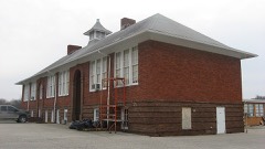 Hall Schoollisted 2004 · 0.2 miles away
Topographic sheets covering this place
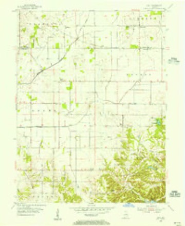
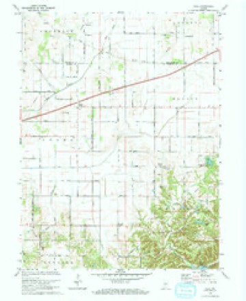
7 surveys from 13 printed sheetsMatched by testing this settlement's coordinate against the published boundary of every sheet in the United States Geological Survey's historical collection. Each opens the scanned sheet at the Survey.
- 1953 USGS Indianapolis quadrangle1:250000, 4 printings
- 1955 USGS Hall quadrangle1:24000
- 1956 USGS Indianapolis quadrangle1:250000
- 1957 USGS Indianapolis quadrangle1:250000, 2 printings
- 1962 USGS Indianapolis quadrangle1:250000
- 1970 USGS Hall quadrangle1:24000, 2 printings
- 1986 USGS Indianapolis quadrangle1:100000, 2 printings





In the county-history sources
11,795 words on this townshipCounties of Morgan, Monroe, and Brown, Indiana. Historical and Biographical, published 1884 names this settlement in its chapter on Gregg Township. These are the passages that mention it, exactly as the scans read.
Then there would be a scattering. All of the prominent early settlers who owned hogs had their individual ear-marks. Solomon Dunegan's mark was " a swallow fork in the left ear, and a slit in the right." His number was 133, showing that 132 had established before him. Mr. Foxworthy, in 1829, had a fine drove of sus scrofa. One night they were attacked by one or more bears where Hall now is, and one or more of them was killed and partly consumed. A bear did not stop long to inquire the name of the owner before falling upon wandering swine and making a merry meal of them. It is even doubted whether they cared . seriously who the owner was. '^hey probably thought that " possession was nine points in law," and accordingly took possession without further ceremony. They would rush upon a drove of hogs, seize one by the back of the neck, and begin to tear with teeth and claws regardless of the piercing death cries of the struggling victim. In a few minutes the hog would be torn to pieces, and would then furnish a sweet repast for bruin. Mr. Dunegan had hogs killed by bears, as did many others of the earliest settlers.
Passage source: Counties of Morgan, Monroe, and Brown, Indiana. Historical and Biographical, published 1884.
The township of Gregg has three spots that are called villages. Wilbur and Herbemont are of a late origin, and consist of one or two stores, a blacksmith or two, a carpenter, a saw mill, a post oflSce, and from a half dozen to fifteen families. The only, village of note is Hall. The first residences there were built long before the town was thought of. Philip Foxworthy and Michael Pruitt both erected dwellings there soon after 1830. The town really started about the year 1861 or 1852. A man named Breedlove erected a storehouse, and he and a Mr. Porter, under the partnership name of Porter & Breedlove, placed therein about $1,500 worth of a general assortment of goods. The store soon attracted a few families, and soon a blacksmith, a carpenter and other tradesmen appeared. " Mr. Brewer bad some interest in the store of Porter & Breedlove. John Whitaker opened a store soon afterward. Jacob Stogsdill was connected with him. John Williams and Benjamin Young began selling goods some time afterward. After them, from time to time, in about the order here given, the following merchants were present in the village : Brewer & Mattox, Joshua Wilhite, Col. Hendricks, A. J. McCoy,
Passage source: Counties of Morgan, Monroe, and Brown, Indiana. Historical and Biographical, published 1884.
The first school in the township was taught near Hall, but when- it was or what the teacher's name was cannot be stated. It was not far from the year 1884. The children of Solomon Dunegan, Philip Foxworthy, Joseph Moser, John Williams, Daniel Smith, Allen Seaton and others attended the school. After a few years, probably about 1838, a log schoolhouse was erected in the northern part of the township, which, for many years, was the principal seat of learning. Schools were started in the eastern and southern portions about 1840, or very soon thereafter. In 1840, if reports are reliable, there were only three established schools in the township, and one of them was not in a house that had been built expressly for school purposes. A dwelling which had been vacated was transformed into a temple of learning. During the forties, several new houses were erected, and by 1850 there were five or six good schools. Now there are seven schoolhouses.
Passage source: Counties of Morgan, Monroe, and Brown, Indiana. Historical and Biographical, published 1884.
Machine-read from a century-old scan, so expect the errors a machine makes: misspelled names, dropped words, stray characters.
Read the whole chapter on Gregg Township - it names this place 13 more 13 times.
Storms near this place
1 since 2001Regional context, not property-specific evidence. The National Weather Service names Hall in 1 storm report in 2001: 1 hail. No death or injury is recorded in these reports. Each account below is quoted exactly as the forecast office filed it, from the NOAA Storm Events Database, and each date opens the federal record of that event.
| When | Event | Place named | Harm | What the report says |
|---|---|---|---|---|
| April 2001 | Hail | Hall | - | no account filed |
Nearest settlements
The eight closest, with where each one stands in the county. Distances are straight-line, computed from the Geographic Names Information System coordinates.
| Map | Place | Distance | Sheets |
|---|---|---|---|
| Briarwood | 1.5 miles | 13 | |
| Mount Zion Corner | 2.5 miles | 13 | |
| Herbamount | 3.2 miles | 13 | |
| Wilbur | 3.4 miles | 14 | |
| Monrovia | 3.5 miles | 14 | |
| Crown Center | 3.5 miles | 13 | |
| Plano | 5.0 miles | 17 | |
| Bunker Hill | 5.1 miles | 14 |
Elsewhere
Matched on this settlement's Geographic Names Information System number rather than its name, so it cannot be a different place of the same name in another state.
| Wikipedia article on Hall | An encyclopaedic summary. Its text is share-alike, so it is linked here rather than copied. |
| Wikidata item Q5642538 | The structured record the population and elevation above come from. Public domain (CC0). |
Provenance
This settlement is recorded in the Geographic Names Information System as feature 435609. The sheet list is computed by point-in-boundary test against the United States Geological Survey's historical topographic inventory. Both are works of the United States government and carry no copyright under 17 U.S.C. 105.
Storms. NOAA National Centers for Environmental Information, Storm Events Database https://www.ncei.noaa.gov/stormevents/ A work of the United States government, no copyright under 17 U.S.C. 105. Narratives are quoted verbatim from the National Weather Service report and are not edited or summarised.