 Block
Fillmore, Indiana
14 topographic sheets cover this place, the earliest surveyed in 1953 and the latest in 1986. It stands in Marion Township. It lies in ZIP code area 46128. It stands on Dyer Creek. The Survey maps it on the Greencastle quadrangle. 532 people lived here at the 2020 count. It stands 846 feet above sea level.
Population over time
2 figuresFillmore fell from 533 to 532 between 2010 and 2020. These are the recorded population figures Wikidata holds for this place, reached through the Geographic Names Information System number this page is keyed on rather than by name, so they belong to this place and not to another of the same name. Most are census counts, but not all are: an early figure may be a founding or settlement estimate, and an estimate published within five years of a census is left out. The change column is computed, and is left blank where more than 20 years separate a figure from the one before it, because a gap that long is not a change between two counts.
| Year | People | Change |
|---|---|---|
| 2010 | 533 | |
| 2020 | 532 | -1 (-0%) |
Topographic sheets covering this place
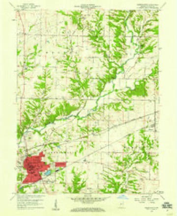
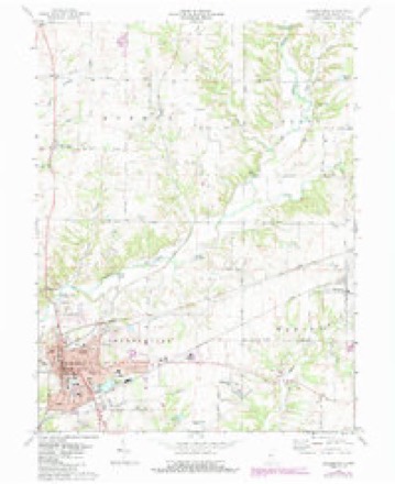
7 surveys from 14 printed sheetsMatched by testing this settlement's coordinate against the published boundary of every sheet in the United States Geological Survey's historical collection. Each opens the scanned sheet at the Survey.
- 1953 USGS Indianapolis quadrangle1:250000, 4 printings
- 1956 USGS Indianapolis quadrangle1:250000
- 1957 USGS Indianapolis quadrangle1:250000, 2 printings
- 1958 USGS Greencastle quadrangle1:24000
- 1962 USGS Indianapolis quadrangle1:250000
- 1970 USGS Greencastle quadrangle1:24000, 3 printings
- 1986 USGS Indianapolis quadrangle1:100000, 2 printings





In the county-history sources
2,305 words on this townshipBiographical and Historical Record of Putnam County, Indiana .., published 1887 names this settlement in its chapter on Marion Township. These are the passages that mention it, exactly as the scans read.
The first house erected in the township was that built by Reuben Ragan in 1822. America Hazelett, daughter of Samuel llazelett, was probably the tirst white child burn in the township. Her birth occurred about 1824. The marriage of John Smith, son of John Smith. and Miss Willie Smith, daughter of Judge Smith, was the first that occurred in the township. The first grist-mill in the township was that built on Deer Creek by Samuel llazelett as early as 1820. It stood on section 17. It was in 1834 that Alien Burk put up his horse-mill. James Agee. who. in 1828, had a shop on section 20, was the first blacksmith. Shortly after Agee came Isaac Hope, who erected a shop near the old family residence on section 12. The first store was kept by Ahijah .Robinson at Nicholsonville about 1845. The first postofiice was also kept by Mr. Robinson at the same place. It was afterward removed to Fillmore; but, for several years thereafter, retained its original name of Nicholsonville. William C. IJopwood was the first resident physician, lie located in Fillmore in 1S53. John Denny was the first justice of the peace. He was followed by his brother James Denny, who held the office for fourteen consecutive years.
Passage source: Biographical and Historical Record of Putnam County, Indiana .., published 1887.
I wife, William Nicholson and wife, and Isaac I Monnett. They finally built a house of wor- S ship on the farm of Carter Hunter; but at \ present they have no church building in the ; township. The Missionary Baptists were j organized about 1841. Elders Jones and j Arnold were among their first preachers. ; They have a good frame church., called Bethel, ! two and a half miles southeast of Fillmore. : The first meetings of the Christian church ; were held at the houses of Charles Knetzer j and Ambrose Day. This was before the or- I ganization of the church, which took place I about 1839, and a building, known as Old
Passage source: Biographical and Historical Record of Putnam County, Indiana .., published 1887.
Machine-read from a century-old scan, so expect the errors a machine makes: misspelled names, dropped words, stray characters.
Read the whole chapter on Marion Township - it names this place 1 more 1 time.
Mines and quarries near this place
1 within 5 milesRegional context, not property-specific evidence. The federal mineral resources record lists 1 working within 5 miles of Fillmore: 1 plant. All of them still produce. What was taken out: Stone, Crushed/Broken. Distance is straight-line from the map coordinates, so a quarry counted here may appear on a neighbouring settlement's page as well.
| Where | Site | Commodity | Status | Recorded |
|---|---|---|---|---|
| Greencastle Pulverizing Plant | Stone, Crushed/Broken | Plant |
Storms near this place
6 since 1996Regional context, not property-specific evidence. The National Weather Service names Fillmore in 6 storm reports between 1996 and 2025: 3 hail, 2 thunderstorm wind, 1 lightning. No death or injury is recorded in these reports. Each account below is quoted exactly as the forecast office filed it, from the NOAA Storm Events Database, and each date opens the federal record of that event.
| When | Event | Place named | Harm | What the report says |
|---|---|---|---|---|
| March 2025 | Thunderstorm Wind | Fillmore | $4,000 | Several trees of unknown size downed by thunderstorm wind gusts across the town. |
| July 2008 | Lightning | Fillmore | $100 | A tree was said to have been on fire on County Road 550 East near Fillmore, presumably as a result of a lightning strike. |
| April 2017 | Thunderstorm Wind | Fillmore | - | An estimated 60 mph thunderstorm wind gust was observed in this location. |
| March 2025 | Hail | Fillmore | - | no account filed |
| April 2017 | Hail | Fillmore | - | no account filed |
| July 1996 | Hail | Fillmore | - | no account filed |
Nearest settlements
The eight closest, with where each one stands in the county. Distances are straight-line, computed from the Geographic Names Information System coordinates.
| Map | Place | Distance | Sheets |
|---|---|---|---|
| Edgewood Lake | 3.1 miles | 14 | |
| Mount Meridian | 4.5 miles | 14 | |
| Cary | 4.6 miles | 14 | |
| Heritage Lake | 4.7 miles | 14 | |
| Fox Ridge | 5.6 miles | 14 | |
| Greencastle | 6.1 miles | 14 | |
| Groveland | 6.7 miles | 13 | |
| Board Park | 6.8 miles | 13 |
Elsewhere
Matched on this settlement's Geographic Names Information System number rather than its name, so it cannot be a different place of the same name in another state.
| Wikipedia article on Fillmore | An encyclopaedic summary. Its text is share-alike, so it is linked here rather than copied. |
| Wikidata item Q2917952 | The structured record the population and elevation above come from. Public domain (CC0). |
Provenance
This settlement is recorded in the Geographic Names Information System as feature 434479. The sheet list is computed by point-in-boundary test against the United States Geological Survey's historical topographic inventory. Both are works of the United States government and carry no copyright under 17 U.S.C. 105.
Mines and quarries. USGS Mineral Resources Data System (MRDS) https://mrdata.usgs.gov/mrds/ A work of the United States government, no copyright under 17 U.S.C. 105.
Storms. NOAA National Centers for Environmental Information, Storm Events Database https://www.ncei.noaa.gov/stormevents/ A work of the United States government, no copyright under 17 U.S.C. 105. Narratives are quoted verbatim from the National Weather Service report and are not edited or summarised.