 Block
Fishers, Indiana
19 topographic sheets cover this place, the earliest surveyed in 1952 and the latest in 1998. It stands in Delaware Township. It lies in ZIP code area 46038. It stands on Cheeney Creek. The Survey maps it on the Fishers quadrangle. 98,977 people lived here at the 2020 count. It stands 817 feet above sea level.
On record in Fishers
Buildings and businesses the archive holds for this place. Each opens its own page, with the source record it came from.
On the National Register 2 records
 West-Harris Houselisted 1999
- William Conner Houselisted 1980
Population over time
2 figuresFishers grew from 76,794 to 98,977 between 2010 and 2020. These are the recorded population figures Wikidata holds for this place, reached through the Geographic Names Information System number this page is keyed on rather than by name, so they belong to this place and not to another of the same name. Most are census counts, but not all are: an early figure may be a founding or settlement estimate, and an estimate published within five years of a census is left out. The change column is computed, and is left blank where more than 20 years separate a figure from the one before it, because a gap that long is not a change between two counts.
| Year | People | Change |
|---|---|---|
| 2010 | 76,794 | |
| 2020 | 98,977 | +22,183 (+29%) |
Topographic sheets covering this place
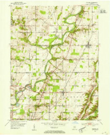
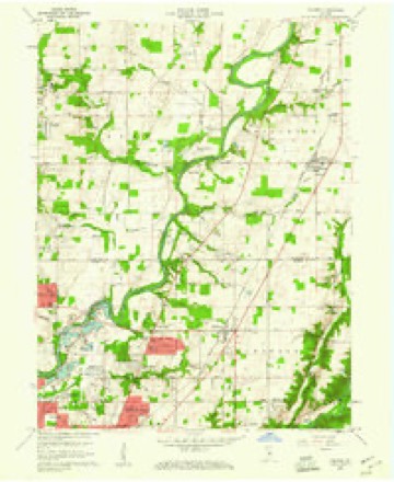
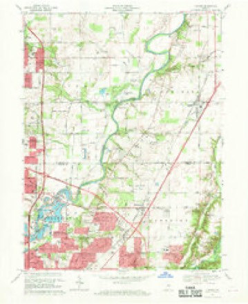
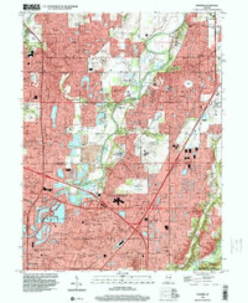
9 surveys from 19 printed sheetsMatched by testing this settlement's coordinate against the published boundary of every sheet in the United States Geological Survey's historical collection. Each opens the scanned sheet at the Survey.
- 1952 USGS Fishers quadrangle1:24000
- 1953 USGS Indianapolis quadrangle1:250000, 4 printings
- 1956 USGS Indianapolis quadrangle1:250000
- 1957 USGS Indianapolis quadrangle1:250000, 2 printings
- 1959 USGS Fishers quadrangle1:24000, 2 printings
- 1962 USGS Indianapolis quadrangle1:250000
- 1967 USGS Fishers quadrangle1:24000, 5 printings
- 1986 USGS Indianapolis quadrangle1:100000, 2 printings
- 1998 USGS Fishers quadrangle1:24000





What happened here
An account from the chapter on Delaware township. The inset identifies its exact source book and publication year.
Early Settlement
William Conner was the first white man to locate in the county. He built his trading post early in the century. It is said he and his brother, John Conner, were given their liberty by the Indians who had captured them when young boys, as a reward for their courage displayed in successfully running the gauntlet.
In the county-history sources
8,379 words on this townshipThe county-history sources names this settlement in its chapter on Delaware Township. These are the passages that mention it, exactly as the scans read.
Machine-read from a century-old scan, so expect the errors a machine makes: misspelled names, dropped words, stray characters.
Read the whole chapter on Delaware Township - it names this place 1 more 1 time.
Fires near this place
1 since 2004Regional context, not property-specific evidence. The federal wildfire occurrence database lists 1 fire within 5 miles of Fishers in 2004, burning under an acre in total. None started naturally. None was recorded as arson. Distance is straight-line from the map coordinates, so a fire counted here may appear on a neighbouring settlement's page as well.
| Reported cause | Fires |
|---|---|
| Equipment and vehicle use | 1 |
The most recent of them, most recent first, with the day each was reported and the service that recorded it.
| Date | Cause | Size | Reported by | Name on the report |
|---|---|---|---|---|
| 23 September 2004 | Equipment and vehicle use | under an acre | Indiana State Fire Marshal's Office | not named |
Settlements close enough to share some of these fires:
Mines and quarries near this place
10 within 5 milesRegional context, not property-specific evidence. The federal mineral resources record lists 10 workings within 5 miles of Fishers: 8 producers, 2 past producers. 8 still produce. What was taken out: Sand and Gravel, Construction, Stone, Crushed/Broken. Distance is straight-line from the map coordinates, so a quarry counted here may appear on a neighbouring settlement's page as well.
| Where | Site | Commodity | Status | Recorded |
|---|---|---|---|---|
| Indianapolis 521 Quarry | Stone, Crushed/Broken | Producer | ||
| Mccordsville Quarry | Stone, Crushed/Broken | Producer | ||
| Beaver Gravel Corp Pit | Sand and Gravel, Construction | Producer | ||
| Carmel 512 Pit | Sand and Gravel, Construction | Producer | ||
| Fishers Sand Plant | Sand and Gravel, Construction | Producer | ||
| Indianapolis 513 Pit | Sand and Gravel, Construction | Producer | ||
| Mccordsville Pit | Sand and Gravel, Construction | Producer | ||
| Road Materials Pit | Sand and Gravel, Construction | Past Producer | ||
| U. S. Aggregates, Inc. | Sand and Gravel, Construction | Past Producer | ||
| U.S. Aggregates Inc. | Sand and Gravel, Construction | Producer |
Storms near this place
60 of 92 shownRegional context, not property-specific evidence. The National Weather Service names Fishers in 92 storm reports between 1996 and 2025: 35 thunderstorm wind, 25 hail, 20 lightning, 6 flash flood. No death or injury is recorded in these reports. Each account below is quoted exactly as the forecast office filed it, from the NOAA Storm Events Database, and each date opens the federal record of that event.
| When | Event | Place named | Harm | What the report says |
|---|---|---|---|---|
| June 2023 | Thunderstorm Wind | Fishers | $600,000 | A 60 mph thunderstorm wind gust was estimated at this location with a 6 inch tree limb downed nearby. Over 13000 power outages across the county caused by the storm. |
| June 2002 | Lightning | Fishers | $400,000 | Lightning struck a house. |
| June 2008 | Lightning | Fishers | $300,000 | Lightning struck a house and caught the house on fire. The house was a total loss. |
| April 2005 | Lightning | Fishers | $250,000 | Lightning struck and damaged at least seven homes in the Fishers area early in the morning of 22 April 2005. One of these homes was so heavily damaged that it was possible that the home may have needed to be razed. |
| July 2005 | Lightning | Fishers | $190,000 | Lightning sparked a fire which severely damaged a home. The damage amount is estimated. |
| July 2006 | Lightning | Fishers | $150,000 | A home was severely damaged by a lightning-induced fire. The fire was initially contained to the roof and attic, before the roof collapsed, causing damage to the second floor. Vinyl siding was melted on a neighboring home. |
| May 2008 | Lightning | Fishers | $100,000 | Lightning struck a house in Fishers causing extensive fire, heat, and smoke damage. The first floor collapsed into the basement. |
| July 2008 | Lightning | Fishers | $100,000 | A lightning strike caused significant damage to most of the second floor of a large home while water damage was throughout the home. Time of occurrence and damage cost are rough estimates. |
| April 2024 | Flood | Fishers | $50,000 | Heavy Rainfall totaling 1.75 to 3.00 inches in 15 hours through 0800 EST on the 11th across portions of southern Hamilton County, produced isolated areal flooding which led to a traffic accident on US-31 north of Westfield which closed all southbound lanes for several hours. Additionally, Hoosier Road in Fishers was impassible due to high water from 106th Street to 126th Street. |
| June 2009 | Hail | Fishers | $50,000 | Hail estimated at two inches in diameter was observed near 111th Street and Allisonville Road. There was also a report of hail-damaged buildings and vehicles in Fishers, from 106th to 126th Street. |
| June 2007 | Lightning | Fishers | $50,000 | Lightning hit a hotel and three homes in the Fishers area. At the hotel the lightning hit the telephone and fire alarm system. A hotel occupant at the time received an electrical shock when he was on the phone during the storm. Some of the houses reported having holes in the roof of their homes due to the lightning strikes. |
| October 2006 | Lightning | Fishers | $50,000 | Lightning was the suspected cause in a house fire. |
| April 1996 | Lightning | Fishers | $45,000 | no account filed |
| September 2002 | Tornado (F0) | Fishers | $25,000 | no account filed |
| July 2008 | Lightning | Fishers | $15,000 | Fire from a lightning strike destroyed the roof of a home in the 8300 block of Bighorn Court. The home sustained heavy smoke and water damage throughout. Two other fires, on Key Court and Weathered Edge Drive, were relatively small and contained to the areas where they were started (no damage cost estimates available). |
| May 2005 | Lightning | Fishers | $15,000 | Lightning struck a home in Fishers, Indiana on the morning of 19 May 2005. The home was struck at the peak of the roof, blowing a small hole in the wood and displacing some shingles. There was also electrical damage to the home's alarm system and to at least one television set. The home's telephones were possibly damaged, as well. The damage amount is estimated. |
| April 2020 | Thunderstorm Wind | Fishers | $10,000 | Structural damage reported to CVS on the intersection of 131st street and State Road 37 due to thunderstorm wind gusts. |
| July 2001 | Lightning | Fishers | $10,000 | no account filed |
| July 2008 | Lightning | Fishers | $8,000 | A firefighter who lives across the street saw sparks fly from the roof of a home and notified the owners. Internal damage to the house was largely from firefighters who fought flames from within. The cost of damage is a rough estimate. |
| November 2007 | Lightning | Fishers | $8,000 | Lightning struck a home in Fishers during the morning hours and started a fire. The fire burned part of the chimney. The fire caused by the lightning also damaged some of the electrical components inside the home. |
| February 2011 | Thunderstorm Wind | Fishers | $7,500 | Part of a roof was torn off a house due to damaging thunderstorm wind gusts. A swing set was also blown across a yard. |
| June 2014 | Thunderstorm Wind | Fishers | $6,000 | Several trees and numerous limbs were downed from 131st to 146th Streets and from Hazel Dell Parkway to River Road due to damaging thunderstorm wind gusts. |
| March 2022 | Thunderstorm Wind | Fishers | $5,000 | Thunderstorm winds ripped some siding off of houses. Report via Twitter. Trees were also reported downed by thunderstorm winds at Promise Road and East 136th Street in Fishers. |
| July 2017 | Thunderstorm Wind | Fishers | $5,000 | Several trees were downed just north of 131st Street on Cumberland Road due to damaging thunderstorm wind gusts. |
| June 2009 | Thunderstorm Wind | Fishers | $4,000 | Numerous trees and branches were reported down by an off-duty NWS employee. The time of this event is estimated. |
| May 2019 | Lightning | Fishers | $3,500 | Lightning struck two trees in this location. They fell on power lines causing a power outage. |
| June 2005 | Lightning | Fishers | $3,000 | Lightning sparked a house fire in Fishers. |
| July 2017 | Thunderstorm Wind | Fishers | $2,500 | Tree limbs, of unknown size, downed several power lines due to damaging thunderstorm wind gusts. Power outages were reported. |
| April 2025 | Thunderstorm Wind | Fishers | $2,000 | Power lines downed by snapped tree limbs caused by thunderstorm wind gusts. |
| June 2020 | Thunderstorm Wind | Fishers | $2,000 | One small tree and several large tree limbs downed due to thunderstorm wind gusts. |
| June 2005 | Lightning | Fishers | $2,000 | Lightning sparked a house fire in Fishers. |
| August 1997 | Thunderstorm Wind | Fishers | $1,500 | Thunderstorm winds blew down trees and power lines at 96th and Ditch. |
| May 2019 | Thunderstorm Wind | Fishers | $1,000 | A large tree was downed near Hague Road and Saint George Boulevard in Fishers due to damaging thunderstorm wind gusts. |
| May 2017 | Flood | Fishers | $1,000 | Rainfall of 2.55 inches was observed in the area, along with numerous flooded roads. |
| August 2016 | Flash Flood | Fishers | $1,000 | Street flooding was reported in Fishers due to heavy thunderstorm rainfall. |
| August 2016 | Flash Flood | Fishers | $1,000 | Street flooding was reported in Fishers due to heavy thunderstorm rainfall. |
| April 2014 | Flood | Fishers | $1,000 | Plum Creek Golf Course was flooded due to heavy thunderstorm rainfall. |
| September 2013 | Flood | Fishers | $1,000 | Cumberland Park was closed due to flooding from thunderstorm heavy rainfall. This report was received via Twitter. |
| June 2009 | Flash Flood | Fishers | $1,000 | Numerous streets in the Fishers area became flooded due to heavy rainfall in a short duration of time. The location of this report is estimated. |
| May 2006 | Thunderstorm Wind | Fishers | $1,000 | Power lines were downed. |
| May 2006 | Thunderstorm Wind | Fishers | $1,000 | Power lines were downed. |
| July 1997 | Thunderstorm Wind | Fishers | $1,000 | Thunderstorm winds blew down trees and limbs in the vicinity of I-69 and State Road 37. |
| July 2014 | Thunderstorm Wind | Fishers | $500 | A tree, 4 to 5 inches in diameter, was blown down due to damaging thunderstorm wind gusts. |
| July 2012 | Thunderstorm Wind | Fishers | $500 | An estimated thunderstorm wind gust of 60 mph was observed in this location, along with quarter sized hail and tree limb damage. |
| June 2009 | Hail | Fishers | $500 | Golf ball sized hail caused window damage to a NWS Employee's house. |
| August 2022 | Thunderstorm Wind | Fishers | - | A 60 mph thunderstorm wind gust was estimated at this location. A metal table was was flipped and mailbox post snapped at the same location. Nearby, a Bradford pair and numerous 2-4 inch tree limbs were snapped. |
| March 2020 | Hail | Fishers | - | Report was relayed via twitter. |
| May 2019 | Thunderstorm Wind | Fishers | - | An estimated thunderstorm wind gust of 60 mph was observed near 126th Street and Hazel Dell Parkway. |
| May 2018 | Thunderstorm Wind | Fishers | - | A thunderstorm wind gust measured at 61 mph was observed in this location. The wind gust was accompanied by penny-sized hail. |
| February 2017 | Thunderstorm Wind | Fishers | - | A 65 mph thunderstorm wind gust was measured in this location. |
| May 2013 | Thunderstorm Wind | Fishers | - | A measured thunderstorm wind gust of 62 mph was observed in this location. |
| June 2010 | Thunderstorm Wind | Fishers | - | A wind gust, estimated at 60 mph, was observed at 131st Street and Allisonville Road in northwest Fishers. |
| June 2010 | Flood | Fishers | - | Heavy rainfall caused minor flooding of Interstate 69 near Exit 3. |
| June 2010 | Flash Flood | Fishers | - | Heavy rainfall caused significant ponding of water over the west bound lane of 116th Street east of Hague and Cumberland Roads. An estimated 4 to 6 inches of water was present. |
| June 2010 | Thunderstorm Wind | Fishers | - | Thunderstorm winds blew at an estimated 50 to 60 MPH at/near the intersection of 131st and Hazel Dell Parkway. Torrential rainfall accompanied these winds. |
| June 2009 | Thunderstorm Wind | Fishers | - | A thunderstorm wind gust was measured at 65 miles per hour at 116th Street and Allisonville Road. |
| June 2009 | Thunderstorm Wind | Fishers | - | A thunderstorm wind gust estimated at 60 mph was observed near State Route 238 and Interstate 69. |
| June 2009 | Thunderstorm Wind | Fishers | - | A thunderstorm wind gust estimated at 60 mph was observed by a NWS employee. |
| May 2009 | Thunderstorm Wind | Fishers | - | Large tree limbs were blown down by thunderstorm winds at 13519 Lantern Road, Fishers, Indiana. |
| September 2008 | Thunderstorm Wind | Fishers | - | A tree was blown down by thunderstorm winds near the intersection of Olio Road and 104th Street just outside northeast Indianapolis in the Fishers area. |
Nearest settlements
The eight closest, with where each one stands in the county. Distances are straight-line, computed from the Geographic Names Information System coordinates.
| Map | Place | Distance | Sheets |
|---|---|---|---|
| Morgan Meadows | 0.3 miles | 19 | |
| Heritage Meadows | 0.4 miles | 19 | |
| Maple Del | 0.6 miles | 19 | |
| Charleston Crossing | 0.7 miles | 19 | |
| Walnut Hills | 0.9 miles | 12 | |
| Sunblest | 0.9 miles | 19 | |
| Burberry Place | 0.9 miles | 19 | |
| Sunblest Farms | 1.0 miles | 19 |
Elsewhere
Matched on this settlement's Geographic Names Information System number rather than its name, so it cannot be a different place of the same name in another state.
| Wikipedia article on Fishers | An encyclopaedic summary. Its text is share-alike, so it is linked here rather than copied. |
| Wikidata item Q2284046 | The structured record the population and elevation above come from. Public domain (CC0). |
Provenance
This settlement is recorded in the Geographic Names Information System as feature 434526. The sheet list is computed by point-in-boundary test against the United States Geological Survey's historical topographic inventory. Both are works of the United States government and carry no copyright under 17 U.S.C. 105.
Wildfire. Short, Karen C. 2022. Spatial wildfire occurrence data for the United States, 1992-2020 [FPA_FOD_20221014]. 6th Edition. Fort Collins, CO: Forest Service Research Data Archive. https://doi.org/10.2737/RDS-2013-0009.6 Collected with United States Government funding and usable without additional permissions or fees.
Mines and quarries. USGS Mineral Resources Data System (MRDS) https://mrdata.usgs.gov/mrds/ A work of the United States government, no copyright under 17 U.S.C. 105.
Storms. NOAA National Centers for Environmental Information, Storm Events Database https://www.ncei.noaa.gov/stormevents/ A work of the United States government, no copyright under 17 U.S.C. 105. Narratives are quoted verbatim from the National Weather Service report and are not edited or summarised.