 Block
Fort Wayne, Indiana
12 topographic sheets cover this place, the earliest surveyed in 1953 and the latest in 1994. It stands in Washington Township. It lies in ZIP code area 46825. It lies near Stevies Island. The Survey maps it on the Huntertown quadrangle. 263,886 people lived here at the 2020 count. It stands 810 feet above sea level.
On record in Fort Wayne
Buildings and businesses the archive holds for this place. Each opens its own page, with the source record it came from.
On the National Register 12 of 74 shown
 Allen County CourthouseNational Historic Landmark · listed 1976
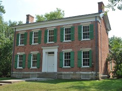 de Richardville, Chief Jean-Baptiste, HouseNational Historic Landmark · listed 1997
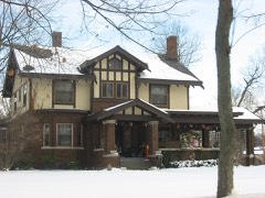 John H. and Mary Abercrombie Houselisted 2013
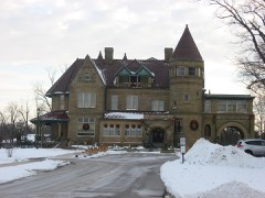 John H. Bass Mansionlisted 1982
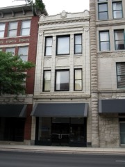 Blackstone Buildinglisted 1988
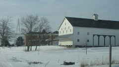 Martin Blume Jr. Farmlisted 2006
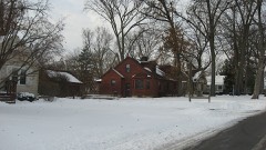 Brookview-Irvington Park Historic Districtlisted 2011
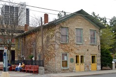 John Brown Stone Warehouselisted 1997
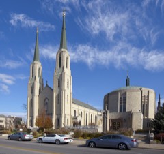 Cathedral of the Immaculate Conceptionlisted 1980
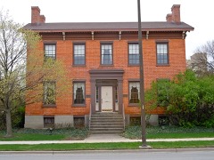 William S. Edsall Houselisted 1976
 Embassy Theater and Indiana Hotellisted 1975
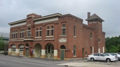 Engine House No. 3listed 1979
Population over time
2 figuresFort Wayne grew from 253,691 to 263,886 between 2010 and 2020. These are the recorded population figures Wikidata holds for this place, reached through the Geographic Names Information System number this page is keyed on rather than by name, so they belong to this place and not to another of the same name. Most are census counts, but not all are: an early figure may be a founding or settlement estimate, and an estimate published within five years of a census is left out. The change column is computed, and is left blank where more than 20 years separate a figure from the one before it, because a gap that long is not a change between two counts.
| Year | People | Change |
|---|---|---|
| 2010 | 253,691 | |
| 2020 | 263,886 | +10,195 (+4%) |
Topographic sheets covering this place
6 surveys from 12 printed sheetsMatched by testing this settlement's coordinate against the published boundary of every sheet in the United States Geological Survey's historical collection. Each opens the scanned sheet at the Survey.
- 1953 USGS Fort Wayne quadrangle1:250000, 4 printings
- 1956 USGS Fort Wayne quadrangle1:250000, 2 printings
- 1957 USGS Huntertown quadrangle1:24000
- 1963 USGS Huntertown quadrangle1:24000, 3 printings
- 1984 USGS Fort Wayne quadrangle1:100000
- 1994 USGS Fort Wayne quadrangle1:100000


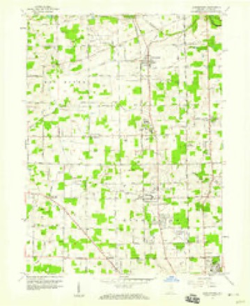
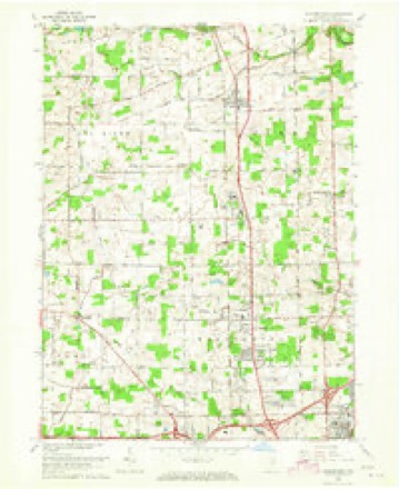


In the county-history sources
45,589 words on this townshipHistory of Allen County, Indiana., published 1880 names this settlement in its chapter on Washington Township. These are the passages that mention it, exactly as the scans read.
As introductory to the distinctively local history of the county, we give an elaborate article on its physical geography, with the geological features apparent, followed by a descriptive account of the mounds and archmological remains discovered by the industrious research of Col. R. S. Robertson, by whose hand the articles in question have been prepared. To be appreciated, they need only to be carefully read.
Passage source: History of Allen County, Indiana., published 1880.
These results have only been attained by the patient, effective labor and untiring energy, appropriated by those having in charge the conduct of the several depart¬ ments of their work. In the preparation of the maps, Messrs. Ellis Kiser and J. A. Johnson, Engineers, have done themselves credit in the completeness, accu¬ racy and finish which characterize their productions. As an artist, Mr: Charles H. Radcliff has acquitted himself with honor, which entitles him to high rank in his profession, as the effusions of his pencil fully attest. And, finally, not only the editor and proprietors, but the citizens of Fort Wayne especially, and ot Allen County generally, owe much to the thoroughness and efficiency of the labors of Mr. Kiser in collecting the details of business and historical miscellany of the city and county, than whom no one, in the opinion of the editor, could have more faithfully ar.d satisfactorily performed the task.
Passage source: History of Allen County, Indiana., published 1880.
Enterin'* the broad gulf at the mouth of the St. Lawrence River, he sailed up that stream as far as the Island of Orleans, in the month of September A little later he ascended to the site of the present city of Montreal, where induce¬ ments were offered by the natives to go farther to the westward, the country abounding in great stores of gold and copper ; " that there were three of fresh water so large that no man had ever found the end is de la all terof discovery during the centuries preceding, to which European enterprise gave origin. With this purpose in view, Christopher Columbus, a Genoese, under the patronage of the united kingdoms of Castile and Leon, on the 3d of August, 1492. started on the voyage which resulted in the discovery of the North American continent. " It was toward the East that his hopes directed his western course, hopes whose supposed fulfillment still lives in the misapplication to the New World of the terms Indian and Indies. Much of our subsequent knowledge of America has been owing to the same desire of reaching the East Indies that led to its discovery." [Cham., Enc., I, 198].
Passage source: History of Allen County, Indiana., published 1880.
Machine-read from a century-old scan, so expect the errors a machine makes: misspelled names, dropped words, stray characters.
Read the whole chapter on Washington Township - it names this place 44 more 44 times.
Mines and quarries near this place
3 within 5 milesRegional context, not property-specific evidence. The federal mineral resources record lists 3 workings within 5 miles of Fort Wayne: 3 producers. All of them still produce. What was taken out: Sand and Gravel, Construction. Distance is straight-line from the map coordinates, so a quarry counted here may appear on a neighbouring settlement's page as well.
| Where | Site | Commodity | Status | Recorded |
|---|---|---|---|---|
| Brudi Pit #3 | Sand and Gravel, Construction | Producer | ||
| Irving Gravel Co., Inc. | Sand and Gravel, Construction | Producer | ||
| Midwest Aggregates Pit 1 | Sand and Gravel, Construction | Producer |
Storms near this place
5 since 1994Regional context, not property-specific evidence. The National Weather Service names Fort Wayne in 5 storm reports between 1994 and 1997: 2 thunderstorm wind, 2 flash flood, 1 hail. No death or injury is recorded in these reports. Each account below is quoted exactly as the forecast office filed it, from the NOAA Storm Events Database, and each date opens the federal record of that event.
| When | Event | Place named | Harm | What the report says |
|---|---|---|---|---|
| June 1995 | Thunderstorm Wind | Fort Wayne | $8,000 | Several automobiles were damaged by trees blown over in Fort Wayne. |
| July 1994 | Thunderstorm Wind | Fort Wayne | $5,000 | Trees and power lines were downed on the north and east sides of Fort Wayne. |
| September 1997 | Flash Flood | Fort Wayne | $1,000 | no account filed |
| April 1994 | Hail | Fort Wayne | $500 | One-inch diameter hail fell on the north side of Fort Wayne at Point Inverness at 2044EST; also one inch hail near United States 33 and Cook Road on the north side of Fort Wayne at 2050 EST. |
| July 1997 | Flash Flood | Fort Wayne | - | no account filed |
Nearest settlements
The eight closest, with where each one stands in the county. Distances are straight-line, computed from the Geographic Names Information System coordinates.
| Map | Place | Distance | Sheets |
|---|---|---|---|
| Northcrest | 0.6 miles | 14 | |
| Crestwood | 0.7 miles | 12 | |
| Ludwig Park | 1.4 miles | 12 | |
| Concordia Gardens | 1.6 miles | 12 | |
| Sunnymeadow | 1.8 miles | 12 | |
| Greendale | 2.4 miles | 13 | |
| Brookside Estates | 2.9 miles | 12 | |
| Royal Oaks | 2.9 miles | 12 |
Elsewhere
Matched on this settlement's Geographic Names Information System number rather than its name, so it cannot be a different place of the same name in another state.
| Wikipedia article on Fort Wayne | An encyclopaedic summary. Its text is share-alike, so it is linked here rather than copied. |
| Wikidata item Q49268 | The structured record the population and elevation above come from. Public domain (CC0). |
Provenance
This settlement is recorded in the Geographic Names Information System as feature 434689. The sheet list is computed by point-in-boundary test against the United States Geological Survey's historical topographic inventory. Both are works of the United States government and carry no copyright under 17 U.S.C. 105.
Mines and quarries. USGS Mineral Resources Data System (MRDS) https://mrdata.usgs.gov/mrds/ A work of the United States government, no copyright under 17 U.S.C. 105.
Storms. NOAA National Centers for Environmental Information, Storm Events Database https://www.ncei.noaa.gov/stormevents/ A work of the United States government, no copyright under 17 U.S.C. 105. Narratives are quoted verbatim from the National Weather Service report and are not edited or summarised.