 Block
Fowlerton, Indiana
13 topographic sheets cover this place, the earliest surveyed in 1953 and the latest in 1986. It stands in Fairmount Township. It lies in ZIP code area 46930. It stands on Fowlerton Drain. The Survey maps it on the Gas City quadrangle. 268 people lived here at the 2020 count. It stands 879 feet above sea level.
Population over time
2 figuresFowlerton grew from 261 to 268 between 2010 and 2020. These are the recorded population figures Wikidata holds for this place, reached through the Geographic Names Information System number this page is keyed on rather than by name, so they belong to this place and not to another of the same name. Most are census counts, but not all are: an early figure may be a founding or settlement estimate, and an estimate published within five years of a census is left out. The change column is computed, and is left blank where more than 20 years separate a figure from the one before it, because a gap that long is not a change between two counts.
| Year | People | Change |
|---|---|---|
| 2010 | 261 | |
| 2020 | 268 | +7 (+3%) |
Topographic sheets covering this place
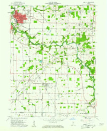
4 surveys from 13 printed sheetsMatched by testing this settlement's coordinate against the published boundary of every sheet in the United States Geological Survey's historical collection. Each opens the scanned sheet at the Survey.
- 1953 USGS Muncie quadrangle1:250000, 5 printings
- 1956 USGS Muncie quadrangle1:250000
- 1960 USGS Gas City quadrangle1:24000, 4 printings
- 1986 USGS Muncie quadrangle1:100000, 3 printings



What happened here
An account from the chapter on Fairmount township. The inset identifies its exact source book and publication year.
Hon. John T. Strange
"The valiant Campbell, for whom General Harrison predicted such a bright future, was promoted in the following year for his success in the Mississinewa expedition. In April, 1814, he was commissioned a Colonel in the Eleventh Infantry, but was fatally wounded in the battle of Chippewa, on July 5th, of that year, and died August 29th, following."
In the county-history sources
158,658 words on this townshipHistory of Grant County, Indiana, published 1886; The Making of a Township, Being an Account of the Early Settlement and Subsequent Development of Fairmount Township, Grant County, Indiana, 1829 to 1917, Based Upon Data Secured by Personal Interviews, from Numerous Communications and Various Other Reliable Sources of Information Concerning Local History;, published 1917 has no passage naming this settlement, which was common for smaller places. Its township is covered in full.
The chapter on Fairmount Township covers the township.
Read the chapter on Fairmount Township - 158,658 words.
Mines and quarries near this place
1 within 5 milesRegional context, not property-specific evidence. The federal mineral resources record lists 1 working within 5 miles of Fowlerton: 1 producer. All of them still produce. What was taken out: Sand and Gravel, Construction. Distance is straight-line from the map coordinates, so a quarry counted here may appear on a neighbouring settlement's page as well.
| Where | Site | Commodity | Status | Recorded |
|---|---|---|---|---|
| Jack Himelick Gravel Pit | Sand and Gravel, Construction | Producer |
Storms near this place
11 since 1998Regional context, not property-specific evidence. The National Weather Service names Fowlerton in 11 storm reports between 1998 and 2023: 6 thunderstorm wind, 3 hail, 1 tornado, 1 flood. The reports record 1 death. Each account below is quoted exactly as the forecast office filed it, from the NOAA Storm Events Database, and each date opens the federal record of that event.
| When | Event | Place named | Harm | What the report says |
|---|---|---|---|---|
| January 2013 | Flood | Fowlerton | 1 killed | Local media reported that a 19 year old male lost control of his vehicle on State road 26, east of Fairmount, Indiana after encountering high water from a nearby stream that had flowed over the road. The vehicle flipped and the passenger compartment became submerged. A passing motorist contacted 911 and when responders arrived only one foot of the vehicle was visible. Deputies waded 30 to 40 feet off the road into roughly 3 feet of water and attached tow lines and subsequently pulled the vehicle out. The male was found unresponsive in the vehicle and was later pronounced dead at a local hospital. |
| June 2008 | Thunderstorm Wind | Fowlerton | $25,000 | Spotters reported a semi was flipped on southbound Interstate 69 near mile marker 53. |
| April 2023 | Thunderstorm Wind | Fowlerton | $12,000 | A semi truck blown over on Interstate 69 north of Fowlerton. |
| May 1999 | Thunderstorm Wind | Fowlerton | $10,000 | Two roofs partially torn off. |
| August 2016 | Thunderstorm Wind | Fowlerton | - | Power lines were reported down onto County Road 500 E. |
| August 2016 | Thunderstorm Wind | Fowlerton | - | A trained spotter reported a tree was blown down along County Road S 600 E near County Road 975 S. |
| June 2015 | Thunderstorm Wind | Fowlerton | - | One tree down, and several large limbs down. A truck was severely damaged by a large branch. |
| April 2011 | Tornado (EF1) | Fowlerton | - | A survey of damage indicated a second circulation touched down three miles southwest of Upland and lifted just to the west northwest of Upland. Minor home damage occurred as well as several hardwood trees being snapped. Winds are consistent with speeds of 90 to 95 mph. |
| May 2005 | Hail | Fowlerton | - | no account filed |
| May 1998 | Hail | Fowlerton | - | no account filed |
| May 1998 | Hail | Fowlerton | - | no account filed |
Nearest settlements
The eight closest, with where each one stands in the county. Distances are straight-line, computed from the Geographic Names Information System coordinates.
| Map | Place | Distance | Sheets |
|---|---|---|---|
| Fairmount | 4.1 miles | 12 | |
| Matthews | 4.2 miles | 14 | |
| Jonesboro | 5.6 miles | 12 | |
| Gas City | 5.8 miles | 13 | |
| Upland | 6.2 miles | 14 | |
| Brookhaven | 7.9 miles | 11 | |
| Bethevan | 8.6 miles | 12 | |
| Home Corner | 8.6 miles | 12 |
Elsewhere
Matched on this settlement's Geographic Names Information System number rather than its name, so it cannot be a different place of the same name in another state.
| Wikipedia article on Fowlerton | An encyclopaedic summary. Its text is share-alike, so it is linked here rather than copied. |
| Wikidata item Q2021926 | The structured record the population and elevation above come from. Public domain (CC0). |
Provenance
This settlement is recorded in the Geographic Names Information System as feature 434733. The sheet list is computed by point-in-boundary test against the United States Geological Survey's historical topographic inventory. Both are works of the United States government and carry no copyright under 17 U.S.C. 105.
Mines and quarries. USGS Mineral Resources Data System (MRDS) https://mrdata.usgs.gov/mrds/ A work of the United States government, no copyright under 17 U.S.C. 105.
Storms. NOAA National Centers for Environmental Information, Storm Events Database https://www.ncei.noaa.gov/stormevents/ A work of the United States government, no copyright under 17 U.S.C. 105. Narratives are quoted verbatim from the National Weather Service report and are not edited or summarised.