 Block
Gosport, Indiana
18 topographic sheets cover this place, the earliest surveyed in 1947 and the latest in 1998. It stands in Wayne Township. It lies in ZIP code area 47433. It stands on Indian Creek. The Survey maps it on the Gosport quadrangle. 842 people lived here at the 2020 count. It stands 696 feet above sea level.
On record in Gosport
Buildings and businesses the archive holds for this place. Each opens its own page, with the source record it came from.
On the National Register 4 records
 Gosport Historic Districtlisted 2013
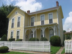 Dr. H. G. Osgood Houselisted 1999
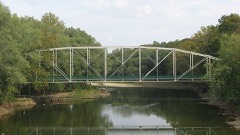 Secrest Ferry Bridgelisted 1996
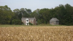 Secrest-Wampler Houselisted 2002
Population over time
2 figuresGosport grew from 826 to 842 between 2010 and 2020. These are the recorded population figures Wikidata holds for this place, reached through the Geographic Names Information System number this page is keyed on rather than by name, so they belong to this place and not to another of the same name. Most are census counts, but not all are: an early figure may be a founding or settlement estimate, and an estimate published within five years of a census is left out. The change column is computed, and is left blank where more than 20 years separate a figure from the one before it, because a gap that long is not a change between two counts.
| Year | People | Change |
|---|---|---|
| 2010 | 826 | |
| 2020 | 842 | +16 (+2%) |
Topographic sheets covering this place
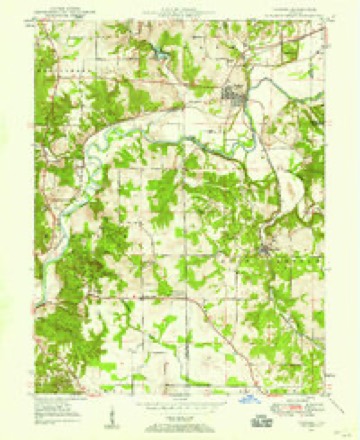
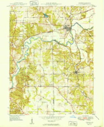
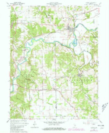
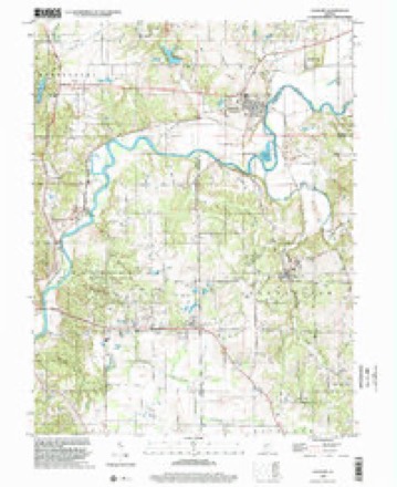
9 surveys from 18 printed sheetsMatched by testing this settlement's coordinate against the published boundary of every sheet in the United States Geological Survey's historical collection. Each opens the scanned sheet at the Survey.
- 1947 USGS Gosport quadrangle1:24000
- 1950 USGS Gosport quadrangle1:24000
- 1953 USGS Indianapolis quadrangle1:250000, 4 printings
- 1956 USGS Indianapolis quadrangle1:250000
- 1957 USGS Indianapolis quadrangle1:250000, 2 printings
- 1962 USGS Indianapolis quadrangle1:250000
- 1965 USGS Gosport quadrangle1:24000, 4 printings
- 1986 USGS Bloomington quadrangle1:100000, 3 printings
- 1998 USGS Gosport quadrangle1:24000





Mines and quarries near this place
2 within 5 milesRegional context, not property-specific evidence. The federal mineral resources record lists 2 workings within 5 miles of Gosport: 2 past producers. None of them still produces. What was taken out: Limestone, General. Distance is straight-line from the map coordinates, so a quarry counted here may appear on a neighbouring settlement's page as well.
| Where | Site | Commodity | Status | Recorded |
|---|---|---|---|---|
| Dunn Limestone Quarry | Limestone, General | Past Producer | ||
| Indiana Limestone Quarry | Limestone, General | Past Producer |
Storms near this place
28 since 1995Regional context, not property-specific evidence. The National Weather Service names Gosport in 28 storm reports between 1995 and 2025: 20 thunderstorm wind, 7 hail, 1 tornado. No death or injury is recorded in these reports. Each account below is quoted exactly as the forecast office filed it, from the NOAA Storm Events Database, and each date opens the federal record of that event.
| When | Event | Place named | Harm | What the report says |
|---|---|---|---|---|
| May 2022 | Thunderstorm Wind | Gosport | $20,000 | Thunderstorm wind downed large trees into power lines. Reported via twitter with video. |
| June 2008 | Tornado (EF0) | Gosport | $20,000 | This tornado formed near Marley Road and Old Boundary Line Road in Owen County. The tornado tracked 3.02 miles to the northeast while in Owen County and passed through Gosport. The tornado moved into Morgan County while moving through an open field. The field is located 3,500 feet east of Drunkards Pike, 1,000 feet north of South Lingle Road, and 1,300 feet south of State Road 67. The tornado continued to the northeast for 1.05 miles in Morgan County before lifting 1,000 feet east of South Vickery Road between State Road 67 and South Lingle Road. This made the total path of the tornado 4.07 miles. The tornado was rated EF-0 while in both counties with wind speeds around 80 miles per hour. The tornado lasted from 1912 to 1916 EST while in Owen County and from 1916 to 1917 EST while in Morgan County. Overall, the tornado was on the ground from 1912 to 1917. The width of the tornado at its peak in both counties was approximately 175 yards. While in Owen County minor damage was sustained to trees, a gas station, a fire station, and residences. While in Morgan County trees, barns, and residences were affected by the tornado. Two young girls were caught outside on property that received the most extensive damage in Morgan County from this tornado. They received minor cuts, scrapes, and bruises from flying debris. |
| March 2023 | Thunderstorm Wind | Gosport | $17,000 | Supercell thunderstorm straight line winds gusted to 58-83 mph for 8 minutes from 2202 to 2210 EST, downing at least 3 trees amid dime-sized hail and horizontal rain. Also, a nearby large tree was downed into a barn. |
| June 2025 | Thunderstorm Wind | Gosport | $15,000 | Trained spotter measured a 71 mph thunderstorm wind gust. Trees and power lines reported down from thunderstorm wind gusts as well. |
| April 2023 | Thunderstorm Wind | Gosport | $10,000 | Several large trees and power lines downed by thunderstorm wind gusts. |
| September 2014 | Thunderstorm Wind | Gosport | $7,000 | Numerous trees were downed or snapped off above the ground near State Route 67 just north of Gosport due to damaging thunderstorm wind gusts. |
| January 2012 | Thunderstorm Wind | Gosport | $6,000 | A garage door was blown in due to damaging thunderstorm wind gusts. |
| July 2012 | Thunderstorm Wind | Gosport | $5,000 | Trees, 18 to 24 inches in diameter, were downed in this location due to damaging thunderstorm wind gusts. Some corn was flattened as well. |
| May 2017 | Thunderstorm Wind | Gosport | $4,000 | Trees were downed and blocking the road due to damaging thunderstorm wind gusts. |
| March 2024 | Thunderstorm Wind | Gosport | $2,000 | Several large tree limbs downed across the road by thunderstorm wind gusts. |
| April 2006 | Thunderstorm Wind | Gosport | $2,000 | Trees were downed and fencing was damaged at a drive-in movie theater near Gosport. |
| April 2010 | Hail | Gosport | $500 | Hail to the size of golf balls broke the windshield of a spotter's car. |
| April 2010 | Hail | Gosport | - | WRTV forwarded a report of 3.25 inch hail in Gosport. |
| June 2008 | Thunderstorm Wind | Gosport | - | A tree at the corner of 7th Street and Greencastle Avenue was toppled. A large tree nearly 100 yards from the 10 O'clock Treaty Line Monument on SR 67 was uprooted. At the corner of SR 67 and Louisa Street a large tree had the majority of its branches snapped off. |
| June 2008 | Thunderstorm Wind | Gosport | - | Trees and limbs were reported down due to damaging thunderstorm winds. |
| June 2006 | Hail | Gosport | - | No property damage reported. |
| September 2002 | Thunderstorm Wind | Gosport | - | Trees down |
| August 1995 | Thunderstorm Wind | Gosport | - | Numerous trees were downed. |
| June 2023 | Hail | Gosport | - | no account filed |
| April 2010 | Hail | Gosport | - | no account filed |
| June 2006 | Hail | Gosport | - | no account filed |
| November 2005 | Hail | Gosport | - | no account filed |
| July 2004 | Thunderstorm Wind | Gosport | - | no account filed |
| June 2001 | Thunderstorm Wind | Gosport | - | no account filed |
| August 2001 | Thunderstorm Wind | Gosport | - | no account filed |
| May 1999 | Thunderstorm Wind | Gosport | - | no account filed |
| May 1999 | Thunderstorm Wind | Gosport | - | no account filed |
| August 1996 | Thunderstorm Wind | Gosport | - | no account filed |
Nearest settlements
The eight closest, with where each one stands in the county. Distances are straight-line, computed from the Geographic Names Information System coordinates.
Elsewhere
Matched on this settlement's Geographic Names Information System number rather than its name, so it cannot be a different place of the same name in another state.
| Wikipedia article on Gosport | An encyclopaedic summary. Its text is share-alike, so it is linked here rather than copied. |
| Wikidata item Q2211691 | The structured record the population and elevation above come from. Public domain (CC0). |
Provenance
This settlement is recorded in the Geographic Names Information System as feature 435238. The sheet list is computed by point-in-boundary test against the United States Geological Survey's historical topographic inventory. Both are works of the United States government and carry no copyright under 17 U.S.C. 105.
Mines and quarries. USGS Mineral Resources Data System (MRDS) https://mrdata.usgs.gov/mrds/ A work of the United States government, no copyright under 17 U.S.C. 105.
Storms. NOAA National Centers for Environmental Information, Storm Events Database https://www.ncei.noaa.gov/stormevents/ A work of the United States government, no copyright under 17 U.S.C. 105. Narratives are quoted verbatim from the National Weather Service report and are not edited or summarised.