 Block
Monrovia, Indiana
14 topographic sheets cover this place, the earliest surveyed in 1953 and the latest in 1986. It stands in Monroe Township. It lies in ZIP code area 46157. It lies near Maxwell Hill. The Survey maps it on the Mooresville West quadrangle. 1,643 people lived here at the 2020 count. It stands 801 feet above sea level.
On record in Monrovia
Buildings and businesses the archive holds for this place. Each opens its own page, with the source record it came from.
On the National Register 2 records
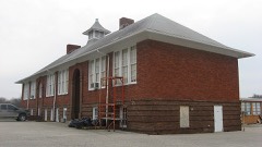 Hall Schoollisted 2004
 Lake Ditch Bridgelisted 2001
Population over time
3 figuresMonrovia grew from 628 to 1,643 between 2000 and 2020. These are the recorded population figures Wikidata holds for this place, reached through the Geographic Names Information System number this page is keyed on rather than by name, so they belong to this place and not to another of the same name. Most are census counts, but not all are: an early figure may be a founding or settlement estimate, and an estimate published within five years of a census is left out. The change column is computed, and is left blank where more than 20 years separate a figure from the one before it, because a gap that long is not a change between two counts.
| Year | People | Change |
|---|---|---|
| 2000 | 628 | |
| 2010 | 1,063 | +435 (+69%) |
| 2020 | 1,643 | +580 (+55%) |
Topographic sheets covering this place
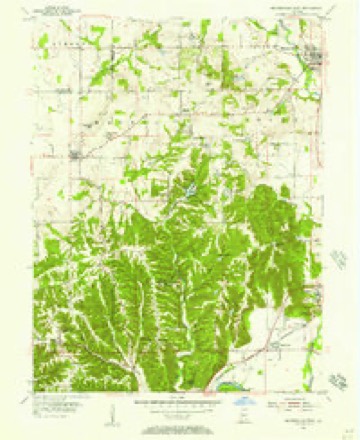
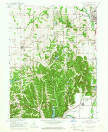
7 surveys from 14 printed sheetsMatched by testing this settlement's coordinate against the published boundary of every sheet in the United States Geological Survey's historical collection. Each opens the scanned sheet at the Survey.
- 1953 USGS Indianapolis quadrangle1:250000, 4 printings
- 1955 USGS Mooresville West quadrangle1:24000
- 1956 USGS Indianapolis quadrangle1:250000
- 1957 USGS Indianapolis quadrangle1:250000, 2 printings
- 1962 USGS Indianapolis quadrangle1:250000
- 1965 USGS Mooresville West quadrangle1:24000, 3 printings
- 1986 USGS Indianapolis quadrangle1:100000, 2 printings





In the county-history sources
2,614 words on this townshipCounties of Morgan, Monroe, and Brown, Indiana. Historical and Biographical, published 1884 names this settlement in its chapter on Monroe Township. These are the passages that mention it, exactly as the scans read.
In the month of June, 1834, Gideon Johnson and George Hubbard employed a surveyor and laid out forty-five lots on Section 12, Township 13 north. Range 1 west, and named the village thus founded Monrovia - a variation of the name of the township. The first merchants were Gideon Johnson and Ira Hadley, each of whom owned a store. If one began selling before the other, such fact is not now remembered. In 1887, Mr. Johnson sold out to Thomas Edwards & Co., for $600, Lots 1, 2, 13 and 14, Block 3, together with all the appurtenances thereunto belonging. This company was composed of Thomas Edwards, I. B. Edwards and C. G. Hussey. This company owned about $2,000 worth of a general assortment of goods. About the time this sale was effected, John Carter laid out an addition of sixteen lots to the town. Mr. Hadley still continued his business, taking in a partner in 1888. Mr. Johnson must have opened another store soon after his sale, as he took out a license in 1839 to sell merchandise. Eli Vestal was an early merchant in the village. Henry and Noah York engaged in the same pursuit early in the forties. Irvin Caveness was the first tavern keeper. Samuel Wilhite and John Valentine were probably the first blacksmiths. A man named Half hill opened a saddle and harness shop, and John Edwards began making wagons. The growth of the village, though not rapid, was steady and permanent. For several years, beginning about 1842, there was no store in town. This is said to have been due to the hard times resulting from the crash of 1837. Owen Johnson opened a store about 1845, and soon afterward Ira Hadley resumed his business, which had been temporarily abandoned. Collins, an Irishman, opened a store about 1850. Milton Lindley was engaged in the same pursuit about the same time, or possibly before. Benjamin Young came in with goods a little later, and Porter & Breedlove still later. After them came Samuel Hadley, Joseph Fulghman, M. B. Shaw, Butler & Mendenhall, Mendenhall & Thompson, W. B. Thompson, Philips & Johnson, R. P. Johnson & Co., and several others, whose names are forgotten. A steam grist mill was built in the town not far from the year 1837, and was the first of the kind in the central part of the State. But the machinery was too rude to compete yet with the numerous powerful water mills, and the mill proved a failure, and was soon abandoned, and the machinery was removed. George Hadley built a wool-carding establishment about 1840, the motor being cattle on an inclined plane. It passed to Silas Gregory, who conducted it until about 1850. No spinning or weaving was done. A man named Dunning manufactured saddles quite extensively in the forties. Halfhill followed the same occupation. Ira Fowler owned a distillery some distance south of town, where lovers of ardent spirits could secure their favorite potations. Mershon was a cabinet and coffin maker, and was probably the first undertaker in the town. Mr. Caveness kept a shoe shop in connection with his tavern. William Wisner conducted a tannery, beginning about 1836. It is said that Joseph Pray started the business, but soon sold out to Wisner. A saw mill was conducted in connection with the steam grist mill. Harris & Goddard built the present steam grist mill in 1856. A woolen mill was added to it. John McDaniel bought both mills about 1861, but soon sold out to Charles Smith, who made money during the war. Hadley & Taylor succeeded Smith. In about 1868, the two mills were separated, each being owned by different parties. John Stanton bought the woolen mill, and Hadley & Taylor owned the grist mill. Mr. Taylor is the present owner of the grist mill. The woolen mill was an important industry. Spinning and weaving was done. Flannels, jeans and other cloths were manufactured. Various other industries have flourished from time to time, but the above are the more important.
Passage source: Counties of Morgan, Monroe, and Brown, Indiana. Historical and Biographical, published 1884.
A newspaper was started in the town about 1880, by a man named Stotzell. After a checkered career of about six months, it became de- ' funct. Late in the sixties, the village became the " incorporated town of Monrovia." Ordinances were adopted, streets were drained, sidewalks were built, etc., but after a few years the municipal government was abandoned.
Passage source: Counties of Morgan, Monroe, and Brown, Indiana. Historical and Biographical, published 1884.
It is not positively known where the first school was taught, as several years elapsed after the first settlement before an attempt was made to establish a school in the township, owing to the fact that within a mile or two- in Brown Township, good schools had been started some years before, and the older children in Monroe could attend there during the winter months, and the younger ones during the summer months, which was then regarded as sufficient schooling for large and small children for the year. It is likely that terms of school were hefd in private residences before the first established school came iato existence. The first school of which any distinct remembrance is had was taught in the West Union Church east of Monrovia during the winter of 1832-33 by Joshua Lindley. He was paid by subscription, and had a full school. David Lindley taught in the church after him. At the end of about three years, the Quakers built a schoolhouse adjoining the church, and in this building Evan Hadley was the first teacher. After that date the school was one of the best in the northern part of the county. A schoolhouse was built west of Monrovia about 1836. A school was also started up in the southeastern part and another in the northeastern part about the same time. In each of these neighborhoods, however, terms of school had been taught in private houses for several years before the public schools were firmly established. The first teacher in Monrovia was a well-educated man named Butterfield, who taught a three months' term during the winter of 1837-38, in a schoolhouse that had been erected the summer and autumn before.
Passage source: Counties of Morgan, Monroe, and Brown, Indiana. Historical and Biographical, published 1884.
Machine-read from a century-old scan, so expect the errors a machine makes: misspelled names, dropped words, stray characters.
Read the whole chapter on Monroe Township - it names this place 5 more 5 times.
Mines and quarries near this place
2 within 5 milesRegional context, not property-specific evidence. The federal mineral resources record lists 2 workings within 5 miles of Monrovia: 1 producer, 1 past producer. 1 still produces. What was taken out: Clay, Sand and Gravel, Construction. Distance is straight-line from the map coordinates, so a quarry counted here may appear on a neighbouring settlement's page as well.
| Where | Site | Commodity | Status | Recorded |
|---|---|---|---|---|
| Adams Pit | Clay | Producer | ||
| Groninger Pit | Sand and Gravel, Construction | Past Producer |
Storms near this place
19 since 1995Regional context, not property-specific evidence. The National Weather Service names Monrovia in 19 storm reports between 1995 and 2026: 10 hail, 8 thunderstorm wind, 1 lightning. The reports record 1 injury. Each account below is quoted exactly as the forecast office filed it, from the NOAA Storm Events Database, and each date opens the federal record of that event.
| When | Event | Place named | Harm | What the report says |
|---|---|---|---|---|
| May 1996 | Lightning | Monrovia | 1 hurt, $10,000 | no account filed |
| February 2024 | Thunderstorm Wind | Monrovia | $10,000 | Large portions of numerous pine trees snapped and uprooted by thunderstorm wind gusts. |
| July 2025 | Thunderstorm Wind | Monrovia | $2,000 | NWS Employee estimated 60 mph thunderstorm wind gust snapped several large tree branches and damaged a road sign in Monrovia. |
| March 2023 | Thunderstorm Wind | Monrovia | $2,000 | Thunderstorm winds in Monrovia destroyed a privacy fence and broke windows. |
| May 2002 | Thunderstorm Wind | Monrovia | $2,000 | Trees and power lines down |
| March 2026 | Hail | Monrovia | - | Wind gusts up to 25 mph were also estimated at this location. |
| April 2025 | Thunderstorm Wind | Monrovia | - | A 70 mph thunderstorm wind gust was estimated at this location. |
| June 2010 | Thunderstorm Wind | Monrovia | - | A 60 mph thunderstorm wind gust was estimated in this location and moved a grill approximately 15 feet. |
| August 2009 | Thunderstorm Wind | Monrovia | - | A trained spotter estimated thunderstorm wind gusts at 60 to 65 miles per hour in this location. Pea sized hail was also noted. |
| February 2026 | Hail | Monrovia | - | no account filed |
| May 2022 | Hail | Monrovia | - | no account filed |
| July 2015 | Hail | Monrovia | - | no account filed |
| June 2004 | Hail | Monrovia | - | no account filed |
| April 2001 | Hail | Monrovia | - | no account filed |
| August 2000 | Thunderstorm Wind | Monrovia | - | no account filed |
| May 1999 | Hail | Monrovia | - | no account filed |
| June 1999 | Hail | Monrovia | - | no account filed |
| May 1996 | Hail | Monrovia | - | no account filed |
| May 1995 | Hail | Monrovia | - | no account filed |
Nearest settlements
The eight closest, with where each one stands in the county. Distances are straight-line, computed from the Geographic Names Information System coordinates.
| Map | Place | Distance | Sheets |
|---|---|---|---|
| Briarwood | 2.3 miles | 13 | |
| Bunker Hill | 2.3 miles | 14 | |
| Gasburg | 2.6 miles | 14 | |
| Lake Hart | 2.8 miles | 14 | |
| Hall | 3.5 miles | 13 | |
| Allman | 3.8 miles | 14 | |
| Wilbur | 4.3 miles | 14 | |
| Beech Grove | 4.7 miles | 14 |
Elsewhere
Matched on this settlement's Geographic Names Information System number rather than its name, so it cannot be a different place of the same name in another state.
| Wikipedia article on Monrovia | An encyclopaedic summary. Its text is share-alike, so it is linked here rather than copied. |
| Wikidata item Q2046840 | The structured record the population and elevation above come from. Public domain (CC0). |
Provenance
This settlement is recorded in the Geographic Names Information System as feature 439349. The sheet list is computed by point-in-boundary test against the United States Geological Survey's historical topographic inventory. Both are works of the United States government and carry no copyright under 17 U.S.C. 105.
Mines and quarries. USGS Mineral Resources Data System (MRDS) https://mrdata.usgs.gov/mrds/ A work of the United States government, no copyright under 17 U.S.C. 105.
Storms. NOAA National Centers for Environmental Information, Storm Events Database https://www.ncei.noaa.gov/stormevents/ A work of the United States government, no copyright under 17 U.S.C. 105. Narratives are quoted verbatim from the National Weather Service report and are not edited or summarised.