 Block
Harlan, Indiana
11 topographic sheets cover this place, the earliest surveyed in 1953 and the latest in 1992. It stands in Springfield Township. It lies in ZIP code area 46743. The Survey maps it on the Grabill quadrangle. 1,577 people lived here at the 2020 count. It stands 784 feet above sea level.
Population over time
2 figuresHarlan fell from 1,634 to 1,577 between 2010 and 2020. These are the recorded population figures Wikidata holds for this place, reached through the Geographic Names Information System number this page is keyed on rather than by name, so they belong to this place and not to another of the same name. Most are census counts, but not all are: an early figure may be a founding or settlement estimate, and an estimate published within five years of a census is left out. The change column is computed, and is left blank where more than 20 years separate a figure from the one before it, because a gap that long is not a change between two counts.
| Year | People | Change |
|---|---|---|
| 2010 | 1,634 | |
| 2020 | 1,577 | -57 (-3%) |
Topographic sheets covering this place
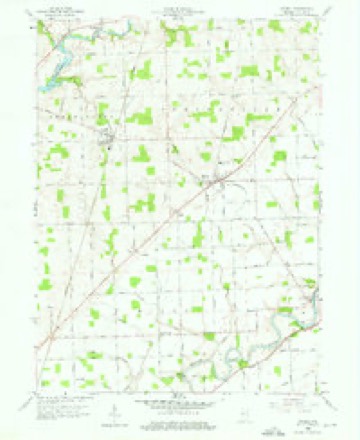
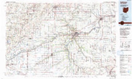
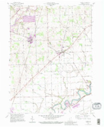
5 surveys from 11 printed sheetsMatched by testing this settlement's coordinate against the published boundary of every sheet in the United States Geological Survey's historical collection. Each opens the scanned sheet at the Survey.
- 1953 USGS Fort Wayne quadrangle1:250000, 4 printings
- 1956 USGS Fort Wayne quadrangle1:250000, 2 printings
- 1958 USGS Grabill quadrangle1:24000, 3 printings
- 1986 USGS Defiance quadrangle1:100000
- 1992 USGS Grabill quadrangle1:24000


In the county-history sources
5,970 words on this townshipHistory of Allen County, Indiana., published 1880 names this settlement in its chapter on Springfield Township. These are the passages that mention it, exactly as the scans read.
The soil is watered by Mary Delarme Creek, which flows through the north eastern portion of the township , Black Creek, which has its source on Section 16, and flows southeast, joining the Maumee River; Twelve Mile Creek has its source in Sectiun 17, and ffi>ws south, joining the Maumee in Milan Township. The surface is of an undulating nature, and the natural drainage is fine. The soil is a black loam, with a substratum of sand, and is very productive.
Passage source: History of Allen County, Indiana., published 1880.
Isaac Hall was born in Beaver County, Penn., in 1804. and at the age of two years removed with his parents to Ohio, and settled in Portage (now Summit) County. Here he was educated in the details of farming, and his course of expe¬ rience developed the physical man ; and when, at the age of thirty-two years, he sought a home in the forests of Allen Couuty, he came prepared lor the hardships which he knew must follow his undertaking. On the 1st day of May, 1836, he placed his family and household goods in a wagon, and started for the West. The roads were good until he reached the valley of the Maumee. Here the traveled road terminated, and from that point to his destination he was compelled to " rough it" - driving up and down ravines whose sides were almost perpendicular, and enduring all the annoyances and discomforts incident to a journey of that nature. He reached the " Maumee Settlement," where he remained during the summer of 1836. He could not then buy land, as the Government office was closed for that season ; but in the following lull he purchased the farm upon which he now resides ; and, taking his family to the new home, began at once the labor °f improvement. He was a prominent man in the settlement, and was chosen to fill various local offices - notably those of Justice of the Peace and County Com¬ missioner. He has witnessed all the changes for the better which have taken place in the township, and has ever been a cordial supporter of public enterprises.
Passage source: History of Allen County, Indiana., published 1880.
In the same year James King came from New York, and rented a tract of land south of the present site of Maysville. He remained about two years, then purchased land on the Maumee, upon which he lived during the remainder of his life.
Passage source: History of Allen County, Indiana., published 1880.
Machine-read from a century-old scan, so expect the errors a machine makes: misspelled names, dropped words, stray characters.
Read the whole chapter on Springfield Township - it names this place 6 more 6 times.
Mines and quarries near this place
1 within 5 milesRegional context, not property-specific evidence. The federal mineral resources record lists 1 working within 5 miles of Harlan: 1 producer. All of them still produce. What was taken out: Stone, Crushed/Broken. Distance is straight-line from the map coordinates, so a quarry counted here may appear on a neighbouring settlement's page as well.
| Where | Site | Commodity | Status | Recorded |
|---|---|---|---|---|
| Woodburn Stone Quarry & Plant | Stone, Crushed/Broken | Producer |
Storms near this place
9 since 1994Regional context, not property-specific evidence. The National Weather Service names Harlan in 9 storm reports between 1994 and 2023: 5 thunderstorm wind, 2 hail, 2 tornado. No death or injury is recorded in these reports. Each account below is quoted exactly as the forecast office filed it, from the NOAA Storm Events Database, and each date opens the federal record of that event.
| When | Event | Place named | Harm | What the report says |
|---|---|---|---|---|
| March 1998 | Tornado (F1) | Harlan | $25,000 | small tornado touched down in Harlan. It damaged a cabinet factory and completely destroyed a mobile home. |
| July 2023 | Thunderstorm Wind | Harlan | $1,000 | Power lines are down on Springfield Center Road near Boger Road. |
| March 2023 | Tornado (EF0) | Harlan | - | A brief, weak EF-0 tornado formed in response to a microburst|that occurred off to the south. Minor damage was observed to a|few homes and barn buildings along Antwerp Rd and Dean Rd. Trees |in the vicinity were snapped and uprooted. Debris was observed |in adjacent fields. |
| August 2021 | Thunderstorm Wind | Harlan | - | Numerous trees downed around Harlan. |
| August 2019 | Thunderstorm Wind | Harlan | - | Amateur radio operators reported a tree down on State Route 37. |
| May 2010 | Thunderstorm Wind | Harlan | - | Law enforcement officials reported a barn was destroyed at the intersection of Cuba and Trammel Road. No damage estimate was available. |
| August 2001 | Thunderstorm Wind | Harlan | - | Trees down. |
| July 1994 | Hail | Harlan | - | Several autos were damaged, and there was also some crop damage. Damage was estimated at $8,000. |
| August 2001 | Hail | Harlan | - | no account filed |
Nearest settlements
The eight closest, with where each one stands in the county. Distances are straight-line, computed from the Geographic Names Information System coordinates.
| Map | Place | Distance | Sheets |
|---|---|---|---|
| Cuba | 1.2 miles | 11 | |
| Grabill | 2.7 miles | 11 | |
| Georgetown | 3.8 miles | 11 | |
| Milan Center | 3.8 miles | 11 | |
| Bluecast | 3.9 miles | 11 | |
| Hursh | 4.6 miles | 11 | |
| Halls Corners | 4.7 miles | 11 | |
| Five Points | 5.1 miles | 11 |
Elsewhere
Matched on this settlement's Geographic Names Information System number rather than its name, so it cannot be a different place of the same name in another state.
| Wikipedia article on Harlan | An encyclopaedic summary. Its text is share-alike, so it is linked here rather than copied. |
| Wikidata item Q5658267 | The structured record the population and elevation above come from. Public domain (CC0). |
Provenance
This settlement is recorded in the Geographic Names Information System as feature 435737. The sheet list is computed by point-in-boundary test against the United States Geological Survey's historical topographic inventory. Both are works of the United States government and carry no copyright under 17 U.S.C. 105.
Mines and quarries. USGS Mineral Resources Data System (MRDS) https://mrdata.usgs.gov/mrds/ A work of the United States government, no copyright under 17 U.S.C. 105.
Storms. NOAA National Centers for Environmental Information, Storm Events Database https://www.ncei.noaa.gov/stormevents/ A work of the United States government, no copyright under 17 U.S.C. 105. Narratives are quoted verbatim from the National Weather Service report and are not edited or summarised.