 Block
Harris City, Indiana
11 topographic sheets cover this place, the earliest surveyed in 1942 and the latest in 1986. It stands in Sandcreek Township. It lies in ZIP code area 47240. It stands on Muddy Fork Sand Creek. The Survey maps it on the Forest Hill quadrangle. It stands 820 feet above sea level.
Topographic sheets covering this place
5 surveys from 11 printed sheetsMatched by testing this settlement's coordinate against the published boundary of every sheet in the United States Geological Survey's historical collection. Each opens the scanned sheet at the Survey.
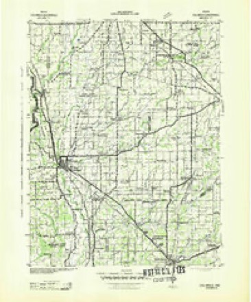
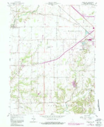
- 1942 USGS Columbus quadrangle1:125000
- 1953 USGS Cincinnati quadrangle1:250000, 3 printings
- 1957 USGS Cincinnati quadrangle1:250000
- 1958 USGS Forest Hill quadrangle1:24000, 4 printings
- 1986 USGS Greensburg quadrangle1:100000, 2 printings



In the county-history sources
2,767 words on this townshipHistory of Decatur County, Indiana : Its People, Industries and Institutions, published 1915 names this settlement in its chapter on Sandcreek Township. These are the passages that mention it, exactly as the scans read.
No town in Decatur county has experienced a greater change in the past quarter of a century than Harris City, which was once the center of the largest blue-limestone quarry of stratified rock in the state, if not in the United States. From this quarry have been shipped thousands of car loads of stone and when it was in the height of its prosperity it frequently turned out more than a hundred car loads of stone a week. Three hundred people were dependent on the operation of the quarry and the Inisy hum of industry which pervaded the place was an apparent indication that the place would one day become a town of some importance.
Passage source: History of Decatur County, Indiana : Its People, Industries and Institutions, published 1915.
Morgan's men were riding through the counties of southern Lidiana in July, 1863, and some of them chanced to pass by what is now Harris City. One of these same men must have been looking for a future place to locate, or at least one of them returned to Decatur county immediately after the close of the Civil War and made a close examination of the spot which had attracted his attention on that hot sultry day in July, 1863.
Passage source: History of Decatur County, Indiana : Its People, Industries and Institutions, published 1915.
Machine-read from a century-old scan, so expect the errors a machine makes: misspelled names, dropped words, stray characters.
Mines and quarries near this place
2 within 5 milesRegional context, not property-specific evidence. The federal mineral resources record lists 2 workings within 5 miles of Harris City: 1 producer, 1 past producer. 1 still produces. What was taken out: Stone, Crushed/Broken, Limestone, Dimension. Distance is straight-line from the map coordinates, so a quarry counted here may appear on a neighbouring settlement's page as well.
| Where | Site | Commodity | Status | Recorded |
|---|---|---|---|---|
| Harris City Quarry | Stone, Crushed/Broken | Producer | ||
| Sipes Stone Quarry | Limestone, Dimension | Past Producer |
Storms near this place
5 since 2010Regional context, not property-specific evidence. The National Weather Service names Harris City in 5 storm reports between 2010 and 2022: 3 thunderstorm wind, 2 hail. The reports record 2 injuries. Each account below is quoted exactly as the forecast office filed it, from the NOAA Storm Events Database, and each date opens the federal record of that event.
| When | Event | Place named | Harm | What the report says |
|---|---|---|---|---|
| July 2015 | Thunderstorm Wind | Harris City | 2 hurt, $8,000 | A tree was down on a vehicle near the intersection of County Roads 500 South and 20 West due to damaging thunderstorm wind gusts. |
| April 2019 | Thunderstorm Wind | Harris City | $58,000 | Roof was blown off of a trailer due to damaging thunderstorm wind gusts. A barn in bad shape was also destroyed and part of a roof was blown off of 4 barns. Siding was pulled off of a house. Trees, one onto a car, and power lines were also reported down south and southwest of Greensburg. No injuries were reported and there were multiple reports of a funnel. Damage survey determined the damage was caused by strong straight-line wind gusts. |
| May 2010 | Thunderstorm Wind | Harris City | $1,000 | Many tree branches over one foot in diameter were reported downed and extremely heavy rain quickly inundated fields. Half inch hail was reported in this location as well. |
| April 2017 | Hail | Harris City | - | Hail was reported to be covering the ground. |
| March 2022 | Hail | Harris City | - | no account filed |
Nearest settlements
The eight closest, with where each one stands in the county. Distances are straight-line, computed from the Geographic Names Information System coordinates.
| Map | Place | Distance | Sheets |
|---|---|---|---|
| Horace | 2.4 miles | 11 | |
| Tarkeo Corner | 2.6 miles | 10 | |
| Gaynorsville | 2.7 miles | 11 | |
| Craig | 3.5 miles | 11 | |
| Letts | 3.8 miles | 11 | |
| Ewington | 3.8 miles | 11 | |
| Letts Corner | 4.1 miles | 11 | |
| Pinhook | 4.3 miles | 11 |
Elsewhere
Matched on this settlement's Geographic Names Information System number rather than its name, so it cannot be a different place of the same name in another state.
| Wikipedia article on Harris City | An encyclopaedic summary. Its text is share-alike, so it is linked here rather than copied. |
| Wikidata item Q14688385 | The structured record the population and elevation above come from. Public domain (CC0). |
Provenance
This settlement is recorded in the Geographic Names Information System as feature 435781. The sheet list is computed by point-in-boundary test against the United States Geological Survey's historical topographic inventory. Both are works of the United States government and carry no copyright under 17 U.S.C. 105.
Mines and quarries. USGS Mineral Resources Data System (MRDS) https://mrdata.usgs.gov/mrds/ A work of the United States government, no copyright under 17 U.S.C. 105.
Storms. NOAA National Centers for Environmental Information, Storm Events Database https://www.ncei.noaa.gov/stormevents/ A work of the United States government, no copyright under 17 U.S.C. 105. Narratives are quoted verbatim from the National Weather Service report and are not edited or summarised.