 Block
Hazleton, Indiana
24 topographic sheets cover this place, the earliest surveyed in 1901 and the latest in 1986. It stands in White River Township. It lies in ZIP code area 47640. It stands on Robb Creek. The Survey maps it on the Patoka quadrangle. 194 people lived here at the 2020 count. It stands 453 feet above sea level.
Research this city
Population over time
2 figuresHazleton fell from 263 to 194 between 2010 and 2020. These are the recorded population figures Wikidata holds for this place, reached through the Geographic Names Information System number this page is keyed on rather than by name, so they belong to this place and not to another of the same name. Most are census counts, but not all are: an early figure may be a founding or settlement estimate, and an estimate published within five years of a census is left out. The change column is computed, and is left blank where more than 20 years separate a figure from the one before it, because a gap that long is not a change between two counts.
| Year | People | Change |
|---|---|---|
| 2010 | 263 | |
| 2020 | 194 | -69 (-26%) |
Topographic sheets covering this place
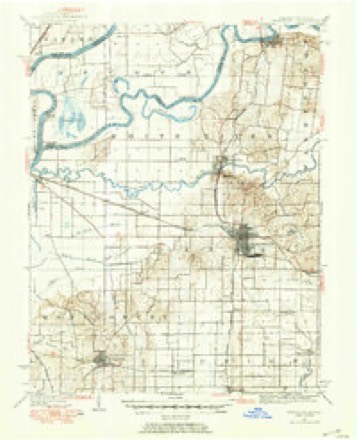
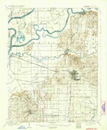
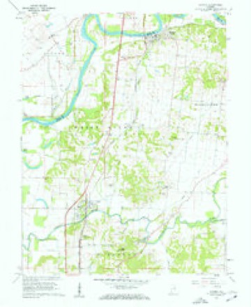
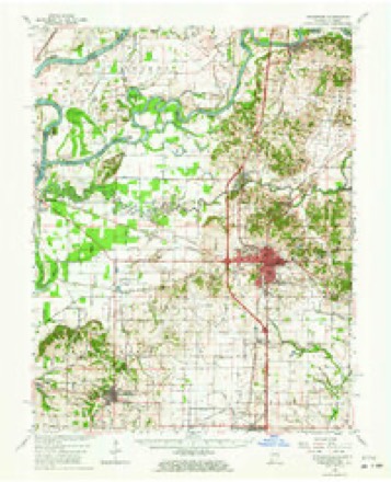
9 surveys from 24 printed sheetsMatched by testing this settlement's coordinate against the published boundary of every sheet in the United States Geological Survey's historical collection. Each opens the scanned sheet at the Survey.
- 1901 USGS Princeton quadrangle1:62500
- 1903 USGS Patoka quadrangle1:125000, 2 printings
- 1903 USGS Princeton quadrangle1:62500, 6 printings
- 1956 USGS Vincennes quadrangle1:250000, 4 printings
- 1957 USGS Vincennes quadrangle1:250000
- 1958 USGS Vincennes quadrangle1:250000, 2 printings
- 1959 USGS Patoka quadrangle1:24000, 4 printings
- 1959 USGS Princeton quadrangle1:62500, 2 printings
- 1986 USGS Princeton quadrangle1:100000, 2 printings





In the county-history sources
10,128 words on this townshipSPC BOOKS STOR - 977.235 H History Of Gibson County Indiana, published 1884 names this settlement in its chapter on White River Township. These are the passages that mention it, exactly as the scans read.
It is fairly supplied with wagon roads leading in different directions through the hilly and along the bottoms. The Evansville & Terre Haute Railroad enters it on Section 25, and passing in a northeasterly direction leaves the township on Section 16. White River has three stations - Patoka, Miller and Hazleton - on this road. This rond, in addition to Patoka and White
Passage source: SPC BOOKS STOR - 977.235 H History Of Gibson County Indiana, published 1884.
Asheraft, whose great grandfather's name was Jeremiah Asheraft. He a Pamesylvanian and from there went at a carly day to Grayson Comty, Ky., where he bought three sons, viz., Jacob, John and Daniel, way back to Pennsylvania he was killed by the Indians. Daniel Ashcraft was the of B. K. He was a soldier in the border wars during the Im ubles, was twice wounded and his wife once in encounters with the Indiaus. He was born March 13, 1768, and died June 5, 1812. He married Sarah Dye, Oct. 18, 1798. She was boru March 21, 1775, and died Sept. 17, 1845. * One of the sons of Daniel 'was Jediah, the father of B. K. Asheroft. He was born Dee. 12, 1794. He married Anna Wilson, in Grayson County, Ky, Feb. 10, 1820. She was born Oct. 19, 1797. They had four sons and five dangliters, and were early residents of this county. Several descendants of | the old pioneer are yet living here. There are many other oll settlers of this township deserving prominent mention, but space will not permit sto do therefore, we will submit their names without extended comment: Among them were John Severns, Daniel Hazleton, David Hazleton, Gervas Hazleton, Keen Fields, Abraham Fields, David Robb, James Robb, | Joseph Milburn, Soh Ma, David Millan, Robert
Passage source: SPC BOOKS STOR - 977.235 H History Of Gibson County Indiana, published 1884.
the Patoka. The second was on White point where the town of Hazleton is located, and called the Hazleton ferry. It was in operation prior to 1800 when James Robb came to the township. Betsey Hazleton, a girl who weighed about 200 Ibs., attended the ferry when James Bobb and family crossed into White River Township. She demanded pay before they got aboard, which was somewhat nettling to the honor und dignity of the proud Kentuckian, who gral his pockets and exhibited to her handfalls of silver with the remark, "We are able to pay our ferrinze.
Passage source: SPC BOOKS STOR - 977.235 H History Of Gibson County Indiana, published 1884.
Machine-read from a century-old scan, so expect the errors a machine makes: misspelled names, dropped words, stray characters.
Read the whole chapter on White River Township - it names this place 7 more 7 times.
Fires near this place
3 since 2001Regional context, not property-specific evidence. The federal wildfire occurrence database lists 3 fires within 5 miles of Hazleton between 2001 and 2012, burning about 23 acres in total. 1 started naturally. None was recorded as arson. Distance is straight-line from the map coordinates, so a fire counted here may appear on a neighbouring settlement's page as well.
| Reported cause | Fires |
|---|---|
| Recreation and ceremony | 1 |
| Natural | 1 |
| Missing data/not specified/undetermined | 1 |
The most recent of them, most recent first, with the day each was reported and the service that recorded it.
| Date | Cause | Size | Reported by | Name on the report |
|---|---|---|---|---|
| 1 July 2012 | Natural | 1.0 acres | Patoka River National Wildlife Refuge | WHITE RIVER |
| 29 April 2001 | Recreation and ceremony | 20 acres | Indiana State Fire Marshal's Office | not named |
| 21 October 2001 | Missing data/not specified/undetermined | 2.0 acres | Indiana State Fire Marshal's Office | not named |
Settlements close enough to share some of these fires:
Mines and quarries near this place
1 within 5 milesRegional context, not property-specific evidence. The federal mineral resources record lists 1 working within 5 miles of Hazleton: 1 past producer. None of them still produces. What was taken out: Sand and Gravel, Construction. Distance is straight-line from the map coordinates, so a quarry counted here may appear on a neighbouring settlement's page as well.
| Where | Site | Commodity | Status | Recorded |
|---|---|---|---|---|
| White Sand and Gravel Pit | Sand and Gravel, Construction | Past Producer |
Storms near this place
60 of 103 shownRegional context, not property-specific evidence. The National Weather Service names Hazleton in 103 storm reports between 2000 and 2025: 90 flood, 4 hail, 4 thunderstorm wind, 3 flash flood. No death or injury is recorded in these reports. Each account below is quoted exactly as the forecast office filed it, from the NOAA Storm Events Database, and each date opens the federal record of that event.
| When | Event | Place named | Harm | What the report says |
|---|---|---|---|---|
| May 2011 | Flood | Hazleton | $400,000 | Major flooding continued on the White River from April. At the Hazleton river gage, the river crested at 29.80 feet on May 4. This was tied for the fourth highest crest on record, and less than two feet below the January, 2005 flood. Boils occurred in the Hazleton levee. Since the levee was upgraded after the January, 2005 flood, it was able to withstand a crest of 31.5 feet. Local levees were at critical levels. Flood fighting and/or evacuations were in progress. Oil fields and residential areas on the river side of the levees flooded extensively. Many evacuations or relocations were necessary. Water was more than 3 feet deep in the west end of Hazleton. People in residential cabins on the riverward side of the levee relocated. Many local roads were completely impassable. Oil fields were inaccessible. Water pumps were installed on the west end of Hazleton. Extensive river flooding occurred in northern Gibson County. Numerous county roads were flooded. |
| June 2018 | Flash Flood | Hazleton | $50,000 | A bridge over Robb Creek in Hazleton was washed out by high water. The bridge was described as an old I-beam bridge. The bridge was located on a lightly traveled side street. |
| March 2008 | Flood | Hazleton | $50,000 | Schools were closed in parts of the county. The sheriff department received six or seven calls about motorists stranded in high water. The Red Cross opened a shelter for people needing to evacuate their homes. Residents of low-lying towns stacked sandbags. Several roads were closed, including one major state road. |
| March 2015 | Flood | Hazleton | $30,000 | Moderate flooding occurred on the White River. At the Hazleton river gage, the river crested at 24.20 feet on the 19th. Flood stage is 16 feet. Some river cabin residents evacuated. Most local roads near the river were flooded. Several oil fields were inaccessible. |
| December 2013 | Flood | Hazleton | $30,000 | Moderate flooding occurred along the White River. There was extensive flooding of bottomland fields and woods in northern Gibson County. Numerous county roads were flooded. Some city streets were flooded in Hazleton. A water pump was installed to keep water off the streets. Some river cabin residents evacuated. Several oil fields were flooded and inaccessible. Flood gates were installed at Hazleton. Flood waters covered the Hazleton softball field. At the Hazleton river gage, the river crested at 25.2 feet on the 29th. Flood stage is 16 feet. |
| April 2011 | Flood | Hazleton | $30,000 | At Hazleton, the river crested at 29.00 feet on the 28th. Major flooding occurs at 28 feet. Boils occurred in the Hazleton levee. Extensive sandbagging was required to prevent levee failure. Local levees were at critical levels. Flood fighting and/or evacuations were in progress. Oil fields and residential areas on the river side of the levees flooded extensively. Many evacuations or relocations were necessary. Water was more than 2 feet deep in the west end of Hazleton. People in residential cabins on the riverward side of the levee relocated. Many local roads were completely impassable. Oil fields were inaccessible. Water pumps were installed on the west end of Hazleton. Extensive river flooding occurred in northern Gibson County. Numerous county roads were flooded. |
| May 2017 | Flood | Hazleton | $25,000 | Moderate flooding occurred on the White River. At the Hazleton river gage, the river crested at 26.70 feet on the 12th. Flood stage is 16 feet. This crest was about a foot lower than the flood crest of March, 2008. Water was more than a foot deep in the west end of Hazleton, with the deepest flood water at the corner of West 2nd Street and Brown Street. People in residential cabins on the riverward side of the levee relocated. Many local roads were completely impassable. Oil fields were inaccessible. Water pumps were installed on the west end of Hazleton. Flood gates were installed at Hazleton. |
| March 2018 | Flood | Hazleton | $15,000 | Moderate flooding continued on the White River from late February. People in residential cabins on the riverward side of the levee relocated. Many local roads were completely impassable. Oil fields were inaccessible. Water pumps were installed on the west end of Hazleton, but some street flooding occurred. At the Hazleton river gage, the river crested at 26.30 feet on March 3. Flood stage there is 16 feet. |
| March 2023 | Flood | Hazleton | $10,000 | Minor flooding occurred on the White River. Some river cabins were inaccessible. Most local river roads were flooded. Several oil fields were inaccessible. There was extensive flooding of bottomland woods and fields. Flood gates were installed at Hazleton. Flood waters covered the Hazleton softball field. The flooding continued into April. |
| June 2019 | Flood | Hazleton | $10,000 | Moderate flooding occurred on the White River. At the Hazleton river gage, the river crested at 26.30 feet on the 25th. Flood stage is 16 feet. Flood gates were installed at Hazleton. Water was nearly two feet deep in the west end of Hazleton, where water pumps were installed. People in cabins on the riverward side of the levee generally relocated. Many local roads were completely impassable. Oil fields were inaccessible. Agricultural impacts were significant. This flood was very similar to the February flood except for the impact on farmers. |
| April 2013 | Flood | Hazleton | $10,000 | Moderate flooding occurred along the White River in the Hazleton area. Numerous county roads were flooded. There was extensive flooding of lowlands across northern Gibson County. Some river cabin residents evacuated. Most local roads were flooded. Several oil fields were inaccessible. A six-inch water pump was installed in Hazleton to keep water off the streets. Flood gates were installed at Hazleton. The flooding continued into early May. |
| September 2012 | Heavy Rain | Hazleton | $10,000 | The 24-hour rainfall at Hazleton was 3.60 inches. Most of this rain fell before dawn on the 26th. A washout that occurred along a small creek broke a buried communications cable. The cable cut interrupted data flow, including data from the weather radar at Owensville. |
| June 2011 | Flood | Hazleton | $10,000 | Minor flooding of the White River inundated bottomland fields and woodlands. High water affected residents in Pottsville river cabins. A few roads were flooded. Oil-stripped fields were flooded. Flood gates were installed at Hazleton. Floodwaters covered the Hazleton softball field. |
| May 2009 | Flood | Hazleton | $10,000 | Minor to moderate flooding of the White River occurred for most of the month. At the Hazleton gage, where flood stage is 16 feet, the river crested at 24.20 feet on the 21st. Significant agricultural damage occurred. Some river cabin residents were evacuated. Most local roads flooded. Several oil fields were inaccessible. Floodgates were installed at Hazleton, and the community softball field was inundated. |
| March 2008 | Flood | Hazleton | $10,000 | Moderate flooding of the White River occurred. At the Hazleton gage, the river crested at 27.70 feet on March 27. Flood stage there is 16 feet, and moderate flooding begins at 24 feet. Water was more than two feet deep in the west end of Hazleton, with the deepest flood water at the corner of West 2nd Street and Brown Street. People in residential cabins on the riverward side of the levee relocated. Many local roads were completely impassable. Oil fields were inaccessible. Water pumps were installed on the west end of Hazleton. Since cropland was dormant, this flood caused little if any agricultural damage. Flood gates were installed at Hazleton. |
| September 2000 | Thunderstorm Wind | Hazleton | $10,000 | A barn was blown over on Cunningham Road. |
| July 2025 | Flash Flood | Hazleton | $5,000 | Torrential rainfall with radar estimated hourly rainfall peaking at around 2/hr produced overflowing creeks which flooded yards. |
| April 2022 | Flood | Hazleton | $5,000 | no account filed |
| January 2017 | Flood | Hazleton | $4,000 | Minor flooding occurred along the White River. Bottomland woods and fields were inundated, including low-lying oil fields. High water affected some river cabins. A few local streets were flooded, and Pottsville Road was underwater and impassable. Flood gates were installed at Hazleton, and floodwaters covered the Hazleton softball field. |
| April 2015 | Flood | Hazleton | $4,000 | Minor flooding occurred on the White River. Bottomland woods and fields were flooded. High water affected any residents that were in river cabins. A few streets were submerged. Oil stripped fields were inundated. Flood gates were installed at Hazleton. Floodwaters covered the Hazleton softball field. Floodwaters covered low farmland, but the land was dormant since it was not agricultural season. |
| April 2016 | Flood | Hazleton | $3,000 | Minor flooding occurred along the White River. Floodwaters covered the Hazleton softball field. One or two lightly travelled roads were underwater and impassable. Many low-lying fields were inundated. Low-lying oil fields were flooded. High water isolated some river cabins. |
| May 2016 | Flood | Hazleton | $3,000 | Minor flooding occurred along the White River. Floodwaters covered the Hazleton softball field. One or two lightly travelled roads were underwater and impassable. Many low-lying fields were inundated. Low-lying oil fields were flooded. High water isolated some river cabins. |
| July 2015 | Flood | Hazleton | $3,000 | Minor flooding continued along the White River from June through most of July. Because it was agricultural season, extensive flooding of river bottomlands caused significant crop damage. High water surrounded any residents in river cabins. Several streets and back roads were flooded and impassable. Oil fields were flooded. Flood gates were installed at Hazleton. A softball field was underwater. |
| June 2015 | Flood | Hazleton | $3,000 | Minor flooding occurred along the White River. Low-lying woods and fields near the river were inundated. High water affected any residents in Pottsville river cabins. A few streets were flooded and impassable. Oil stripped fields were flooded. Flood gates were installed at Hazleton. A softball field was underwater. The flooding continued into July. |
| January 2012 | Flood | Hazleton | $3,000 | Minor flooding occurred along the White River. Most of the low bottomlands were flooded. Flooding began in higher bottomlands. A few streets on the river side of the railroad tracks were flooded. Oil stripped fields were flooded. Floodgates were installed at Hazleton. Floodwaters covered the Hazleton softball field. Pottsville Road and a few other low rural roads flooded. High water isolated Pottstown, a river cabin community. |
| May 2022 | Thunderstorm Wind | Hazleton | $2,000 | Tree limbs were blown down. Wind gusts were estimated up to 60 mph. |
| August 2019 | Thunderstorm Wind | Hazleton | $2,000 | A tree was down on Highway 56 in Hazleton, and another tree was down along a rural county road southeast of town. |
| March 2016 | Flood | Hazleton | $2,000 | Minor flooding continued from February along the White River. Bottomland woods and fields were underwater. Floodwaters covered the Hazleton softball field. A few low rural roads were underwater and impassable. Low-lying oil fields were flooded. |
| March 2016 | Flood | Hazleton | $2,000 | Minor flooding occurred along the White River. Floodwaters covered the Hazleton softball field. A few rural county roads were flooded and impassable. Low-lying oil fields were flooded. Bottomland woods and fields were inundated. |
| December 2015 | Flood | Hazleton | $2,000 | The White River began its rise above flood stage late in the month. The river crested in early January. Minor flooding of low-lying fields and woodlands occurred. Several streets and county roads were underwater. A softball field was flooded. River cabins were inaccessible. |
| December 2014 | Flood | Hazleton | $2,000 | Minor flooding occurred along the White River near Hazleton. Floodwaters covered low ground, inundating low-lying oil fields. A couple of low rural roads were flooded. A community of river cabins was isolated. Four floods in the past two years were significantly worse than this flood. |
| January 2014 | Flood | Hazleton | $2,000 | Minor flooding occurred along the White River. Low-lying fields and woodlands were underwater. Low lying oil fields and a few low rural roads flooded. High water isolated river cabins. |
| July 2013 | Flood | Hazleton | $2,000 | Minor flooding continued from late June along the White River in the Hazleton area. Floodwaters covered low farmland. Low-lying oil fields and a few low rural roads were flooded. High water isolated a river cabin community. |
| February 2012 | Flood | Hazleton | $2,000 | Minor flooding occurred along the White River. Most of the low bottomlands were flooded. Flooding began in higher bottomlands. A few streets on the river side of the railroad tracks were flooded. Oil stripped fields were flooded. Floodgates were installed at Hazleton. Floodwaters covered the Hazleton softball field. Pottsville Road and a few other low rural roads flooded. High water isolated Pottstown, a river cabin community. |
| December 2011 | Flood | Hazleton | $2,000 | Minor flooding occurred on the White River in the Hazleton area. High water surrounded residents in river cabins. Oil fields and local river roads were flooded. Most of the low bottomlands flooded, and flooding began in higher bottomlands. Flood gates were installed at Hazleton. Flood waters covered the Hazleton softball field. |
| April 2009 | Flood | Hazleton | $2,000 | Minor flooding of the White River occurred near Hazleton. Most of the low bottomlands flooded. Flooding began in higher bottomlands. High water affected any residents that did not evacuate Pottsville river cabins. Pottsville Road, North C Street on the river side of the railroad tracks, and Catt Street near U. S. Highway 41 were flooded. Oil stripped fields flooded. Flood gates were installed at Hazleton. At the Hazleton river gage, where flood stage is 16 feet, the river crested at 21 feet on the 14th. |
| August 2025 | Thunderstorm Wind | Hazleton | $1,000 | Thunderstorm winds knocked down a tree just east of Hazleton. |
| June 2013 | Flood | Hazleton | $1,000 | Minor flooding occurred along the White River in the Hazleton area. Floodwaters covered low farmland. Low-lying oil fields and a few low rural roads were flooded. High water isolated a river cabin community. The flooding continued into early July. |
| June 2010 | Flood | Hazleton | $1,000 | Minor flooding occurred on the White River near Hazleton. Most bottomland fields were flooded, including cropland. High water affected any residents who stayed in Pottsville river cabins. A few back roads near the river were flooded, including at least one that was impassable. Low oil fields were flooded. Flood gates were installed at Hazleton. Flood waters covered the Hazleton softball field. |
| February 2025 | Hail | Hazleton | - | A lone storm moved east northeast from Mt Carmel Illinois and across northern Gibson county where it pulsed up and produced hail up to quarter size just southwest of Hazleton. |
| May 2025 | Flood | Hazleton | - | River levels on the White River rose into minor flood at Hazleton early May with limited impacts to low-lying agricultural lands and a few local roads. |
| February 2022 | Flood | Hazleton | - | Minor flooding occurred on the White River. Low-lying rural areas near the river were underwater, affecting a number of county roads. The flooding continued into March. |
| July 2021 | Flood | Hazleton | - | Minor flooding occurred on the White River. Floodwaters covered the Hazleton softball field. A county road was underwater and impassable. Floodwaters covered much low cropland. Low-lying oil fields and possibly a few other low rural roads flooded. High water isolated Pottstown, a river cabin community. |
| January 2020 | Flood | Hazleton | - | Moderate flooding occurred on the White River. The river crested at 25.53 feet on the 19th at the Hazleton river gage. Moderate flooding begins at 24 feet. People in residential cabins on the riverward side of the levee generally relocate at this level. Many local roads were completely impassable. Oil fields were inaccessible. Water began to come onto the street at the corner of West 2nd Street and Brown Street in the town of Hazleton. Extensive flooding of agricultural fields occurred. Since this flood occurred primarily outside of the growing season, little if any crop damage occurred. |
| March 2019 | Flood | Hazleton | - | Moderate flooding continued on the White River from February into the first few days of March. At the Hazleton river gage, the river crested at 26.67 feet on Feb. 15th. Flood stage is 16 feet. Flood gates were installed at Hazleton. Water was nearly two feet deep in the west end of Hazleton, where water pumps were installed. People in cabins on the riverward side of the levee generally relocated. Many local roads were completely impassable. Oil fields were inaccessible. |
| March 2019 | Flood | Hazleton | - | Minor flooding redeveloped on the White River. Most low bottomlands were flooded. Some river cabins were affected. Several rural roads along the river outside of levee protection were flooded. Oil fields were flooded. Flood gates were installed at Hazleton. Flood waters covered the Hazleton softball field. |
| February 2018 | Flood | Hazleton | - | Moderate flooding developed on the White River. People in residential cabins on the riverward side of the levee relocated. Many local roads were completely impassable. Oil fields were inaccessible. Water pumps were installed on the west end of Hazleton, but some street flooding occurred. The river continued rising into March. |
| March 2018 | Flood | Hazleton | - | The White River rose above flood stage on the 28th and continued rising through the end of the month. The flooding during late March was minor, consisting of bottomland woods and fields. |
| September 2018 | Flood | Hazleton | - | Minor flooding occurred along the White River. A few oil fields and a few local roads were inundated, along with some agricultural land. |
| June 2018 | Flash Flood | Hazleton | - | Standing water was over numerous roads, especially in and near Hazleton and Oakland City. An automated rain gage reporting site near Oakland City measured 2.62 inches in 6 hours. |
| November 2018 | Flood | Hazleton | - | Minor flooding occurred along the White River. Floodwaters covered low-lying fields and woods near the river, including some low-lying oil fields. A few local rural roads were flooded. High water isolated a small community of river cabins. |
| March 2017 | Flood | Hazleton | - | Minor flooding occurred along the White River. Low-lying woods and fields near the river were flooded. Low-lying oil fields and a few low rural roads were flooded. High water isolated Pottstown, a cluster of river cabins. |
| July 2017 | Flood | Hazleton | - | Minor flooding occurred along the White River. Floodwaters covered low-lying farm fields. Low-lying oil fields and a few low rural roads were flooded. High water isolated Pottstown, a river cabin community. Crops damaged by the flooding could not be replanted because of the lateness of the season. |
| February 2016 | Flood | Hazleton | - | Minor flooding occurred along the White River. Bottomland woods and fields were underwater. Floodwaters covered the Hazleton softball field. A few low rural roads were underwater and impassable. Low-lying oil fields were flooded. The river remained above flood stage into early March. |
| August 2016 | Flood | Hazleton | - | Minor flooding occurred on the White River. Some low-lying fields and woodlands were underwater, as well as a few local roads. |
| January 2014 | Flood | Hazleton | - | Flooding lingered along the White River for the first few days of 2014. The river continued to recede after cresting on December 29. At the peak of the flood, there was extensive flooding of bottomland fields and woods in northern Gibson County. Numerous county roads were flooded. Some city streets were flooded in Hazleton. A water pump was installed to keep water off the streets. Some river cabin residents evacuated. Several oil fields were flooded and inaccessible. Flood gates were installed at Hazleton. Flood waters covered the Hazleton softball field. At the Hazleton river gage, the river crested at 25.2 feet on December 29th. |
| May 2014 | Flood | Hazleton | - | Minor flooding occurred along the White River. Low-lying fields and woodlands near the river were inundated. Low-lying oil fields and a couple of low rural roads were flooded. High water isolated a river cabin community. |
| March 2014 | Flood | Hazleton | - | Minor flooding occurred along the White River. Many low-lying woods and fields were underwater. Some river cabins were affected. A couple of Hazleton city streets were flooded, along with at least one rural county road. Low-lying oil fields were inundated. Flood gates were installed at Hazleton. Floodwaters covered the Hazleton softball field. The flooding continued from late February. |
| October 2013 | Heavy Rain | Hazleton | - | A co-operative observer measured a daily rainfall total of 4.70 inches of rain. |
| March 2013 | Flood | Hazleton | - | Minor flooding occurred along the White River at Hazleton. Some low-lying agricultural and oil fields were underwater. A few low county roads were flooded. A river cabin community was isolated. |
Nearest settlements
The eight closest, with where each one stands in the county. Distances are straight-line, computed from the Geographic Names Information System coordinates.
| Map | Place | Distance | Sheets |
|---|---|---|---|
| Giro | 4.1 miles | 14 | |
| Mount Olympus | 4.6 miles | 17 | |
| Patoka | 6.1 miles | 24 | |
| Wheeling | 7.0 miles | 17 | |
| Princeton | 9.3 miles | 24 | |
| Lyles | 10.3 miles | 23 | |
| Baldwin Heights | 10.3 miles | 24 | |
| Douglas | 11.1 miles | 24 |
Elsewhere
Matched on this settlement's Geographic Names Information System number rather than its name, so it cannot be a different place of the same name in another state.
| Wikipedia article on Hazleton | An encyclopaedic summary. Its text is share-alike, so it is linked here rather than copied. |
| Wikidata item Q3293334 | The structured record the population and elevation above come from. Public domain (CC0). |
Provenance
This settlement is recorded in the Geographic Names Information System as feature 435943. The sheet list is computed by point-in-boundary test against the United States Geological Survey's historical topographic inventory. Both are works of the United States government and carry no copyright under 17 U.S.C. 105.
Wildfire. Short, Karen C. 2022. Spatial wildfire occurrence data for the United States, 1992-2020 [FPA_FOD_20221014]. 6th Edition. Fort Collins, CO: Forest Service Research Data Archive. https://doi.org/10.2737/RDS-2013-0009.6 Collected with United States Government funding and usable without additional permissions or fees.
Mines and quarries. USGS Mineral Resources Data System (MRDS) https://mrdata.usgs.gov/mrds/ A work of the United States government, no copyright under 17 U.S.C. 105.
Storms. NOAA National Centers for Environmental Information, Storm Events Database https://www.ncei.noaa.gov/stormevents/ A work of the United States government, no copyright under 17 U.S.C. 105. Narratives are quoted verbatim from the National Weather Service report and are not edited or summarised.