 Block
Princeton, Indiana
24 topographic sheets cover this place, the earliest surveyed in 1901 and the latest in 1986. It stands in Patoka Township. It lies in ZIP code area 47670. The Survey maps it on the Princeton quadrangle. 8,301 people lived here at the 2020 count. It stands 397 feet above sea level.
On record in Princeton
Buildings and businesses the archive holds for this place. Each opens its own page, with the source record it came from.
On the National Register 4 records
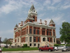 Gibson County Courthouselisted 1984
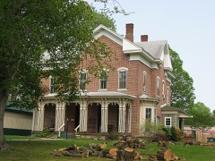 Welborn-Ross Houselisted 1996
- Princeton Courthouse Square Historic Districtlisted 2025
- Princeton Westside Historic Districtlisted 2025
Population over time
2 figuresPrinceton fell from 8,644 to 8,301 between 2010 and 2020. These are the recorded population figures Wikidata holds for this place, reached through the Geographic Names Information System number this page is keyed on rather than by name, so they belong to this place and not to another of the same name. Most are census counts, but not all are: an early figure may be a founding or settlement estimate, and an estimate published within five years of a census is left out. The change column is computed, and is left blank where more than 20 years separate a figure from the one before it, because a gap that long is not a change between two counts.
| Year | People | Change |
|---|---|---|
| 2010 | 8,644 | |
| 2020 | 8,301 | -343 (-4%) |
Topographic sheets covering this place
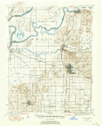
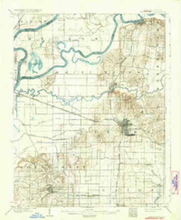
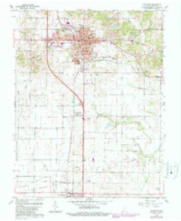
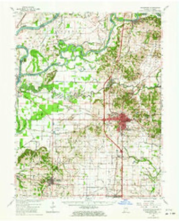
9 surveys from 24 printed sheetsMatched by testing this settlement's coordinate against the published boundary of every sheet in the United States Geological Survey's historical collection. Each opens the scanned sheet at the Survey.
- 1901 USGS Princeton quadrangle1:62500
- 1903 USGS Patoka quadrangle1:125000, 2 printings
- 1903 USGS Princeton quadrangle1:62500, 6 printings
- 1956 USGS Vincennes quadrangle1:250000, 4 printings
- 1957 USGS Vincennes quadrangle1:250000
- 1958 USGS Vincennes quadrangle1:250000, 2 printings
- 1959 USGS Princeton quadrangle1:24000, 4 printings
- 1959 USGS Princeton quadrangle1:62500, 2 printings
- 1986 USGS Princeton quadrangle1:100000, 2 printings





In the county-history sources
7,017 words on this townshipHistory of Gibson County Indiana, published 1884 names this settlement in its chapter on Patoka Township. These are the passages that mention it, exactly as the scans read.
This town is three miles north of Princeton, the county seat, twenty-one miles south of Vincennes, and thirty-one miles north of Evansville, situated on Sections 24 and 25, Township 1 South, Range 10 West, and on the Evansville & Terre Haute Railroad, and the banks of the Patoka River, from which it derives its name. Patoka is an Indian name and signifies 'log on the bottom," and was applied to the river on account of so many logs having settled to the bottom, which stuck fast in the slimy mud. This town was first called Smithfield, then Columbia, and was platted and recorded as such in October, 1818. We cannot fix the date when Columbia began to assume village proportions. It is undoubtedly the oldest town or hamlet in the county, and that quite a collection of families had built homes and lived here long before it was laid out and recorded. It was for years a stage station between "Stringtown " (now Evansville) and Vincennes, until the Evansville & Terre Haute Railroad made staging over this route a thing that was. The old log building which was erected for a hotel and stage station is still standing, and having been weather-boarded and otherwise repaired, it presents quite a respectable appearance, and, with its veranda or porch extending along the entire front, is suggestive of old time hospitality and comfort to the cramped and stage-weary traveler, the stiff and saddle-chaffed equestrian and the tired and foot-sore pedestrian. There being another Columbia in the state, the post-office here was given the name of " Patoka," and the town assumed the name of the office. Patoka River, though not properly a navigable stream, has had its day of steamboating. During high water boats of small tonnage occasionally ran up as far as the town of Patoka, and two small boats, Staver and Maud, built on the river at and above Patoka, one for the stave trade, the other for handling flats and barges, operated above Patoka for some time, but they are not operating here now, one having been sunk by the ice, and the other, finding it more profitable, is plowing the waters of the Wabash and White Rivers. Thomas H. Martin is believed to be the first hotel keeper, as well as the first spiritual adviser in this ancient village, which is not incorporated, but running on the broad tread or what the "wise ones" suppose to be the more economical plan. She has at this time about 800 inhabitants and has seen better days. Distilleries first made her prosperous, and then crooked whisky sheared her golden locks, nipped her prestine vigor, made her prematurely gray and hurled her on the down grade of the stream of time, from which she is not likely soon to recover; and also disgraced and bankrupted several of her own citizens and made criminals of other residents of the county, only a few of whom were made to feel the power of the law which they had violated. Whisky has ever been one of the staples of this town; two saloons here now, and the time was when merchants and hotels all kept it on sale. A business man here to-day says that on looking over his grandfather's old bills of purchase he found the average about thus: - One barrel of molasses, two barrels of whisky, showing a double demand for the "necessary tanglefoot" over luxurious treacle. Patoka has three churches - Baptist, Presbyterian and Methodist - over which the following gentlemen preside as expounders of their faith: - Baptist, W. A. Oliphant, of Fort Branch; Presbyterian, W. B. Crawford; Methodist, Gideon Heavenridge. The school facilities are excellent, having a graded system. The school building is a two story and substantial frame structure with six large, comfortable rooms, five for the different grades and one for general school exercises and school entertainments. The management of these schools has been under the supervision of competent instructors, and are in a prosperous condition.
Passage source: History of Gibson County Indiana, published 1884.
Are among the early settlers of Gibson County. They are of Scotch origin. The ancestors emigrated from Scotland to America and settled in Virginia prior to the Revolutionary War,in which memorable contest some of them took an active part. Thomas Stewart, the great grandfather, was born near Lynchburg, Va., April 9, 1768. He married Terzah Morrison, Jan. 30, 1794. She was born in the same locality in Virginia, Aug. 80, 1759. By that union there were three children, viz.: - William, Nancy and Samuel Ayres Stewart. William came West with his brother to Gibson County in 1818, and settled in Patoka, and from there went North to the lead mines at Galena, Ill., and there dicd. Nancy married a man by the name of Lacky, removed to Kentucky, where she remained until her death. Samuel Ayres Stewart, the father and grandfather of the present family, was born in Virginia Dee. 10, 1797, and there grew to:manhood. On arriving at his nativity, hein company with his brother came West to seek their fortunes; landing herein 1818. They were attracted to Gibson County through their acquaintance with parties who were then former neighbors, and who had preceded them here. Here Mr. Stewart engaged first in the milling business and in the winter months taught school. He also scon after entered land and engaged in farming, which was his principal occupation until his death. He died prematurely young from an attack of pnemnonia, May 24, 1849, while in his fiftysecond year. During his life and residence in Gibson
Passage source: History of Gibson County Indiana, published 1884.
settled in Kentucky soon after the clese of the Revolutionary War. Keen Fields, the grandfather of the present family, was a native of Kentucky, and emigrated to Indiana while it was yet under teriitorial form of government. He made his first hcme cn a militia tract east and adjoining the farm of Mrs. Nancy A. Richards (whose maiden name was Fields) in White Township. He there opened up a faim and made it his permanent place of abode, until his death, which occurred in 1815. He married Anna West, who servived him a number of years. By that union there were ten children, eight sons and two daughters. One yet survives. The youngest son, Keen Fields, a resident of Greene County, Ill. Abraham Fields, the father of Mrs. Nancy A. Richards, was bern in Kentucky Dec. 27, 1793. He came with his parents to Indiana and was yet in his boylocd when the family landed here. He followed, for the greater portion of his life, the peaceful occupation of a farmer. He also built flat boats and teamed, hauling goods from Evansville to Terre Haute and Palmyra, Il]. That was before the days of railroads. He died at the old homestead April 12, 1870. He married Grace Reiney, daughter of William and Esther Reiney, who were native of Ireland. William Reiney was born in Dublin in 1776. He married Esther Robinson, who was born in Ireland in 1777. The marriage tcok place in 1798 in South Carolina. Mr. Reiney dicd in Missouri Jan.
Passage source: History of Gibson County Indiana, published 1884.
Machine-read from a century-old scan, so expect the errors a machine makes: misspelled names, dropped words, stray characters.
Read the whole chapter on Patoka Township - it names this place 2 more 2 times.
Mines and quarries near this place
1 within 5 milesRegional context, not property-specific evidence. The federal mineral resources record lists 1 working within 5 miles of Princeton: 1 producer. All of them still produce. What was taken out: Stone. Distance is straight-line from the map coordinates, so a quarry counted here may appear on a neighbouring settlement's page as well.
| Where | Site | Commodity | Status | Recorded |
|---|---|---|---|---|
| Gibson County Hwy. Dept. | Stone | Producer |
Storms near this place
60 of 75 shownRegional context, not property-specific evidence. The National Weather Service names Princeton in 75 storm reports between 1996 and 2025: 36 thunderstorm wind, 20 hail, 7 flash flood, 5 heavy rain. The reports record 2 injuries. Each account below is quoted exactly as the forecast office filed it, from the NOAA Storm Events Database, and each date opens the federal record of that event.
| When | Event | Place named | Harm | What the report says |
|---|---|---|---|---|
| June 1998 | Thunderstorm Wind | Princeton | 2 hurt, $500,000 | Very damaging thunderstorm winds in excess of 70 MPH affected a narrow swath of Gibson County from near Princeton to Oakland City. Two trailers were destroyed, numerous trees were downed, and 40 to 50 homes were damaged. About 90 percent of the town of Princeton was without power. Midnight curfews were enacted in Oakland City and Patoka. Indiana Route 64 was closed due to debris on the roadway. Grain bins were blown over near Princeton. Most of the house damage was a result of falling trees. A few houses had roofs ripped off. Oakland City was hit very hard, with hundreds of trees blown down, some on houses and vehicles. |
| May 1996 | Hail | Princeton | $1,500,000 | no account filed |
| February 2011 | Tornado (EF2) | Princeton | $350,000 | Near the start of the damage path near Princeton, several trees were uprooted and an antenna was blown down by winds near 85 mph. Four miles east of Princeton off Indiana Highway 64, shingles were off two homes and another antenna was down. The tornado reached its peak intensity in Oakland City, where two houses were deemed total losses and several others were heavily damaged. Windows were blown out. A funnel cloud was sighted by a trained spotter. Peak wind was 115 mph. Average path width was 300 yards. The tornado crossed into Pike County just east of Oakland City. |
| June 2013 | Thunderstorm Wind | Princeton | $100,000 | Lots of trees were blown down. Large limbs were snapped off. Some of the trees and tree limbs produced damage to houses. The damage occurred on the west side of U.S. Highway 41 just north of County Road 350S. |
| April 1996 | Flash Flood | Princeton | $100,000 | no account filed |
| September 2012 | Thunderstorm Wind | Princeton | $40,000 | Three trees and three power poles were blown down. One tree fell on a home, and another fell on a car. |
| May 2024 | Thunderstorm Wind | Princeton | $30,000 | Power lines were downed and power poles broken by straight-line thunderstorm winds moving eastward through Gibson County. |
| June 1999 | Thunderstorm Wind | Princeton | $25,000 | Winds gusting to 70 MPH downed numerous trees and power lines. A mobile home was destroyed by a falling tree in Francisco. Cleaning up tree limbs blocking county roads took road crews 3 days. Downed trees caused damage to vehicles. |
| August 2021 | Thunderstorm Wind | Princeton | $20,000 | Roof damage occurred to the county correctional building. |
| March 1997 | Thunderstorm Wind | Princeton | $20,000 | no account filed |
| April 2024 | Thunderstorm Wind | Princeton | $10,000 | Thunderstorm winds uprooted a tree on the south side of Princeton, with power outages occurring in the city. |
| June 2019 | Thunderstorm Wind | Princeton | $10,000 | Several trees and power lines were down in Princeton. Approximately 1000 customers were without power in the Patoka and Hazleton areas. |
| January 2013 | Thunderstorm Wind | Princeton | $10,000 | A tree fell on a carport, and power lines were down. |
| June 2008 | Thunderstorm Wind | Princeton | $10,000 | Large branches were blown down, and several saplings were blown over. A parked car was struck by a flying shelf. The damage occurred along State Route 64. |
| December 2008 | Thunderstorm Wind | Princeton | $10,000 | A semi was blown over on U.S. Highway 41 near the Toyota assembly plant. |
| April 2002 | Thunderstorm Wind | Princeton | $10,000 | Multiple trees were blown down, including one on a car and another on an outbuilding. The damage was near the Toyota plant on Highway 41. |
| July 2001 | Flash Flood | Princeton | $8,000 | Slow-moving thunderstorms produced excessive amounts of rainfall over much of Gibson County. Widespread street flooding occurred in Princeton. A section of Route 168 between Owensville and Fort Branch was flooded, but the road remained open. South of Princeton, one lane of U.S. Highway 41 was flooded. Behind the Toyota auto plant, Pigeon Creek rose rapidly out of its banks and flooded a couple of homes. Backed-up storm sewers flooded at least one basement in Princeton. |
| July 1996 | Thunderstorm Wind | Princeton | $8,000 | no account filed |
| August 2013 | Thunderstorm Wind | Princeton | $7,000 | Numerous large tree limbs were blown down. A trampoline was moved 15 to 20 feet. |
| June 2019 | Thunderstorm Wind | Princeton | $6,000 | Power lines were down. A flag pole was bent. Tree limbs were broken. |
| June 1998 | Flash Flood | Princeton | $5,000 | no account filed |
| May 1996 | Tornado (F0) | Princeton | $5,000 | no account filed |
| May 1996 | Thunderstorm Wind | Princeton | $5,000 | no account filed |
| May 2022 | Thunderstorm Wind | Princeton | $3,000 | Large tree limbs and a couple of signs were blown down. |
| June 2010 | Thunderstorm Wind | Princeton | $3,000 | Several tree limbs were blown down. |
| May 1999 | Thunderstorm Wind | Princeton | $3,000 | Gusts to 60 MPH downed trees and power lines. |
| June 1998 | Thunderstorm Wind | Princeton | $3,000 | Wind gusts estimated between 60 and 65 MPH downed a few trees. |
| October 2025 | Thunderstorm Wind | Princeton | $2,000 | Power outages occurred on the south side of Princeton. |
| July 2023 | Thunderstorm Wind | Princeton | $2,000 | Large tree limbs were down. |
| June 2022 | Thunderstorm Wind | Princeton | $2,000 | A tree was down on a home in Princeton. Small tree limbs were down around the city. |
| August 2008 | Lightning | Princeton | $2,000 | Lightning struck a house and started a small fire. |
| April 2007 | Thunderstorm Wind | Princeton | $2,000 | Trees were blown down on the north side of Princeton. |
| June 1998 | Thunderstorm Wind | Princeton | $2,000 | Wind gusts up to 60 MPH occurred at Princeton. |
| October 1996 | Thunderstorm Wind | Princeton | $1,000 | no account filed |
| March 2025 | Hail | Princeton | - | Golfball size hail occurred in Princeton. |
| February 2022 | Flash Flood | Princeton | - | Some roads were flooded around the area, mostly secondary roads. |
| June 2019 | Flash Flood | Princeton | - | Numerous roads were flooded in Princeton and between Patoka and Princeton. Water was over portions of Old U.S. Highway 41 near Princeton. |
| May 2018 | Hail | Princeton | - | There were multiple reports of quarter-size hail from Princeton to just southwest of Francisco. |
| June 2018 | Flash Flood | Princeton | - | Several roads around the county were closed or impassable due to flash flooding. |
| May 2016 | Thunderstorm Wind | Princeton | - | A trained spotter estimated a wind gust of 55 to 60 mph. |
| January 2015 | Heavy Rain | Princeton | - | Water was over roads due to heavy rain overnight. |
| March 2015 | Heavy Rain | Princeton | - | A storm-total of 1.66 inches of rain was reported, with rain still falling. |
| October 2014 | Hail | Princeton | - | Pea to dime-size hail covered the ground. |
| April 2013 | Hail | Princeton | - | Quarter size hail was reported on the south side of town. In the downtown area, penny size hail was reported. |
| May 2012 | Thunderstorm Wind | Princeton | - | A wind gust was estimated up to 60 mph by a trained spotter. |
| January 2012 | Thunderstorm Wind | Princeton | - | A wind gust was estimated near 60 mph. |
| March 2012 | Hail | Princeton | - | Two inch diameter hail was reported just north of Princeton. |
| September 2012 | Heavy Rain | Princeton | - | A trained spotter measured 2.10 inches of rain in an hour and ten minutes. |
| May 2011 | Thunderstorm Wind | Princeton | - | Wind gusts were estimated from 60 to 70 mph by a trained spotter. |
| May 2011 | Thunderstorm Wind | Princeton | - | A wind gust to 60 mph was estimated by a trained spotter. |
| September 2007 | Heavy Rain | Princeton | - | Street flooding was reported. Estimated rainfall rates were between one and two inches per hour. |
| January 2007 | Flood | Princeton | - | At Princeton, where flood stage is 18 feet, the Patoka River crested at 20.48 feet on the 21st. This resulted in minor flooding of lowland fields and woods. |
| March 2006 | Flood | Princeton | - | Major flooding of the Patoka River occurred after repeated episodes of widespread thunderstorms. At Princeton, where flood stage is 18 feet, the river crested at 24.00 feet on March 16. |
| April 2006 | Hail | Princeton | - | Quarter size hail accumulated to a depth of two inches in Princeton. Hailstones to nearly the size of baseballs occurred in Oakland City. |
| May 2005 | Hail | Princeton | - | Nickel-size hail was reported on the west side of Princeton. |
| June 2005 | Thunderstorm Wind | Princeton | - | Numerous trees were blown down. |
| June 2004 | Thunderstorm Wind | Princeton | - | Several trees were down on County Road 350S. |
| June 2003 | Thunderstorm Wind | Princeton | - | Several large trees and power lines were blown down in Princeton, Francisco, and Owensville. State Route 64 was blocked by large trees, and cars and homes were damaged by falling trees. |
| July 2001 | Thunderstorm Wind | Princeton | - | Trees and power lines were blown down on the east and northeast side of Princeton. |
| June 1999 | Hail | Princeton | - | Nickel size hail fell at U.S. Highway 41 and State Route 64, which is just west of Princeton. Hail up to the size of golf balls was observed by spotters a couple miles south of Princeton. |
Nearest settlements
The eight closest, with where each one stands in the county. Distances are straight-line, computed from the Geographic Names Information System coordinates.
| Map | Place | Distance | Sheets |
|---|---|---|---|
| Baldwin Heights | 1.0 miles | 24 | |
| King | 3.6 miles | 24 | |
| Patoka | 3.7 miles | 24 | |
| Douglas | 3.9 miles | 24 | |
| Lyles | 5.0 miles | 23 | |
| Fort Gibson (historical) | 6.2 miles | 24 | |
| Durham | 6.6 miles | 24 | |
| Francisco | 6.7 miles | 17 |
Elsewhere
Matched on this settlement's Geographic Names Information System number rather than its name, so it cannot be a different place of the same name in another state.
| Wikipedia article on Princeton | An encyclopaedic summary. Its text is share-alike, so it is linked here rather than copied. |
| Wikidata item Q2179848 | The structured record the population and elevation above come from. Public domain (CC0). |
Provenance
This settlement is recorded in the Geographic Names Information System as feature 452074. The sheet list is computed by point-in-boundary test against the United States Geological Survey's historical topographic inventory. Both are works of the United States government and carry no copyright under 17 U.S.C. 105.
Mines and quarries. USGS Mineral Resources Data System (MRDS) https://mrdata.usgs.gov/mrds/ A work of the United States government, no copyright under 17 U.S.C. 105.
Storms. NOAA National Centers for Environmental Information, Storm Events Database https://www.ncei.noaa.gov/stormevents/ A work of the United States government, no copyright under 17 U.S.C. 105. Narratives are quoted verbatim from the National Weather Service report and are not edited or summarised.