 Block
Hillsdale, Indiana
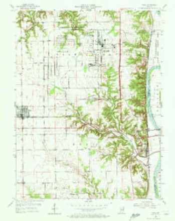
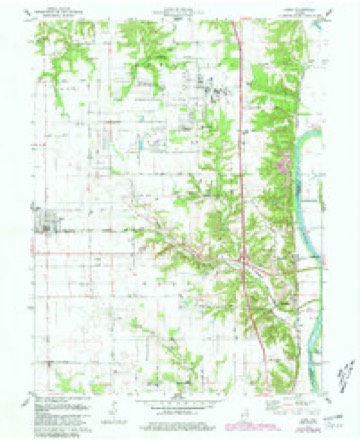
16 topographic sheets cover this place, the earliest surveyed in 1953 and the latest in 1986. It stands in Helt Township. It lies in ZIP code area 47854. It stands on Little Raccoon Creek. The Survey maps it on the Dana quadrangle. It stands 620 feet above sea level.
Topographic sheets covering this place
7 surveys from 16 printed sheetsMatched by testing this settlement's coordinate against the published boundary of every sheet in the United States Geological Survey's historical collection. Each opens the scanned sheet at the Survey.
- 1953 USGS Indianapolis quadrangle1:250000, 4 printings
- 1955 USGS Dana quadrangle1:24000, 2 printings
- 1956 USGS Indianapolis quadrangle1:250000
- 1957 USGS Indianapolis quadrangle1:250000, 2 printings
- 1962 USGS Indianapolis quadrangle1:250000
- 1978 USGS Dana quadrangle1:24000, 4 printings
- 1986 USGS Paris quadrangle1:100000, 2 printings




In the county-history sources
4,817 words on this townshipHistory of Parke and Vermillion Counties, Indiana : with Historical Sketches of Representative Citizens and Genealogical Records of Many of the Old Families, published 1913 names this settlement in its chapter on Helt Township. These are the passages that mention it, exactly as the scans read.
The first fox hunt of which there now seems to be any record in Vermillion county was that held March 31, 1883, when the citizens placed themselves, according to a pre-arranged plan, in a kind of a circle around a large section of territory, mostly in Helt township. At 9:30 in the forenoon they started forward. All the marshals exercised due diligence to keep the men in proper shape, none of whom were allowed to be intoxicated or to carry a gun or have a dog with them. The east and north divisions, ha\ing to travel over a very broken, hilly section of countr}-, and some of the men also disobeying orders, permitted eight fine foxes to escape. At eleven-thirty o'clock men and boys could be seen in every direction, about eight hundred strong, approaching the center, and it was also observed at this moment tliat three red foxes were surrounded. Forming into a ring about forty yards in diameter on the meadow near the Ciinley school house, three of the most active young men entered the ring to capture the game by their unassisted hands. One fox, which was crippled in trying to pass out, was soon caught; liut the other two were chased for some time, when finalh' one of them broke the line where some women were standing and got away. The remaining one, after being chased for some time by different ones, was finally caught by one Fred Ford. William Darnell was called for; who at auction sold the two foxes to the highest bidder, Richard Wimsett. of Opedee. Every person present greatly enjoyed the day's sport. Having seen wliere they erred in letting so many foxes away, they concluded March T5th, the next ^ear, to tiT it again, on a larger scale, but failed tn ca])ture a single fdx, and made llelt township has an area of se\-ent_\'-two square miles, twehe n ore than any township in \'ermillion county. In 1880 its population was 3,027 and its ])ersonal pmperty was valued at $1,411,745. In 1910 its population was 3,543. including Dana with 748 population. The assessed value of all ])ersonal and real estate property within the township in 1911 was. according to the county records, $3,202,720, and Dana with $486,395.
Passage source: History of Parke and Vermillion Counties, Indiana : with Historical Sketches of Representative Citizens and Genealogical Records of Many of the Old Families, published 1913.
Machine-read from a century-old scan, so expect the errors a machine makes: misspelled names, dropped words, stray characters.
Read the whole chapter on Helt Township - it names this place 2 more 2 times.
Mines and quarries near this place
6 within 5 milesRegional context, not property-specific evidence. The federal mineral resources record lists 6 workings within 5 miles of Hillsdale: 3 producers, 2 past producers, 1 plant. 4 still produce. What was taken out: Sand and Gravel, Construction, Clay, Stone, Clay. Distance is straight-line from the map coordinates, so a quarry counted here may appear on a neighbouring settlement's page as well.
| Where | Site | Commodity | Status | Recorded |
|---|---|---|---|---|
| Dee Clay Pit | Stone, Clay | Producer | ||
| Dana Clay Pit | Clay | Past Producer | ||
| Montezuma Shale Plant | Clay | Plant | ||
| Montezuma Gravel | Sand and Gravel, Construction | Producer | ||
| Parke County Pit | Sand and Gravel, Construction | Past Producer | ||
| W.C. Hargis Pit | Sand and Gravel, Construction | Producer |
Storms near this place
8 since 2001Regional context, not property-specific evidence. The National Weather Service names Hillsdale in 8 storm reports between 2001 and 2012: 4 flood, 3 thunderstorm wind, 1 hail. No death or injury is recorded in these reports. Each account below is quoted exactly as the forecast office filed it, from the NOAA Storm Events Database, and each date opens the federal record of that event.
| When | Event | Place named | Harm | What the report says |
|---|---|---|---|---|
| February 2007 | Flood | Hillsdale | $10,000 | The Wabash River flooded in Vermillion County. The river remained in flood into March. Crests were over 7 feet above flood stage. |
| January 2007 | Flood | Hillsdale | $10,000 | The Wabash River in Vermillion County remained above flood stage through most of January. Crests were as high as 12 feet above flood stage. |
| March 2007 | Flood | Hillsdale | $10,000 | The Wabash River in Vermillion County remained above flood stage from February through all of March. Crests were 10 feet above flood stage. |
| June 2012 | Thunderstorm Wind | Hillsdale | $4,000 | Trees were reported down in Hillsdale due to damaging outflow winds from a thunderstorm. Time was estimated by radar. |
| November 2007 | Flood | Hillsdale | $1,000 | Heavy rain caused lowland flooding along the Wabash River in Vermillion County. |
| June 2008 | Thunderstorm Wind | Hillsdale | - | Trees were down due to damaging thunderstorm winds. |
| June 2008 | Thunderstorm Wind | Hillsdale | - | Trees were knocked down due to damaging thunderstorm winds. |
| May 2001 | Hail | Hillsdale | - | no account filed |
Nearest settlements
The eight closest, with where each one stands in the county. Distances are straight-line, computed from the Geographic Names Information System coordinates.
| Map | Place | Distance | Sheets |
|---|---|---|---|
| Montezuma Station | 0.7 miles | 16 | |
| Highland | 0.7 miles | 16 | |
| Alta | 1.0 miles | 16 | |
| Early Station | 1.6 miles | 16 | |
| Summit Grove | 4.2 miles | 14 | |
| Toronto | 5.6 miles | 16 | |
| Dana | 5.8 miles | 16 | |
| Bono | 5.8 miles | 16 |
Elsewhere
Matched on this settlement's Geographic Names Information System number rather than its name, so it cannot be a different place of the same name in another state.
| Wikipedia article on Hillsdale | An encyclopaedic summary. Its text is share-alike, so it is linked here rather than copied. |
| Wikidata item Q5763747 | The structured record the population and elevation above come from. Public domain (CC0). |
Provenance
This settlement is recorded in the Geographic Names Information System as feature 436218. The sheet list is computed by point-in-boundary test against the United States Geological Survey's historical topographic inventory. Both are works of the United States government and carry no copyright under 17 U.S.C. 105.
Mines and quarries. USGS Mineral Resources Data System (MRDS) https://mrdata.usgs.gov/mrds/ A work of the United States government, no copyright under 17 U.S.C. 105.
Storms. NOAA National Centers for Environmental Information, Storm Events Database https://www.ncei.noaa.gov/stormevents/ A work of the United States government, no copyright under 17 U.S.C. 105. Narratives are quoted verbatim from the National Weather Service report and are not edited or summarised.