 Block
Dana, Indiana
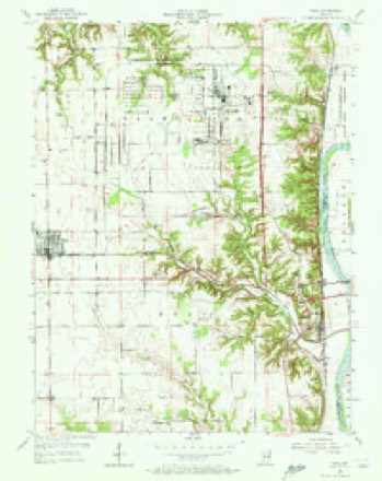
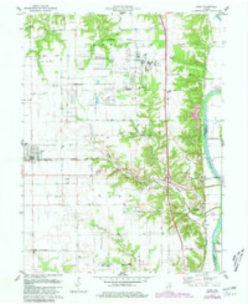
16 topographic sheets cover this place, the earliest surveyed in 1953 and the latest in 1986. It stands in Helt Township. It lies in ZIP code area 47847. The Survey maps it on the Dana quadrangle. 555 people lived here at the 2020 count. It stands 640 feet above sea level.
On record in Dana
Buildings and businesses the archive holds for this place. Each opens its own page, with the source record it came from.
On the National Register 2 records
 Possom Bottom Covered Bridgelisted 1994
- Elder-Pyle Houselisted 2021
Population over time
2 figuresDana fell from 608 to 555 between 2010 and 2020. These are the recorded population figures Wikidata holds for this place, reached through the Geographic Names Information System number this page is keyed on rather than by name, so they belong to this place and not to another of the same name. Most are census counts, but not all are: an early figure may be a founding or settlement estimate, and an estimate published within five years of a census is left out. The change column is computed, and is left blank where more than 20 years separate a figure from the one before it, because a gap that long is not a change between two counts.
| Year | People | Change |
|---|---|---|
| 2010 | 608 | |
| 2020 | 555 | -53 (-9%) |
Topographic sheets covering this place
7 surveys from 16 printed sheetsMatched by testing this settlement's coordinate against the published boundary of every sheet in the United States Geological Survey's historical collection. Each opens the scanned sheet at the Survey.
- 1953 USGS Indianapolis quadrangle1:250000, 4 printings
- 1955 USGS Dana quadrangle1:24000, 2 printings
- 1956 USGS Indianapolis quadrangle1:250000
- 1957 USGS Indianapolis quadrangle1:250000, 2 printings
- 1962 USGS Indianapolis quadrangle1:250000
- 1978 USGS Dana quadrangle1:24000, 4 printings
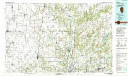
- 1986 USGS Paris quadrangle1:100000, 2 printings




In the county-history sources
4,817 words on this townshipBiographical and Historical Record of Vermillion County, Indiana : Containing Portraits of All the Presidents of the United States from Washington to Cleveland, with Accompanying Biographies of Each; a Condensed History of the State of Indiana; Portraits and Biographies of Some of the Prominent Men of the State; Engravings of Prominent Citizens in Vermillion County, with Personal Histories of Many of the Leading Families, and a Concise History of the County and Its Villages, published 1888 names this settlement in its chapter on Helt Township. These are the passages that mention it, exactly as the scans read.
Methodism in Helt Township has of course existed from the earliest pioneer period, and has always been strong and influential. The Methodist class in Dana was organized in 1879 by Rev. Daniel Morrison, of the Greencastle District, Northwest Indiana Conference. The pastors since liis time have been Revs. Elijah Johnson, J. C. McDaniels, Mr. Woods and William Smith, the present incumbent, wlio lives west of Terre Haute, although there is a parsonage at Ilelt's Prairie. There were about forty members at the time of organization, led by J. O. Rogers. Tlie present membership is about sixty, and the class-leaders, J. O. Rogers and Andrew Carmack. Sunday-school is maintained throughout tlic year, with an attendance of sixty to 100, superintended by J. O. Rogers. The liouse of worship, 30 x 50 feet, was erected in 1882, at a cost, including grounds, of $1,800.
The Toronto Presbyterian Church, at Bono, was organized many years ago, but the members are now changing their places of meeting to Dana, wlu^-e they have just completed one of the most beautiful frame church edifices in the nation. Its size is 32 x 54 feet, besides a "rostrum" 8x14 feet; its style is of course modern and of fancy finish, and the cost about |l2,800, not counting the pews and other funiture. It was dedicated June 26, 1887, by Rev. T. D. Fyfle, of Eoseville Indiana. The location is in the northern part of the village, in Samuel Aikman's addition. The leading men in building this church were "W. M. Taylor, Samuel Aikman and Samuel Hall.
Dana Baptist Church was organized in 1880, with twelve members, by Rev. G. T. Willis, of Hoopeston, Illinois. Pastors, Revs. Willis, Cartwright, of Fountain County, Indiana, William McMasters of Montezuma, Palmer, of Waveland, and Mr. Franklin. At present there is a vacancy. The membership numbers twenty. Charles Thompson has been deacon from the time of organization, and G. H. Fisher, at the first clerk, is now also deacon, Elizabeth Thomas Meyer, clerk. The church, a fancy brick structure, in the northern part of the village, is 36 x 60 feet in dimensions, and was erected this year (18S7) at a cost of about $2,500, not counting the pews.
Machine-read from a century-old scan, so expect the errors a machine makes: misspelled names, dropped words, stray characters.
Read the whole chapter on Helt Township - it names this place 9 more 9 times.
Storms near this place
21 since 1996Regional context, not property-specific evidence. The National Weather Service names Dana in 21 storm reports between 1996 and 2020: 7 thunderstorm wind, 7 hail, 4 flash flood, 2 tornado. No death or injury is recorded in these reports. Each account below is quoted exactly as the forecast office filed it, from the NOAA Storm Events Database, and each date opens the federal record of that event.
| When | Event | Place named | Harm | What the report says |
|---|---|---|---|---|
| April 1998 | Tornado (F0) | Dana | $25,000 | Small weak tornado touched down briefly and destroyed a pole barn. |
| June 2008 | Flash Flood | West Dana | $10,000 | Highway 71 in and around Dana flooded due to heavy rainfall and was under two to three feet of water. In addition to Dana area flooding there were numerous streets in Clinton flooded by Feather Creek overflowing its banks. Some evacuations were reported in Clinton. |
| May 1998 | Tornado (F0) | Dana | $10,000 | Tornado damagedseveral storage buildings and blew down numerous trees. |
| May 2014 | Thunderstorm Wind | Dana | $8,000 | Trees were reported down in this location due to damaging thunderstorm wind gusts. Some minor street flooding was also noted. |
| July 2020 | Thunderstorm Wind | Dana | $5,000 | Several trees and power lines downed due to thunderstorm wind gusts across the central and southern portions of the county with no specific locations noted. |
| June 2008 | Flash Flood | Dana | $2,000 | Flash flooding was occurring due to heavy rain. Water was going over State Road 71 through Dana as well as County Road 450 South on the east side of Dana. |
| June 2008 | Flash Flood | Dana | $2,000 | County Road 500 South was washed out due to flash flooding caused by heavy rain. |
| April 2006 | Thunderstorm Wind | Dana | $1,000 | Power lines were downed. |
| May 1996 | Thunderstorm Wind | Dana | $1,000 | no account filed |
| June 2009 | Flood | Dana | $750 | Flooding was observed in numerous locations on State Road 71 through Dana due to thunderstorm heavy rainfall. Water was reported to be over one foot deep in spots. |
| June 2009 | Thunderstorm Wind | Dana | $750 | Tree limbs were downed due to thunderstorm wind gusts. |
| June 2013 | Hail | Dana | $250 | Some tree limbs were reported down as well. This report was received via Twitter. |
| February 2009 | Thunderstorm Wind | Dana | - | Power outages were reported in Clinton and Dana. |
| June 2002 | Hail | Dana | - | Golfball size hail reported. |
| May 2000 | Hail | Dana | - | Penny size hail reported by law enforcement. |
| July 2008 | Hail | Dana | - | no account filed |
| April 2007 | Hail | Dana | - | no account filed |
| May 2004 | Flash Flood | Dana | - | no account filed |
| April 2003 | Hail | Dana | - | no account filed |
| December 1998 | Thunderstorm Wind | Dana | - | no account filed |
| May 1998 | Hail | Dana | - | no account filed |
Nearest settlements
The eight closest, with where each one stands in the county. Distances are straight-line, computed from the Geographic Names Information System coordinates.
Elsewhere
Matched on this settlement's Geographic Names Information System number rather than its name, so it cannot be a different place of the same name in another state.
| Wikipedia article on Dana | An encyclopaedic summary. Its text is share-alike, so it is linked here rather than copied. |
| Wikidata item Q389733 | The structured record the population and elevation above come from. Public domain (CC0). |
Provenance
This settlement is recorded in the Geographic Names Information System as feature 433305. The sheet list is computed by point-in-boundary test against the United States Geological Survey's historical topographic inventory. Both are works of the United States government and carry no copyright under 17 U.S.C. 105.
Storms. NOAA National Centers for Environmental Information, Storm Events Database https://www.ncei.noaa.gov/stormevents/ A work of the United States government, no copyright under 17 U.S.C. 105. Narratives are quoted verbatim from the National Weather Service report and are not edited or summarised.