 Block
Ireland, Indiana
15 topographic sheets cover this place, the earliest surveyed in 1946 and the latest in 1994. It stands in Madison Township. It lies in ZIP code area 47546. It stands on Ire Run. The Survey maps it on the Jasper quadrangle. It stands 469 feet above sea level.
On record in Ireland
Buildings and businesses the archive holds for this place. Each opens its own page, with the source record it came from.
On the National Register 1 record
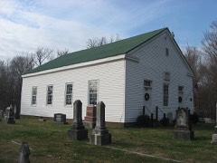 Shiloh Meeting House and Cemeterylisted 1982
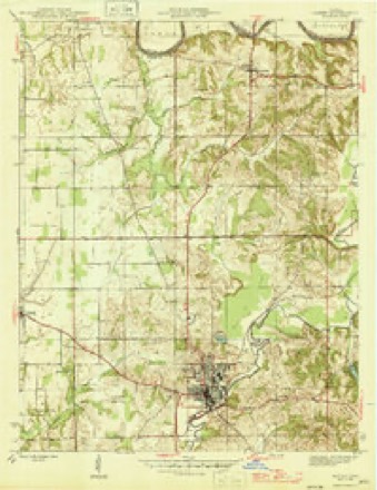
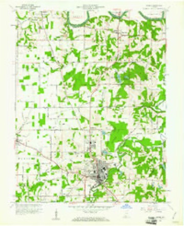
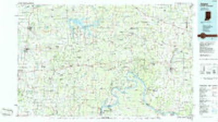
Topographic sheets covering this place
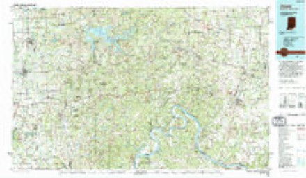
7 surveys from 15 printed sheetsMatched by testing this settlement's coordinate against the published boundary of every sheet in the United States Geological Survey's historical collection. Each opens the scanned sheet at the Survey.
- 1946 USGS Jasper quadrangle1:24000, 2 printings
- 1956 USGS Vincennes quadrangle1:250000, 4 printings
- 1957 USGS Vincennes quadrangle1:250000
- 1958 USGS Vincennes quadrangle1:250000, 2 printings
- 1960 USGS Jasper quadrangle1:24000, 4 printings
- 1986 USGS Jasper quadrangle1:100000
- 1994 USGS Jasper quadrangle1:100000



In the county-history sources
619 words on this townshipHistory of Dubois County from Its Primitive Days to 1910, published 1910 names this settlement in its chapter on Madison Township. These are the passages that mention it, exactly as the scans read.
Ireland. This town is situated four miles northwest of Jasper. It was once intended to be called American City, and its settlers were proud of its proposed name. The name "American City" was not approved by the post office department, so the name Ireland was retained in honor of the nativit}' of John Stewart, who bought the land of the United States, on December 23, 1S16, a short time after Indiana became a state. John Stewart died in the autumn of 1842. His son, James G. and four others laid out the town. The map bears date of May 20, 1S65, but the place was a small village many 3'ears before that. Ireland has parochial, common, and high schools, three churches, and many lodges. The Masons and the Odd Fellows own more improved real estate at Ireland than at any other point in Dubois county. James G. Stewart, one of the founders of Ireland, was born October 4, 1814, and died November 12, 1S74. [Page 129.] The first house erected in Ireland was built by Henry Green. It stood on the line between sections nineteen and twenty, on the Jasper and Petersburg road. It was built about 1842, and is yet in use. The second house was erected in 1852 by Dr. E. A. Glezen. A steam flour mill was erected in 1855 by John Cooper. This had much to do toward the future progress of Ireland. The mill was lost by fire in September, 1882. A new one was erected. Ephraini Woods is reported as first merchant at Ireland. Alsephus McGinnis and Harvey Green were also merchants in the early history of this place. Others were Taylor, Dillon, Fleming, Armstrong, and Hardin. Later, Stewart, Thomas, Hobbs, Wilson, Dillon, Fowler, Kahn, and Calvin were merchants. The doctors or druggists were Kean, Kelso, Blackburn, Strain, Parr, Glezen, Harrison, Freeland, and McCown.
Passage source: History of Dubois County from Its Primitive Days to 1910, published 1910.
Samuel Postlethwait secured the establishment of the first post office in Madison township on February 12, 1851. It was called "Alder Creek Postoffice," and was located about one mile west of Ireland. It was discontinued October 27. 1852. On July 26, 1853, the office went to Ireland and Ephraim Woods became postmaster.
Passage source: History of Dubois County from Its Primitive Days to 1910, published 1910.
Machine-read from a century-old scan, so expect the errors a machine makes: misspelled names, dropped words, stray characters.
Read the whole chapter on Madison Township - it names this place 1 more 1 time.
Mines and quarries near this place
1 within 5 milesRegional context, not property-specific evidence. The federal mineral resources record lists 1 working within 5 miles of Ireland: 1 producer. All of them still produce. What was taken out: Stone. Distance is straight-line from the map coordinates, so a quarry counted here may appear on a neighbouring settlement's page as well.
| Where | Site | Commodity | Status | Recorded |
|---|---|---|---|---|
| Dubois County Highway Dept. | Stone | Producer |
Storms near this place
54 since 1999Regional context, not property-specific evidence. The National Weather Service names Ireland in 54 storm reports between 1999 and 2026: 26 thunderstorm wind, 16 hail, 6 flash flood, 4 flood. No death or injury is recorded in these reports. Each account below is quoted exactly as the forecast office filed it, from the NOAA Storm Events Database, and each date opens the federal record of that event.
| When | Event | Place named | Harm | What the report says |
|---|---|---|---|---|
| March 2017 | Tornado (EF2) | Ireland | $350,000 | The National Weather Service, in conjunction with Dubois County Emergency Management, conducted a damage survey just hours after an overnight tornado touched down in the northwest corner of the county. The EF-2 tornado, with maximum wind speeds of 130 mph, touched down 4.1 miles WSW of Ireland, Indiana. It first destroyed a large pole barn, then moved on to damage several homes near the intersection of county roads 150 North and 875 West. ||After damaging several outbuildings, it traveled a mile northeast where it heavily damaged two brick ranch homes on county roads 200 North and 750 West, taking off their roofs and collapsing an outer wall on one. An elderly woman in one of the homes was uninjured despite the roof of her home being torn off and an exterior wall collapsing 15 feet from her. She had been sitting under the only part of the home where the ceiling remained intact after the roof blew away. ||The tornado continued skipping east-northeast over primarily open farmland, but gave a glancing blow to the north side of Ireland, where it damaged the roofs of several homes and destroyed a block garage. After skipping over an additional mile of farmland, the twister destroyed a silo and damaged an outbuilding on county road 300 North then snapping several pine trees along a lane before lifting. The maximum path width was 150 yards and it was on the ground for 5 to 6 minutes. |
| April 2026 | Thunderstorm Wind | Ireland | - | A tree was down blocking one lane of West Stewart Road. |
| March 2025 | Thunderstorm Wind | Ireland | - | There was a tree down on power lines along State Road 56, west of Jasper. |
| March 2025 | Thunderstorm Wind | Ireland | - | Several trees and power lines were down between Jasper and Ireland. |
| March 2025 | Thunderstorm Wind | Ireland | - | Power lines were down at the intersection of 350 West and West Schuetter Road. |
| March 2025 | Thunderstorm Wind | Ireland | - | A large pine tree fell near Stewart Road, west of Jasper. |
| March 2025 | Thunderstorm Wind | Ireland | - | A barn was destroyed, and a nearby home was damaged by flying debris. |
| March 2025 | Thunderstorm Wind | Ireland | - | A shed roof was blocking the roadway on 350 West, west of Jasper. |
| March 2024 | Thunderstorm Wind | Ireland | - | A tree fell and blocked State Road 56 and 750 West. |
| July 2024 | Flash Flood | Ireland | - | Flooding was observed along Indiana State Road 56 in the Ireland area. |
| July 2024 | Thunderstorm Wind | Ireland | - | Trees and power lines were brought down by strong winds between Jasper and Ireland. |
| January 2023 | Hail | Ireland | - | Quarter size hail reported in Ireland in northwest Dubois County. |
| May 2022 | Thunderstorm Wind | Ireland | - | Power lines were down at the intersection of State Road 56 and County Road 600 West in northwest Dubois County. |
| March 2022 | Thunderstorm Wind | Ireland | - | A tree was in the roadway at State Road 56 and 500 West. |
| March 2019 | Hail | Ireland | - | Hail was reported in Ireland, Indiana. |
| February 2019 | Flood | Ireland | - | There was a road closed on the west side of Jasper due to flooding. |
| May 2019 | Flash Flood | Ireland | - | Deputies reported water was over State Road 56 west of Jasper near Ireland. |
| June 2018 | Flash Flood | Ireland | - | A lane of State Road 56 was closed due to high water. |
| June 2018 | Flash Flood | Ireland | - | Water was reported flowing out of ditches at the intersection of county road 100 south and 350 west. Flooding also occurred at 400 west just west of Jasper. |
| April 2015 | Flood | Ireland | - | State officials reported that several roads were closed due to high water flowing over them. Between 1 and 3 inches of rain fell on top of very saturated ground. |
| June 2013 | Thunderstorm Wind | Ireland | - | The Dubois County emergency manager reported numerous trees down in Jasper. |
| May 2012 | Thunderstorm Wind | Ireland | - | A trained spotter estimated 60 mph winds just to the west of Jasper. |
| January 2012 | Thunderstorm Wind | Ireland | - | The county's emergency manager relayed an estimated 60 mph wind gust from a spotter. |
| March 2012 | Hail | Ireland | - | This one inch hail came from a second supercell that tracked over Dubois County. |
| February 2011 | Thunderstorm Wind | Ireland | - | A trained spotter reported a measured wind gust of 64 mph. |
| April 2011 | Tornado (EF1) | Ireland | - | An NWS storm survey confirmed an EF-1 tornado with wind speed estimated at 100-105 mph north of Ireland. A well-constructed 75-foot tall grain silo had the top 40 feet sheared off. A 40ft x 50ft outbuilding in the vicinity of the silo was destroyed, its siding thrown 500 yards downwind. In addition to the tornado, straight-line wind damage was observed. Two hog buildings were destroyed and a grain silo was shifted on its foundation. |
| June 2011 | Thunderstorm Wind | Ireland | - | A tree was downed due to thunderstorm winds in Ireland. |
| May 2011 | Flash Flood | Ireland | - | State Hwy. 56 west of Jasper was partially submerges. Two other county roads were covered with water as well. At the time of the report Huntingburg had received around 2 inches of rain over the previous 3 hours. |
| May 2010 | Thunderstorm Wind | Ireland | - | One tree was reported down in Ireland in northwest Dubois county. |
| October 2010 | Thunderstorm Wind | Ireland | - | A spotter in DuBois county measured a wind gust of 64 mph. |
| June 2010 | Thunderstorm Wind | Ireland | - | Tiles were blown off the roof of a residence. |
| July 2010 | Thunderstorm Wind | Ireland | - | A trained spotter reported estimated wind gusts of 60 mph. |
| October 2009 | Flash Flood | Ireland | - | Numerous roads across the county were flooded and impassable. |
| April 2008 | Flood | Ireland | - | Numerous roads in the county were closed due to high water. |
| March 2008 | Flood | Ireland | - | Numerous roads across the county remained closed due to high water. |
| January 2008 | Thunderstorm Wind | Ireland | - | Thunderstorm winds downed trees on several roads. |
| May 2006 | Thunderstorm Wind | Ireland | - | Tree limbs were blown down. The spotter estimated a 60 mph gust. |
| May 2006 | Thunderstorm Wind | Ireland | - | Trees were downed. |
| July 2004 | Thunderstorm Wind | Ireland | - | A 10 inch diameter tree was downed. |
| April 2002 | Hail | Ireland | - | Hail covered the ground. |
| November 2002 | Thunderstorm Wind | Ireland | - | Thunderstorm gusts blew down six inch diameter trees. |
| April 1999 | Hail | Ireland | - | Dime size hail |
| April 2011 | Hail | Ireland | - | no account filed |
| May 2011 | Hail | Ireland | - | no account filed |
| May 2010 | Hail | Ireland | - | no account filed |
| April 2006 | Hail | Ireland | - | no account filed |
| April 2006 | Thunderstorm Wind | Ireland | - | no account filed |
| June 2006 | Hail | Ireland | - | no account filed |
| May 2006 | Hail | Ireland | - | no account filed |
| May 2006 | Hail | Ireland | - | no account filed |
| May 2003 | Hail | Ireland | - | no account filed |
| February 2002 | Hail | Ireland | - | no account filed |
| April 2002 | Hail | Ireland | - | no account filed |
| May 2002 | Hail | Ireland | - | no account filed |
Nearest settlements
The eight closest, with where each one stands in the county. Distances are straight-line, computed from the Geographic Names Information System coordinates.
| Map | Place | Distance | Sheets |
|---|---|---|---|
| Jasper | 4.0 miles | 15 | |
| Millersport | 5.7 miles | 16 | |
| Portersville | 6.0 miles | 15 | |
| Duff | 6.2 miles | 16 | |
| Haysville | 6.6 miles | 15 | |
| Maltersville | 7.5 miles | 14 | |
| Huntingburg | 8.3 miles | 14 | |
| Kellerville | 10.0 miles | 13 |
Elsewhere
Matched on this settlement's Geographic Names Information System number rather than its name, so it cannot be a different place of the same name in another state.
| Wikipedia article on Ireland | An encyclopaedic summary. Its text is share-alike, so it is linked here rather than copied. |
| Wikidata item Q14688494 | The structured record the population and elevation above come from. Public domain (CC0). |
Provenance
This settlement is recorded in the Geographic Names Information System as feature 436827. The sheet list is computed by point-in-boundary test against the United States Geological Survey's historical topographic inventory. Both are works of the United States government and carry no copyright under 17 U.S.C. 105.
Mines and quarries. USGS Mineral Resources Data System (MRDS) https://mrdata.usgs.gov/mrds/ A work of the United States government, no copyright under 17 U.S.C. 105.
Storms. NOAA National Centers for Environmental Information, Storm Events Database https://www.ncei.noaa.gov/stormevents/ A work of the United States government, no copyright under 17 U.S.C. 105. Narratives are quoted verbatim from the National Weather Service report and are not edited or summarised.