 Block
Jasper, Indiana
15 topographic sheets cover this place, the earliest surveyed in 1946 and the latest in 1994. It stands in Bainbridge Township. It lies in ZIP code area 47546. It stands on Pat Run. The Survey maps it on the Jasper quadrangle. 16,703 people lived here at the 2020 count. It stands 466 feet above sea level.
Research this city
On record in Jasper
Buildings and businesses the archive holds for this place. Each opens its own page, with the source record it came from.
On the National Register 8 records
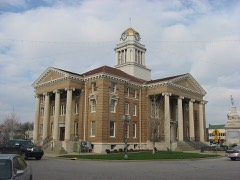 Dubois County Courthouselisted 1996
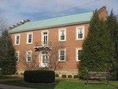 Gramelspacher-Gutzweiler Houselisted 1983
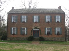 John Opel Houselisted 1984
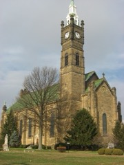 St. Joseph Catholic Churchlisted 1980
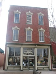 Louis H. Sturm Hardware Storelisted 2003
- Indiana Desk Companylisted 2025
- Jasper Downtown Historic Districtlisted 2017
- Jasper High School Gymnasiumlisted 2025
Population over time
2 figuresJasper grew from 15,038 to 16,703 between 2010 and 2020. These are the recorded population figures Wikidata holds for this place, reached through the Geographic Names Information System number this page is keyed on rather than by name, so they belong to this place and not to another of the same name. Most are census counts, but not all are: an early figure may be a founding or settlement estimate, and an estimate published within five years of a census is left out. The change column is computed, and is left blank where more than 20 years separate a figure from the one before it, because a gap that long is not a change between two counts.
| Year | People | Change |
|---|---|---|
| 2010 | 15,038 | |
| 2020 | 16,703 | +1,665 (+11%) |
Topographic sheets covering this place
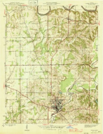
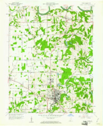
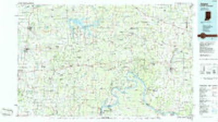
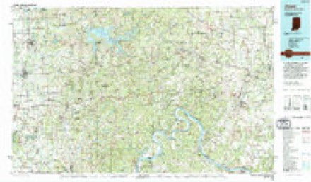
7 surveys from 15 printed sheetsMatched by testing this settlement's coordinate against the published boundary of every sheet in the United States Geological Survey's historical collection. Each opens the scanned sheet at the Survey.
- 1946 USGS Jasper quadrangle1:24000, 2 printings
- 1956 USGS Vincennes quadrangle1:250000, 4 printings
- 1957 USGS Vincennes quadrangle1:250000
- 1958 USGS Vincennes quadrangle1:250000, 2 printings
- 1960 USGS Jasper quadrangle1:24000, 4 printings
- 1986 USGS Jasper quadrangle1:100000
- 1994 USGS Jasper quadrangle1:100000



In the county-history sources
1,079 words on this townshipHistory of Dubois County from Its Primitive Days to 1910, published 1910 names this settlement in its chapter on Bainbridge Township. These are the passages that mention it, exactly as the scans read.
Bainbridge township is one of the original five townships of Dubois county. In 1850, its population was given at 1,700, with 340 voters. The township was much larger in 1850, than at present. I^ainbridge township contains thirty-five square miles, and, including the town of Jasper is estimated to be worth $1,750,000.
Passage source: History of Dubois County from Its Primitive Days to 1910, published 1910.
Jasper was incorporated as a town, in March, 1866, with a population of 507. The death rate at Jasper is exceedingly low, though Patoka river, at Jasper, is only 450 feet above the sea. It is 123 feet below Lake Erie. The town has many manufacturing establishments, two banks, many fine residences, three churches, water works, electric lights, a college, an academy, commissioned high schools, improved streets, and two good weekly papers. In 187 1. 1891, and 1908 the present high school building was erected.
Passage source: History of Dubois County from Its Primitive Days to 1910, published 1910.
The Indiana Gazetteer of 1850, in speaking of Jasper, says: "It was first settled in 1830, by Dr. McCrillus, Col. Morgan, B. B. EdmOnston. Z. Dillon, and J. McDonald. It has five stores, three groceries, two ware-houses, one brewery, one distiller}^ and a population of 532. Jasper is situated on the Patoka river one hundred twenty miles southwest of Indianapolis, fifty northeast of Evansville. and forty-four southeast of Vincennes."
Passage source: History of Dubois County from Its Primitive Days to 1910, published 1910.
Machine-read from a century-old scan, so expect the errors a machine makes: misspelled names, dropped words, stray characters.
Read the whole chapter on Bainbridge Township - it names this place 7 more 7 times.
Mines and quarries near this place
3 within 5 milesRegional context, not property-specific evidence. The federal mineral resources record lists 3 workings within 5 miles of Jasper: 2 past producers, 1 producer. 1 still produces. What was taken out: Stone, Clay, Aluminum, Silica, Water, Free, Iron. Distance is straight-line from the map coordinates, so a quarry counted here may appear on a neighbouring settlement's page as well.
| Where | Site | Commodity | Status | Recorded |
|---|---|---|---|---|
| Coal I Underclays | Clay | Past Producer | ||
| Coal I Underclays | Aluminum, Silica, Water, Free, Iron | Past Producer | ||
| Dubois County Highway Dept. | Stone | Producer |
Storms near this place
60 of 87 shownRegional context, not property-specific evidence. The National Weather Service names Jasper in 87 storm reports between 1996 and 2025: 52 thunderstorm wind, 21 hail, 10 flash flood, 2 lightning. No death or injury is recorded in these reports. Each account below is quoted exactly as the forecast office filed it, from the NOAA Storm Events Database, and each date opens the federal record of that event.
| When | Event | Place named | Harm | What the report says |
|---|---|---|---|---|
| August 2019 | Thunderstorm Wind | Jasper | $20,000 | Dubois County Emergency Management reported a tree down at 15th and Leopold in Jasper. He also reported a transformer on fire at 9th and McArthur. |
| October 2019 | Thunderstorm Wind | Jasper | $15,000 | A tree was down across power lines near Jasper-Dubois Road and State Road 164. |
| June 2014 | Thunderstorm Wind | Jasper | $10,000 | The Dubois County emergency manager surveyed the Jasper Middle School, which had a fiberglass panel removed from the side of its gymnasium. One mile south, construction material was blown off the roof of the Jasper High School. In the neighborhood, a dumpster was blown over and several trees were downed. |
| July 2000 | Lightning | Jasper | $10,000 | A lightning strike started a fire that damaged a home. |
| May 2003 | Thunderstorm Wind | Jasper | $10,000 | no account filed |
| June 1998 | Thunderstorm Wind | Jasper | $10,000 | no account filed |
| June 2004 | Lightning | Jasper | $3,500 | A lightning strike at the Jasper Water Treatment Plant damaged a control panel and a surge protector. The time of occurrence was estimated. |
| March 2025 | Thunderstorm Wind | Jasper | - | A tree was down blocking Schuetter Road. |
| June 2025 | Thunderstorm Wind | Jasper | - | Power poles were blown down at the intersection of Omega Drive and West Division Road. |
| June 2025 | Thunderstorm Wind | Jasper | - | Two trees were blown down in the roadway on Kellerville Road. |
| April 2025 | Thunderstorm Wind | Jasper | - | There was a tree on a power line completely blocking County Road 190 North, near Sultans Run. |
| July 2025 | Flash Flood | Jasper | - | Second Avenue in Jasper flooded. |
| July 2024 | Flash Flood | Jasper | - | A vehicle was partially submerged in flood waters in Jasper. |
| July 2024 | Flash Flood | Jasper | - | The intersection of St Charles Street and Schuetter Road was submerged in water. |
| July 2024 | Flash Flood | Jasper | - | A vehicle was submerged in water at the intersection of 16th Street and Mill Street in Jasper. |
| July 2024 | Flash Flood | Jasper | - | People were briefly trapped inside of buildings due to flood waters at Knoll Ridge apartments. |
| July 2024 | Heavy Rain | Jasper | - | A cluster of rain gauges in and around Jasper measured between 4 and 5 inches of rainfall in just over an hour. |
| April 2024 | Thunderstorm Wind | Jasper | - | There was a tree and power line on fire on the 2500 block of Portersville Road. |
| August 2023 | Thunderstorm Wind | Jasper | - | There was damage to street lights. |
| August 2023 | Thunderstorm Wind | Jasper | - | Trees fell on the roadway. |
| May 2022 | Thunderstorm Wind | Jasper | - | Power poles were down on 34th Street blocking the roadway. |
| July 2022 | Thunderstorm Wind | Jasper | - | A traffic light was knocked down along 30th Street and Newton Street. |
| June 2022 | Thunderstorm Wind | Jasper | - | Trees were down blocking the roadway. |
| June 2022 | Thunderstorm Wind | Jasper | - | Hoosier Hills Credit Union had roof damage. |
| April 2020 | Thunderstorm Wind | Jasper | - | Power lines were downed on 36th Street. |
| October 2020 | Thunderstorm Wind | Jasper | - | A 30 foot limb, 16 inches in diameter, was reported down by the parks department. It was blocking a road. |
| June 2019 | Flash Flood | Jasper | - | Flood prone roads were closed due to high water at multiple locations across the county. |
| June 2018 | Thunderstorm Wind | Jasper | - | The emergency manager reported a large tree down at Lechner Lane and 2nd Street in Jasper. |
| April 2017 | Flash Flood | Jasper | - | The Dubois Emergency Manager reported high water over the roadway at Saint Charles Street and 36th Street. |
| April 2017 | Flood | Jasper | - | Local law enforcement reported that Highway 164 closed due to flooding. |
| April 2016 | Thunderstorm Wind | Jasper | - | A Dubois County law enforcement official reported 2 trees down in Jasper due to severe thunderstorm winds. |
| June 2016 | Thunderstorm Wind | Jasper | - | The Dubois COunty emergency manager reported trees and power poles down. |
| June 2016 | Thunderstorm Wind | Jasper | - | The Dubois County emergency manager reported trees down blocking the road near the intersection of East County Road 300 North and North Kellerville Road. |
| May 2016 | Thunderstorm Wind | Jasper | - | Trained spotters reported numerous trees down in the city. |
| April 2015 | Thunderstorm Wind | Jasper | - | The Jasper Middle School mesonet weather observation measured a gust of 52 knots. |
| April 2015 | Thunderstorm Wind | Jasper | - | Emergency management reported trees down around the Jasper area. |
| December 2015 | Thunderstorm Wind | Jasper | - | A 51 knot wind gust was reported from the mesonet station located at Jasper Middle School. |
| April 2014 | Flash Flood | Jasper | - | A CoCoRahs observer reported numerous streets and intersections flooded across Jasper, especially along the Patoka River. |
| May 2012 | Thunderstorm Wind | Jasper | - | Dubois County Emergency Management reported that several trees were downed just to the southeast of Jasper. |
| July 2012 | Thunderstorm Wind | Jasper | - | A county official reported that power lines were downed in Jasper. |
| July 2012 | Thunderstorm Wind | Jasper | - | A tree fell in a backyard in Jasper. Local emergency management later relayed a report of several other trees down across northeastern Jasper. |
| April 2011 | Thunderstorm Wind | Jasper | - | The gust was measured at the Jasper Middle School. |
| April 2011 | Thunderstorm Wind | Jasper | - | Numerous trees and power lines were down across the city. |
| April 2011 | Thunderstorm Wind | Jasper | - | Overturned mobile homes were reported in the city of Jasper. |
| May 2011 | Thunderstorm Wind | Jasper | - | Trees were blown down in Jasper along with reported 60 mph winds. |
| July 2010 | Thunderstorm Wind | Jasper | - | Five trees 12 to 30 inches in diameter were snapped at the base in Jasper. |
| October 2010 | Thunderstorm Wind | Jasper | - | A tree was blown down and blocking IN 56 at St. Charles St. |
| June 2009 | Thunderstorm Wind | Jasper | - | Several out buildings were damaged and trees downed. |
| October 2007 | Hail | Jasper | - | Penny size hail covered the ground. |
| January 2006 | Hail | Jasper | - | One inch hail covered the ground. |
| July 2006 | Flash Flood | Jasper | - | A few creeks were out of their banks and flowing across roadways around Jasper. |
| June 2006 | Thunderstorm Wind | Jasper | - | Trees were downed. |
| August 2006 | Thunderstorm Wind | Jasper | - | A couple trees were downed. |
| July 2004 | Thunderstorm Wind | Jasper | - | An amateur radio operator estimated a 70 mph wind gust. |
| July 2004 | Thunderstorm Wind | Jasper | - | Numerous large tree limbs were blown down near Highway 45. |
| April 2003 | Thunderstorm Wind | Jasper | - | Trees were blown down. |
| July 2003 | Thunderstorm Wind | Jasper | - | Highway 56 was blocked by a fallen tree and another large tree limb. Pea size hail was also reported west of Jasper. |
| May 2000 | Thunderstorm Wind | Jasper | - | Power lines were downed in Huntingsburg. |
| February 1999 | Hail | Jasper | - | One inch hail fell in Jasper |
| May 1999 | Thunderstorm Wind | Jasper | - | Trees down |
Nearest settlements
The eight closest, with where each one stands in the county. Distances are straight-line, computed from the Geographic Names Information System coordinates.
| Map | Place | Distance | Sheets |
|---|---|---|---|
| Maltersville | 3.8 miles | 14 | |
| Ireland | 4.0 miles | 15 | |
| Huntingburg | 6.5 miles | 14 | |
| Haysville | 6.6 miles | 15 | |
| Duff | 6.7 miles | 16 | |
| Bretzville | 7.1 miles | 13 | |
| Millersport | 7.3 miles | 16 | |
| Saint Anthony | 7.7 miles | 13 |
Elsewhere
Matched on this settlement's Geographic Names Information System number rather than its name, so it cannot be a different place of the same name in another state.
| Wikipedia article on Jasper | An encyclopaedic summary. Its text is share-alike, so it is linked here rather than copied. |
| Wikidata item Q941441 | The structured record the population and elevation above come from. Public domain (CC0). |
Provenance
This settlement is recorded in the Geographic Names Information System as feature 436944. The sheet list is computed by point-in-boundary test against the United States Geological Survey's historical topographic inventory. Both are works of the United States government and carry no copyright under 17 U.S.C. 105.
Mines and quarries. USGS Mineral Resources Data System (MRDS) https://mrdata.usgs.gov/mrds/ A work of the United States government, no copyright under 17 U.S.C. 105.
Storms. NOAA National Centers for Environmental Information, Storm Events Database https://www.ncei.noaa.gov/stormevents/ A work of the United States government, no copyright under 17 U.S.C. 105. Narratives are quoted verbatim from the National Weather Service report and are not edited or summarised.