 Block
Larwill, Indiana
12 topographic sheets cover this place, the earliest surveyed in 1950 and the latest in 1994. It stands in Richland Township. It lies in ZIP code area 46764. The Survey maps it on the Pierceton quadrangle. 273 people lived here at the 2020 count. It stands 961 feet above sea level.
On record in Larwill
Buildings and businesses the archive holds for this place. Each opens its own page, with the source record it came from.
On the National Register 1 record
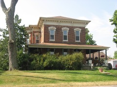 Dr. Christopher Souder Houselisted 2005
Population over time
2 figuresLarwill fell from 283 to 273 between 2010 and 2020. These are the recorded population figures Wikidata holds for this place, reached through the Geographic Names Information System number this page is keyed on rather than by name, so they belong to this place and not to another of the same name. Most are census counts, but not all are: an early figure may be a founding or settlement estimate, and an estimate published within five years of a census is left out. The change column is computed, and is left blank where more than 20 years separate a figure from the one before it, because a gap that long is not a change between two counts.
| Year | People | Change |
|---|---|---|
| 2010 | 283 | |
| 2020 | 273 | -10 (-4%) |
Topographic sheets covering this place
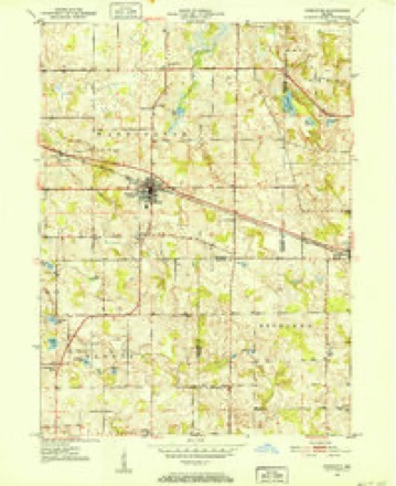
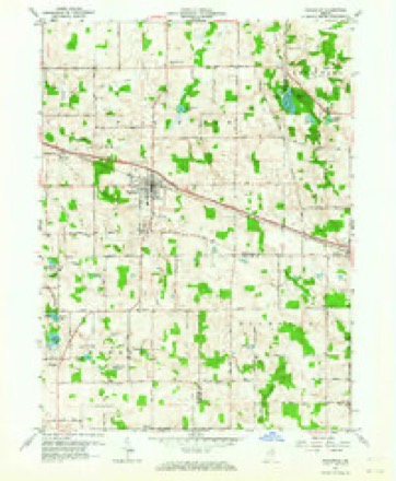
6 surveys from 12 printed sheetsMatched by testing this settlement's coordinate against the published boundary of every sheet in the United States Geological Survey's historical collection. Each opens the scanned sheet at the Survey.
- 1950 USGS Pierceton quadrangle1:24000, 2 printings
- 1953 USGS Fort Wayne quadrangle1:250000, 4 printings
- 1956 USGS Fort Wayne quadrangle1:250000, 2 printings
- 1962 USGS Pierceton quadrangle1:24000, 2 printings
- 1984 USGS Fort Wayne quadrangle1:100000
- 1994 USGS Fort Wayne quadrangle1:100000




In the county-history sources
22,916 words on this townshipHistory of Whitley County, Indiana, published 1907 names this settlement in its chapter on Richland Township. These are the passages that mention it, exactly as the scans read.
Previous to 1869 the voters of the old townships of Troy and Richland had to go to the central school house of each township to vote. On December 5. 1868, there was held a meeting in Larwill and a petition gutten up to be presented to the county commissioners, praying for a new township to be named Larwill township and formed of a two-mile strip off the south side of Troy township and a two-mile strip off the north side <if Richland township. This was on Saturday evening and by Monday evening the petition had been circulated ever the win ile territory, and on Tuesday, I think, the petition was presented to the commissioners. It seems the commissioners granted the re- quest, but in the meantime the voters in South Richland petitioned for a two-mile strip off of the south side of Richland township to be annexed to Cleveland township. This petition was granted and the Larwill proposition was reconsidered, which resulted in the two-mile strip off the south side of Troy township being annexed to Richland township and the remainder of Troy and Etna township forming one township. The date of these proceedings was about December n, 1868. Since this time Larwill has been the place of holding the elections. The township was divided into two precincts in 1884. since which time there have been two voting places, and usually both in Larwill. In 1905 and since there have been special elections held in each road district to select a road supervisor.
Passage source: History of Whitley County, Indiana, published 1907.
When Richland township was first settled ii was covered with a dense forest of beech, oak, sugar-maple, ash, walnut, poplar, elm, lind, hickory, wild-cherry, butternut and smaller varieties of timber. Therewere several swamps and a few small wet prairies. There are five or six small lakes within its borders. Spring creek, with itstwo branches in the eastern part and Cleark creek (sometimes called "Little Spring creek") in the western part carry off most of the surplus .water. The face of the country is somewhat hilly, but nearly all of it can be farmed. The make-up of the the soil is generally good as the name of the township implies, a good depth of soil underlaid with clay or gravelly subsoil. The lowlands for somepurposes are better than the highlands. The soil of these lowlands is underlaid in some places with clay and other places withmuck or peat to considerable depth, and' marl is found in a few places. There is plenty of gravel for road and building purposes. Some parts of the township are somewhat stony, especially the -western part. They are of the boulder variety, many of these stones have been used to good account for building purposes. A great deal of the lowland has been ditched and brought into cultivation. There are a good many springs, but since the country has been drained, the springs have grown weaker, and now most of the water for house use is obtained from wells, and for the past fifteen years, there has been man)' tubular wells put down, ranging from forty to two hundred feet deep, and in many places wind power pumps adorn the landscape. There were several Indian trails crossing the township in various directions. TheSquawbuck trail was ' the most noted. It crossed the northeast corner of the township. It was named for an Indian by the name of Bill Squawbuck, a Miami, I believe, and a leader of a gang or faction. It is said there was a trail from the Asa Shoemaker place in the northwest corner of Columbia township through in a western direction past where Larwill now stands and on west by Hayden's to Kosciusko county. There was another crossed this somewhere about where Summit was, in a northeast and southwest direction. It crossed sections five and six, but in the other direction I am not certain where it ran, but I suppose to the Squawbuck trail. I think these trails ran by springs. The Indians changed camping places frequently on account of hunting. There was a camp in section 6, in the southeast part. There was plenty of water in springs nearby and here Bill "Wois-see" or "Wa-wa-es-see" (with the accent on the third syllable) and an old squaw named Mem-shaw, and some younger Indians camped. They also camped sometimes on the Perin place, in section 32 and on the Lancaster place in section 8 or in section 17. These two I have named were not transported with the other Indians. The squaw was supposed to be ninety years old and was know as "Granny Meem-shaw." There were in some places a great many maple trees, and the Indians were great lovers of sweets, and they used to make sugar (sis-ko-quet-see they called it) where the maple trees were most plentiful. I never saw an Indian sugar trough or an ax that the Indians used to tap the trees. I think the troughs were made of broad pieces of elm bark, about ten inches or more wide and about two feet long. The ends were gathered together and tied tight enough so it would hold water. The tree was tapped with a hatchet or tomahawk, by cutting a sloping gash in the wood. I suppose they used split-spiles. I have seen many of the trees with their scars on. They boiled the water in their little camp kettles. They were also great lovers of whiskey, "Good-neytosh." It has been said that whiskey was better in those days than now, that it would not make a man crazy at it does now. But it worked differently on the Indian, he would g'et just like the drunken man of today.
Passage source: History of Whitley County, Indiana, published 1907.
Bethany Nickels used to make ropes. He had a set of rope tools, the only ones I ever saw. Of course he believed in raising flax and had a flax-wheel and a flax-break. He had a foot-power turning lathe. He could make a drum. He lived in section 18. He died in 1879. Truman Hunt had the first shingle machine I knew of. I think he commenced the shingle business about 1850. He lived at Larwill in section 4.
Passage source: History of Whitley County, Indiana, published 1907.
Machine-read from a century-old scan, so expect the errors a machine makes: misspelled names, dropped words, stray characters.
Read the whole chapter on Richland Township - it names this place 40 more 40 times.
Fires near this place
1 since 2003Regional context, not property-specific evidence. The federal wildfire occurrence database lists 1 fire within 5 miles of Larwill in 2003, burning about 4 acres in total. None started naturally. None was recorded as arson. Distance is straight-line from the map coordinates, so a fire counted here may appear on a neighbouring settlement's page as well.
| Reported cause | Fires |
|---|---|
| Recreation and ceremony | 1 |
The most recent of them, most recent first, with the day each was reported and the service that recorded it.
| Date | Cause | Size | Reported by | Name on the report |
|---|---|---|---|---|
| 24 March 2003 | Recreation and ceremony | 4.0 acres | Indiana State Fire Marshal's Office | not named |
Settlements close enough to share some of these fires:
Storms near this place
24 since 1996Regional context, not property-specific evidence. The National Weather Service names Larwill in 24 storm reports between 1996 and 2024: 15 thunderstorm wind, 8 hail, 1 flood. No death or injury is recorded in these reports. Each account below is quoted exactly as the forecast office filed it, from the NOAA Storm Events Database, and each date opens the federal record of that event.
| When | Event | Place named | Harm | What the report says |
|---|---|---|---|---|
| May 2024 | Thunderstorm Wind | Larwill | $75,000 | Photos on Facebook show several barns damaged in Larwill. |
| June 2023 | Thunderstorm Wind | Larwill | $20,000 | Tree down onto vehicle. No injuries reported. |
| August 2022 | Thunderstorm Wind | Larwill | $10,000 | A tree was reported down onto power lines. |
| July 2011 | Thunderstorm Wind | Larwill | $10,000 | A trained spotter reported the roof torn off a barn. A tree was also snapped at the base. |
| June 2023 | Thunderstorm Wind | Larwill | $5,000 | Powerlines are down in Larwill. |
| August 2007 | Thunderstorm Wind | Larwill | $5,000 | A telephone pole was snapped off with numerous pine trees blown down in the area. |
| August 2021 | Thunderstorm Wind | Larwill | $200 | Additional correction to the time of a mangled trampoline in the median of U.S. 30. |
| August 2021 | Thunderstorm Wind | Larwill | - | Corrects a previous report: Trampoline in the median of U.S. 30. |
| August 2018 | Thunderstorm Wind | Larwill | - | Emergency management officials reported several trees were blown down near Deniston Nature Preserve. |
| April 2013 | Flood | Larwill | - | Heavy rainfall across much of Whitley county caused over 50 county roads to experience high water issues. The greatest focus for flooding and a few road closures resulted from rapid water rises along the Eel River (impacting Collamer and South Whitley) and several of the local lakes (mainly around the Tri-Lakes area). No evacuations were noted, but high water did persist well into the 19th. |
| July 2012 | Thunderstorm Wind | Larwill | - | A trained spotter measured a 60 mph wind gust. |
| July 2011 | Thunderstorm Wind | Larwill | - | Emergency management officials reported a large tree across the road in the 200 block of West Main Street. |
| July 2011 | Thunderstorm Wind | Larwill | - | Emergency management officials reported a tree down onto County Road 625 North. |
| May 2004 | Thunderstorm Wind | Larwill | - | An off duty NWS employee reported large tree limbs down north of Larwill. |
| July 2003 | Thunderstorm Wind | Larwill | - | Law enforcement reported trees down near Larwill. |
| June 2001 | Thunderstorm Wind | Larwill | - | Trees down. |
| May 2011 | Hail | Larwill | - | no account filed |
| March 2003 | Hail | Larwill | - | no account filed |
| May 2003 | Hail | Larwill | - | no account filed |
| April 2000 | Hail | Larwill | - | no account filed |
| June 2000 | Hail | Larwill | - | no account filed |
| June 2000 | Hail | Larwill | - | no account filed |
| May 1998 | Hail | Larwill | - | no account filed |
| May 1996 | Hail | Larwill | - | no account filed |
Nearest settlements
The eight closest, with where each one stands in the county. Distances are straight-line, computed from the Geographic Names Information System coordinates.
| Map | Place | Distance | Sheets |
|---|---|---|---|
| Lorane | 4.0 miles | 10 | |
| South Whitley | 6.6 miles | 10 | |
| Etna | 7.0 miles | 11 | |
| Five Points | 7.1 miles | 11 | |
| Columbia City | 7.4 miles | 11 | |
| Collamer | 7.5 miles | 10 | |
| Walnut Corners | 7.6 miles | 11 | |
| Cresco | 8.1 miles | 11 |
Elsewhere
Matched on this settlement's Geographic Names Information System number rather than its name, so it cannot be a different place of the same name in another state.
| Wikipedia article on Larwill | An encyclopaedic summary. Its text is share-alike, so it is linked here rather than copied. |
| Wikidata item Q525265 | The structured record the population and elevation above come from. Public domain (CC0). |
Provenance
This settlement is recorded in the Geographic Names Information System as feature 437635. The sheet list is computed by point-in-boundary test against the United States Geological Survey's historical topographic inventory. Both are works of the United States government and carry no copyright under 17 U.S.C. 105.
Wildfire. Short, Karen C. 2022. Spatial wildfire occurrence data for the United States, 1992-2020 [FPA_FOD_20221014]. 6th Edition. Fort Collins, CO: Forest Service Research Data Archive. https://doi.org/10.2737/RDS-2013-0009.6 Collected with United States Government funding and usable without additional permissions or fees.
Storms. NOAA National Centers for Environmental Information, Storm Events Database https://www.ncei.noaa.gov/stormevents/ A work of the United States government, no copyright under 17 U.S.C. 105. Narratives are quoted verbatim from the National Weather Service report and are not edited or summarised.