 Block
South Whitley, Indiana
10 topographic sheets cover this place, the earliest surveyed in 1953 and the latest in 1994. It stands in Cleveland Township. It lies in ZIP code area 46787. It stands on Sugar Creek. The Survey maps it on the South Whitley West quadrangle. 1,818 people lived here at the 2020 count. It stands 801 feet above sea level.
On record in South Whitley
Buildings and businesses the archive holds for this place. Each opens its own page, with the source record it came from.
On the National Register 1 record
- South Whitley Historic Districtlisted 2017
Population over time
2 figuresSouth Whitley grew from 1,751 to 1,818 between 2010 and 2020. These are the recorded population figures Wikidata holds for this place, reached through the Geographic Names Information System number this page is keyed on rather than by name, so they belong to this place and not to another of the same name. Most are census counts, but not all are: an early figure may be a founding or settlement estimate, and an estimate published within five years of a census is left out. The change column is computed, and is left blank where more than 20 years separate a figure from the one before it, because a gap that long is not a change between two counts.
| Year | People | Change |
|---|---|---|
| 2010 | 1,751 | |
| 2020 | 1,818 | +67 (+4%) |
Topographic sheets covering this place
5 surveys from 10 printed sheetsMatched by testing this settlement's coordinate against the published boundary of every sheet in the United States Geological Survey's historical collection. Each opens the scanned sheet at the Survey.
- 1953 USGS Fort Wayne quadrangle1:250000, 4 printings
- 1956 USGS Fort Wayne quadrangle1:250000, 2 printings
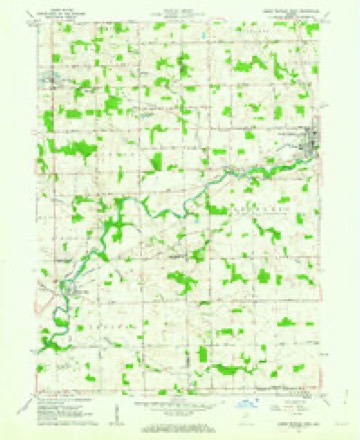
- 1962 USGS South Whitley West quadrangle1:24000, 2 printings
- 1984 USGS Fort Wayne quadrangle1:100000
- 1994 USGS Fort Wayne quadrangle1:100000




In the county-history sources
1,767 words on this townshipHistory of Whitley County, Indiana, published 1907 names this settlement in its chapter on Cleveland Township. These are the passages that mention it, exactly as the scans read.
September 8, 1849, a postoffke was established. The name asked for was Millersburgh, but as there was already a town and postoffice by the name in Elkhart county, the authorities named it Collamer, in honor of Jacob Collamer, then postmaster-general, and it is now known as Collamer. There were ten lots surveyed. Lot one was three by eight poles, lot ten was ten poles on the north line and bent around river. The other lots were four by eight poles. The first lots were sold on February 6, 1847. On that day Rambo sold four lots or parts : To Christian Harter, lot one and a rod off the south side of lot two for sixteen dollars and ninety-six cents, and to John W. Nottingham, lot seven for fourteen dollars, and lot six for eleven dollars and sixty-six cents. The next sale was November 25, 1847, lots four and five to Ellis Miller for twenty-five dollars and fifty cents. Ellis Miller had built the dam across the river in the summer of 1845 anc' sometime in the winter of 1845 anr' 1846 began to grind corn and shortly after wheat and other small grain. The mill and dam remain, the only waterpower left in the whole county, the South Whitley dam having gone out on the dredging of Eel river a few years ago. Millersburgh, nr Collamer, though having the only water-power mill in the county and having the Vandalia Railroad, and being: in as fine country as the world affords, has made no headway and is no better town than a half century ago. The railroad station has been abandoned and it has been hinted that the postoffice will soon yield up the ghost before the march of rural delivery.
Passage source: History of Whitley County, Indiana, published 1907.
While the first town and postoffice in the county were at South Whitley, and Cleveland township was the first organized, there were two or three, perhaps more, settlers in Smith township prior to the Eel river settlement. It is impossible to ascertain who was the very first settler or to determine the priority of several of the first ones. James Chaplin lived on section 7 in 1835 and blazed a trail or road from his farm to intersect the Squawbuck trail in Richland township. This was the highway to Oswego and Turkey Prairie. It is most likely that the Clevelands, Parretts, Samuel Obenchain and John Collins were all settlers before January 1, 1836. Joseph Creager soon followed. Creager and Joseph Parrett settled on land now covered by South Whitley. The Goshen and Huntington road was the only established road in that part of the county at the time of organization. The only other in the county was the Fort Wayr.e and Goshen road in the northeast part of the county, though there were several applications pending at the time of organization, proceedings began in Huntington county and concluded in Whitley. Soon after the establishment of the countv seat a road was blazed through, practically what is today called the "North, Whitley and Columbia road." It was blazed almost through in 1839 and finished early in 1840. Soon after the river road was opened up to what is now Collamer, Liberty Mills and North Manchester.
Passage source: History of Whitley County, Indiana, published 1907.
There were no Indian habitations or villages about South Whitley when the settlers came, the villages were south and in Huntington county and in Columbia township. They gave some trouble as beggars, but the settlers forgave this propensity so much different from what they had expected of savages.
Passage source: History of Whitley County, Indiana, published 1907.
Machine-read from a century-old scan, so expect the errors a machine makes: misspelled names, dropped words, stray characters.
Read the whole chapter on Cleveland Township - it names this place 2 more 2 times.
Fires near this place
14 since 2002Regional context, not property-specific evidence. The federal wildfire occurrence database lists 14 fires within 5 miles of South Whitley between 2002 and 2004, burning about 13 acres in total. 2 started naturally. None was recorded as arson. Distance is straight-line from the map coordinates, so a fire counted here may appear on a neighbouring settlement's page as well.
| Reported cause | Fires |
|---|---|
| Recreation and ceremony | 5 |
| Missing data/not specified/undetermined | 5 |
| Natural | 2 |
| Debris and open burning | 2 |
The most recent of them, most recent first, with the day each was reported and the service that recorded it.
| Date | Cause | Size | Reported by | Name on the report |
|---|---|---|---|---|
| 31 July 2002 | Recreation and ceremony | 1.0 acres | Indiana State Fire Marshal's Office | not named |
| 7 April 2002 | Natural | under an acre | Indiana State Fire Marshal's Office | not named |
| 3 April 2003 | Missing data/not specified/undetermined | 1.0 acres | Indiana State Fire Marshal's Office | not named |
| 28 April 2003 | Missing data/not specified/undetermined | 1.0 acres | Indiana State Fire Marshal's Office | not named |
| 27 April 2003 | Missing data/not specified/undetermined | 1.0 acres | Indiana State Fire Marshal's Office | not named |
| 18 April 2003 | Missing data/not specified/undetermined | 1.0 acres | Indiana State Fire Marshal's Office | not named |
| 16 April 2004 | Recreation and ceremony | under an acre | Indiana State Fire Marshal's Office | not named |
| 10 April 2003 | Natural | 1.0 acres | Indiana State Fire Marshal's Office | not named |
Settlements close enough to share some of these fires:
Mines and quarries near this place
1 within 5 milesRegional context, not property-specific evidence. The federal mineral resources record lists 1 working within 5 miles of South Whitley: 1 producer. All of them still produce. What was taken out: Sand and Gravel, Construction. Distance is straight-line from the map coordinates, so a quarry counted here may appear on a neighbouring settlement's page as well.
| Where | Site | Commodity | Status | Recorded |
|---|---|---|---|---|
| South Whitley Pit and Mill | Sand and Gravel, Construction | Producer |
Storms near this place
36 since 1996Regional context, not property-specific evidence. The National Weather Service names South Whitley in 36 storm reports between 1996 and 2026: 24 thunderstorm wind, 10 hail, 1 flash flood, 1 flood. No death or injury is recorded in these reports. Each account below is quoted exactly as the forecast office filed it, from the NOAA Storm Events Database, and each date opens the federal record of that event.
| When | Event | Place named | Harm | What the report says |
|---|---|---|---|---|
| January 2008 | Flood | South Whitley | $150,000 | Numerous roads were closed or posted with high water signs across the county as a result of 1 to 3 inches of rain, as well as snow melt. Several residences and businesses were sandbagged as a precaution but no significant damage was reported. Damage is estimated at around $150,000. |
| July 1996 | Thunderstorm Wind | South Whitley | $150,000 | no account filed |
| August 2022 | Thunderstorm Wind | South Whitley | $40,000 | Law enforcement reports trees are down on 300 and 400 south. A tree is down on a house on Broad Street in South Whitley. |
| May 2024 | Thunderstorm Wind | South Whitley | $20,000 | Barn downed in South Whitley. |
| August 2022 | Thunderstorm Wind | South Whitley | $10,000 | Trees are down on the road at 204 N Short St. |
| August 2022 | Thunderstorm Wind | South Whitley | $10,000 | Various trees are down on the road. |
| October 1996 | Thunderstorm Wind | South Whitley | $10,000 | no account filed |
| July 2008 | Thunderstorm Wind | South Whitley | $8,000 | Scattered areas of trees, tree limbs and power poles were observed from near the South Whitley area to northeast of Coesse. The wind damage continued into Allen County. As noted in a separate event, a brief tornado was confirmed within this swatch of damage. Damage is estimated at $8,000. |
| July 2024 | Thunderstorm Wind | South Whitley | $3,000 | Multiple trees down in the South Whitley area. |
| March 2025 | Thunderstorm Wind | South Whitley | $1,000 | Tree down in South Whitley and 1/4 inch hail. |
| June 2025 | Hail | South Whitley | $1,000 | Ping pong to golf ball size hail in South Whitley. |
| February 2026 | Hail | South Whitley | - | Video and pictures shared of at least penny size hail in South Whitley. |
| June 2020 | Thunderstorm Wind | South Whitley | - | EM reported trees down, one into a house. |
| June 2020 | Thunderstorm Wind | South Whitley | - | EM reported tree fell onto power pole and caught fire. |
| June 2020 | Thunderstorm Wind | South Whitley | - | EM reports large tree down on road. |
| August 2020 | Thunderstorm Wind | South Whitley | - | Emergency management officials reported trees and power lines were blown down. |
| June 2017 | Thunderstorm Wind | South Whitley | - | Emergency management officials reported tree damage on County Road 500 South, just west of State Route 5. Trees were reported to be large and healthy. |
| June 2013 | Thunderstorm Wind | South Whitley | - | Emergency management officials reported power lines down on West River Road. |
| April 2011 | Thunderstorm Wind | South Whitley | - | The public reported the rood of a milk house was blown off and a concrete wall of the structure blown down. A 32 foot travel trailer was rolled twice and destroyed and a nearby mobile home suffered skirting damage. |
| July 2011 | Thunderstorm Wind | South Whitley | - | Emergency management officials estimated wind gusts to 60 mph; also reported numerous small to medium size branches down. |
| July 2011 | Thunderstorm Wind | South Whitley | - | Emergency management officials reported power lines down across State Route 105, south of South Whitley. |
| July 2004 | Thunderstorm Wind | South Whitley | - | Power lines down. 1 power pole broken. |
| July 2003 | Thunderstorm Wind | South Whitley | - | Law enforcement reported trees and power lines down in South Whitley. |
| September 1999 | Thunderstorm Wind | South Whitley | - | A few tree limbs and one tree were blown down. |
| July 1998 | Thunderstorm Wind | South Whitley | - | MANY LIMBS DOWN IN COLLAMER AND SOUTH WHITLEY. 2 TREES DOWN IN SOUTH WHITLEY. |
| August 2012 | Hail | South Whitley | - | no account filed |
| August 2012 | Hail | South Whitley | - | no account filed |
| May 2011 | Hail | South Whitley | - | no account filed |
| May 2010 | Hail | South Whitley | - | no account filed |
| May 2003 | Thunderstorm Wind | South Whitley | - | no account filed |
| June 2001 | Hail | South Whitley | - | no account filed |
| June 2001 | Hail | South Whitley | - | no account filed |
| May 2000 | Hail | South Whitley | - | no account filed |
| September 1999 | Thunderstorm Wind | South Whitley | - | no account filed |
| June 1998 | Hail | South Whitley | - | no account filed |
| July 1997 | Flash Flood | South Whitley | - | no account filed |
Nearest settlements
The eight closest, with where each one stands in the county. Distances are straight-line, computed from the Geographic Names Information System coordinates.
| Map | Place | Distance | Sheets |
|---|---|---|---|
| Collamer | 2.0 miles | 10 | |
| Tunker | 4.5 miles | 10 | |
| Luther | 6.3 miles | 10 | |
| Larwill | 6.6 miles | 12 | |
| Washington Center | 6.8 miles | 10 | |
| Peabody | 7.3 miles | 11 | |
| Walnut Corners | 7.7 miles | 11 | |
| Briggs | 8.4 miles | 11 |
Elsewhere
Matched on this settlement's Geographic Names Information System number rather than its name, so it cannot be a different place of the same name in another state.
| Wikipedia article on South Whitley | An encyclopaedic summary. Its text is share-alike, so it is linked here rather than copied. |
| Wikidata item Q2855600 | The structured record the population and elevation above come from. Public domain (CC0). |
Provenance
This settlement is recorded in the Geographic Names Information System as feature 443869. The sheet list is computed by point-in-boundary test against the United States Geological Survey's historical topographic inventory. Both are works of the United States government and carry no copyright under 17 U.S.C. 105.
Wildfire. Short, Karen C. 2022. Spatial wildfire occurrence data for the United States, 1992-2020 [FPA_FOD_20221014]. 6th Edition. Fort Collins, CO: Forest Service Research Data Archive. https://doi.org/10.2737/RDS-2013-0009.6 Collected with United States Government funding and usable without additional permissions or fees.
Mines and quarries. USGS Mineral Resources Data System (MRDS) https://mrdata.usgs.gov/mrds/ A work of the United States government, no copyright under 17 U.S.C. 105.
Storms. NOAA National Centers for Environmental Information, Storm Events Database https://www.ncei.noaa.gov/stormevents/ A work of the United States government, no copyright under 17 U.S.C. 105. Narratives are quoted verbatim from the National Weather Service report and are not edited or summarised.