 Block
Lebanon, Indiana
11 topographic sheets cover this place, the earliest surveyed in 1953 and the latest in 1984. It stands in Center Township. It lies in ZIP code area 46052. The Survey maps it on the Lebanon quadrangle. 16,662 people lived here at the 2020 count. It stands 938 feet above sea level.
On record in Lebanon
Buildings and businesses the archive holds for this place. Each opens its own page, with the source record it came from.
On the National Register 4 records
 Boone County Courthouselisted 1986
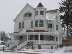 Strange Nathanial Cragun Houselisted 2011
 Oak Hill Cemeterylisted 2014
- Lebanon Courthouse Square Historic Districtlisted 2016
Population over time
2 figuresLebanon grew from 15,792 to 16,662 between 2010 and 2020. These are the recorded population figures Wikidata holds for this place, reached through the Geographic Names Information System number this page is keyed on rather than by name, so they belong to this place and not to another of the same name. Most are census counts, but not all are: an early figure may be a founding or settlement estimate, and an estimate published within five years of a census is left out. The change column is computed, and is left blank where more than 20 years separate a figure from the one before it, because a gap that long is not a change between two counts.
| Year | People | Change |
|---|---|---|
| 2010 | 15,792 | |
| 2020 | 16,662 | +870 (+6%) |
Topographic sheets covering this place
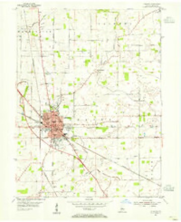
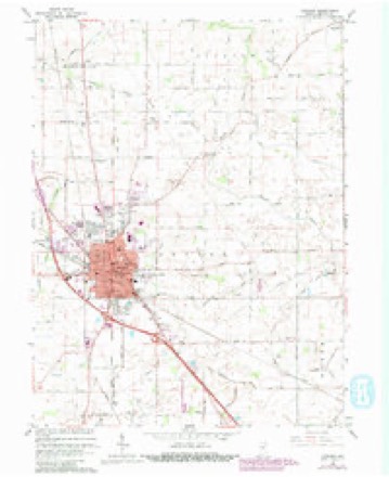
6 surveys from 11 printed sheetsMatched by testing this settlement's coordinate against the published boundary of every sheet in the United States Geological Survey's historical collection. Each opens the scanned sheet at the Survey.
- 1953 USGS Danville quadrangle1:250000, 3 printings
- 1953 USGS Lebanon quadrangle1:24000
- 1955 USGS Danville quadrangle1:250000
- 1956 USGS Danville quadrangle1:250000
- 1963 USGS Lebanon quadrangle1:24000, 3 printings
- 1984 USGS Lafayette quadrangle1:100000, 2 printings




In the county-history sources
705 words on this townshipEarly Life and Times in Boone County Indiana, published 1861 names this settlement in its chapter on Center Township. These are the passages that mention it, exactly as the scans read.
Center Township occupies a central position in the county and contains about sixty-two square miles. It is a very irregular shape, having in and out corners almost without number. The principal stream draining it is Prairie Creek, flowing from the southeast to the northwest past Lebanon. In former years this little stream had its own way, especially when it got ona high. Of late years, however, at a great expense it has been confined to a channel. Thus improved it affords an outlet for countless ditches, drains, ete. The Indianapolis, Cincinnati & Louisville Railroad passes through Center a distance of about ten miles, running in a northwest direction, entering at section ten at the southeast and leaving it at section twenty-one at the northwest. The soil here is on an average with the other townships and has kept pace in improvements. We speak now of the township only. Under the head of "Sketch of Lebanon " will be found a more detailed account. It is difficult to speak of one without referring to the other, especially in regard to the early settlement, so closely are their histories allied. Necessarily this sketch of Center must be short, and under the head referred to above we will speak more in full of what might seem proper here. It would be useless to repeat, as we have decided to put it in the "Sketch of Lebanon," the first settlement having been made there. The history of Center Township is not unlike the histories of the other townships. First, a few hardy pioneers settling in the woods, building their cabins, clearing their patches here and there, log-rollings, house-raisings, etc. Improvements came gradually. The little fields widened out, the cabin gave way to hewed log houses and then to frame and brick dwellings. Thus it has been here and in every township in our now grand county. First the little blazed paths, then the cut out roads, then the gravel roads in their own good time, and . thousands of like improvements and advancements have dawned upon us. A few have lived to see these changes and many have fallen by the way. It has cost toil and labor untold to bring about these improvements. The pioneers underwent privations and hardships that the present generation know nothing about. No citizen, can view these changes without a feeling of pride and satisfaction. The contrasts in many respects are wonderful. Center Township has grown in popu- Jation from a few souls in 1829 to now near four thousand. The population in 1870 was 2,856; in 1880 it was 3,826. Number of voters in 1886 was 1,573 ; number of school houses, 17; number of school children in 1885 was 1,097, not includ- ing Lebanon. The following have served as trustees: A- - Robinson, A. C. Daily, Millroy Lane, J. A. Gardner, Thos. H. Martin, R. W. Matthews, and H. L. Bynum, elected April, 1886.
Passage source: Early Life and Times in Boone County Indiana, published 1861.
Machine-read from a century-old scan, so expect the errors a machine makes: misspelled names, dropped words, stray characters.
Read the whole chapter on Center Township - it names this place 1 more 1 time.
Storms near this place
60 of 90 shownRegional context, not property-specific evidence. The National Weather Service names Lebanon in 90 storm reports between 1994 and 2025: 43 thunderstorm wind, 28 hail, 8 flash flood, 5 flood. The reports record 1 death and 6 injuries. Each account below is quoted exactly as the forecast office filed it, from the NOAA Storm Events Database, and each date opens the federal record of that event.
| When | Event | Place named | Harm | What the report says |
|---|---|---|---|---|
| May 2022 | Thunderstorm Wind | Lebanon | 1 killed, $50,000 | Thunderstorm winds at 904 Edwards Drive pushed over a boom lift that was 125 feet high. An adult male in the boom at the time of the strong winds was killed. |
| May 1995 | Tornado (F2) | Lebanon | 5 hurt, $2,000,000 | The Montgomery County tornado entered Boone County at 0008 EST near Interstate 74 and moved through the south side of the town of Advance before lifting near County Roads 325S and 700W. Nine homes were destroyed and 28 were damaged in Advance. Two businesses received major damage including the Boone County Frontier CO-OP. |
| July 1998 | Thunderstorm Wind | Lebanon | 1 hurt, $10,000 | Tree blown down on house trapped man underneath, seriously injuring him. |
| April 2020 | Thunderstorm Wind | Lebanon | $100,000 | Emergency manager reports severe tree damage across county due to thunderstorm wind gusts. Numerous snapped tree limbs and small trees with widespread power outages. |
| April 2004 | Tornado (F0) | Lebanon | $75,000 | A second tornado, associated with a low-topped supercell that damaged homes in the Jamestown area, touched down in rural Boone county. Eyewitnesses reported funnel clouds and scattered damage along the path. |
| May 2011 | Thunderstorm Wind | Lebanon | $50,000 | The roof was taken off an apartment building with plywood on the street near the intersection of State Route 39 and State Route 32 due to damaging thunderstorm wind gusts. |
| June 2011 | Thunderstorm Wind | Lebanon | $21,000 | In the 1700 block of Crimson Lane, a chimney was blown onto a roof, shingles were blown off, and a swing set was knocked over due to damaging thunderstorm wind gusts. |
| November 2005 | Thunderstorm Wind | Lebanon | $12,000 | A semi was blown off of Interstate 65 north of Lebanon. |
| August 2022 | Thunderstorm Wind | Lebanon | $10,000 | Numerous trees downed by thunderstorm wind gusts on Camp Street near the elementary school. Powerlines were also affected by the tree damage. |
| April 2020 | Thunderstorm Wind | Lebanon | $10,000 | Semi-trailer blown over by thunderstorm wing gusts on Indiana State Road 32. |
| May 2014 | Thunderstorm Wind | Lebanon | $10,000 | Numerous trees and power lines were downed due to damaging thunderstorm wind gusts. One of the trees was a three-foot diameter tree and a utility pole was down as well. |
| March 2022 | Thunderstorm Wind | Lebanon | $6,000 | Thunderstorm winds downed trees in the 600 block of South East Street and the 600 block of South Evans Street. |
| May 2008 | Flash Flood | Lebanon | $5,000 | Fields and county roads were flooded county wide due to flash flooding. |
| June 2008 | Thunderstorm Wind | Lebanon | $5,000 | Thunderstorm winds blew a tree down, which fell into a home. |
| May 1998 | Thunderstorm Wind | Lebanon | $5,000 | Thunderstorm winds blew over semi-trailor. |
| July 2003 | Thunderstorm Wind | Lebanon | $5,000 | no account filed |
| July 2002 | Thunderstorm Wind | Lebanon | $5,000 | no account filed |
| April 2000 | Thunderstorm Wind | Lebanon | $5,000 | no account filed |
| March 2025 | Thunderstorm Wind | Lebanon | $2,000 | Power lines downed by thunderstorm winds breaking tree limbs. |
| August 2012 | Thunderstorm Wind | Lebanon | $2,000 | An outbuilding was damaged in southwest Lebanon due to damaging thunderstorm wind gusts. |
| June 2025 | Thunderstorm Wind | Lebanon | $1,000 | Tree blown down by thunderstorm wind gusts. |
| May 2022 | Thunderstorm Wind | Lebanon | $1,000 | Thunderstorm winds downed a couple tree limbs. |
| May 2014 | Flash Flood | Lebanon | $1,000 | Eighteen inches of water was reported to be over Smiley Street in Lebanon due to heavy thunderstorm rainfall. |
| May 2014 | Flash Flood | Lebanon | $1,000 | Two feet of water was on the road in areas between the 500 to 800 block of East Street due to heavy thunderstorm rainfall. |
| August 2014 | Flood | Lebanon | $1,000 | Six to eight inches of water was over roads in the southern part of Lebanon due to heavy thunderstorm rainfall. In some isolated spots, the flooding was almost 18 inches deep. |
| August 2009 | Thunderstorm Wind | Lebanon | $1,000 | A tree, 3 feet in diameter, was blown down in the 300 block of South Meridian due to thunderstorm wind gusts. |
| October 1996 | Thunderstorm Wind | Lebanon | $1,000 | no account filed |
| June 2010 | Flood | Lebanon | $750 | Water, 12 inches deep, was reportedly over the intersection of State Route 32 and Indianapolis Avenue. |
| June 2014 | Flash Flood | Lebanon | $500 | Ankle deep water was across North East Street in Lebanon due to heavy thunderstorm rainfall. |
| June 2011 | Thunderstorm Wind | Lebanon | $500 | Six inch tree limbs were downed at the intersection of North Park Street and East Washington Street due to damaging thunderstorm wind gusts. |
| November 2011 | Flood | Lebanon | $500 | Up to two feet of water flooded the intersection of Noble and East Streets on the south side of Lebanon. |
| June 1998 | Thunderstorm Wind | Lebanon | $500 | Thunderstorm winds blew down several trees. |
| June 1997 | Thunderstorm Wind | Lebanon | $500 | Several trees blown down. |
| April 1994 | Thunderstorm Wind | Lebanon | $500 | A tractor-semitrailer was blown over on Interstate 65 just south of Lebanon. Also, several telephone poles were blown down by the same storm about 3 miles east of Lebanon. |
| November 2011 | Flood | Lebanon | $250 | Water was reported to be covering Interstate 65 at mile marker 139. Vehicles could still slowly make it across. Flooding was still around at 8 pm. |
| May 2023 | Hail | Lebanon | - | Relayed via social media. |
| May 2023 | Hail | Lebanon | - | Relayed via mPing. |
| May 2015 | Hail | Lebanon | - | Hail was covering the ground. |
| March 2012 | Funnel Cloud | Lebanon | - | Rotation and a small funnel cloud was observed in Lebanon. |
| September 2012 | Thunderstorm Wind | Lebanon | - | A 62 mph thunderstorm wind gust was measured in this location. |
| June 2011 | Thunderstorm Wind | Lebanon | - | A wind gust estimated at 60 mph occurred on along a gust front in Lebanon. |
| June 2010 | Thunderstorm Wind | Lebanon | - | A thunderstorm wind gust measured at 60 mph was observed in this location. |
| May 2010 | Funnel Cloud | Lebanon | - | A funnel cloud was reported near Interstate 65 North. |
| April 2006 | Flash Flood | Lebanon | - | Flooding occurred on Interstate 65. No property damage was reported. |
| June 2005 | Flash Flood | Lebanon | - | Street flooding was reported in Lebanon. |
| July 2005 | Thunderstorm Wind | Lebanon | - | Trees were blown down. |
| July 2005 | Flash Flood | Lebanon | - | State Road 32 was flooded one mile east of Interstate 65. Cars were stalled in the water. |
| July 2005 | Thunderstorm Wind | Lebanon | - | Trees were blown down. At least two cars and a lightpole were damaged by falling trees. No damage estimates were available. |
| November 2005 | Thunderstorm Wind | Lebanon | - | Several trees were downed. |
| November 2005 | Thunderstorm Wind | Lebanon | - | Tree limbs were downed. |
| November 2005 | Thunderstorm Wind | Lebanon | - | Tree limbs were broken. |
| July 2003 | Tornado (F0) | Lebanon | - | An F0 tornado touched down briefly near Lebanon. The only damage was downed trees. |
| August 2000 | Hail | Lebanon | - | Trained spotter reported nickel size hail. |
| March 2025 | Hail | Lebanon | - | no account filed |
| March 2017 | Hail | Lebanon | - | no account filed |
| April 2017 | Hail | Lebanon | - | no account filed |
| April 2015 | Hail | Lebanon | - | no account filed |
| May 2015 | Hail | Lebanon | - | no account filed |
| May 2014 | Hail | Lebanon | - | no account filed |
| May 2014 | Hail | Lebanon | - | no account filed |
Nearest settlements
The eight closest, with where each one stands in the county. Distances are straight-line, computed from the Geographic Names Information System coordinates.
| Map | Place | Distance | Sheets |
|---|---|---|---|
| Northfield Village | 1.0 miles | 11 | |
| Ulen | 1.0 miles | 11 | |
| Brendan Wood | 1.3 miles | 11 | |
| Elmwood | 1.4 miles | 11 | |
| Hazel College | 2.2 miles | 9 | |
| Stringtown | 2.3 miles | 11 | |
| Dale | 4.3 miles | 11 | |
| Pike | 5.3 miles | 11 |
Elsewhere
Matched on this settlement's Geographic Names Information System number rather than its name, so it cannot be a different place of the same name in another state.
| Wikipedia article on Lebanon | An encyclopaedic summary. Its text is share-alike, so it is linked here rather than copied. |
| Wikidata item Q922352 | The structured record the population and elevation above come from. Public domain (CC0). |
Provenance
This settlement is recorded in the Geographic Names Information System as feature 437719. The sheet list is computed by point-in-boundary test against the United States Geological Survey's historical topographic inventory. Both are works of the United States government and carry no copyright under 17 U.S.C. 105.
Storms. NOAA National Centers for Environmental Information, Storm Events Database https://www.ncei.noaa.gov/stormevents/ A work of the United States government, no copyright under 17 U.S.C. 105. Narratives are quoted verbatim from the National Weather Service report and are not edited or summarised.