 Block
Pike, Indiana
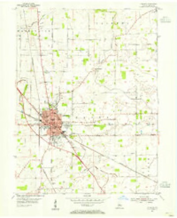
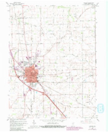
11 topographic sheets cover this place, the earliest surveyed in 1953 and the latest in 1984. It stands in Washington Township. It lies in ZIP code area 46052. The Survey maps it on the Lebanon quadrangle. It stands 912 feet above sea level.
Topographic sheets covering this place
6 surveys from 11 printed sheetsMatched by testing this settlement's coordinate against the published boundary of every sheet in the United States Geological Survey's historical collection. Each opens the scanned sheet at the Survey.
- 1953 USGS Danville quadrangle1:250000, 3 printings
- 1953 USGS Lebanon quadrangle1:24000
- 1955 USGS Danville quadrangle1:250000
- 1956 USGS Danville quadrangle1:250000
- 1963 USGS Lebanon quadrangle1:24000, 3 printings
- 1984 USGS Lafayette quadrangle1:100000, 2 printings




In the county-history sources
13,329 words on this townshipEarly Life and Times in Boone County Indiana, published 1861 names this settlement in its chapter on Washington Township. These are the passages that mention it, exactly as the scans read.
W. W. Trout, one among the clever men of Boone, is living on the old farm of the late H. G. Hazlerigg. He is not an old citizen here, but has lived in the county nearly if not all his life. His wife is one of a pioneer family (Neese).
Passage source: Early Life and Times in Boone County Indiana, published 1861.
The following poems were received too late to be placed in their proper place, but are too good not to appear in this work. They will be read with great interest by the people of the county. We regret very much that we are compelled to put them in at so late a day, but something has to be last, and this will give our book a poetical wind-up. A few late sketches and biographies will appear after these poems, when the soldier list of the "boys in blue," who in their youth and strong manhood went out that our country might live, will follow. It is with great pleasure we give this list. Our work would not at all be worthy the patronage of the people without it. Of course, among so many names, there will doubtless be mistakes and omissions, but we have in this case, as well as in others, done the best under the circumstances.
Passage source: Early Life and Times in Boone County Indiana, published 1861.
Sterling C. and Anna Rose, with two children, emigrated from North Carolina in 1832, settling first in Pike Township, Marion County, and four years later (1836) removed to Eagle Village, Boone County. Sterling C. Rose was born in North Carolina in 1795, and worked at farming and as a carpenter. Anna Rose, his wife, was born in North Carolina in 1800, and carried on tailoring in order to help her husband support their family in early life in Indiana. While he, in addition to building houses, made looms, spinning wheels, plows and wagons, she cut and made the fashionable clothing for the settlers. Sterling C. Rose served in the war of 1812, and drew a pension at the time of his death in 1875, being about eighty years old. Anna, his wife, died in 1863, being sixty-three years old. Their remains lie in the little cemetery at Eagle Village. They were honest, hard-working people, and filled well their part in the early settlement of Indiana.
Passage source: Early Life and Times in Boone County Indiana, published 1861.
Machine-read from a century-old scan, so expect the errors a machine makes: misspelled names, dropped words, stray characters.
Read the whole chapter on Washington Township - it names this place 4 more 4 times.
Mines and quarries near this place
1 within 5 milesRegional context, not property-specific evidence. The federal mineral resources record lists 1 working within 5 miles of Pike: 1 producer. All of them still produce. What was taken out: Sand and Gravel, Construction. Distance is straight-line from the map coordinates, so a quarry counted here may appear on a neighbouring settlement's page as well.
| Where | Site | Commodity | Status | Recorded |
|---|---|---|---|---|
| Midstate Aggregate Pit | Sand and Gravel, Construction | Producer |
Storms near this place
3 since 2011Regional context, not property-specific evidence. The National Weather Service names Pike in 3 storm reports between 2011 and 2013: 3 thunderstorm wind. No death or injury is recorded in these reports. Each account below is quoted exactly as the forecast office filed it, from the NOAA Storm Events Database, and each date opens the federal record of that event.
| When | Event | Place named | Harm | What the report says |
|---|---|---|---|---|
| April 2011 | Thunderstorm Wind | Pike | $300,000 | Multiple cars and trucks were blown off of Interstate 65, between mile markers 147 and 152, due to damaging thunderstorm wind gusts. A barn was also destroyed near this location. A larger pole barn was destroyed on County Road 400 North near 450 North. |
| April 2011 | Thunderstorm Wind | Pike | $20,000 | Damaging thunderstorm wind gust caused widespread structural damage to grain elevators and outside buildings, with multiple large trees down. |
| November 2013 | Thunderstorm Wind | Pike | $3,000 | Trees, two feet in diameter, were downed near 200 East and 500 North due to damaging thunderstorm wind gusts. |
Nearest settlements
The eight closest, with where each one stands in the county. Distances are straight-line, computed from the Geographic Names Information System coordinates.
| Map | Place | Distance | Sheets |
|---|---|---|---|
| Mechanicsburg | 2.5 miles | 9 | |
| Stringtown | 2.9 miles | 11 | |
| Brendan Wood | 4.0 miles | 11 | |
| Elmwood | 4.0 miles | 11 | |
| Ulen | 4.3 miles | 11 | |
| Northfield Village | 4.3 miles | 11 | |
| Hazelrigg | 5.2 miles | 9 | |
| Lebanon | 5.3 miles | 11 |
Elsewhere
Matched on this settlement's Geographic Names Information System number rather than its name, so it cannot be a different place of the same name in another state.
| Wikipedia article on Pike | An encyclopaedic summary. Its text is share-alike, so it is linked here rather than copied. |
| Wikidata item Q7193549 | The structured record the population and elevation above come from. Public domain (CC0). |
Provenance
This settlement is recorded in the Geographic Names Information System as feature 441127. The sheet list is computed by point-in-boundary test against the United States Geological Survey's historical topographic inventory. Both are works of the United States government and carry no copyright under 17 U.S.C. 105.
Mines and quarries. USGS Mineral Resources Data System (MRDS) https://mrdata.usgs.gov/mrds/ A work of the United States government, no copyright under 17 U.S.C. 105.
Storms. NOAA National Centers for Environmental Information, Storm Events Database https://www.ncei.noaa.gov/stormevents/ A work of the United States government, no copyright under 17 U.S.C. 105. Narratives are quoted verbatim from the National Weather Service report and are not edited or summarised.