 Block
Lexington, Indiana
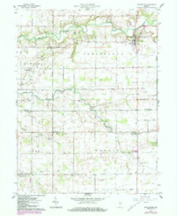
10 topographic sheets cover this place, the earliest surveyed in 1953 and the latest in 1984. It stands in Democrat Township. It lies in ZIP code area 46920. The Survey maps it on the Burlington quadrangle. It stands 748 feet above sea level.
Topographic sheets covering this place
5 surveys from 10 printed sheetsMatched by testing this settlement's coordinate against the published boundary of every sheet in the United States Geological Survey's historical collection. Each opens the scanned sheet at the Survey.
- 1953 USGS Danville quadrangle1:250000, 3 printings
- 1955 USGS Danville quadrangle1:250000
- 1956 USGS Danville quadrangle1:250000
- 1961 USGS Burlington quadrangle1:24000, 3 printings
- 1984 USGS Lafayette quadrangle1:100000, 2 printings




In the county-history sources
328 words on this townshipHistory of Carroll County Indiana, published 1916 names this settlement in its chapter on Democrat Township. These are the passages that mention it, exactly as the scans read.
The oldest mill was the Adam's mill, located on Wild Cat creek, east of Cutler, in 1831. Mr. Adams erected a flouring-mill in 1835. Samuel Weaver operated a carding-mill, also manufactured linseed oil, and later operated a woolen-mill at Prince William. A tannery was operated by a Mr. Campbell from 1835 to 1840. Lexington was laid out on land of Eli Patty in 1835, and was a good trading point. Prince William was noted in early times as a popular place for the holding of political meetings. Considerable business was transacted at this place during the palmy days of the "Plank Road" existence. Wild Cat creek is the principal stream in the township, having several branches in the southeastern part of the town¬ ship.
Passage source: History of Carroll County Indiana, published 1916.
Machine-read from a century-old scan, so expect the errors a machine makes: misspelled names, dropped words, stray characters.
Read the whole chapter on Democrat Township - it names this place 1 more 1 time.
Storms near this place
6 since 2009Regional context, not property-specific evidence. The National Weather Service names Lexington in 6 storm reports between 2009 and 2024: 5 thunderstorm wind, 1 hail. No death or injury is recorded in these reports. Each account below is quoted exactly as the forecast office filed it, from the NOAA Storm Events Database, and each date opens the federal record of that event.
| When | Event | Place named | Harm | What the report says |
|---|---|---|---|---|
| May 2024 | Thunderstorm Wind | Lexington | $50,000 | A hog barned was damaged by a locally stronger thunderstorm wind gust. |
| October 2021 | Thunderstorm Wind | Lexington | $4,000 | Ten trees were downed across the eastern portions of the county by thunderstorm wind gusts with no specific location noted. |
| June 2011 | Thunderstorm Wind | Lexington | $500 | An estimated 70 mph thunderstorm wind gust was observed near the intersection of County Roads 350 South and 300 East. Tree limbs were also reported down in this location. |
| May 2019 | Hail | Lexington | - | A trained spotter reported hail mostly to the size of nickels, with a few as large as quarters. |
| May 2009 | Thunderstorm Wind | Lexington | - | A downburst began near County Road 400 East and County Road 800 South, removing a southwest facing rooftop. Thirteen barns and outbuildings were damaged further northeast. Trees were blown down and a storage shed were the last damaged items on the south end of the town of Burlington at State Route 29. The damage path was approximately 4 miles long and one half mile wide with winds estimated near 95 MPH.||A local newspaper reported the following: A utility shed containing a large riding lawn mower and other items at State Route 29 south of Burlington was lifted and thrown about 100 feet into a neighbor's yard. A list of tornado/wind damaged properties known so far in order of damage: 7821 South 400 East, house roof and utility shed; 5472 East 700 South, wooden barn, metal pole barn and trees; 5675 East 700 South, house, trees, outbuildings, 100 year-old barn and a horse injured; 5910 East 700 South, a wooden barn down; 6614 South 600 East, house roof, animal building and barn; 6289 East 600 South, three barns torn down; 5574 South State Route 29, utility shed and mowers; and, 5556 South State Route 29, trees and playground equipment. |
| May 2009 | Thunderstorm Wind | Lexington | - | Law enforcement reported numerous barns down in Cutler and toward Burlington. Horses were trapped in one of the barns. |
Nearest settlements
The eight closest, with where each one stands in the county. Distances are straight-line, computed from the Geographic Names Information System coordinates.
| Map | Place | Distance | Sheets |
|---|---|---|---|
| Adams Mill | 1.8 miles | 9 | |
| Ray | 2.0 miles | 9 | |
| Cutler | 2.2 miles | 9 | |
| Prince William | 4.6 miles | 9 | |
| Bringhurst | 5.0 miles | 9 | |
| Burlington | 5.2 miles | 10 | |
| Flora | 6.4 miles | 9 | |
| Carrollton | 6.6 miles | 8 |
Elsewhere
Matched on this settlement's Geographic Names Information System number rather than its name, so it cannot be a different place of the same name in another state.
| Wikipedia article on Lexington | An encyclopaedic summary. Its text is share-alike, so it is linked here rather than copied. |
| Wikidata item Q6537752 | The structured record the population and elevation above come from. Public domain (CC0). |
Provenance
This settlement is recorded in the Geographic Names Information System as feature 437810. The sheet list is computed by point-in-boundary test against the United States Geological Survey's historical topographic inventory. Both are works of the United States government and carry no copyright under 17 U.S.C. 105.
Storms. NOAA National Centers for Environmental Information, Storm Events Database https://www.ncei.noaa.gov/stormevents/ A work of the United States government, no copyright under 17 U.S.C. 105. Narratives are quoted verbatim from the National Weather Service report and are not edited or summarised.