 Block
Lone Tree, Indiana
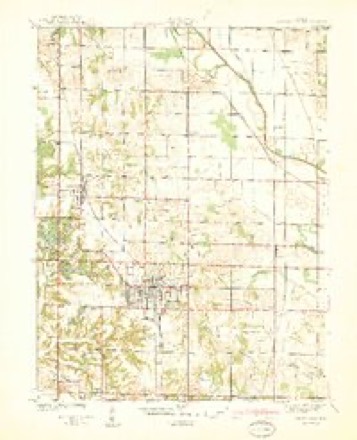
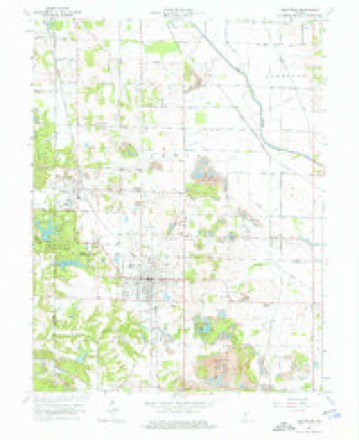
17 topographic sheets cover this place, the earliest surveyed in 1940 and the latest in 1986. It stands in Smith Township. It lies in ZIP code area 47438. The Survey maps it on the Jasonville quadrangle.
Topographic sheets covering this place
7 surveys from 17 printed sheetsMatched by testing this settlement's coordinate against the published boundary of every sheet in the United States Geological Survey's historical collection. Each opens the scanned sheet at the Survey.
- 1940 USGS Jasonville quadrangle1:24000, 2 printings
- 1953 USGS Indianapolis quadrangle1:250000, 4 printings
- 1956 USGS Indianapolis quadrangle1:250000
- 1957 USGS Indianapolis quadrangle1:250000, 2 printings
- 1962 USGS Indianapolis quadrangle1:250000
- 1963 USGS Jasonville quadrangle1:24000, 5 printings
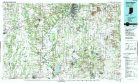
- 1986 USGS Terre Haute quadrangle1:100000, 2 printings




In the county-history sources
3,900 words on this townshipEarly History of Greene County, Indiana : As Taken from the Official Records, and Compiled from Authentic Recollection, by Pioneer Settlers ... Including Brief Sketches of Pioneer Families ..., published 1875 names this settlement in its chapter on Smith Township. These are the passages that mention it, exactly as the scans read.
The Lone Tree creek and Lone Tree prairie Avcrc named for the old oak tree which stood alone in the brairie for a great number of ycj^rs. That noted old red-oak stood on the north side of the old General ILirri- Bon trace, made by the soldiers in 3B14. Many persons can yet point out the place the Lone tree Ptood, about one mile north-cnst of ^Villiam W. Babcr's. The big lake, on the county line, two miles eust oi l^owesvillc, has, evidently, at one time been the old river bed, and a great many stories could be told for the truth, about the many exploits and adventures of the old pioneer hunters and trappers on the river from Worthington up to the old reservoir.
Passage source: Early History of Greene County, Indiana : As Taken from the Official Records, and Compiled from Authentic Recollection, by Pioneer Settlers ... Including Brief Sketches of Pioneer Families ..., published 1875.
Rev. Alexander Poe was an elder' and preacher in the Christian church for many years in that old neighborhood. Besides it was said of him that he was the best bee hUnter, and could catch more fish, and kill more deer" than any other matt. At one time when tho Big Lake had been frozen over with very thick ice for several weeks, in the winter of 1834, Mr. Poe and his boys Went over on the ice at the lake, east of the old Lone Tree, and within two days they caught at least a hundred wagon loads of big fish, and every person in that country" had fish for the next three months.
Passage source: Early History of Greene County, Indiana : As Taken from the Official Records, and Compiled from Authentic Recollection, by Pioneer Settlers ... Including Brief Sketches of Pioneer Families ..., published 1875.
a very large old bear and her three young cub bears among the bushcsi, over on Lick creek and the old negro shot at the old bear, -vvhich frightened her away from the young ones, whilst the three young bears ran up a small tree, and Mr. Poe stood guard at the i-ootof the tree while the old darkey negro went up the tree and shook off the three cub bears, killing one of them in its fall, and capturing the other two. Those two young bears were made pets of by Mr. Poe's family, and were afterwards taken to Louisville, Kentucky, and sold for a good price.
Passage source: Early History of Greene County, Indiana : As Taken from the Official Records, and Compiled from Authentic Recollection, by Pioneer Settlers ... Including Brief Sketches of Pioneer Families ..., published 1875.
Machine-read from a century-old scan, so expect the errors a machine makes: misspelled names, dropped words, stray characters.
Read the whole chapter on Smith Township - it names this place 1 more 1 time.
Fires near this place
43 since 2002Regional context, not property-specific evidence. The federal wildfire occurrence database lists 43 fires within 5 miles of Lone Tree between 2002 and 2008, burning about 108 acres in total. None started naturally. 7 were recorded as arson. Distance is straight-line from the map coordinates, so a fire counted here may appear on a neighbouring settlement's page as well.
| Reported cause | Fires |
|---|---|
| Recreation and ceremony | 21 |
| Missing data/not specified/undetermined | 8 |
| Arson/incendiarism | 7 |
| Equipment and vehicle use | 4 |
| Debris and open burning | 3 |
The most recent of them, most recent first, with the day each was reported and the service that recorded it.
| Date | Cause | Size | Reported by | Name on the report |
|---|---|---|---|---|
| 5 September 2002 | Equipment and vehicle use | 10 acres | Indiana State Fire Marshal's Office | not named |
| 29 September 2007 | Missing data/not specified/undetermined | under an acre | Indiana State Fire Marshal's Office | not named |
| 21 September 2007 | Equipment and vehicle use | under an acre | Indiana State Fire Marshal's Office | not named |
| 6 August 2006 | Missing data/not specified/undetermined | 1.0 acres | Indiana State Fire Marshal's Office | not named |
| 30 August 2002 | Recreation and ceremony | 2.0 acres | Indiana State Fire Marshal's Office | not named |
| 6 July 2002 | Recreation and ceremony | 2.0 acres | Indiana State Fire Marshal's Office | not named |
| 25 July 2002 | Debris and open burning | 10 acres | Indiana State Fire Marshal's Office | not named |
| 27 June 2003 | Recreation and ceremony | under an acre | Indiana State Fire Marshal's Office | not named |
Settlements close enough to share some of these fires:
Mines and quarries near this place
4 within 5 milesRegional context, not property-specific evidence. The federal mineral resources record lists 4 workings within 5 miles of Lone Tree: 4 past producers. None of them still produces. What was taken out: Clay, Aluminum, Iron, Silica, Water, Free. Distance is straight-line from the map coordinates, so a quarry counted here may appear on a neighbouring settlement's page as well.
| Where | Site | Commodity | Status | Recorded |
|---|---|---|---|---|
| Coal Iii Underclay | Clay | Past Producer | ||
| Coal Iii Underclay | Aluminum, Iron, Silica, Water, Free | Past Producer | 1967 | |
| Lower Block Coal Underclays | Clay | Past Producer | ||
| Lower Block Coal Underclays | Aluminum, Iron, Silica, Water, Free | Past Producer |
Nearest settlements
The eight closest, with where each one stands in the county. Distances are straight-line, computed from the Geographic Names Information System coordinates.
| Map | Place | Distance | Sheets |
|---|---|---|---|
| Redcuff Corner | 2.2 miles | 17 | |
| Midland | 3.3 miles | 19 | |
| Midland Junction | 3.7 miles | 19 | |
| Vicksburg | 4.4 miles | 19 | |
| Jasonville | 4.5 miles | 17 | |
| Hoosier | 5.1 miles | 19 | |
| Gilmour | 5.9 miles | 17 | |
| Antioch | 6.1 miles | 19 |
Provenance
This settlement is recorded in the Geographic Names Information System as feature 438240. The sheet list is computed by point-in-boundary test against the United States Geological Survey's historical topographic inventory. Both are works of the United States government and carry no copyright under 17 U.S.C. 105.
Wildfire. Short, Karen C. 2022. Spatial wildfire occurrence data for the United States, 1992-2020 [FPA_FOD_20221014]. 6th Edition. Fort Collins, CO: Forest Service Research Data Archive. https://doi.org/10.2737/RDS-2013-0009.6 Collected with United States Government funding and usable without additional permissions or fees.
Mines and quarries. USGS Mineral Resources Data System (MRDS) https://mrdata.usgs.gov/mrds/ A work of the United States government, no copyright under 17 U.S.C. 105.