 Block
Macy, Indiana
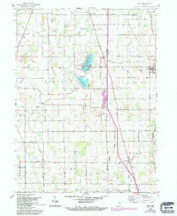
10 topographic sheets cover this place, the earliest surveyed in 1953 and the latest in 1985. It stands in Allen Township. It lies in ZIP code area 46951. The Survey maps it on the Macy quadrangle. 199 people lived here at the 2020 count. It stands 850 feet above sea level.
Population over time
2 figuresMacy fell from 209 to 199 between 2010 and 2020. These are the recorded population figures Wikidata holds for this place, reached through the Geographic Names Information System number this page is keyed on rather than by name, so they belong to this place and not to another of the same name. Most are census counts, but not all are: an early figure may be a founding or settlement estimate, and an estimate published within five years of a census is left out. The change column is computed, and is left blank where more than 20 years separate a figure from the one before it, because a gap that long is not a change between two counts.
| Year | People | Change |
|---|---|---|
| 2010 | 209 | |
| 2020 | 199 | -10 (-5%) |
Topographic sheets covering this place
5 surveys from 10 printed sheetsMatched by testing this settlement's coordinate against the published boundary of every sheet in the United States Geological Survey's historical collection. Each opens the scanned sheet at the Survey.
- 1953 USGS Danville quadrangle1:250000, 3 printings
- 1955 USGS Danville quadrangle1:250000
- 1956 USGS Danville quadrangle1:250000
- 1960 USGS Macy quadrangle1:24000, 3 printings
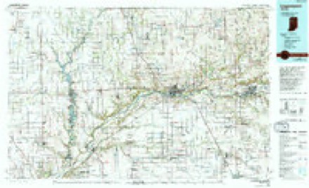
- 1985 USGS Logansport quadrangle1:100000, 2 printings



What happened here
An account from the chapter on Allen township. The inset identifies its exact source book and publication year.
The Historical Incidents
Of Butier township have ever been interesting topics of conversation. The Wilhelm murder occurred about 1845. It seems that old Martin Wilhelm had a daughter to whom a young man by the name of Ullery wished to pay his. respects. 'The father forbade the young man ever to enter the house. The lover, however, continued his visits to the object of his affections.
In the county-history sources
21,742 words on this townshipHistory of Miami County, published 1896 names this settlement in its chapter on Allen Township. These are the passages that mention it, exactly as the scans read.
Mr Horton moved his family to the township in 1835, and until 1836, ke was the only white settler. George Neece came in 1836 and settled just north of what is now Macy. The country did not suit Mr. Neece very well, so after a residence of about a year he moved with his family to some lands farther west. His brother, William Neece, came a short time afterward and settled about a mile north of Macy. William soon sold his claim to Isaac Williams. Jonathan Williams came in 1836 and settled about two miles northeast of Macy. 'These men were all brave, upright, honest citizens and well suited to the life of a pioneer.
Passage source: History of Miami County, published 1896.
George took up a track of land where Macy now stands in 1837, and Anderson located just north of town. James located east of town. In a short time John Reiker came and settled east of town on the farm afterwards sold to Sullivan Waite.
Passage source: History of Miami County, published 1896.
Another family of sturdy. pioneers came in 1839, by the name of Carvey. They were Mathias and his son, Peter M. Carvy, who settled ona track of land on which Peter M. Carvy still lives. The same year. William Hatch, a brotherin-law of Peter Carvey arrived, and took up his residence a short distance east of Macy. During the same year, Thomas Clemens purchased the Waite farm and moved his family the same year. Mr. Clemans still lives on this farm, were he enjoys peace and plenty and the confidence of all who know him.
Passage source: History of Miami County, published 1896.
Machine-read from a century-old scan, so expect the errors a machine makes: misspelled names, dropped words, stray characters.
Read the whole chapter on Allen Township - it names this place 25 more 25 times.
Mines and quarries near this place
2 within 5 milesRegional context, not property-specific evidence. The federal mineral resources record lists 2 workings within 5 miles of Macy: 1 past producer, 1 producer. 1 still produces. What was taken out: Sand and Gravel, Construction. Distance is straight-line from the map coordinates, so a quarry counted here may appear on a neighbouring settlement's page as well.
| Where | Site | Commodity | Status | Recorded |
|---|---|---|---|---|
| D. and C. Pit | Sand and Gravel, Construction | Past Producer | ||
| Van Duyne Pit | Sand and Gravel, Construction | Producer |
Storms near this place
14 since 1995Regional context, not property-specific evidence. The National Weather Service names Macy in 14 storm reports between 1995 and 2025: 10 thunderstorm wind, 2 hail, 2 tornado. No death or injury is recorded in these reports. Each account below is quoted exactly as the forecast office filed it, from the NOAA Storm Events Database, and each date opens the federal record of that event.
| When | Event | Place named | Harm | What the report says |
|---|---|---|---|---|
| March 2025 | Tornado (EF0) | Macy | $150,000 | A damage survey confirmed an EF0 tornado touched down east of CR N 25 W, south of Pleasant Hill Rd where an outbuilding in a wooded area was flipped from north to south against a tree and some debris thrown to the southwest. The tornado reached peak intensity at the intersection of Meridian and Pleasant Hill Rd where one of two older barns suffered extensive damage. The majority of the barn remained at the site, but roof and siding material was visible across fields and in trees into Fulton county. Four of eight center pivot spans were flipped near the damaged barn. The tornado crossed S 1000 E, E 350 S and S 1075 E before dissipating. Damage in Fulton county was limited to mainly tree damage or a few trees onto homes. The maximum estimated winds are around 85 mph, associated with the barn damage with a maximum width of 100 yards. |
| September 1999 | Thunderstorm Wind | Macy | $10,000 | Several trees and power lines blown down. |
| June 1995 | Thunderstorm Wind | Macy | $3,000 | Trees were downed, a barn was damaged, and there was some roof damage. |
| July 1997 | Thunderstorm Wind | Macy | $1,000 | Thunderstorm winds blew down trees in Macy. |
| July 2020 | Thunderstorm Wind | Macy | - | Two tree limbs downed, each around six inches in diameter. |
| May 2019 | Tornado (EF3) | Macy | - | Tornado started nearly one and a half miles north of Macy. Lots of tree damage and roofing material removed. Satellite tornado destroyed a grain silo that was tossed into a tree line about quarter mile southeast and completely destroyed a barn building as well. Tornado intensified and broadened its width as it carried ENE and completely leveled a two story house with debris scattered downstream across a field and across CR 200 W. It then passed through a heavily wooded area snapping or uprooting most trees before crossing CR 100 W and then completely destroying a single story brick ranch home. Adjacent machine shed was heavily damaged here as well and included a pickup truck that was picked up and tossed northeast of the house. Extensive tree damage continues ENE from here through a large grove of trees. Tornado continued northeast crossing West Pleasant Hill Road where two high voltage transmission towers were destroyed as well as extensive damage to structures in the area. Tornado continued northeast crossing north Meridian Road and heavily damaging two large farm properties with extensive structural damage noted. The tornado straddled the Miami/Fulton county line before crossing into Fulton county somewhere along E County Road 1600 N between N County Roads 100 E and 175 E. The maximum intensity of the tornado in Miami county was EF3 with maximum winds of around 140 mph. |
| June 2013 | Thunderstorm Wind | Macy | - | Emergency management officials reported numerous power lines down between County Roads 500 and 600 North. |
| June 2013 | Thunderstorm Wind | Macy | - | Local television media reported uprooted trees as well as an antenna being blown down at Nyona Lake, near Macy. |
| July 2003 | Thunderstorm Wind | Macy | - | Emergency management reported trees and power lines down in Macy. |
| September 2002 | Thunderstorm Wind | Macy | - | Emergency management reported trees blown down. |
| April 2001 | Thunderstorm Wind | Macy | - | Large tree limbs down on several roads. |
| August 2000 | Thunderstorm Wind | Macy | - | Large tree limbs down. |
| May 2011 | Hail | Macy | - | no account filed |
| April 2006 | Hail | Macy | - | no account filed |
Nearest settlements
The eight closest, with where each one stands in the county. Distances are straight-line, computed from the Geographic Names Information System coordinates.
| Map | Place | Distance | Sheets |
|---|---|---|---|
| Birmingham | 1.8 miles | 10 | |
| Wagoner (historical) | 2.4 miles | 10 | |
| Deedsville | 3.6 miles | 10 | |
| Perrysburg | 4.4 miles | 10 | |
| Gilead | 5.8 miles | 10 | |
| Denver | 6.9 miles | 13 | |
| Chili | 8.7 miles | 13 | |
| Courter | 9.1 miles | 13 |
Elsewhere
Matched on this settlement's Geographic Names Information System number rather than its name, so it cannot be a different place of the same name in another state.
| Wikipedia article on Macy | An encyclopaedic summary. Its text is share-alike, so it is linked here rather than copied. |
| Wikidata item Q3293527 | The structured record the population and elevation above come from. Public domain (CC0). |
Provenance
This settlement is recorded in the Geographic Names Information System as feature 438463. The sheet list is computed by point-in-boundary test against the United States Geological Survey's historical topographic inventory. Both are works of the United States government and carry no copyright under 17 U.S.C. 105.
Mines and quarries. USGS Mineral Resources Data System (MRDS) https://mrdata.usgs.gov/mrds/ A work of the United States government, no copyright under 17 U.S.C. 105.
Storms. NOAA National Centers for Environmental Information, Storm Events Database https://www.ncei.noaa.gov/stormevents/ A work of the United States government, no copyright under 17 U.S.C. 105. Narratives are quoted verbatim from the National Weather Service report and are not edited or summarised.