 Block
Marion, Indiana
12 topographic sheets cover this place, the earliest surveyed in 1953 and the latest in 1992. It stands in Center Township. It lies in ZIP code area 46952. It stands on Boots Creek. The Survey maps it on the Marion quadrangle. 28,310 people lived here at the 2020 count. It stands 810 feet above sea level.
Research this city
On record in Marion
Buildings and businesses the archive holds for this place. Each opens its own page, with the source record it came from.
On the National Register 12 of 14 shown
 Webster, George, Jr. and Marie Daugherty, HouseNational Historic Landmark · listed 1992
 First Presbyterian Churchlisted 2018
 Grant County Jail and Sheriff's Residencelisted 1990
 Abijah C. Jay Houselisted 2003
 Israel Jenkins Houselisted 2003
 Marion Downtown Commercial Historic Districtlisted 1994
 Marion PCC & St. Louis Railroad Depotlisted 2018
 Aaron Swayzee Houselisted 1983
 J. Woodrow Wilson Houselisted 1988
 Woodsidelisted 1997
- Marion Branch, National Home for Disabled Volunteer Soldiers Historic Districtlisted 1999
- Marion Firestone Auto Supply & Service Centerlisted 2025
Population over time
2 figuresMarion fell from 29,948 to 28,310 between 2010 and 2020. These are the recorded population figures Wikidata holds for this place, reached through the Geographic Names Information System number this page is keyed on rather than by name, so they belong to this place and not to another of the same name. Most are census counts, but not all are: an early figure may be a founding or settlement estimate, and an estimate published within five years of a census is left out. The change column is computed, and is left blank where more than 20 years separate a figure from the one before it, because a gap that long is not a change between two counts.
| Year | People | Change |
|---|---|---|
| 2010 | 29,948 | |
| 2020 | 28,310 | -1,638 (-5%) |
Topographic sheets covering this place
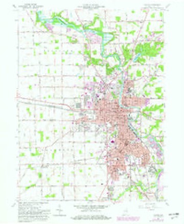
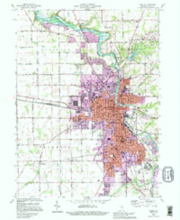
5 surveys from 12 printed sheetsMatched by testing this settlement's coordinate against the published boundary of every sheet in the United States Geological Survey's historical collection. Each opens the scanned sheet at the Survey.
- 1953 USGS Muncie quadrangle1:250000, 5 printings
- 1956 USGS Muncie quadrangle1:250000
- 1961 USGS Marion quadrangle1:24000, 3 printings
- 1986 USGS Wabash quadrangle1:100000, 2 printings
- 1992 USGS Marion quadrangle1:24000


Mines and quarries near this place
3 within 5 milesRegional context, not property-specific evidence. The federal mineral resources record lists 3 workings within 5 miles of Marion: 3 producers. All of them still produce. What was taken out: Sand and Gravel, Construction, Stone. Distance is straight-line from the map coordinates, so a quarry counted here may appear on a neighbouring settlement's page as well.
| Where | Site | Commodity | Status | Recorded |
|---|---|---|---|---|
| Grant Co. Hwy. Dept.- Own Crews | Stone | Producer | ||
| Grant Co. Hwy. Dept. | Sand and Gravel, Construction | Producer | ||
| Marion Plant | Sand and Gravel, Construction | Producer |
Storms near this place
48 since 1996Regional context, not property-specific evidence. The National Weather Service names Marion in 48 storm reports between 1996 and 2015: 26 thunderstorm wind, 18 hail, 3 flash flood, 1 lightning. The reports record 1 injury. Each account below is quoted exactly as the forecast office filed it, from the NOAA Storm Events Database, and each date opens the federal record of that event.
| When | Event | Place named | Harm | What the report says |
|---|---|---|---|---|
| December 1998 | Thunderstorm Wind | Marion | 1 hurt, $10,000 | AUTOMOBILE SIGNIFICANTLY DAMAGED WHEN PART OF A TREE FELL ACROSS IT. |
| August 1998 | Flash Flood | Marion | $1,000,000 | EXTENSIVE FLOODING THROUGHOUT MARION AND THE COUNTY. MANY ROADS AND BRIDGES UNDER WATER. NUMEROUS RESIDENCES WERE EVACUATED ALONG THE MISSISSINEWA RIVER AS ARMY NATIONAL GUARDSMEN SANDBAGGED A WEAKENING DIKE ON THE EAST SIDE OF MARION. THE DIKE HELD BUT SEVERAL HOMES SUSTAINED WATER DAMAGE. |
| August 1998 | Thunderstorm Wind | Marion | $150,000 | WIDESPREAD TREE DAMAGE IN MARION AND ACROSS GRANT COUNTY. |
| November 1998 | Thunderstorm Wind | Marion | $50,000 | SEVERAL TREES AND POWER LINES WERE BLOWN DOWN IN TOWN. ONE CAR WAS BADLY DAMAGED BY A LARGE TREE LIMB. ONE FARM OUTSIDE OF TOWN HAD A ROOF BLOWN OFF THE BARN. |
| July 2003 | Flash Flood | Marion | $25,000 | Law enforcement reported one house with water into the first floor and numerous roads closed due to flash flooding. |
| June 2006 | Thunderstorm Wind | Marion | $15,000 | A section of the Grant County courthouse roof was blown off. Several power lines blown down. |
| November 2005 | Thunderstorm Wind | Marion | $5,000 | Power lines were blown down in the area. |
| May 2000 | Thunderstorm Wind | Marion | $5,000 | Tree down on car. |
| June 2006 | Thunderstorm Wind | Marion | $3,000 | Several trees blown down with some coming down on power lines. |
| September 2001 | Thunderstorm Wind | Marion | $2,000 | A large tree at 1623 East 37th Street in Marion was blown down by thunderstorm wind gusts. The tree brought down utility lines, damaged a garage roof, and blocked part of a road. |
| July 2005 | Lightning | Marion | $1,000 | Lightning struck the side of a house north of Marion, going through a piece of metal and sparking a small fire in attic insulations as well as an associated overhang. The fire was quickly extinguished with no injuries reported, but damage was estimated to be at least $1,000. |
| May 2000 | Thunderstorm Wind | Marion | $1,000 | Trees blown down and brick wall blown onto a car. |
| May 2015 | Hail | Marion | - | A trained spotter reported quarter size hail at the intersection of County Road 125 North and 1000 East. |
| May 2015 | Thunderstorm Wind | Marion | - | A trained spotter estimated wind gusts to 60 mph at the intersection of County Road 125 North and 1000 East. |
| November 2013 | Thunderstorm Wind | Marion | - | County officials reported the Summit Village Trailer park was heavily damaged, with some mobile homes on top of each other. |
| June 2010 | Thunderstorm Wind | Marion | - | Widespread power outages with estimated gusts to 60 mph. |
| June 2010 | Thunderstorm Wind | Marion | - | Numerous power lines down. |
| May 2006 | Thunderstorm Wind | Marion | - | One tree was blown down. |
| September 2006 | Hail | Marion | - | Nickel size hail covered the ground to a depth of 3 inches in some spots. |
| June 2005 | Hail | Marion | - | Hail ranging from nickel to golf ball size was reported in the city. |
| July 2005 | Thunderstorm Wind | Marion | - | Trees were reported blown down. |
| July 2004 | Thunderstorm Wind | Marion | - | Trees were reported down across the southern parts of the county. |
| July 2003 | Thunderstorm Wind | Marion | - | Law enforcement reported trees and power lines down throughout the county. |
| July 2003 | Flash Flood | Marion | - | Emergency management reported some roads closed due to flash flooding. |
| July 2002 | Thunderstorm Wind | Marion | - | Law enforcement reported large tree limbs down southeast of Marion. |
| September 2002 | Thunderstorm Wind | Marion | - | Ham radio operators reported trees down. |
| April 2001 | Hail | Marion | - | Power lines reported blown down. |
| July 2001 | Thunderstorm Wind | Marion | - | A large tree was uprooted on the east side of the Grant county fairgrounds. The tree blocked the entrance to the grounds and hit power lines cutting power to the fairgrounds into early afternoon. |
| June 2001 | Thunderstorm Wind | Marion | - | Power lines down |
| June 2001 | Thunderstorm Wind | Marion | - | Two trees down. |
| September 2001 | Thunderstorm Wind | Marion | - | Two trees blown down on Meridian Street between 50th and 53rd Streets. |
| May 2000 | Thunderstorm Wind | Marion | - | Minor wind damage. |
| July 1998 | Hail | Marion | - | HAIL IN MARION AND ON NORTH SIDE OF CITY. |
| July 1998 | Thunderstorm Wind | Marion | - | TREES DOWN IN TOWN. |
| March 2006 | Hail | Marion | - | no account filed |
| September 2006 | Hail | Marion | - | no account filed |
| May 2005 | Hail | Marion | - | no account filed |
| November 2005 | Hail | Marion | - | no account filed |
| May 2002 | Hail | Marion | - | no account filed |
| April 2001 | Hail | Marion | - | no account filed |
| April 2001 | Hail | Marion | - | no account filed |
| April 2001 | Hail | Marion | - | no account filed |
| September 2001 | Hail | Marion | - | no account filed |
| May 2000 | Hail | Marion | - | no account filed |
| May 1999 | Hail | Marion | - | no account filed |
| June 1998 | Hail | Marion | - | no account filed |
| May 1996 | Hail | Marion | - | no account filed |
| October 1996 | Thunderstorm Wind | Marion | - | no account filed |
Nearest settlements
The eight closest, with where each one stands in the county. Distances are straight-line, computed from the Geographic Names Information System coordinates.
| Map | Place | Distance | Sheets |
|---|---|---|---|
| Westwood Square | 1.9 miles | 12 | |
| Shady Hills | 2.3 miles | 12 | |
| Kiley | 2.4 miles | 12 | |
| Home Corner | 2.6 miles | 12 | |
| Bethevan | 2.7 miles | 12 | |
| Michaelsville | 3.3 miles | 12 | |
| Brookhaven | 3.5 miles | 11 | |
| Shadeland | 4.1 miles | 11 |
Elsewhere
Matched on this settlement's Geographic Names Information System number rather than its name, so it cannot be a different place of the same name in another state.
| Wikipedia article on Marion | An encyclopaedic summary. Its text is share-alike, so it is linked here rather than copied. |
| Wikidata item Q286068 | The structured record the population and elevation above come from. Public domain (CC0). |
Provenance
This settlement is recorded in the Geographic Names Information System as feature 438611. The sheet list is computed by point-in-boundary test against the United States Geological Survey's historical topographic inventory. Both are works of the United States government and carry no copyright under 17 U.S.C. 105.
Mines and quarries. USGS Mineral Resources Data System (MRDS) https://mrdata.usgs.gov/mrds/ A work of the United States government, no copyright under 17 U.S.C. 105.
Storms. NOAA National Centers for Environmental Information, Storm Events Database https://www.ncei.noaa.gov/stormevents/ A work of the United States government, no copyright under 17 U.S.C. 105. Narratives are quoted verbatim from the National Weather Service report and are not edited or summarised.