 Block
Shady Hills, Indiana
12 topographic sheets cover this place, the earliest surveyed in 1953 and the latest in 1992. It stands in Center Township. It lies in ZIP code area 46952. It stands on Hummel Creek. The Survey maps it on the Marion quadrangle.
On record in Shady Hills
Buildings and businesses the archive holds for this place. Each opens its own page, with the source record it came from.
On the National Register within a mile 1 record
The National Register names another town for these. They stand within one mile of this settlement's coordinate.
 Woodsidelisted 1997 · 0.0 miles away
Topographic sheets covering this place
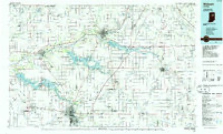
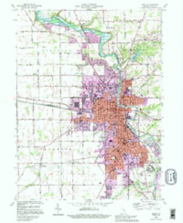
5 surveys from 12 printed sheetsMatched by testing this settlement's coordinate against the published boundary of every sheet in the United States Geological Survey's historical collection. Each opens the scanned sheet at the Survey.
- 1953 USGS Muncie quadrangle1:250000, 5 printings
- 1956 USGS Muncie quadrangle1:250000
- 1961 USGS Marion quadrangle1:24000, 3 printings
- 1986 USGS Wabash quadrangle1:100000, 2 printings
- 1992 USGS Marion quadrangle1:24000



Mines and quarries near this place
3 within 5 milesRegional context, not property-specific evidence. The federal mineral resources record lists 3 workings within 5 miles of Shady Hills: 2 producers, 1 past producer. 2 still produce. What was taken out: Sand and Gravel, Construction, Stone. Distance is straight-line from the map coordinates, so a quarry counted here may appear on a neighbouring settlement's page as well.
| Where | Site | Commodity | Status | Recorded |
|---|---|---|---|---|
| Grant Co. Hwy. Dept.- Own Crews | Stone | Producer | ||
| Grant Co. Hwy. Dept. | Sand and Gravel, Construction | Producer | ||
| Jalapa Pit | Sand and Gravel, Construction | Past Producer |
Storms near this place
49 since 2007Regional context, not property-specific evidence. The National Weather Service names Shady Hills in 49 storm reports between 2007 and 2026: 34 thunderstorm wind, 15 hail. No death or injury is recorded in these reports. Each account below is quoted exactly as the forecast office filed it, from the NOAA Storm Events Database, and each date opens the federal record of that event.
| When | Event | Place named | Harm | What the report says |
|---|---|---|---|---|
| June 2009 | Thunderstorm Wind | Shady Hills | $100,000 | Emergency management officials reported an old lumber building was blown down by the strong winds in Marion near the intersection of Branson and Swayzee St. In addition, several trees were uprooted onto cars and house and a railroad track crossing arm was broken. Damage is estimated at $100,000. |
| June 2008 | Thunderstorm Wind | Shady Hills | $50,000 | Emergency management officials reported numerous trees and power lines down in and around Marion. |
| August 2007 | Thunderstorm Wind | Shady Hills | $50,000 | Emergency Management officials reported 15 power poles down along N 500 E from CR 300 N to 100 N. Portions of State Route 15 in Marion were closed due to trees and power lines being blown down. Other trees and tree limbs were reported down across the county. |
| July 2024 | Thunderstorm Wind | Shady Hills | $20,000 | Several healthy trees snapped or downed. One travel trailer was tipped on its side. |
| July 2007 | Thunderstorm Wind | Shady Hills | $10,000 | A semi was blown over at State Route 18 and Interstate 69. A steel shed was also blown over in the Marion area. |
| July 2024 | Thunderstorm Wind | Shady Hills | $5,000 | Large trees down and power lines down in the Avondale Area. |
| April 2026 | Thunderstorm Wind | Shady Hills | $2,000 | Report of a tree down and damage to a porch on the east side of Marion. |
| March 2026 | Hail | Shady Hills | $1,000 | A member of the public reports 1 inch diameter hail. |
| August 2023 | Thunderstorm Wind | Shady Hills | $1,000 | A trained spotter reported large tree branches were down in Marion. |
| June 2025 | Thunderstorm Wind | Shady Hills | - | Trained spotter recorded a 60 mph wind gust. |
| July 2022 | Thunderstorm Wind | Shady Hills | - | Reports of trees down and debris in roadway via central dispatch. |
| July 2020 | Thunderstorm Wind | Shady Hills | - | Spotter relayed report of power lines downed. |
| April 2017 | Hail | Shady Hills | - | Hail damage was reported to a van, as well as a house. |
| August 2016 | Thunderstorm Wind | Shady Hills | - | Emergency management officials reported a power pole down on Sherman Street. Other reports of trees and power lines down were received across the county. |
| May 2015 | Thunderstorm Wind | Shady Hills | - | A trained spotter estimated wind gusts to 60 mph. Pea size hail was also observed with the storm. |
| May 2015 | Thunderstorm Wind | Shady Hills | - | A trained spotter reported a large tree was blown down across Lincoln Blvd. |
| July 2013 | Thunderstorm Wind | Shady Hills | - | A trained spotter reported numerous trees were blown down in Marion as well as across the county. |
| July 2013 | Thunderstorm Wind | Shady Hills | - | Emergency management officials reported a tree was blown down onto Lawson Road, near State Route 15. |
| July 2013 | Thunderstorm Wind | Shady Hills | - | A trained spotter measured a 64 mph wind gust and observed large tree limbs down. |
| July 2013 | Thunderstorm Wind | Shady Hills | - | A trained spotter estimated a 60 mph wind gust. |
| June 2013 | Thunderstorm Wind | Shady Hills | - | A trained spotter measures a 67 mph wind gust. Several four inch tree limbs were blown down in the area. |
| June 2013 | Thunderstorm Wind | Shady Hills | - | A trained spotter measured a 65 mph wind gust at the intersection of County Roads 300 West and 300 North. |
| November 2013 | Thunderstorm Wind | Shady Hills | - | Trained spotters reported many trees and power lines down throughout the county. |
| November 2013 | Thunderstorm Wind | Shady Hills | - | A trained spotter reported 50 to 60 trees down across the city. A semi was overturned near Meyer Road in southern Marion. The armory on State Route 18 suffered roof damage. |
| June 2012 | Thunderstorm Wind | Shady Hills | - | A trained spotter recorded a 64 mph wind gust at the intersection of State Route 18 and County Road 325 West. A flag pole was also reported blown down in Marion. |
| April 2011 | Thunderstorm Wind | Shady Hills | - | A trained spotter in Marion reported a 61 mph wind gust. |
| May 2011 | Thunderstorm Wind | Shady Hills | - | Trained spotters reported several tree limbs, up to four inches in diameter, down on several streets in and around Marion. |
| October 2010 | Thunderstorm Wind | Shady Hills | - | A trained spotter reported large tree limbs down on 9th Street and Miller Avenue. |
| October 2010 | Thunderstorm Wind | Shady Hills | - | A trained spotter reported damage to the wall of a building at Bradford Avenue and Washington Street. |
| October 2010 | Hail | Shady Hills | - | A trained spotter reported golf ball size hail. |
| October 2010 | Thunderstorm Wind | Shady Hills | - | A trained spotter reported numerous trees down in the city of Marion. |
| July 2010 | Thunderstorm Wind | Shady Hills | - | Law enforcement officials reported two trees down onto a road north of Marion. |
| January 2008 | Thunderstorm Wind | Shady Hills | - | A trained spotter estimated winds gusting to 60 mph in Marion. |
| June 2008 | Thunderstorm Wind | Shady Hills | - | Emergency management officials reported that numerous reports of trees and power line down across the county. |
| March 2020 | Hail | Shady Hills | - | no account filed |
| April 2017 | Hail | Shady Hills | - | no account filed |
| March 2016 | Hail | Shady Hills | - | no account filed |
| March 2016 | Hail | Shady Hills | - | no account filed |
| August 2016 | Hail | Shady Hills | - | no account filed |
| April 2013 | Hail | Shady Hills | - | no account filed |
| August 2012 | Hail | Shady Hills | - | no account filed |
| June 2011 | Hail | Shady Hills | - | no account filed |
| April 2011 | Hail | Shady Hills | - | no account filed |
| May 2011 | Hail | Shady Hills | - | no account filed |
| May 2011 | Hail | Shady Hills | - | no account filed |
| October 2010 | Hail | Shady Hills | - | no account filed |
| June 2010 | Thunderstorm Wind | Shady Hills | - | no account filed |
| June 2010 | Thunderstorm Wind | Shady Hills | - | no account filed |
| July 2008 | Thunderstorm Wind | Shady Hills | - | no account filed |
Nearest settlements
The eight closest, with where each one stands in the county. Distances are straight-line, computed from the Geographic Names Information System coordinates.
| Map | Place | Distance | Sheets |
|---|---|---|---|
| Marion | 2.3 miles | 12 | |
| Westwood Square | 2.4 miles | 12 | |
| Shadeland | 3.6 miles | 11 | |
| Fox | 3.6 miles | 12 | |
| Kiley | 4.3 miles | 12 | |
| Jalapa | 4.6 miles | 12 | |
| Michaelsville | 4.8 miles | 12 | |
| Home Corner | 4.9 miles | 12 |
Provenance
This settlement is recorded in the Geographic Names Information System as feature 443248. The sheet list is computed by point-in-boundary test against the United States Geological Survey's historical topographic inventory. Both are works of the United States government and carry no copyright under 17 U.S.C. 105.
Mines and quarries. USGS Mineral Resources Data System (MRDS) https://mrdata.usgs.gov/mrds/ A work of the United States government, no copyright under 17 U.S.C. 105.
Storms. NOAA National Centers for Environmental Information, Storm Events Database https://www.ncei.noaa.gov/stormevents/ A work of the United States government, no copyright under 17 U.S.C. 105. Narratives are quoted verbatim from the National Weather Service report and are not edited or summarised.