 Block
Morgantown, Indiana
21 topographic sheets cover this place, the earliest surveyed in 1942 and the latest in 1998. It stands in Jackson Township. It lies in ZIP code area 46160. It stands on Bear Creek. The Survey maps it on the Morgantown quadrangle. 1,014 people lived here at the 2020 count. It stands 679 feet above sea level.
On record in Morgantown
Buildings and businesses the archive holds for this place. Each opens its own page, with the source record it came from.
On the National Register 2 records
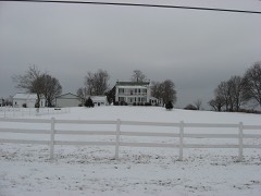 Cedar Point Farmlisted 2003
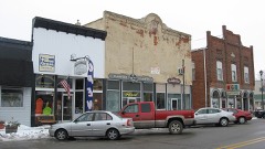 Morgantown Historic Districtlisted 2006
Population over time
2 figuresMorgantown grew from 986 to 1,014 between 2010 and 2020. These are the recorded population figures Wikidata holds for this place, reached through the Geographic Names Information System number this page is keyed on rather than by name, so they belong to this place and not to another of the same name. Most are census counts, but not all are: an early figure may be a founding or settlement estimate, and an estimate published within five years of a census is left out. The change column is computed, and is left blank where more than 20 years separate a figure from the one before it, because a gap that long is not a change between two counts.
| Year | People | Change |
|---|---|---|
| 2010 | 986 | |
| 2020 | 1,014 | +28 (+3%) |
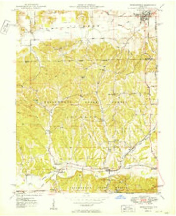
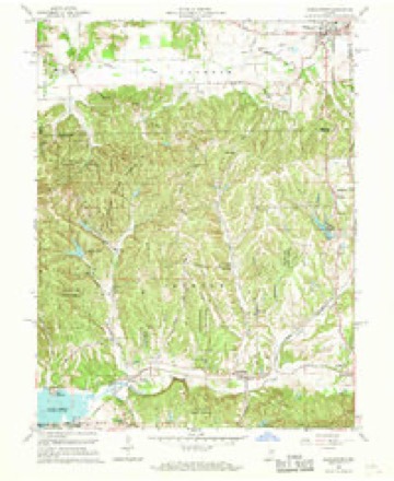
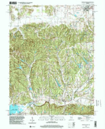
Topographic sheets covering this place
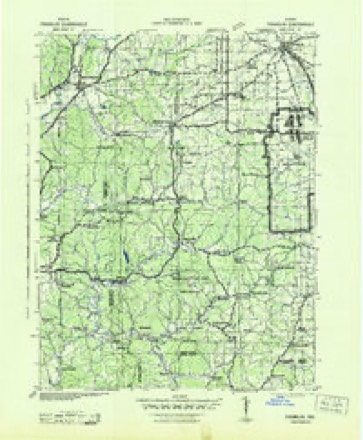
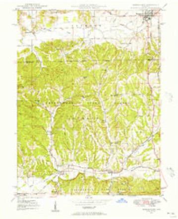
10 surveys from 21 printed sheetsMatched by testing this settlement's coordinate against the published boundary of every sheet in the United States Geological Survey's historical collection. Each opens the scanned sheet at the Survey.
- 1942 USGS Franklin quadrangle1:125000
- 1948 USGS Morgantown quadrangle1:24000
- 1950 USGS Morgantown quadrangle1:24000, 2 printings
- 1953 USGS Indianapolis quadrangle1:250000, 4 printings
- 1956 USGS Indianapolis quadrangle1:250000
- 1957 USGS Indianapolis quadrangle1:250000, 2 printings
- 1961 USGS Morgantown quadrangle1:24000, 5 printings
- 1962 USGS Indianapolis quadrangle1:250000
- 1986 USGS Bloomington quadrangle1:100000, 3 printings
- 1998 USGS Morgantown quadrangle1:24000





In the county-history sources
25,325 words on this townshipCounties of Morgan, Monroe, and Brown, Indiana. Historical and Biographical, published 1884 names this settlement in its chapter on Jackson Township. These are the passages that mention it, exactly as the scans read.
THE location of Jackson Township, remote from any considerable water-course, delayed its settlement for a few years. The valley of Indian Creek, however, was too rich a tract of country to remain long in its primitive state, and about the middle of the twenties the settlers began to arrive, but not in considerable numbers until the thirties, at which time the greater portion of the land was entered by actual residents. The first man, if accounts are correct, to locate permanently in the township was John Hamilton. He came to the township in 1826, and the following year entered a tract of land where now stands the thriving little village of Morgantown. He had a family of five or six children. He was scarcely in the township before he was joined by Daniel Troxel, Thomas Teeter, Samuel Teeter, Robert Bowles, John Shrum. William Williams, Sampson Canatsey and a few others, all ot whom located in the vicinity of Morgantown on Sections 24 and 25. It cannot be stated with any certainty that Mr. Hamilton was the first settler. Indeed there are evidences that he was not. The first land entered from the Government in the township was on Section 1 in July, 1821. by William W. Drew and Elisha Herndon, but if reports are reliable neither of these men resided in the township. William Harriman entered a tract on Section 26 in 1824, but it is stated that he did not reside there. He lived in Washington Xownship. William Knox came in 1828, locating on Section 25, and Charles Ross in 1827, on Section 26. Henry Adams bought land on Section 13 in 1828, and Jesse Daugherty on Section 21 the same year. Finney Courtney and Jonathan Hostetter entered land on Section 26 in 1826, but no traces of their residence in the township could be found. They probably soon sold out to actual residents. Thomas Hudiburgh entered a tract on Section 26 in 1828, and another tract on Section 27 the same time. These were about the only land owners who had entered their farms from the Government in the twenties, but there were other families in the township who were too poor to purchase land, and then again, there were other families who had bought their farms second-hand. The names of such cannot be given.
Passage source: Counties of Morgan, Monroe, and Brown, Indiana. Historical and Biographical, published 1884.
By the year 1842, the township was quite well settled and the citizens were in better circumstances and more comfortable. The log cabin was still the rule, but a few frame houses had made their appearance. The wild animals had largely disappeared. Even deer had become somewhat scarce,' though down in Brown County among the precipitous ravines and almost impenetrable woods, all of the native wild animals could still be found, not excepting bears and panthers. These were rare, but still they were there for the hunter who had sufficient courage to follow them to their lairs. Deer were very numerous there yet, and many interesting incidents could be told of the hairbreadth escapes of those of Jackson Township who went down there on hunting excursions. Deer, wolves, catamounts, foxes, wild turkeys, myriads of squirrels, snakes, wild cats, etc., etc., were still found in Jackson in greater or less abundance. The earliest settlers in Jackson had a picnic, so to speak. John Hamilton, who lived near Morgantown, tells of shooting wild turkeys and deer on the present town site almost every morning, or whenever they were required for food or otherwise. He would get up just as the light began to break in the East, take his rifle, walk out a few hundred yards from his cabin, and in a few minutes the crack of his rifle would announce the death of either a deer or a wild turkey. The latter in the fall of the year became often very fat. It is stoutly averred by old settlers, that sometimes when they were shot from the top of the high trees and fell the long distance on the hard ground, the skin upon their backs burst open like a ripe pod. >This sounds "fishy '.' now, but no doubt the old settlers state the truth. Take such a bird, pluck it and dress it, and roast it to a ripe brown before the fire-place, and then garnish it with rich dressing and smother it in delicious gravy and the old settlers had a feast fit for the gods. It makes the mouth water to think of it. A great sport in early times was the hunting of bee trees. It may not be generally known, yet it is a fact that wild bees are unknown far out in the wilderness, hundreds of miles from human habitation. They are like the pioneer hunters, and just precede the advance guard of pioneers. It required some experience to be able to find bee trees readily. In the summer the flight of the bees was watched and the direction taken followed. A close and experienced observer could thus trace them to their store of sweets. It could be told fairly well, also, when a bee was coming from the hive or returning. An examination of its honey bags would reveal whether it was loaded or not. If it was loaded and on the wing, its course was a "bee line" for its hive, otherwise it was seeking some flowery pasture. In the winter time when the snow was on the ground, bees would venture out of their trees on warm days, would be frozen to death and would drop on the snow, where their bodies would cause a yellow discoloration of two or three inches in diameter. A cluster of these yellow spots could be seen a long distance - often twenty or thirty rods, and the location of the bee trees could thus be found. The Hamiltons, on one occasion, discovered a fine bee tree on the present site of Morgantown, from which almost a tubful of the finest candied honey was obtained. The old settlers, many of them, did not fare so badly after all.
Passage source: Counties of Morgan, Monroe, and Brown, Indiana. Historical and Biographical, published 1884.
About the year 1830, Joshua Whiteley built a small corn-cracker on Indian Creek, just east of Morgantown. Of course, water was the motor, and the wheel was of the tub or bucket kind. It is said the owner would leave it for hours at a time, and, upon returning,, would find the grist ground. He had an old dog that became very fond of corn meal, and sometimes when the master had left the mill to run itself the old dog would enter, seat himself on his haunches and lick up the meal as fast as it fell from the spout. The manufacture of meal was so slow that it would not come down as fast as the canine desired, whereupon he would howl dismally until another mite had fallen. The reader may take the story for what it is worth. A few years after this corn-cracker was built, James Blair erected another on the creek a short distance west of town. This was operated until about I84O4 when it was abandoned. Joshua Bowles also built a.grist mill near town late in the thirties, which ran for eight or ten years and did good work. The old Vansicke Mill at Mahalasville was built in the forties, and under various owners and with many improvements is yet in operation. It was originally built by John Coonfield. David Haase owned a small distillery where apple and peach brandy and corn and rye whisky were manufactured. Considerable good liquor was made here. It was moved across the line into Washington Township, and was conducted after the last war.
Passage source: Counties of Morgan, Monroe, and Brown, Indiana. Historical and Biographical, published 1884.
Machine-read from a century-old scan, so expect the errors a machine makes: misspelled names, dropped words, stray characters.
Read the whole chapter on Jackson Township - it names this place 5 more 5 times.
Storms near this place
5 since 1997Regional context, not property-specific evidence. The National Weather Service names Morgantown in 5 storm reports between 1997 and 2001: 3 hail, 2 thunderstorm wind. No death or injury is recorded in these reports. Each account below is quoted exactly as the forecast office filed it, from the NOAA Storm Events Database, and each date opens the federal record of that event.
| When | Event | Place named | Harm | What the report says |
|---|---|---|---|---|
| July 2001 | Hail | Morgantown | - | no account filed |
| July 2001 | Thunderstorm Wind | Morgantown | - | no account filed |
| July 2001 | Thunderstorm Wind | Morgantown | - | no account filed |
| August 2001 | Hail | Morgantown | - | no account filed |
| August 1997 | Hail | Morgantown | - | no account filed |
Nearest settlements
The eight closest, with where each one stands in the county. Distances are straight-line, computed from the Geographic Names Information System coordinates.
| Map | Place | Distance | Sheets |
|---|---|---|---|
| Painted Hills | 4.8 miles | 16 | |
| Chetwynd | 5.0 miles | 16 | |
| Mahalasville | 5.4 miles | 21 | |
| Cope | 6.2 miles | 16 | |
| Taggart Crossing | 7.4 miles | 18 | |
| Fewell Rhoades | 8.1 miles | 18 | |
| Shelburne | 8.3 miles | 18 | |
| Wolff | 8.3 miles | 18 |
Elsewhere
Matched on this settlement's Geographic Names Information System number rather than its name, so it cannot be a different place of the same name in another state.
| Wikipedia article on Morgantown | An encyclopaedic summary. Its text is share-alike, so it is linked here rather than copied. |
| Wikidata item Q644950 | The structured record the population and elevation above come from. Public domain (CC0). |
Provenance
This settlement is recorded in the Geographic Names Information System as feature 439438. The sheet list is computed by point-in-boundary test against the United States Geological Survey's historical topographic inventory. Both are works of the United States government and carry no copyright under 17 U.S.C. 105.
Storms. NOAA National Centers for Environmental Information, Storm Events Database https://www.ncei.noaa.gov/stormevents/ A work of the United States government, no copyright under 17 U.S.C. 105. Narratives are quoted verbatim from the National Weather Service report and are not edited or summarised.