 Block
Mount Jackson, Indiana
19 topographic sheets cover this place, the earliest surveyed in 1948 and the latest in 1998. It stands in Wayne Township. It lies in ZIP code area 46222. It stands on Little Eagle Creek. The Survey maps it on the Indianapolis West quadrangle.
On record in Mount Jackson
Buildings and businesses the archive holds for this place. Each opens its own page, with the source record it came from.
On the National Register within a mile 5 records
The National Register names another town for these. They stand within one mile of this settlement's coordinate.
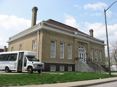 Hawthorne Branch Library No. 2listed 2000 · 0.3 miles away
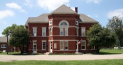 Old Pathology Buildinglisted 1972 · 0.5 miles away
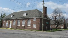 Christamore Houselisted 1985 · 0.7 miles away
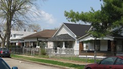 Haughville Historic Districtlisted 1992 · 0.9 miles away
- Floral Park Cemeterylisted 2026 · 1.0 miles away
Topographic sheets covering this place
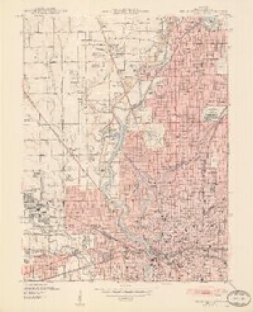
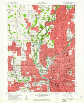
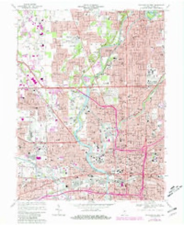
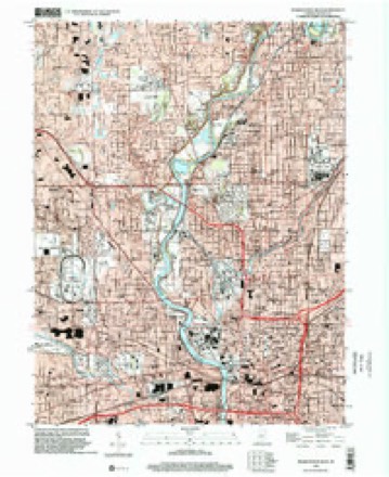
9 surveys from 19 printed sheetsMatched by testing this settlement's coordinate against the published boundary of every sheet in the United States Geological Survey's historical collection. Each opens the scanned sheet at the Survey.
- 1948 USGS Indianapolis West quadrangle1:24000, 2 printings
- 1953 USGS Indianapolis quadrangle1:250000, 4 printings
- 1956 USGS Indianapolis quadrangle1:250000
- 1957 USGS Indianapolis quadrangle1:250000, 2 printings
- 1959 USGS Indianapolis West quadrangle1:24000
- 1962 USGS Indianapolis quadrangle1:250000
- 1967 USGS Indianapolis West quadrangle1:24000, 5 printings
- 1986 USGS Indianapolis quadrangle1:100000, 2 printings
- 1998 USGS Indianapolis West quadrangle1:24000





In the county-history sources
12,230 words on this townshipHistory of Indianapolis and Marion County, Indiana, published 1884 names this settlement in its chapter on Wayne Township. These are the passages that mention it, exactly as the scans read.
William McCaw, the southwest quarter and the west half of the southeast quarter of section 21, township 16, range 3. Lands located near Eagle Creek, northwest of Mount Jackson. He was a native of Westmoreland County, Pa., born in 1787, and came to Marion County in April, 1822.
Passage source: History of Indianapolis and Marion County, Indiana, published 1884.
It is said by some who know Mr. Beeler that, though naturally rather slow to act, he is fully in earnest when aroused, and that opinion was. fully verified in this case, for he acted with such promptness and energy that in less than twenty-four hours, he, with the assistance of the city police, had secured the arrest of two of the robbers, while the other (a property-owner in Indianapolis) had fled from the county. In less than a week the robber who had held the horse's head had been tried and sentenced to eight years in the penitentiary. A friend and accomplice (though not one of the three who robbed Mr. Beeler) had falsely sworn an alibi for the one convicted, and in less than another week he was himself on the way to the penitentiary under an eight-years' sentence for perjury. The other arrested robber had a father who was possessed of considerable property, and it was supposed that the criminal fraternity also contributed largely towards his defense. When his trial came on (the prosecuting attorney who conducted the proceedings against the other robber having resigned his office) the prosecution of the case devolved on a young lawyer of good talents, but little experience, and thereupon Mr. Beeler, being determined that the villain should not escape from justice, employed at his own expense an eminent and experienced lawyer to assist the prosecution. After a protracted trial, in which there was a great amount of false swearing, and money freely used to save the prisoner, he was convicted, and sentenced to the penitentiary for three years (the verdict being a compromise one, some of the jury holding out for eight years and others being for acquittal). This ruffian, after serving out his term, returned to Indianapolis, and a short time afterwards was engaged in the attempted robbery of a farm-house, in which he received several severe wounds, was captured, tried, and sentenced to the southern prison for eight years. Shortly after his incarceration there he became the leader in an attempt by a number of convicts to escape, in which attempt he killed one of the guards, for which he received sentence of death, but succeeded in obtaining a new trial, which resulted in a sentence of imprisonment for life in the penitentiary. The village of Mount Jackson, situated on the east line of the township, had its origin in a public-house built by W. C. Holmes and others, about 183Y, on the National road, at that point. Adjoining the place were the lands of Obadiah Harris and Nathaniel Bolton. The village was laid out by Harris and Muir in 1838, and the plat recorded October 27th of that year. A store was opened by Daniel Hoover, and another by Moore & Kempton. The buildings of the Asylum for the Insane, which have been erected just north of the hamlet of Mount Jackson, are more fully mentioned in the history of Indianapolis, though not within the city limits.
Passage source: History of Indianapolis and Marion County, Indiana, published 1884.
An old Baptist Church building, erected more than half a century ago (one of the first frame churches in Marion County), is still standing near Mount Jackson, a little west of the Insane Asylum. The first church organization that worshiped here included among its prominent members Israel, Samuel, and Ede Harding, with others of the pioneer settlers of that vicinity. The organization ceased to exist many years ago, and the church building was abandoned as a house of worship.
Passage source: History of Indianapolis and Marion County, Indiana, published 1884.
Machine-read from a century-old scan, so expect the errors a machine makes: misspelled names, dropped words, stray characters.
Mines and quarries near this place
10 of 12 shownRegional context, not property-specific evidence. The federal mineral resources record lists 12 workings within 5 miles of Mount Jackson: 5 past producers, 4 producers, 2 occurrences, 1 unknown. 4 still produce. What was taken out: Sand and Gravel, Construction, Fluorine-Fluorite, Stone, Crushed/Broken, Tungsten. Distance is straight-line from the map coordinates, so a quarry counted here may appear on a neighbouring settlement's page as well.
| Where | Site | Commodity | Status | Recorded |
|---|---|---|---|---|
| Mallory Metallurgical/ Indianapolis | Tungsten | Past Producer | ||
| Fluorite Occurrence Number 1 | Fluorine-Fluorite | Occurrence | ||
| Fluorite Occurrence Number 1 | Fluorine-Fluorite | Occurrence | ||
| Indianapolis 522 Quarry | Stone, Crushed/Broken | Producer | ||
| Kentucky Ave Mine & Mill | Stone, Crushed/Broken | Producer | ||
| Ace Lake Pit | Sand and Gravel, Construction | Past Producer | ||
| Eagle Gravel Pit | Sand and Gravel, Construction | Unknown | ||
| Kentucky Avenue Sand | Sand and Gravel, Construction | Producer | ||
| Ok Sand & Gravel Co., Inc. | Sand and Gravel, Construction | Producer | ||
| R.L. Schutt Borrow Pit | Sand and Gravel, Construction | Past Producer |
Nearest settlements
The eight closest, with where each one stands in the county. Distances are straight-line, computed from the Geographic Names Information System coordinates.
| Map | Place | Distance | Sheets |
|---|---|---|---|
| Belmont | 1.1 miles | 19 | |
| Fairview Station | 1.3 miles | 19 | |
| Glendale | 1.6 miles | 19 | |
| Lynhurst | 2.2 miles | 19 | |
| Indianapolis | 2.6 miles | 19 | |
| Drexel Gardens | 2.7 miles | 17 | |
| Maywood | 2.7 miles | 17 | |
| Mars Hill | 3.1 miles | 17 |
Provenance
This settlement is recorded in the Geographic Names Information System as feature 439587. The sheet list is computed by point-in-boundary test against the United States Geological Survey's historical topographic inventory. Both are works of the United States government and carry no copyright under 17 U.S.C. 105.
Mines and quarries. USGS Mineral Resources Data System (MRDS) https://mrdata.usgs.gov/mrds/ A work of the United States government, no copyright under 17 U.S.C. 105.