 Block
Pecksburg, Indiana
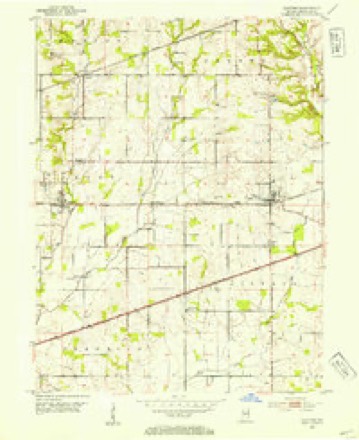
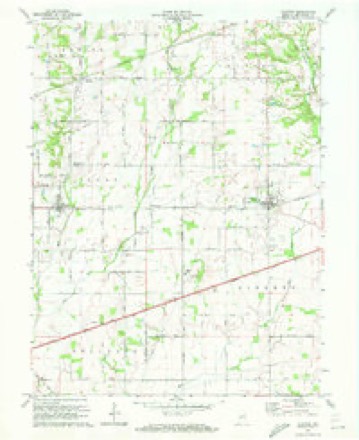
12 topographic sheets cover this place, the earliest surveyed in 1953 and the latest in 1986. It stands in Clay Township. It lies in ZIP code area 46118. The Survey maps it on the Clayton quadrangle.
Topographic sheets covering this place
7 surveys from 12 printed sheetsMatched by testing this settlement's coordinate against the published boundary of every sheet in the United States Geological Survey's historical collection. Each opens the scanned sheet at the Survey.
- 1953 USGS Clayton quadrangle1:24000
- 1953 USGS Indianapolis quadrangle1:250000, 4 printings
- 1956 USGS Indianapolis quadrangle1:250000
- 1957 USGS Indianapolis quadrangle1:250000, 2 printings
- 1962 USGS Indianapolis quadrangle1:250000
- 1970 USGS Clayton quadrangle1:24000
- 1986 USGS Indianapolis quadrangle1:100000, 2 printings





In the county-history sources
6,757 words on this townshipHistory of Hendricks County, Indiana, published 1885 names this settlement in its chapter on Clay Township. These are the passages that mention it, exactly as the scans read.
Constables : William Moore and Alfred Hunt, 1845; William Tincher and James Wright, 1846; Hiram D. Jones and James Wright, 1847; John 0. Gambold and Cyrus Moore, 1848; Cyrus Moore and John Rushton, 1849; James Crews and William Hutch¬ ings, 1850; Milton Wright and Thomas E. Harrison, 1851; A. M. Cleghorn and William Page, 1852; Joseph McAninch and Milton Wright, 1853-'4; Joseph McAuinch and William Tincher, 1855; William Tincher and Henry Yount, 1856; Quincy C. Tomlinson and John A. Phillips, 1857; Quincy C. Tomlinson and Benja¬ min Hiatt, 1858; Cyrus L. Stanley and Renal F. Swaim, 1859; Al¬ fred Y. Coffin and Stephens. Kitchen, 1860; John A. Phillips and Stephen S. Kitchen, 1861; John C. Gambold and James Queen, 1862-'3; Himelius Kendall and Annuel Edwards, 1864; Jason Tomlinson and Josiah Phillips, 1866; William M. Farmer and John C. Gambold, 1867; P. P. Thomas and George Smith, 1868; William White and Joseph Bundy, 1869; Stephen Climeworth and Zimri Warren, 1870; James L. Astley and Zimri War¬ ren, 1872; John Harris and Annuel Edwards, 1874; John Cham¬ pion and William Stanley, 1876; John Champion and William Stanley, 1878; Lewis Shaw and Woodson Bryant, 1880; J. A. Bo¬ hannon and John Crews, 1882; W. H. Crose and John Crews, 1884.
Passage source: History of Hendricks County, Indiana, published 1885.
In political sentiment the people of Clay have always been over¬ whelmingly Republican, and before the birth of that party they were as loyal to its predecessor, the Whig party. The township was also a stronghold of free-soilism during the days of Clay and Webster, and in the campaigns of 1848 and 1852 many more votes were given to the Free-Soil than to the Democratic candidates. Following is the vote cast at each presidential election from 1848 to 1884, inclusive:
Passage source: History of Hendricks County, Indiana, published 1885.
Pecksburg, which was named in honor of the first President of the Yandalia Railroad, is near the east line of the township, on section 31. It has one store, kept by Abraham Bowen, who is also Postmaster and station agent. There is also a church, of the Lutheran denomination, where services are usually held every other Sunday. William Tinster preached for several years, and in 1882 removed to Mud Creek. At present writing there is no regular pastor, the last one having been Rev. Mr. Keller, now in Kentucky. The congregation numbers about fifty. Sunday-school sessions are held every Sunday, under charge of Allen Reitzel. Pecksburg is not prosperous as a village, and has now but fifty in¬ habitants.
Passage source: History of Hendricks County, Indiana, published 1885.
Machine-read from a century-old scan, so expect the errors a machine makes: misspelled names, dropped words, stray characters.
Read the whole chapter on Clay Township - it names this place 1 more 1 time.
Fires near this place
1 since 2010Regional context, not property-specific evidence. The federal wildfire occurrence database lists 1 fire within 5 miles of Pecksburg in 2010, burning about 4 acres in total. None started naturally. None was recorded as arson. Distance is straight-line from the map coordinates, so a fire counted here may appear on a neighbouring settlement's page as well.
| Reported cause | Fires |
|---|---|
| Equipment and vehicle use | 1 |
The most recent of them, most recent first, with the day each was reported and the service that recorded it.
| Date | Cause | Size | Reported by | Name on the report |
|---|---|---|---|---|
| 6 October 2010 | Equipment and vehicle use | 4.0 acres | Hoosier National Forest | BLANTON |
Settlements close enough to share some of these fires:
Nearest settlements
The eight closest, with where each one stands in the county. Distances are straight-line, computed from the Geographic Names Information System coordinates.
| Map | Place | Distance | Sheets |
|---|---|---|---|
| Springtown | 2.0 miles | 12 | |
| Summit | 2.0 miles | 12 | |
| Amo | 2.1 miles | 12 | |
| Clayton | 2.7 miles | 12 | |
| Hadley | 3.4 miles | 12 | |
| North Belleville | 4.2 miles | 16 | |
| Belleville | 4.6 miles | 16 | |
| Nash | 4.6 miles | 12 |
Provenance
This settlement is recorded in the Geographic Names Information System as feature 449707. The sheet list is computed by point-in-boundary test against the United States Geological Survey's historical topographic inventory. Both are works of the United States government and carry no copyright under 17 U.S.C. 105.
Wildfire. Short, Karen C. 2022. Spatial wildfire occurrence data for the United States, 1992-2020 [FPA_FOD_20221014]. 6th Edition. Fort Collins, CO: Forest Service Research Data Archive. https://doi.org/10.2737/RDS-2013-0009.6 Collected with United States Government funding and usable without additional permissions or fees.