 Block
Clayton, Indiana
12 topographic sheets cover this place, the earliest surveyed in 1953 and the latest in 1986. It stands in Liberty Township. It lies in ZIP code area 46118. The Survey maps it on the Clayton quadrangle. 908 people lived here at the 2020 count. It stands 876 feet above sea level.
On record in Clayton
Buildings and businesses the archive holds for this place. Each opens its own page, with the source record it came from.
On the National Register 1 record
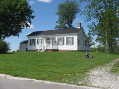 McCormack-Bowman Houselisted 1995
Population over time
2 figuresClayton fell from 972 to 908 between 2010 and 2020. These are the recorded population figures Wikidata holds for this place, reached through the Geographic Names Information System number this page is keyed on rather than by name, so they belong to this place and not to another of the same name. Most are census counts, but not all are: an early figure may be a founding or settlement estimate, and an estimate published within five years of a census is left out. The change column is computed, and is left blank where more than 20 years separate a figure from the one before it, because a gap that long is not a change between two counts.
| Year | People | Change |
|---|---|---|
| 2010 | 972 | |
| 2020 | 908 | -64 (-7%) |
Topographic sheets covering this place
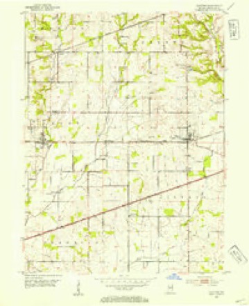
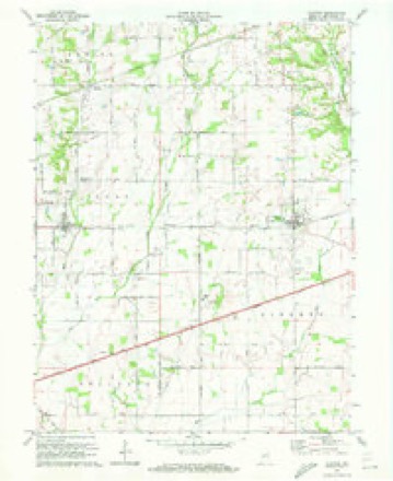
7 surveys from 12 printed sheetsMatched by testing this settlement's coordinate against the published boundary of every sheet in the United States Geological Survey's historical collection. Each opens the scanned sheet at the Survey.
- 1953 USGS Clayton quadrangle1:24000
- 1953 USGS Indianapolis quadrangle1:250000, 4 printings
- 1956 USGS Indianapolis quadrangle1:250000
- 1957 USGS Indianapolis quadrangle1:250000, 2 printings
- 1962 USGS Indianapolis quadrangle1:250000
- 1970 USGS Clayton quadrangle1:24000
- 1986 USGS Indianapolis quadrangle1:100000, 2 printings





In the county-history sources
9,884 words on this townshipHistory of Hendricks County, Indiana, Together with Sketches of Its Cities, Villages and Towns, Educational, Religious, Civil, Military, and Political History, Portraits of Prominent Persons, and Biographies of Representative Citizens, published 1885 names this settlement in its chapter on Liberty Township. These are the passages that mention it, exactly as the scans read.
Liberty Township is in the southern part of the coutitv, and is bounded as follows: On the north by Center and "Washiiio-toD, on the east by Guilford, on the south by Morgan County and on the west by Franklin and Clay. It comprises about forty-nine square miles, in townships 1-i and 15 north, ranges 1 east and 1 west. It is the largest township in the county. The surface in the northern and eastern portions is high and rolling, while the southwestern portion is low, level, and in places inclined to be swampy. East Fork crosses the northeast corner of the township near Clayton, and passes out of it near the southwestern corner. The natural drainage of the higher portions of the township is excellent, and the small streams or branches generally afford an abundance of pure water the season through. Mud Creek Valley, in the southwest, is of easy drainage on account of the large proportion of sand in the soil. The lands of the township are fertile throughout and well cultivated, and the most e.xtensive farmers in the county live in it.
Passage source: History of Hendricks County, Indiana, Together with Sketches of Its Cities, Villages and Towns, Educational, Religious, Civil, Military, and Political History, Portraits of Prominent Persons, and Biographies of Representative Citizens, published 1885.
Odell and J. S. Wills, 1S36; Clayton T. Swindler, 1841; John W Bryan, 1S45; Nathan Meredith, 18i7; John W. Bryan lSi9- iXathan Meredith and Clayton T. Swindler, 1851; Araos s' Wills' 1854; Jacob S. Redmond and Elisha Franklin, J,S55- Amos s' AYdls and Samuel J. Banta, 1S5S; Elisha Franklin and J. F Powell' lSo9;.John P. McCormick, 1860; Amos S. Wills, 186-> Elisha Franklin, 1863; William Williams, 1864; Amos S Wills and Abraham Bland, 1866; W. W. Irons, 1868; H. A. Marley 1869- Amos S. Wills and Abraham Bland, 1870; Elisha Franklin and j' Ballard, 1872; Amos S. Wills and H. C. Harper, 1874- Amos Elmore and H. F. Swindler, 1876; Araos S. Wills and D H Watts, 1878; John Glover and Reuben Franklin, 1880- Alvin Graves, R. C. Franklin and William Shepherd, 1882; Dan Watts and M. F. Jones, 1884.
Passage source: History of Hendricks County, Indiana, Together with Sketches of Its Cities, Villages and Towns, Educational, Religious, Civil, Military, and Political History, Portraits of Prominent Persons, and Biographies of Representative Citizens, published 1885.
Clayton is the largest village in Liberty Township, having 500 inhabitants. It is situated on the Vandf^lia Eailroad, in the northwestern part of the township, on sections 33 and 34. It was platted in 1851, by George W.Wills, and contains about eleyen acres, which tract was purchased from Elizabeth Wills. Its first name was Claysville, in honor of the Kentucky statesman, and had its name afterward changed because there was already a postoffice m the State by that name. The first house was built by Thomas Potts, and the second by Lewis T. Pounds, b-?th frame structures. The first store was opened by Parker & Foote, the second by Eichard and James Worrel, and :.he third bj Morrison & Thomas, m which the first postoffice was kept by P>enjarain F. Thomas, about 1852. The first hotel was buiH by George W. Wills, and was run by Ephraim Hartsuck.
Passage source: History of Hendricks County, Indiana, Together with Sketches of Its Cities, Villages and Towns, Educational, Religious, Civil, Military, and Political History, Portraits of Prominent Persons, and Biographies of Representative Citizens, published 1885.
Machine-read from a century-old scan, so expect the errors a machine makes: misspelled names, dropped words, stray characters.
Read the whole chapter on Liberty Township - it names this place 27 more 27 times.
Mines and quarries near this place
1 within 5 milesRegional context, not property-specific evidence. The federal mineral resources record lists 1 working within 5 miles of Clayton: 1 past producer. None of them still produces. What was taken out: Sand and Gravel, Construction. Distance is straight-line from the map coordinates, so a quarry counted here may appear on a neighbouring settlement's page as well.
| Where | Site | Commodity | Status | Recorded |
|---|---|---|---|---|
| Happy Valley Gravel Pit | Sand and Gravel, Construction | Past Producer |
Storms near this place
16 since 1998Regional context, not property-specific evidence. The National Weather Service names Clayton in 16 storm reports between 1998 and 2023: 8 thunderstorm wind, 4 hail, 2 flash flood, 1 flood. No death or injury is recorded in these reports. Each account below is quoted exactly as the forecast office filed it, from the NOAA Storm Events Database, and each date opens the federal record of that event.
| When | Event | Place named | Harm | What the report says |
|---|---|---|---|---|
| August 2016 | Tornado (EF1) | Clayton | $18,000 | An EF-1 tornado, with maximum winds estimated at 105 mph, caused minor damage to a few farm buildings, rolled a trailer, and uprooted trees. |
| June 1998 | Thunderstorm Wind | Clayton | $15,000 | no account filed |
| May 2016 | Thunderstorm Wind | Clayton | $4,000 | A large tree was downed covering the westbound lanes of Highway 40, south of Clayton, due to damaging thunderstorm wind gusts. Power lines were downed on both sides of the road. |
| December 2015 | Thunderstorm Wind | Clayton | $3,000 | A barn door was blown in near US Highway 40 and Highway 0 due to damaging thunderstorm wind gusts. |
| July 2015 | Flash Flood | Clayton | $2,000 | Several roads were closed around the county because of flooding due to heavy thunderstorm rainfall. Also, White Lick Creek was about a foot out of its banks. |
| July 2015 | Flood | Clayton | $1,000 | An estimated 4 inches of water was on the road at the intersection of State Route 39 and York Avenue due to moderate to heavy rainfall. |
| June 2018 | Thunderstorm Wind | Clayton | $250 | A 6-inch diameter tree limb was blown down at County Road 100 West and Highway 40 due to strong thunderstorm wind gusts. |
| June 2023 | Hail | Clayton | - | Thunderstorm hail as large as ping pongs in Clayton. |
| June 2008 | Thunderstorm Wind | Clayton | - | A three foot diameter tree was blown down in the roadway near a cemetery. |
| July 2008 | Thunderstorm Wind | Clayton | - | A one-foot diameter tree was blown down by thunderstorm winds at County Road 200 West and United States Highway 40. |
| July 2005 | Thunderstorm Wind | Clayton | - | Several large limbs were broken. A road was blocked by the debris. |
| July 2015 | Hail | Clayton | - | no account filed |
| May 2014 | Hail | Clayton | - | no account filed |
| July 2008 | Thunderstorm Wind | Clayton | - | no account filed |
| May 2004 | Hail | Clayton | - | no account filed |
| July 2003 | Flash Flood | Clayton | - | no account filed |
Nearest settlements
The eight closest, with where each one stands in the county. Distances are straight-line, computed from the Geographic Names Information System coordinates.
| Map | Place | Distance | Sheets |
|---|---|---|---|
| Summit | 0.8 miles | 12 | |
| North Belleville | 1.5 miles | 16 | |
| Belleville | 2.0 miles | 16 | |
| Pecksburg | 2.7 miles | 12 | |
| Magnetic Springs | 3.0 miles | 16 | |
| Cartersburg | 3.2 miles | 16 | |
| Nash | 4.2 miles | 12 | |
| Springtown | 4.5 miles | 12 |
Elsewhere
Matched on this settlement's Geographic Names Information System number rather than its name, so it cannot be a different place of the same name in another state.
| Wikipedia article on Clayton | An encyclopaedic summary. Its text is share-alike, so it is linked here rather than copied. |
| Wikidata item Q3292489 | The structured record the population and elevation above come from. Public domain (CC0). |
Provenance
This settlement is recorded in the Geographic Names Information System as feature 432598. The sheet list is computed by point-in-boundary test against the United States Geological Survey's historical topographic inventory. Both are works of the United States government and carry no copyright under 17 U.S.C. 105.
Mines and quarries. USGS Mineral Resources Data System (MRDS) https://mrdata.usgs.gov/mrds/ A work of the United States government, no copyright under 17 U.S.C. 105.
Storms. NOAA National Centers for Environmental Information, Storm Events Database https://www.ncei.noaa.gov/stormevents/ A work of the United States government, no copyright under 17 U.S.C. 105. Narratives are quoted verbatim from the National Weather Service report and are not edited or summarised.