 Block
Peru, Indiana
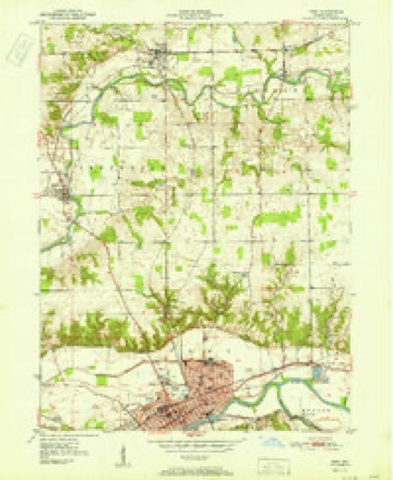
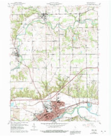
13 topographic sheets cover this place, the earliest surveyed in 1951 and the latest in 1985. It stands in Peru Township. It lies in ZIP code area 46970. The Survey maps it on the Peru quadrangle. 11,073 people lived here at the 2020 count. It stands 650 feet above sea level.
Research this city
On record in Peru
Buildings and businesses the archive holds for this place. Each opens its own page, with the source record it came from.
On the National Register 12 records
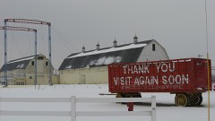 Wallace Circus and American Circus Corporation Winter QuartersNational Historic Landmark · listed 1987
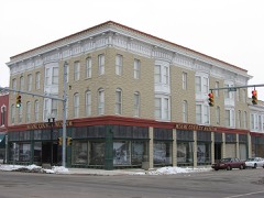 Brownell Block/Senger Dry Goods Company Buildinglisted 1983
 James Omar Cole Houselisted 1984
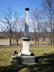 Francis Godfroy Cemeterylisted 1984
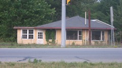 Terrell Jacobs Circus Winter Quarterslisted 2012
 Miami County Courthouselisted 2008
 Peru High School Historic Districtlisted 2013
 Shirk-Edwards Houselisted 1995
 Westleigh Farmslisted 2003
- Godfroy's Addition Historic Districtlisted 2023
- Peru Courthouse Square Historic Districtlisted 2018
- Peru Westside Historic Districtlisted 2023
Population over time
3 figuresPeru grew from 1,266 to 11,073 between 1850 and 2020. These are the recorded population figures Wikidata holds for this place, reached through the Geographic Names Information System number this page is keyed on rather than by name, so they belong to this place and not to another of the same name. Most are census counts, but not all are: an early figure may be a founding or settlement estimate, and an estimate published within five years of a census is left out. The change column is computed, and is left blank where more than 20 years separate a figure from the one before it, because a gap that long is not a change between two counts.
| Year | People | Change |
|---|---|---|
| 1850 | 1,266 | |
| 2010 | 11,417 | |
| 2020 | 11,073 | -344 (-3%) |
Topographic sheets covering this place
6 surveys from 13 printed sheetsMatched by testing this settlement's coordinate against the published boundary of every sheet in the United States Geological Survey's historical collection. Each opens the scanned sheet at the Survey.
- 1951 USGS Peru quadrangle1:24000, 2 printings
- 1953 USGS Danville quadrangle1:250000, 3 printings
- 1955 USGS Danville quadrangle1:250000
- 1956 USGS Danville quadrangle1:250000
- 1960 USGS Peru quadrangle1:24000, 4 printings
- 1985 USGS Logansport quadrangle1:100000, 2 printings



In the county-history sources
9,898 words on this townshipHistory of Miami County, Indiana : a Narrative Account of Its Historical Progress, Its People and Its Principal Interests, published 1914 names this settlement in its chapter on Peru Township. These are the passages that mention it, exactly as the scans read.
Peru, the county seat and only incorporated city of Jliami county, is situated on the north bank of the Wabash river, a little southwest of the geographical center of the county. Its history begins with the treaty negotiated with the Miami Indians at the mouth of the Mississinewa river on October 23, 1826, at which time John B. Richardville, the principal chief of the Miamis, was granted, among other tracts of land, a reservation of one section where the city now stands. The following February John McGregor built a small cabin on the western part of this reservation and he has the credit of being the first white man to establish a permanent domicile within the present limits of Miami county. On August 18, 1827, Richardville and his wife, Pem-e-se-(iuah, conveyed this .section to Joseph Holman for a consideration of $500, and it is said that part of the purcha.se price was "paid in trade," instead of all cash.
Passage source: History of Miami County, Indiana : a Narrative Account of Its Historical Progress, Its People and Its Principal Interests, published 1914.
It is to be regi'etted that not more is known of the early settlers of Miamisport. Joseph Holman, the proprietor of the town, was born in Kentucky in 1788 and in 1820 removed to Wayne county, Indiana. During the administration of President John Q. Adams he was land commissioner at Fort Wayne and just before Miami county was erected represented the district composed of Allen and Cass counties in the legislature. In 1839 he returned to Wayne county, where he died in 1872. He was an active politician during the greater part of his mature life and was a delegate to the convention that framed the present constitution of Indiana. His first residence in :\Iiami county was a small cabin on the bank of the Wabash river, a short distance below the town of Miamisport, where he lived for several years, when he built a stone house on Ilolman street between Main and Third streets, within the present limits of Peru. Subsequently he built a frame house on his farm and lived there until he went back to AYayne county.
Passage source: History of Miami County, Indiana : a Narrative Account of Its Historical Progress, Its People and Its Principal Interests, published 1914.
William N, Hood, one of the most influential men in the early history of the county and founder of the city of Peru, was born in Ohio in 1791. ^Vhen only aliout eijjhteen years of age he eame to Indiana, first locating at Fort Wayne, where he was engaged in mercantile pursuits for several years and amassed considerable wealth for that period. In 1831 he came to Miami county and in 1886 was elected to represent the counties of Cass and Miami in the state legislature. He was again elected representative in 1838, and died in July of that year, soon after the expiration of the legislative session.
Passage source: History of Miami County, Indiana : a Narrative Account of Its Historical Progress, Its People and Its Principal Interests, published 1914.
Machine-read from a century-old scan, so expect the errors a machine makes: misspelled names, dropped words, stray characters.
Read the whole chapter on Peru Township - it names this place 38 more 38 times.
Fires near this place
3 since 2003Regional context, not property-specific evidence. The federal wildfire occurrence database lists 3 fires within 5 miles of Peru between 2003 and 2005, burning about 2 acres in total. None started naturally. None was recorded as arson. Distance is straight-line from the map coordinates, so a fire counted here may appear on a neighbouring settlement's page as well.
| Reported cause | Fires |
|---|---|
| Missing data/not specified/undetermined | 2 |
| Debris and open burning | 1 |
The most recent of them, most recent first, with the day each was reported and the service that recorded it.
| Date | Cause | Size | Reported by | Name on the report |
|---|---|---|---|---|
| 6 April 2003 | Missing data/not specified/undetermined | under an acre | Indiana State Fire Marshal's Office | not named |
| 30 April 2003 | Missing data/not specified/undetermined | 1.0 acres | Indiana State Fire Marshal's Office | not named |
| 26 February 2005 | Debris and open burning | under an acre | Indiana State Fire Marshal's Office | not named |
Settlements close enough to share some of these fires:
Mines and quarries near this place
6 within 5 milesRegional context, not property-specific evidence. The federal mineral resources record lists 6 workings within 5 miles of Peru: 4 producers, 1 unknown, 1 plant. 5 still produce. What was taken out: Sand and Gravel, Construction, Stone, Crushed/Broken, Stone, Fire Clay (Refractory). Distance is straight-line from the map coordinates, so a quarry counted here may appear on a neighbouring settlement's page as well.
| Where | Site | Commodity | Status | Recorded |
|---|---|---|---|---|
| Kickapoo Stone Quarry | Stone, Crushed/Broken | Producer | ||
| Miami Co. Hwy. Dept. | Stone | Producer | ||
| Precision Ceramics Plant | Fire Clay (Refractory) | Plant | ||
| Comersford Pit | Sand and Gravel, Construction | Unknown | ||
| Kickapoo Sand & Gravel | Sand and Gravel, Construction | Producer | ||
| Kratzer Pit | Sand and Gravel, Construction | Producer |
Storms near this place
60 of 83 shownRegional context, not property-specific evidence. The National Weather Service names Peru in 83 storm reports between 1995 and 2025: 50 thunderstorm wind, 26 hail, 5 flash flood, 1 flood. The reports record 1 injury. Each account below is quoted exactly as the forecast office filed it, from the NOAA Storm Events Database, and each date opens the federal record of that event.
| When | Event | Place named | Harm | What the report says |
|---|---|---|---|---|
| May 2004 | Tornado (F3) | Peru | 1 hurt, $6,000,000 | NWS storm survey found a tornado with a path length near four and one half miles and just less than one quarter mile wide at its greatest width. The storm touched down three and one half miles west southwest of downtown Peru as an F0 and moved northeast at 35 MPH across the northwest corner of the city of Peru. The storm then caused F1 and F2 damage to trees, buildings, and a trailer park where two homes were destroyed and one woman was injured. The storm then intensified to F3 strength as it moved across an industrial park on the north side of Peru, tearing off a roof and knocking down a large communications tower. The storm then quickly began to dissipate as it appeared the rear flank downdraft quickly choked off the circulation in a field near the intersection of Highways U.S. 24 and SR19. Damage estimates were from 5 to 6 million dollars to private property and more than one half million in public property. Miami county was declared a presidential disaster area on June 3rd. |
| July 1998 | Flash Flood | Peru | $1,000,000 | MAUGANS ROAD MOBILE HOME PARK SUSTAINED SEVERE FLOODING. SEVERAL MOBILE HOMES WERE INUNDATED WITH WATER UP TO 4 FEET DEEP. MANY OF THE RESIDENTS SUFFERED FLOODED VEHICLES INCLUDING ONE MAN WHO LOST A VAN, A TRUCK AND A HARLEY DAVIDSON MOTORCYCLE. MANY HOMES IN PERU WERE FLOODED WITH RAW SEWAGE AS STORM SEWERS FLOODED AND BACKED UP INTO HOMES. |
| June 2008 | Thunderstorm Wind | Peru | $50,000 | Emergency management officials reported numerous trees and power lines down in Peru. |
| April 2001 | Thunderstorm Wind | Peru | $50,000 | Several homes sustained window and siding damage due to the hail and high winds. |
| August 2005 | Thunderstorm Wind | Peru | $20,000 | Several large trees and power lines were blown down throughout the city of Peru. One of these trees fell onto a car. |
| December 1998 | Thunderstorm Wind | Peru | $20,000 | WIND DESTROYED ONE MOBILE HOME AND DAMAGED ANOTHER. |
| July 2008 | Thunderstorm Wind | Peru | $15,000 | Emergency manangement officials reported trees and power lines down in and around Peru. |
| June 2006 | Thunderstorm Wind | Peru | $10,000 | Mobile Home sustained structural damage. Trees and power lines down. |
| June 2006 | Thunderstorm Wind | Peru | $10,000 | Numerous trees and power lines down. |
| December 1998 | Thunderstorm Wind | Peru | $10,000 | POWER OUTAGES CAUSED BY HIGH WINDS KNOCKING TREE BRANCHES ONTO WIRES. |
| July 2024 | Thunderstorm Wind | Peru | $5,000 | Powerlines down in Peru. |
| June 2006 | Hail | Peru | $5,000 | Several homes in the Willow Creek subdivision sustained hail damage. |
| June 2001 | Thunderstorm Wind | Peru | $3,000 | Large tree and telephone poles down. |
| August 2022 | Thunderstorm Wind | Peru | $2,000 | Tree limbs are down in the area. A trained spotter estimates wind gusts of 55 mph. |
| July 2005 | Thunderstorm Wind | Peru | $2,000 | Several trees and power lines were blown down. |
| September 1997 | Thunderstorm Wind | Peru | $1,500 | Thunderstorm winds blew down several trees in the southern part of the county. |
| June 1997 | Thunderstorm Wind | Peru | $1,000 | Circus tent and tiger cage blown over at circus. |
| March 2025 | Thunderstorm Wind | Peru | - | Wind gust reported from a personal weather station. Tree limbs down. |
| March 2023 | Thunderstorm Wind | Peru | - | A member of the public estimated a 60 mph wind gust. |
| July 2020 | Thunderstorm Wind | Peru | - | Utility poles down at W. Main and Fremont Street. |
| August 2020 | Thunderstorm Wind | Peru | - | The public reported large trees were blown down in Peru. |
| May 2017 | Thunderstorm Wind | Peru | - | Emergency management officials reported several trees down around the Peru area. |
| August 2015 | Thunderstorm Wind | Peru | - | Emergency management officials reported several tree limbs down along with scattered power outages. |
| June 2015 | Thunderstorm Wind | Peru | - | Tree down over the road. |
| June 2015 | Flash Flood | Peru | - | Water flowing rapidly over Flora Dr. |
| June 2014 | Thunderstorm Wind | Peru | - | Emergency management officials reported a tree was blown down onto power lines. |
| November 2013 | Thunderstorm Wind | Peru | - | Emergency management officials estimated wind gusts of at least 60 mph with multiple power outages in the area. |
| July 2012 | Thunderstorm Wind | Peru | - | An off duty NWS employee estimated a wind gust to 60 mph in Peru. |
| June 2011 | Hail | Peru | - | The public reported quarter size hail as well as estimated wind gusts of 55 to 60 mph. |
| June 2011 | Thunderstorm Wind | Peru | - | Law enforcement officials reported trees and power lines down in and around Peru, as well as southern portions of the county. |
| June 2010 | Thunderstorm Wind | Peru | - | Emergency management officials reported numerous trees and power lines down in Peru. |
| July 2010 | Thunderstorm Wind | Peru | - | Law enforcement officials reported a large tree down onto County Road 500 North. |
| June 2010 | Thunderstorm Wind | Peru | - | Large tree down on State Road 19 south of Peru. |
| June 2010 | Thunderstorm Wind | Peru | - | Trees down on power lines. |
| March 2009 | Thunderstorm Wind | Peru | - | Emergency management officials reported a large tree fell onto a residence. |
| August 2007 | Thunderstorm Wind | Peru | - | A 14 inch diameter tree down on 6th street and several 8 to 10 inch diameter trees along Daniels Street in Peru. |
| May 2007 | Thunderstorm Wind | Peru | - | Local officials reported receiving scattered tree and power line damage across the central part of the county. |
| May 2005 | Thunderstorm Wind | Peru | - | Numerous trees and power lines down. |
| June 2005 | Thunderstorm Wind | Peru | - | Numerous trees were reported blown down. |
| June 2004 | Thunderstorm Wind | Peru | - | Emergency management reported several trees down east of Peru. |
| June 2004 | Flash Flood | Peru | - | Law enforcement reported US 31 flooded and impassable in places east of Peru with water flowing across the highway. |
| July 2003 | Thunderstorm Wind | Peru | - | Law enforcement reported trees down north of Peru. |
| July 2003 | Flash Flood | Peru | - | Law enforcement reported several roads closed around Peru due to flash flooding. |
| July 2003 | Thunderstorm Wind | Peru | - | Law enforcement reported trees and power lines down in Peru. |
| July 2003 | Flash Flood | Peru | - | Law enforcement reported a trailer park was being evacuated along Highway 31 outside of Peru due to flash flooding. |
| July 2003 | Thunderstorm Wind | Peru | - | Law enforcement reported trees down in Peru. |
| May 2002 | Thunderstorm Wind | Peru | - | A HAM reported numerous trees and power lines down southeast of Peru. |
| July 2002 | Thunderstorm Wind | Peru | - | Sheriff reported trees down north of Peru. |
| May 2001 | Thunderstorm Wind | Peru | - | Power lines down in county. |
| May 2001 | Thunderstorm Wind | Peru | - | Power lines down in county. |
| April 2001 | Thunderstorm Wind | Peru | - | Several tree limbs blown down along Wabash road. |
| May 2000 | Thunderstorm Wind | Peru | - | Construction trailer overturned and 6 inch tree limbs down. |
| June 2000 | Thunderstorm Wind | Peru | - | Tree downed against a house. Minor damage. |
| September 2000 | Thunderstorm Wind | Peru | - | Tree blown down on Highway 24. |
| May 1995 | Hail | Peru | - | Trees and power lines were downed across the county. |
| June 1995 | Thunderstorm Wind | Peru | - | Trees were downed. |
| June 1995 | Thunderstorm Wind | Peru | - | One tree and several limbs blown down. |
| June 2018 | Hail | Peru | - | no account filed |
| June 2012 | Hail | Peru | - | no account filed |
| June 2011 | Hail | Peru | - | no account filed |
Nearest settlements
The eight closest, with where each one stands in the county. Distances are straight-line, computed from the Geographic Names Information System coordinates.
| Map | Place | Distance | Sheets |
|---|---|---|---|
| Ridgeview | 0.6 miles | 13 | |
| South Peru | 0.8 miles | 13 | |
| Oakdale | 1.3 miles | 13 | |
| Park View Heights | 1.3 miles | 13 | |
| Flora | 2.1 miles | 13 | |
| Hidden Hills | 2.4 miles | 13 | |
| Wells | 2.7 miles | 13 | |
| Missisinewa (historical) | 3.2 miles | 13 |
Elsewhere
Matched on this settlement's Geographic Names Information System number rather than its name, so it cannot be a different place of the same name in another state.
| Wikipedia article on Peru | An encyclopaedic summary. Its text is share-alike, so it is linked here rather than copied. |
| Wikidata item Q386657 | The structured record the population and elevation above come from. Public domain (CC0). |
Provenance
This settlement is recorded in the Geographic Names Information System as feature 441047. The sheet list is computed by point-in-boundary test against the United States Geological Survey's historical topographic inventory. Both are works of the United States government and carry no copyright under 17 U.S.C. 105.
Wildfire. Short, Karen C. 2022. Spatial wildfire occurrence data for the United States, 1992-2020 [FPA_FOD_20221014]. 6th Edition. Fort Collins, CO: Forest Service Research Data Archive. https://doi.org/10.2737/RDS-2013-0009.6 Collected with United States Government funding and usable without additional permissions or fees.
Mines and quarries. USGS Mineral Resources Data System (MRDS) https://mrdata.usgs.gov/mrds/ A work of the United States government, no copyright under 17 U.S.C. 105.
Storms. NOAA National Centers for Environmental Information, Storm Events Database https://www.ncei.noaa.gov/stormevents/ A work of the United States government, no copyright under 17 U.S.C. 105. Narratives are quoted verbatim from the National Weather Service report and are not edited or summarised.