 Block
Francisco, Indiana
17 topographic sheets cover this place, the earliest surveyed in 1902 and the latest in 1986. It stands in Center Township. It lies in ZIP code area 47649. The Survey maps it on the Francisco quadrangle. 545 people lived here at the 2020 count. It stands 472 feet above sea level.
Population over time
2 figuresFrancisco grew from 469 to 545 between 2010 and 2020. These are the recorded population figures Wikidata holds for this place, reached through the Geographic Names Information System number this page is keyed on rather than by name, so they belong to this place and not to another of the same name. Most are census counts, but not all are: an early figure may be a founding or settlement estimate, and an estimate published within five years of a census is left out. The change column is computed, and is left blank where more than 20 years separate a figure from the one before it, because a gap that long is not a change between two counts.
| Year | People | Change |
|---|---|---|
| 2010 | 469 | |
| 2020 | 545 | +76 (+16%) |
Topographic sheets covering this place
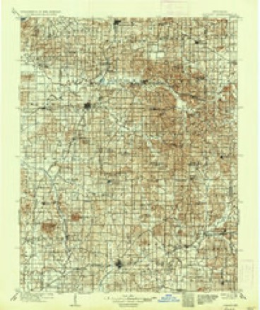
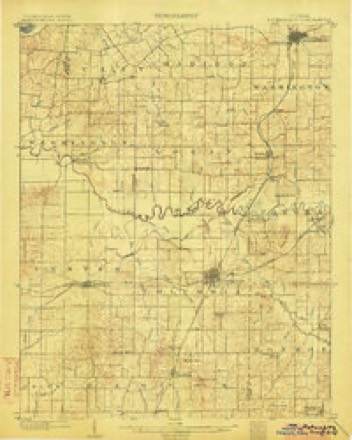
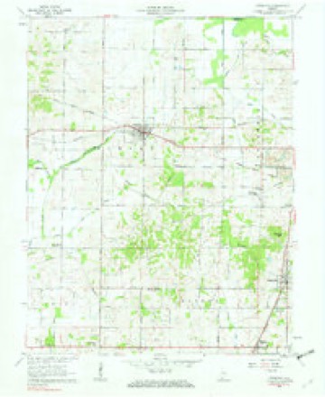
7 surveys from 17 printed sheetsMatched by testing this settlement's coordinate against the published boundary of every sheet in the United States Geological Survey's historical collection. Each opens the scanned sheet at the Survey.
- 1902 USGS Ditney quadrangle1:125000, 3 printings
- 1903 USGS Petersburg quadrangle1:62500, 2 printings
- 1956 USGS Vincennes quadrangle1:250000, 4 printings
- 1957 USGS Vincennes quadrangle1:250000
- 1958 USGS Vincennes quadrangle1:250000, 2 printings
- 1961 USGS Francisco quadrangle1:24000, 3 printings
- 1986 USGS Princeton quadrangle1:100000, 2 printings




In the county-history sources
13,276 words on this townshipHistory of Gibson County Indiana, published 1884 names this settlement in its chapter on Center Township. These are the passages that mention it, exactly as the scans read.
Ranges 9 and 10. Its greatest length from north to south is seven and a half miles, and from east to west five miles. It comprises an area of thirty-six and a half square miles, or twenty-three thousand three hundred and sixty acres. The northeastern portion of the township is drained by the Patoka River and iis
Passage source: History of Gibson County Indiana, published 1884.
When the canal was built it extended through this township, and Francisco was then quite an important trading point. The track of the Air Line Railroad enters the township on the east on Section 18, and leaves it on Section 23. The lands of Center were originally covered with a heavy growth of timber, which furnished an excellent shelter for wild animals. It was regarded by the pioneers of the county as a good hunting ground.
Passage source: History of Gibson County Indiana, published 1884.
Among the early settlers of this township was William Reavis. He was a North Carolinian by birth, and was descended from a long line of Szotch-Ivish ancestors, who were among the pioneers of the Carolinas, and during the memorable struggle for American independence they did valiant service for the cause of freedom, and aided by their brawny arm and strength of muscle in defeating the British forces at the battle of the Cow Pens. They are also ranked among the heroes of King Mountain. In the year 1817 William Reavis married Catharine Hensley, and soon after this event they made the long and tedious trip to this county on | pack horses, arriving in the summer of the same year. They settled near the present town of Francisco, about a mile southwest in the timber, where they cleared a tract, erected the usual humble log cabin, and by industry and perseverance made them a farm and home. The eldest child of Mr. Reavis and wife was Julia Ann, born in 1819. She married John T. Wallace, and is residing in Columbia on Section 23. The other children were James, Mary, Rebecca and Alexander. The latter was a soldier in the Union army during the late war, and died at Andersonville prison. Mr. Reavis died at the homestead in 1855. His widow survived him about two years. They were both mombers of the Regular Baptist Church.
Passage source: History of Gibson County Indiana, published 1884.
Machine-read from a century-old scan, so expect the errors a machine makes: misspelled names, dropped words, stray characters.
Read the whole chapter on Center Township - it names this place 26 more 26 times.
Fires near this place
6 since 2003Regional context, not property-specific evidence. The federal wildfire occurrence database lists 6 fires within 5 miles of Francisco between 2003 and 2016, burning about 50 acres in total. None started naturally. 1 was recorded as arson. Distance is straight-line from the map coordinates, so a fire counted here may appear on a neighbouring settlement's page as well.
| Reported cause | Fires |
|---|---|
| Debris and open burning | 2 |
| Missing data/not specified/undetermined | 2 |
| Arson/incendiarism | 1 |
| Recreation and ceremony | 1 |
The most recent of them, most recent first, with the day each was reported and the service that recorded it.
| Date | Cause | Size | Reported by | Name on the report |
|---|---|---|---|---|
| 5 September 2003 | Debris and open burning | under an acre | Indiana State Fire Marshal's Office | not named |
| 13 June 2012 | Missing data/not specified/undetermined | 15 acres | Patoka River National Wildlife Refuge | OATSVILLE FIRE |
| 28 February 2004 | Debris and open burning | under an acre | Indiana State Fire Marshal's Office | not named |
| 6 November 2016 | Arson/incendiarism | 3.0 acres | Patoka River National Wildlife Refuge | HUGHES FIRE |
| 5 November 2008 | Missing data/not specified/undetermined | 30 acres | Patoka River National Wildlife Refuge | HUGE TRACT |
| 28 October 2010 | Recreation and ceremony | 1.5 acres | Patoka River National Wildlife Refuge | OATSVILLE |
Settlements close enough to share some of these fires:
Storms near this place
22 since 1998Regional context, not property-specific evidence. The National Weather Service names Francisco in 22 storm reports between 1998 and 2025: 10 thunderstorm wind, 4 flash flood, 4 flood, 3 heavy rain. No death or injury is recorded in these reports. Each account below is quoted exactly as the forecast office filed it, from the NOAA Storm Events Database, and each date opens the federal record of that event.
| When | Event | Place named | Harm | What the report says |
|---|---|---|---|---|
| June 2023 | Thunderstorm Wind | Francisco | $60,000 | A mobile home was blown over, entrapping an occupant. Trees were down. |
| June 2009 | Thunderstorm Wind | Francisco | $20,000 | Trees were down with minor structural damage in Francisco and along Indiana 65 a few miles west of Wheeling. |
| June 2023 | Thunderstorm Wind | Francisco | $10,000 | Trees were down, and the roof was blown off a shed. |
| July 2012 | Thunderstorm Wind | Francisco | $10,000 | Siding was peeled off a house. |
| July 2011 | Thunderstorm Wind | Francisco | $10,000 | Trees and power lines were blown down. |
| June 2010 | Thunderstorm Wind | Francisco | $9,000 | A power pole with a transformer on it was blown down. |
| April 2002 | Thunderstorm Wind | Francisco | $8,000 | Several trees were blown down in and near Francisco. One of the trees landed on a vehicle, and the others fell across roads. |
| July 2025 | Flood | Francisco | $5,000 | Street flooding occurred in Francisco as torrential rain fell in northern Gibson County mid-morning with hourly radar estimated rainfall peaking at around 2, much of which fell after this report was made. |
| July 2024 | Thunderstorm Wind | Francisco | $5,000 | A tree was downed on a power line on S 2nd St in Francisco. |
| May 1998 | Thunderstorm Wind | Francisco | $3,000 | Trees were down in eastern Gibson County. |
| July 2024 | Flash Flood | Francisco | - | Water flowed over County Rd 550 E, south of Francisco. Radar estimated rainfall was 1-2 inches in 3 hours, with around an inch falling between 1745-1815CST. |
| July 2020 | Flood | Francisco | - | Water was over County Road 550 S between State Routes 64 and 168. |
| May 2019 | Flash Flood | Francisco | - | A water rescue was conducted along County Road 550 E south of Francisco. West of Princeton, water was over County Road 100 N just west of County Road 500 W. |
| June 2017 | Flash Flood | Francisco | - | Local creeks and streams were out of their banks in the Francisco area. A trained spotter at Fort Branch measured 3.30 inches of rain during the morning. |
| October 2014 | Thunderstorm Wind | Francisco | - | A trained spotter estimated the wind gusted to 60 mph. Small tree limbs were blown down. Small hail covered the ground. |
| June 2013 | Heavy Rain | Francisco | - | A spotter measured 2.05 inches of rain in the morning and early afternoon. Flood-prone low-lying areas were inundated, including secondary roads. |
| June 2013 | Heavy Rain | Francisco | - | A trained spotter measured 1.57 inches of rain in one hour. |
| October 2013 | Heavy Rain | Francisco | - | A trained spotter reported 1.15 inches of rain, most of that in 30 minutes. |
| November 2010 | Flood | Francisco | - | Between three and four feet of water covered County Road 725 near Francisco. Water was streaming over County Road 450 near Somerville. Water was over several other roads in Gibson County. A trained spotter measured a storm total rainfall of 4.80 inches near Fort Branch. |
| August 2004 | Flash Flood | Francisco | - | High water was reported on low-lying roads. |
| March 2011 | Flood | Francisco | - | no account filed |
| August 2002 | Hail | Francisco | - | no account filed |
Nearest settlements
The eight closest, with where each one stands in the county. Distances are straight-line, computed from the Geographic Names Information System coordinates.
| Map | Place | Distance | Sheets |
|---|---|---|---|
| Douglas | 3.0 miles | 24 | |
| Oak Hill | 4.2 miles | 18 | |
| Gudgel | 4.7 miles | 18 | |
| Fort Gibson (historical) | 5.0 miles | 24 | |
| Somerville | 5.3 miles | 17 | |
| Oakland City | 5.3 miles | 18 | |
| Gray Junction | 5.3 miles | 18 | |
| Wheeling | 5.6 miles | 17 |
Elsewhere
Matched on this settlement's Geographic Names Information System number rather than its name, so it cannot be a different place of the same name in another state.
| Wikipedia article on Francisco | An encyclopaedic summary. Its text is share-alike, so it is linked here rather than copied. |
| Wikidata item Q3293348 | The structured record the population and elevation above come from. Public domain (CC0). |
Provenance
This settlement is recorded in the Geographic Names Information System as feature 434755. The sheet list is computed by point-in-boundary test against the United States Geological Survey's historical topographic inventory. Both are works of the United States government and carry no copyright under 17 U.S.C. 105.
Wildfire. Short, Karen C. 2022. Spatial wildfire occurrence data for the United States, 1992-2020 [FPA_FOD_20221014]. 6th Edition. Fort Collins, CO: Forest Service Research Data Archive. https://doi.org/10.2737/RDS-2013-0009.6 Collected with United States Government funding and usable without additional permissions or fees.
Storms. NOAA National Centers for Environmental Information, Storm Events Database https://www.ncei.noaa.gov/stormevents/ A work of the United States government, no copyright under 17 U.S.C. 105. Narratives are quoted verbatim from the National Weather Service report and are not edited or summarised.